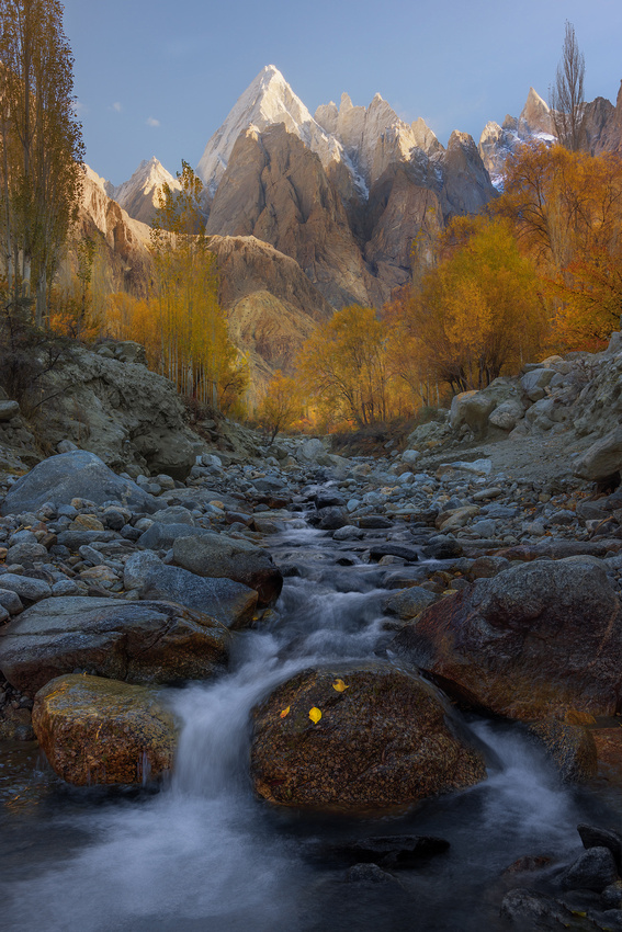
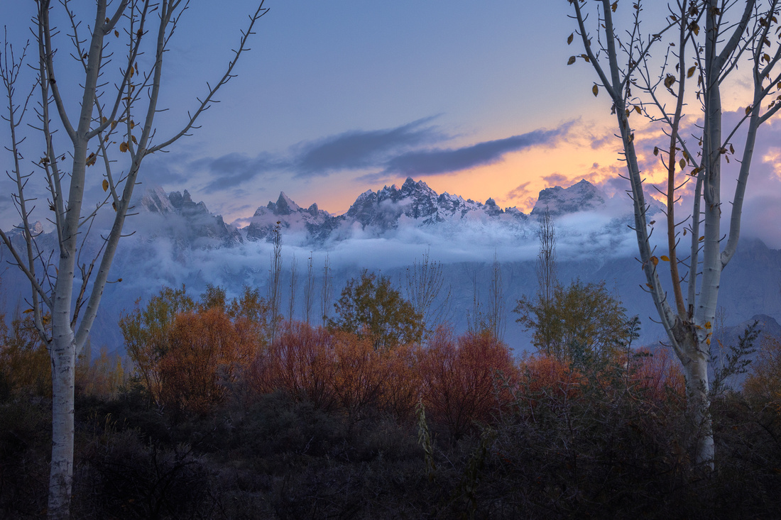
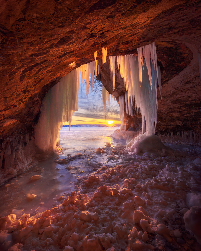
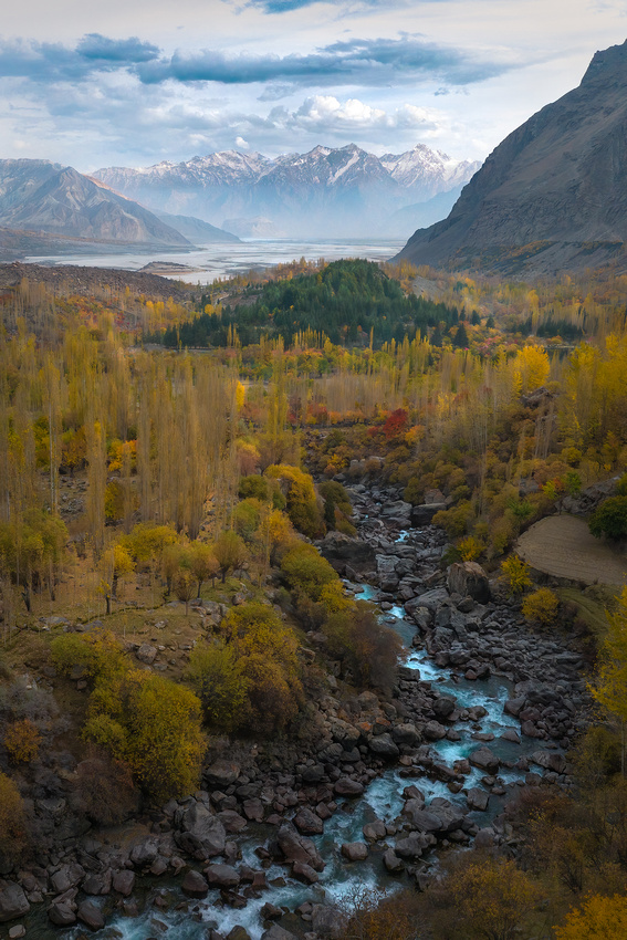
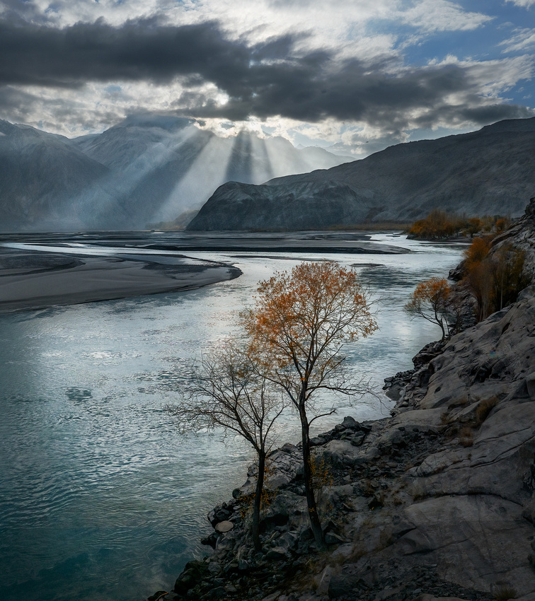
The Cones fuse beauty and grandeur to create a breathtaking amalgam. Granite peaks soar majestically to the heavens, adorned with ragged ridges, sharp spires, and towering cliffs. Most of these peaks have never been climbed because of the rugged terrain, technical difficulties, and limited access.
The Cones are situated near Haldi village in the Ghanche district of Gilgit Baltistan in Pakistan. The landscape surrounding Haldi village is mesmerizing, Verdant valleys, glistening streams, and snow-capped peaks create an idyllic setting.
Along with the captivating Cones, the area offers other attractions. The Saling Valley, Yochung Valley, Machulu Valley, and Haldi Village itself are exceptional sightseeing locations. However, the Machulu Village viewpoint truly shines among these options.
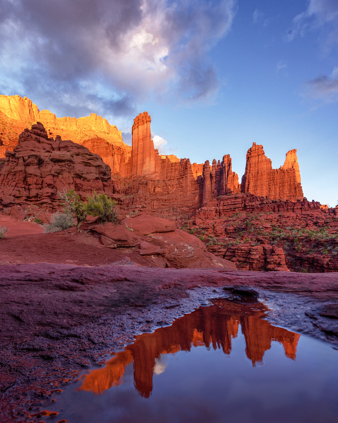
The Haldi Cones from Machulu Village
Working the Area
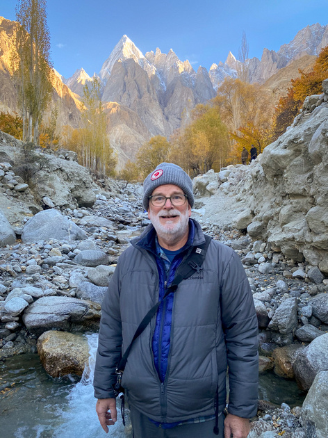
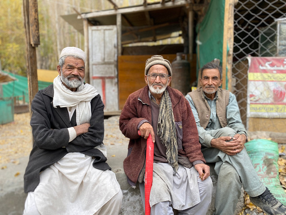
As usual, we arrived early on the morning of November 4 and scouted for locations along the stream running through Haldi village. The villagers were curious and several of them struck up conversations with our group of photographers.
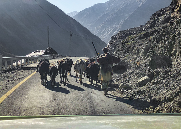
We kept crisscrossing a stream evaluating compositions leading to the Cones. In some spots, it was tricky crossing the rocky stream. Only a single footbridge graced the stream. And in Pakistan, bridges are shared by people, vehicles, and livestock.
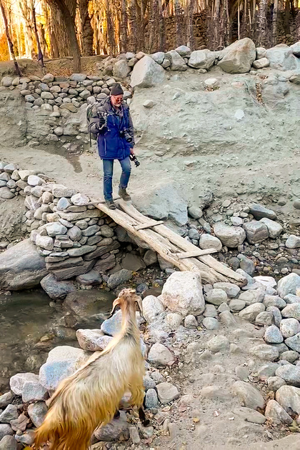
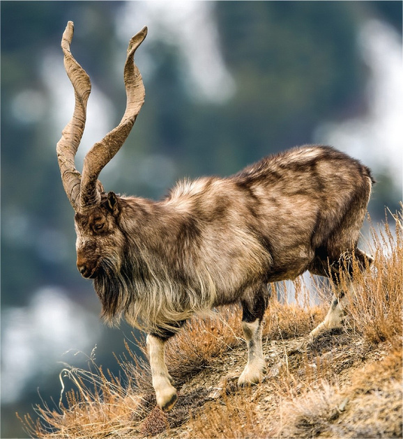
This goat thought the better of it and turned around when he spotted friend and fellow photographer Jon Christofersen starting to cross.
The Shot
After finding a composition, we waited for the light. If the sun was too low, the mountain would be unappealing. And if it was too high, numerous harsh shadows on the mountain and in the valley would be chaotic and distracting.
To play it safe, we took photographs every five minutes or so for about a half hour. After that, it was back to town for breakfast and a warm cup of coffee.
I’ll be in the field for the next two weeks, so the next Friday Photo will be on April 19.
Thanks for looking,
Chuck Derus
]]>
Picturesque is the word to describe northern Pakistan. And the Saling Valley is filled with vivid images.
Nestled in the Ghanche District of Khaplu in Gilgit-Baltistan, the Valley is a destination waiting to be discovered. It also serves as a gateway to the enchanting Hushe Valley.
The markhor goat is the national animal of Pakistan and is abundantly present in the Valley. The word mārkhor (مارخور), meaning "snake-eater," comes from both Pashto and classical Persian languages. It stems from the snake-like form of the male markhor's horns, possibly leading ancient peoples to associate them with snakes.
From science.org
Most people in the Valley grow wheat, potatoes, tomatoes, and other vegetables. Small herds of livestock add milk and meat to the diet. We found everyone to be hospitable and friendly.
The Shot
We awoke well before dawn in nearby Khaplu on November 3 and then drove east. After a short while, we turned north on a connecting road to the town of Saling. Before we reached town, we stopped, parked, and hiked about a mile east looking for a foreground to complement the distant mountains.
The pre-dawn light beautifully embraced the distant peaks. We had colorful bushes in the foreground and a pair of trees created a complimentary frame-within-a-frame for our composition. Once the sun came up, harsh shadow lines created so many distracting shadows that we put away our cameras.
After that, it was a short hike back to our vehicles. Luckily, breakfast and a hot cup of coffee was not far away in Khaplu.
Thanks for looking,
Chuck Derus
]]>
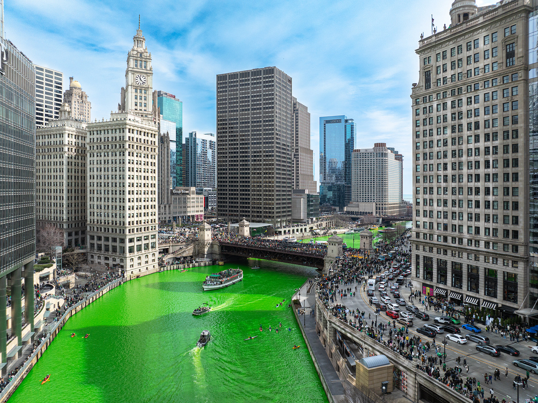
Greener Than Green River Soda!
Is it a celebration of Irish heritage or an excuse to party? It’s probably both. Parties, bar crawls, and parades are held worldwide celebrating St. Patrick’s Day.
The history of St. Patrick’s Day in Chicago dates back more than 175 years. Now a longstanding tradition, Chicago’s Irish parade was first held in 1843 becoming an official city event in the 1950s. Along with the downtown festivities, Chicago’s proud Irish heritage is also on full display in multiple neighborhoods.
Since 1962, Chicago has dyed the east branch of the Chicago River neon green in a now iconic annual celebration. Thousands of people line the Riverwalk and crowd Chicago’s bridges to glimpse the phenomenon. It’s typically held at 10 a.m. the Saturday before St. Patrick’s Day and is followed by the downtown parade.
Crews from the Chicago Plumbers Union Local 130 create a spellbinding spectacle spreading the dye from boats in honor of St. Patrick’s Day. The best views of the newly colored river are from Upper Wacker Drive between Columbus and Fairbanks.
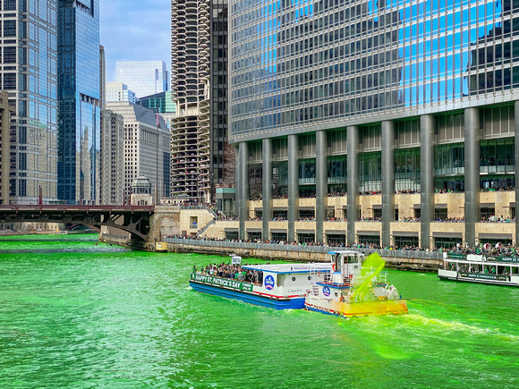
iPhone shot from the Michigan Avenue bridge.
The event started thanks to serendipity. In 1961 Stephen Bailey, business manager of the Chicago Plumbers Local 130, was approached by a plumber.
His normally white coveralls were heavily stained (or dyed) the perfect shade of Irish green. When Bailey asked how his coveralls got this way, he learned that the dye used to detect leaks into the river colored the fabric that special color.
That's when Mr. Bailey bellowed, “Call the mayor…we will dye the Chicago River green!” That first 1962 river dyeing turned the waters green for nearly a month. Currently, the color only lasts for a few hours. The union’s environmentally friendly dye formula remains a closely held secret.
The Shot
I had never witnessed the event, so fellow photographer Jon Christofersen and I headed downtown last Saturday. In retrospect, we should have left earlier as the traffic and crowds made for slow going.
After trying in vain to find a place to launch our drones in the Columbus/Fairbanks area, we hiked west to Wolf Point at the convergence of the north, south, and east branches of the Chicago River. It was easy to launch drones from there, but signal interference from the buildings limited our range.
I enjoyed this view the most. After the drone landed, we made our way back to our parked car. I should have brought my regular camera as the St. Patrick’s Day revelers were as colorful as the river!
Thanks for looking,
Chuck Derus
]]>
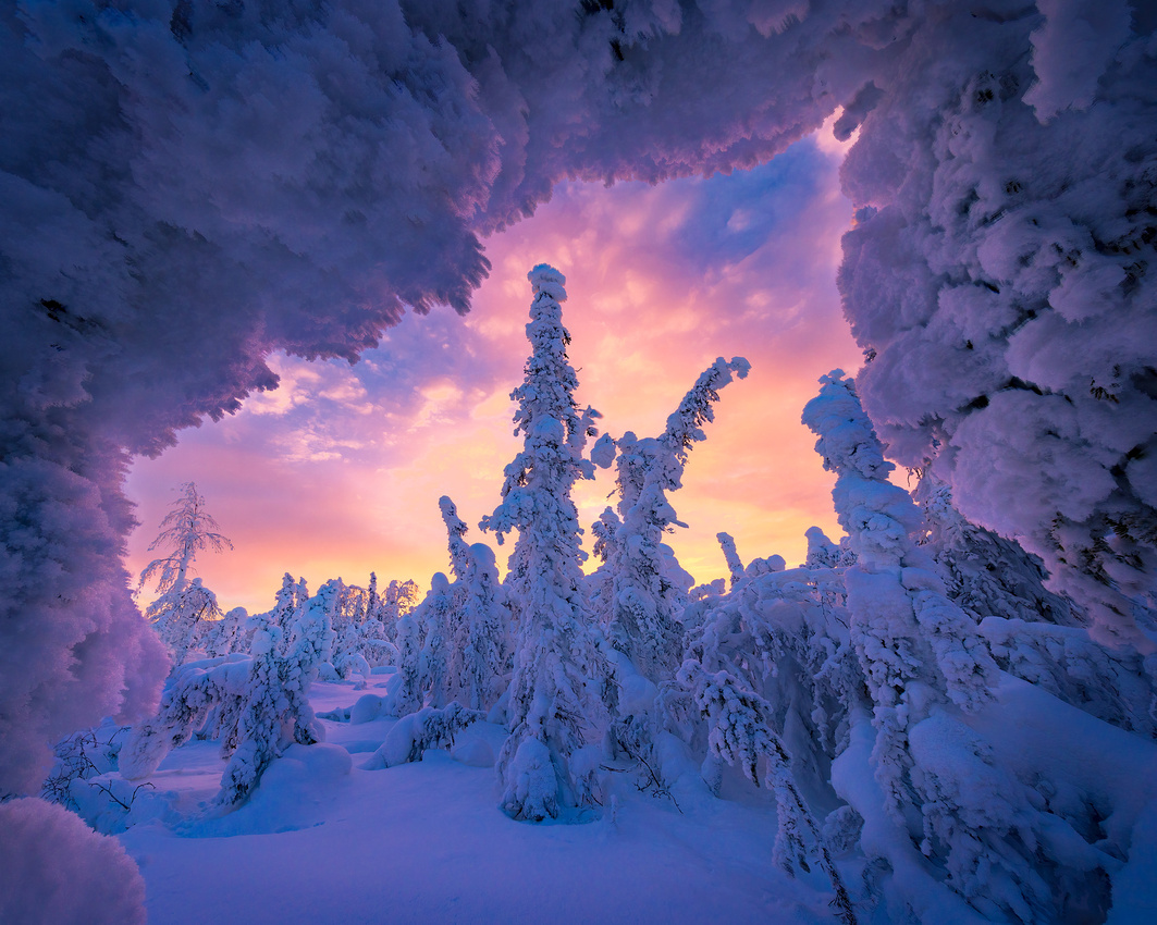
From the ordinary to wild and downright wacky. The variety of ice we encounter in nature depends on the conditions that created it.
Two forms of ice, hoar frost, and rime ice, excite photographers the most because of their photogenic nature.
Hoar Frost
We’re all familiar with dew. When supersaturated moist air near the surface of the ground is cooled to its dew point, tiny droplets of water condense on surfaces.
Hoar frost is formed by a similar process. But with hoar frost, the supersaturated moisture in the air skips the liquid droplet stage and goes straight to ice when temperatures are below freezing. Hoar frost also needs calm air that allows those complex lacy deposits of crystals to form.
The name derives from the old English word “hoary,” meaning getting on in age. Many trees, especially evergreens, take on a "hair-like" appearance resembling a white, feathery beard. These deposits are quite fragile.
An example of hoar frost crystals on the icy Dietrich River in Alaska.
Rime Ice
Rime ice can also coat nature in magical ways. When supercooled (below 32°F) fog droplets instantly freeze and attach to exposed surfaces below 32°F, you get rime ice.
Soft rime ice forms under calm wind conditions. The fog usually freezes to the windward side of solid objects, particularly tree branches and wires. It is similar in appearance to hoar frost with narrow white icy needles and scales. Soft rime is quite fragile.
Hard rime ice is denser and more difficult to remove. It’s often seen on trees atop mountains and ridges in winter, when low-hanging clouds cause freezing fog. The fog freezes to the windward side of tree branches, buildings, or any other solid objects, usually with high wind velocities and air temperatures between 28 and 18 °F.
The Shot
We arose on the morning of February 18 and drove the Dalton Highway to an area near Livengood, Alaska looking for a group of hard rime ice-encased trees. We arrived too early and waited in the van where it was warm.
The two trucks that went by both stopped to check on us as we might have been a disabled vehicle. It was a good feeling to know that people cared about our welfare in that remote stretch of Alaska.
As dawn approached, we wandered through the knee-deep snow looking for compositions. This composition was framed on top by a bowed-over tree and an upright tree. Inside the frame were three rime-encased trees and clouds to the east.
Normally, sunrise shooting is a frantic race against time. You typically have mere minutes to capture the warm colors of dawn. But near the Arctic Circle, we had close to an hour of good light! After two hours of photography, we headed back to the van for the long drive south to Sutton, Alaska.
Thanks for looking,
Chuck Derus
]]>
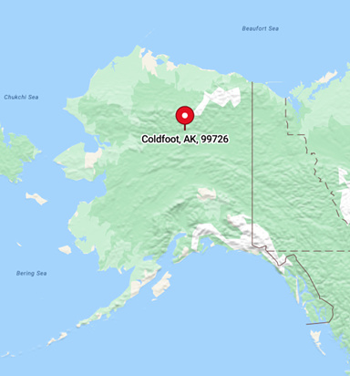
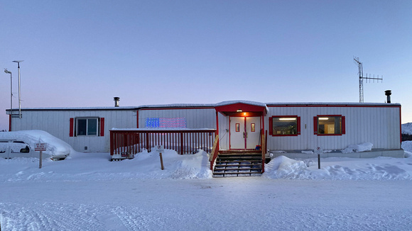
What a name! Coldfoot, Alaska (population 34) is aptly named. The lowest unofficial recorded temperature there was a chilly -82 degrees Fahrenheit!
The town began as an 1899 gold mining camp named Slate Creek. Folklore has it that the current name was derived from gold rush prospectors getting "cold feet" about making the 240-mile journey further north to Deadhorse.
The town languished until the 1970s when the Alaska Pipeline was built. Now it’s a rest stop on the Dalton Highway for ice road truckers heading to the oil fields on Alaska’s northern coast.
The town consists of a truck stop, a motley collection of old-school gas pumps, a hotel, a trooper’s office, an Alaskan Department of Transportation office, post office, and a runway for bush planes.
The Coldfoot Camp truck stop was founded by Iditarod champion Dick Mackey. He started his operation selling burgers out of a converted school bus. Truckers then helped build the truck stop and cafe.

The Coldfoot Camp Trucker’s Café menu.
The hotel rooms are spartan former pipeline worker trailers. But the hotel is the best (and only) hotel in town, so I paid the $300 per night price and enjoyed the experience!
The hotel.
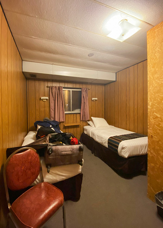
Heat, hot water, a shower, and electricity!
The Shot
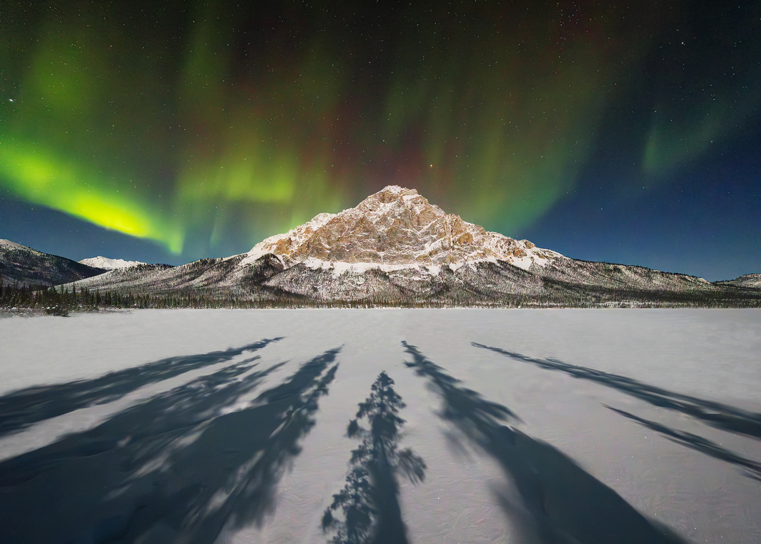
Our photography group left Coldfoot on the evening of February 16 in search of the Aurora Borealis. After driving about an hour North, we stopped at the Dietrich River bridge and headed to a location we scouted that afternoon.
But the foreground and the anticipated location of the Aurora didn’t seem quite right. So, we piled into the car and relocated further upriver. We had to trudge about 100 yards in knee deep snow after we stopped at a nearby frozen lake.
Our reward was a pattern of strong leading lines created by tree shadows aimed at a mountain peak across a frozen lake. Now we just had to wait.
Our patience was rewarded when the light show began. We didn’t even notice or care that it was a chilly -11 degrees out. Nature’s beauty mesmerized us. After about three hours, the show stopped, and we headed for the warmth of our unique hotel rooms.
Thanks for looking,
Chuck Derus
]]>

The morning of January 20 began in a joyous, beautiful, and blessed place. I was at Holy Trinity Polish Catholic Church in the Pulaski Park neighborhood of Chicago. The occasion was a photo tour of this historic church. The tour ended on a somber note.
The church, completed in 1906, is a blend of several architectural styles. This blending is reminiscent of Poland’s Middle Ages churches. As churches sustained damage by war or fire, they were rebuilt and remodeled in a multitude of styles. The architect evidently hoped to remind the Holy Trinity parishioners of churches from the old country.
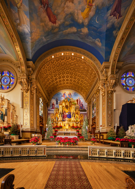
Christmas decorations in the Polish tradition go up on December 24 and come down February 2nd on Candlemas.
For over a half century, Holy Trinity was the center of activities for its 60,000 parishioners. Everything you could possibly want was available at church or in the square mile that it served. In 1960, when the Kennedy Expressway cut through the heart of Chicago’s Polonia, the neighborhood and parish slowly declined as Poles moved to the suburbs.
Mass is celebrated strictly in the Polish language. In honor of its 100th anniversary, the congregation began a renovation campaign in 2005. Today, the church’s many features are beautifully restored.
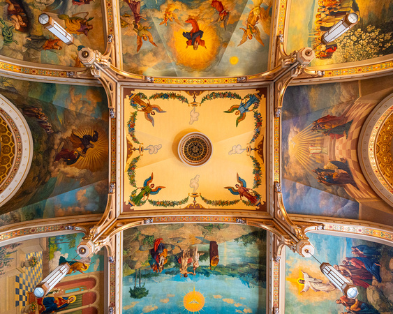
Part of the ceiling
Catacombs
During construction, pastor Casimir Sztuczko CSC wanted to set aside an area to venerate the holy relics of saints and the beatified. The result is one of the most distinctive and interesting aspects of Holy Trinity, the so-called Catacombs.
Located in the basement, it consists of a winding path lined with niches containing saintly relics leading up to a chamber containing the grave of Christ. There are now 267 relics in the catacomb.
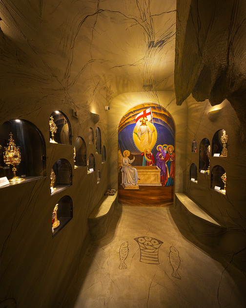
Part of the Catacombs
The Shot
One heart-wrenching relic commanded my attention. I was looking at a rosary made from bits of bread at Germany’s Ravensbrück concentration camp.
Ravensbrück was a Nazi concentration camp in northern Germany exclusively for women from 1939 to 1945. An estimated 132,000 women passed through the camp during the war. Many of them were slaves working under unspeakable conditions for the Siemens & Halske company. Among other things, Siemens produced field telephones of the type "Feldfernsprecher 33."
About 48,500 women were from Poland. Fifteen percent of the prisoners were Jewish, with eighty-five percent from other races and cultures. Almost half of all prisoners died at Ravensbrück. The majority perished from disease, starvation, overwork, and despair. About 2,200 were gassed.
Hoping they might survive; Polish Catholic prisoners made rosaries from their skimpy bread rations and hid them. Discovery meant death. The homemade rosary on display had been soaked in the blood of a Polish mother and daughter killed at Ravensbrück.
My thoughts were jolted back to the November 10, 1961, episode of The Twilight Zone. In the episode Deaths-Head Revisited about a concentration camp commandant, Rod Serling ended with this powerful outro.
“All the Dachaus must remain standing. The Dachaus, the Belsens, the Buchenwalds, the Auschwitzes; all of them. They must remain standing because they are a monument to a moment in time when some men decided to turn the Earth into a graveyard. Into it they shoveled all their reason, their logic, their knowledge, but worst of all, their conscience. And the moment we forget this, the moment we cease to be haunted by its remembrance, then we become the gravediggers. Something to dwell on and to remember, not only in the Twilight Zone but wherever men walk God's Earth.”
Lest we forget,
Chuck Derus
]]>
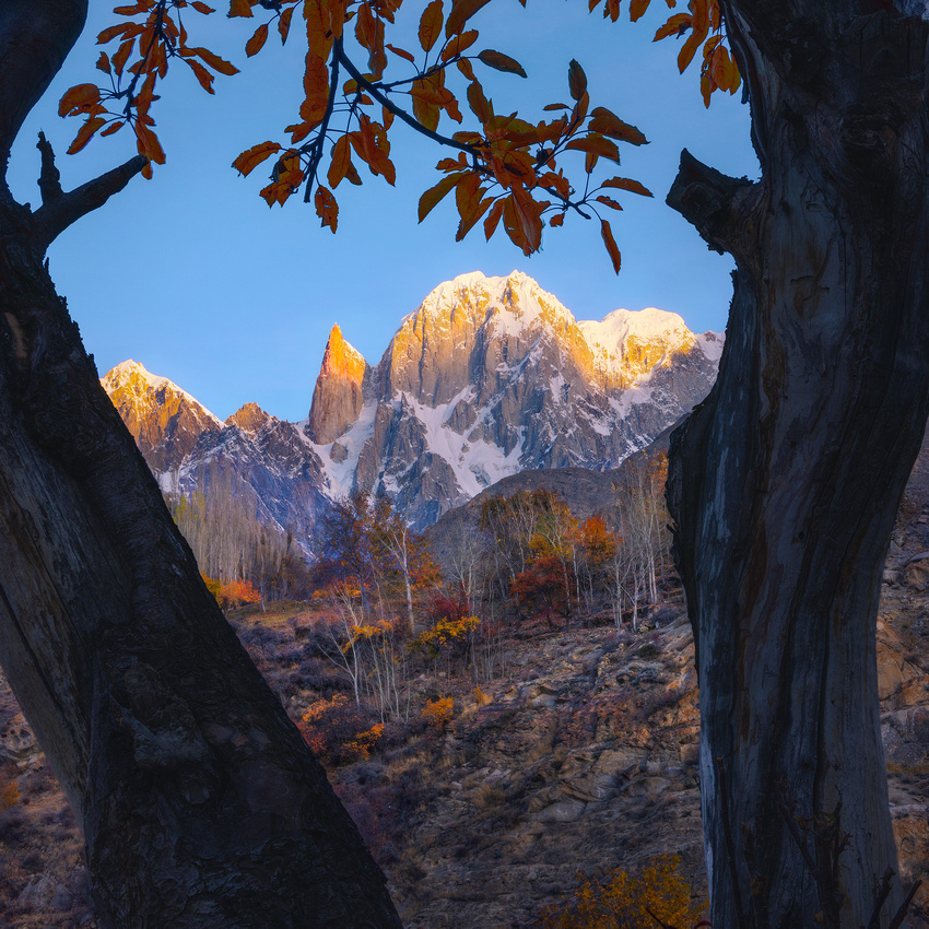
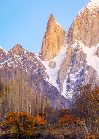
Last week’s blog was about compositions that use a frame within a frame. This is a second composition framing Ladyfinger using a pair of trees. Let me know if you prefer the horizontal photograph from last week or this week’s vertical composition.
Driving Through Pakistan
We drove every day during our thirteen days in Pakistan’s Hunza Valley. Delays were not uncommon. 😊
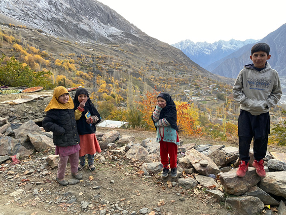
Scores of children walking, laughing, and talking while walking to and from school were a ubiquitous sight. There were no parents dropping off their kids at school. Walking several miles up and down thousands of vertical feet was common.
Our expedition leader, Muqeem Baig (Climax Adventure Pakistan | (climaxadventurepk.com)) commented that the literacy rate of Hunza Valley is above 95 percent. And all children have access to a high school education.
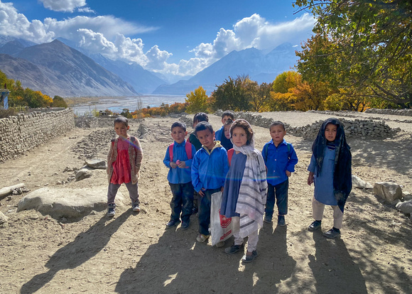
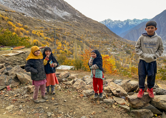
A few of the schoolchildren we met in villages walking to and from class.
Government school is only $2 US dollars a month. Private schools are substantially more, up to $200 a month.
The Shot
It was early on the morning of November 7 when we arrived at our Ladyfinger viewpoint. The Peak was about 5.5 miles away in the distance. We had sufficient time to scout several possible compositions.
This composition really seemed to place Ladyfinger in a frame within the two-dimensional frame of my photograph. Ladyfinger is in the left center, with nearby Hunza Peak at 20,570 feet on the right.
Thanks for looking,
Chuck Derus
]]>
Ladyfinger Peak (also known as Bublimotin, Bubli Motin, or Bublimating) is a distinctive rock spire. Located near the city of Gilgit in the westernmost part of Pakistan’s towering Karakoram Mountain range, it stands tall as a lone sentry amidst the gorgeous embrace of the Hunza Valley.
The Peak is a sharp, relatively snowless rock spire that climbs to a dizzying height of 20,000 feet. The last 1,830 feet to the top are nearly vertical.
Ladyfinger is climbed mostly by alpinists, not mountaineers. Alpinism is a specialized form of climbing that focuses on ascending difficult routes in cold and challenging environments. It’s much more demanding, dangerous, and deadly than mountaineering.
Very few alpinists attempt Lady Finger. It’s one of the more difficult climbs in the area. The final 1,830 feet of sheer rock wall are extremely challenging. Those who succeed often paraglide back to the valley.
The Lady in Waiting
Legend has it that Kisar, a magical prince from Baltistan, came to the Hunza Valley on one of his adventures. While there, the already married prince met and married a princess named Bubli. Afterwards, Kisar learned that his first wife had been kidnapped. He promptly prepared to set off and rescue her.
Taking Bubli up the mountain that would later bear her name, he handed her a sack of grain and a chicken. Bubli asked him whether and when he would return. Kisar told her, "Every year give this chicken a single grain to eat. When the sack is empty, I will return. Until that time, stay here."
He left and they say Bubli is still waiting on Ladyfinger Peak.
The Shot
We left early on the morning of November 7 for our Ladyfinger photoshoot. Arriving well before sunrise, we had plenty of time to evaluate possible compositions. The Peak was about 5.5 miles away in the distance.
When I first saw it, I instinctively grabbed a shot. But the easiest photo is oftentimes the most boring photograph you can create. And that was the case this morning. What could be changed to make a more visually appealing image?
Boring!!!
Every time we take a photograph, we frame our subject. But frames within that frame potentially create striking and powerful images. Careful use of framing can help lead the viewer’s eye through the image and hold their interest much longer.
Luckily, there were several potential compositions that framed Ladyfinger. You’ll see more than one Friday Photo featuring Ladyfinger in a frame.
This framing composition excited me the most. Getting down on my stomach with my camera inches from the ground, an overhead arch of branches and leaves framed the top of the image. Ladyfinger is in the left center, with nearby Hunza Peak at 20,570 feet on the right.
Thanks for looking,
Chuck Derus
]]>
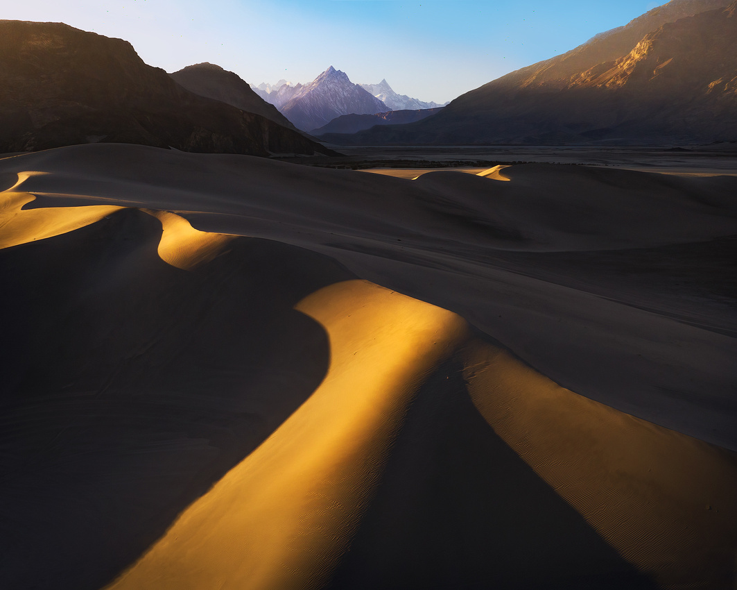
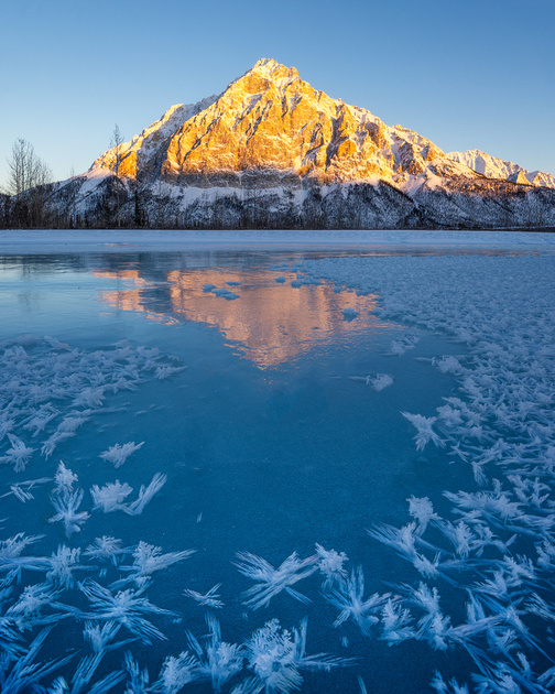
Hot comes to mind when you hear the word desert. But imagine a bizarre landscape of sand dunes, mountains, and extremely cold temperatures.
Welcome to a desert in Pakistan where biting cold dominates the landscape. At 7,500 feet above sea level, you’re in the Sarfaranga Desert, also called the Sarfaranga Cold Desert.
Located in the Shigar Valley near the town of Skardu, this desert displays immense diversity. The Indus River flows nearby. Towering mountains encircle the desert, with their greyish-black hues providing a dramatic backdrop that contrasts with endless golden sand fields. Sinuous, sensual dune shapes are everywhere. Ever-present strong winds create a magical atmosphere of dust and sand in the air.
Flying into Skardu in the Shigar Valley gave us our first taste of the sheer mountains in the area. You don’t gradually descend into the Skardu airport; you corkscrew your way down to the ground.
Our group leader somehow talked his way into a cockpit jump seat ride to Skardu. Arriving over Skardu, the pilot put the plane into a tight spiraling descent to the airfield, with the cockpit warning system blaring “Terrain!” repeatedly until the plane landed.
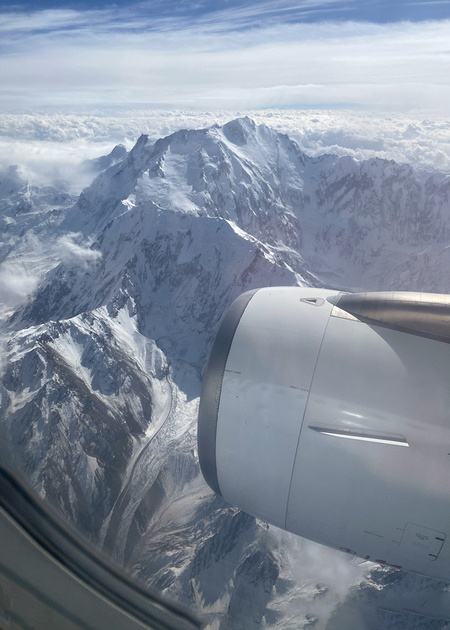
The view out my window near Skardu. Our cruising altitude isn’t much higher than the mountains!
The best time to visit the Sarfaranga Desert is from June to September when temperatures range between 46 and 75 degrees. The temperature can drop as low as 1 degree above zero between October and May. Luckily, we had a mild afternoon day in the 30s when I was there.
The Shot
On the afternoon of November 4, our photography group turned off the main road from Skardu and into the Sarfaranga Desert. Because the mountains are so high, sunset was going to occur at least an hour early when the sun dipped below the mountains.
I launched my drone with a wide-angle lens and pulled out my big camera with a telephoto lens. It turned out that one camera couldn’t capture the magic of what my eye was seeing.
I used a photo from each camera to create a focal length blend. Blending the wide-angle drone photo of the foreground dunes with the distant telephoto view of the mountains allows viewers “to be there” and experience what I saw.
Thanks for looking,
Chuck Derus
]]>
 “By the shores of old Lake Michigan / Where the Hawk Wind blows so cold..."
The first line of Steve Goodman's song, "A Dying Cub Fan's Last Request"
Five generations of loyal fans endured 108 years of seemingly endless exasperation. The 2016 World Series Champion Chicago Cubs finally snapped a losing streak dating back to 1908. During that void, resilient Chicagoans reassured each other that “Anyone can have a bad century.”
Steve Goodman’s classic song captured the angst of loyal Cub fans during those dark decades. While most of the lyrics make sense to me, I’ve always wondered about the Hawk Wind reference.
If you’ve been to Wrigley Field or anywhere near the Chicago lakefront, you know how a cold wind off the lake can transform a pleasant outing into an exercise in cold weather survival. But what’s this Hawk Wind reference?
Describing Chicago's wind as “The Hawk” or “Hawk Wind” or “Hawkins” is attributable to its popularity in African American vernacular English. The first mention is in "Weather-Lore," by J. H. Evans, published in the 1896 Southern Workman.
The article suggests that the use of “Hawkins is coming,” meaning cold weather is coming, was passed down from the "dark ages of [African American] slavery." The article further states “…when our fore parents were driven by their owners late, and early, they were taught nothing but hard work, therefore they were not able to read or write. But nature taught them many signs regarding the weather.”
Evans documents many examples of cold weather signs including “...If turkeys roost high in a tree, it's a sign of cold weather. You will hear the old folks say, ‘Look out children, Hawkins is coming.’”
The Baltimore Sun ran a series of columns in 1934 examining the origin of the phrase. According to the newspaper, "Hawkins is coming" describes a cold, winter wind.
The Chicago Defender first used the term on October 20, 1936. It wrote "And these cold mornings are on us - in other words 'Hawkins' has got us."
In 1967, Chicago native Lou Rawls wrote this opening lyric to his song Dead End Street.
“I was born in a city they called the 'Windy City'
And they call it the 'Windy City' because of the 'Hawk.' All mighty Hawk
Talking about Mr. Wind kind of mean around wintertime…”
The Shot
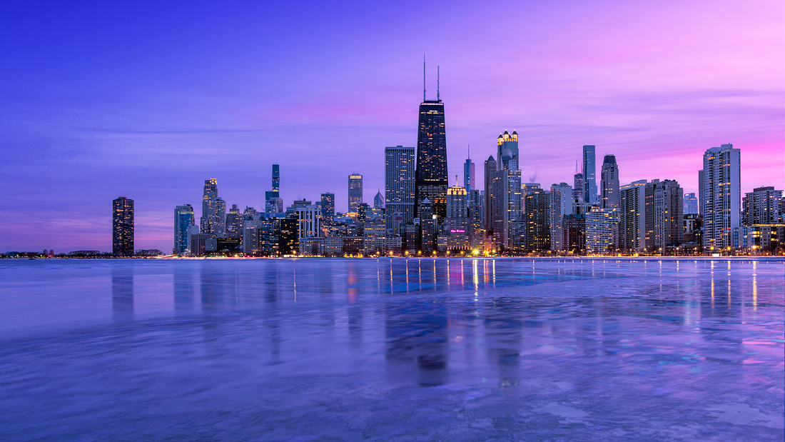
It’s been cold enough in Chicago recently for some serious ice to form on the Lake Michigan Shore. Last Sunday afternoon I joined fellow photographers Scott Fuller and John Tarsha for a trip to the city. We settled on North Avenue Beach as the location to explore with our cameras.
Multiple ice-covered objects were on the beach and near the shore. But it was the skyline that interested me the most. The ice in the water left an indelible impression of cold as I looked through the viewfinder.
I set up my camera to look south at the skyline. And then I waited for sunset and the blue hour. The weather up to that point had been cold but tolerable with a light breeze.
Color started to appear in the clouds as the sun neared the horizon. But the approaching sunset also brought The Hawk. The now biting cold wind convinced me to head for the warmth and shelter of Scott’s car instead of lingering.
Thanks for looking,
Chuck Derus
]]>
“Growing up in a place that has winter, you learn to avoid self-pity. Winter is not a personal experience, everybody else is just as cold as you, so you shouldn't complain about it too much. You learn this as a kid, coming home crying from the cold, and Mother looks down and says, 'It's only a little frostbite. You're okay.' And thus, you learn to be okay. What's done is done. Get over it. Drink your coffee. It's not the best you'll ever get but it's good enough.” Garrison Keillor of Prairie Home Companion
A Rude Awakening
My annoying iPhone alarm jarred me from a deep sleep. I groggily looked around a dark, unfamiliar room. Where was I? And why was I getting up at 5am?
And then I remembered. It was my hotel room in Munising, Michigan. Today was my second day to head out and photograph the icy Lake Superior shoreline in subzero, windy conditions.
For a moment, I was tempted to pull the warm comforter over my head and go back to sleep. It was supposed to be even colder today. And it had taken me hours to warm up yesterday.
But wait a minute. I’m from Minnesota and going out on a cold day is what you do! So, I dressed in layers, ate a few mini donuts for breakfast, and headed to the snowmobile parking area.
Along with several other photographers that cold March 4, 2022, morning, we were transported by snowmobile across the frozen bay to Grand Island.
It looked promising. Unlike the day before, there was an opening in the overcast to the east. Colorful clouds or a star around the sun as it peaked above the horizon were both possible. And thanks to scouting the area the day before, we knew the location of several sea caves offering interesting compositions.
The Shot
I wedged myself as far back in a sea cave as I could go. I locked down my camera on the tripod after tweaking my composition and waited for the sunrise.
I wasn’t disappointed! As the sun cleared the horizon, red-yellow sunlight flooded the cave, bouncing off the ice and sandstone further intensifying the already warm light. I pressed the shutter just as the sun peaked over the distant shore, capturing my star around the sun.
We continued to photograph until we started to lose feeling in our fingers and toes. After that, we returned to the Falling Rock Cafe and Book Store in downtown Munising for a hot cup of coffee and breakfast.
Getting ready to leave for breakfast in town.
Thanks for looking,
Chuck Derus
]]>
 Doorway to Heaven
This evocative phrase opens chapter two in Peter Zuckerman’s book, Buried in The Sky, about climbing K2. The K stands for Karakoram and the 2 for the second of 32 numbered peaks in the towering Karakoram Mountain range of Northern Pakistan.
The Karakorum is the Earth’s youngest mountain range. It was born a mere 65 million years ago at a time when the dinosaurs were facing extinction.
The Indian continental tectonic plate was speeding North at six inches a year, “a reckless pace in geologic time” according to Zuckerman. It ploughed into Eurasia wedging itself under the larger continent. The Karakorum Mountains, like Mount Everest, rose from the sea and are still rising today.
This 500-mile-long Karakoram range has the world’s largest concentration of peaks more than five miles high. It contains eighteen summits higher than 24,600 feet in elevation. Four of them are above 26,000 feet: K2, the second-highest peak on Earth at 28,251 feet, Gasherbrum I, Broad Peak, and Gasherbrum II.
Harsher than the Himalayas, the Karakoram is the most glaciated place on the planet outside of the poles. And unlike older mountain ranges, erosion has barely smoothed the jagged edges of the Karakorum.
Kara means black, and koram means gravel or rock. Central Asian traders originally applied the name Karakoram to a pass in the range. At an elevation of 18,176 feet, the Karakorum pass is the highest pass on the ancient silk road.
The pass connects Leh in Ladakh (Kashmir in Northern India) and Yarkand in the Tarim Basin (the Chinese gateway to Central Asia). Shawls, indigo, tea, corals, and muslin went North, while silk, precious metals, costumes, and jewelry went South.
Early European travelers, including William Moorcroft and George Hayward, climbed the pass in the 1820s and applied the name Karakorum to the range of mountains west of the pass.
K1 to K32
British Lieutenant Thomas Montgomerie was part of the Great Trigonometric Survey of British India that set out to measure the shape of the Earth in the 1850s. His porters labored for four days to haul a plane table, heliostat, and theodolite up Mount Haramukh in the Himalayan foothills to measure the peaks. Montgomerie was rewarded by a panoramic view of multiple spires.
Two peaks towered among the others 130 miles to the Northeast. He labeled the tallest peak K1. K stood for Karakorum and the 1 signified the first peak in his survey. He labeled the second highest peak K2. He eventually logged 32 peaks in total.
But Montgomerie’s initial visual measurements proved to be incorrect. K2 is actually taller than K1 by 2,592 feet. That makes K2 the second highest mountain on Earth and only 781 feet less tall than Mount Everest.
K1 quickly reverted to its native Balti name of Masherbrum. K2 has retained its alphanumeric moniker. But its actual name is Chogori, a Tibetan name meaning “Doorway to heaven.”
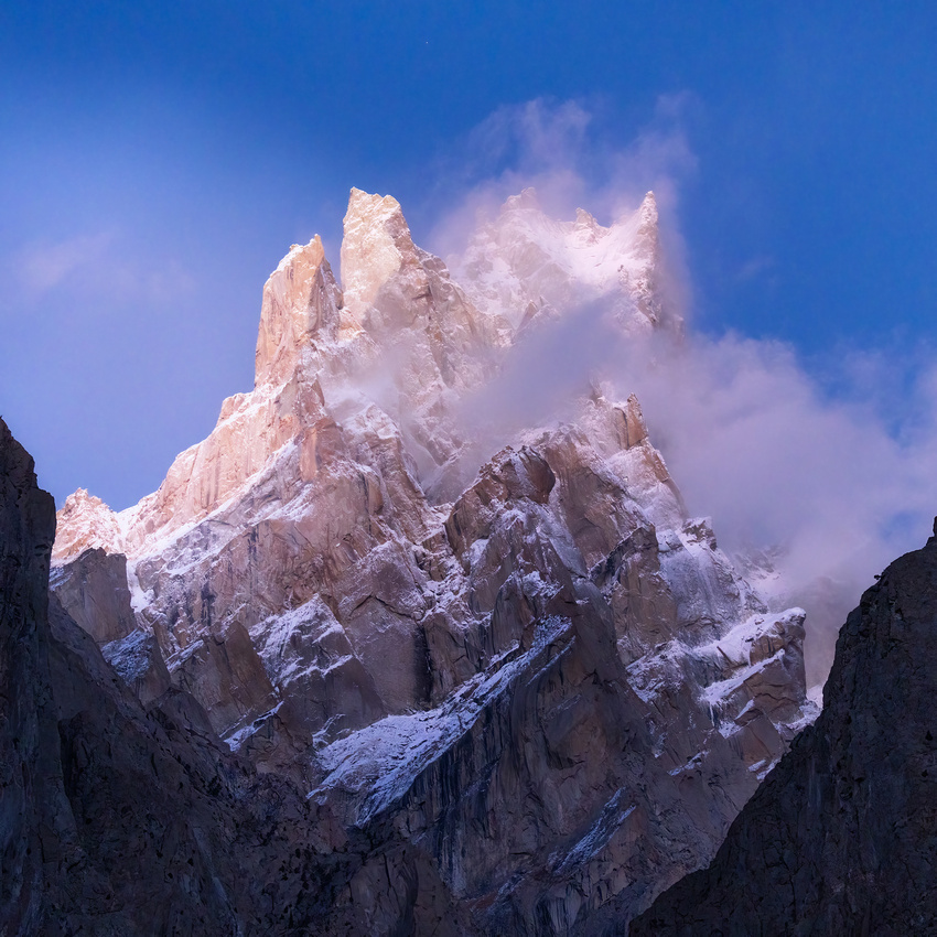
The Shot
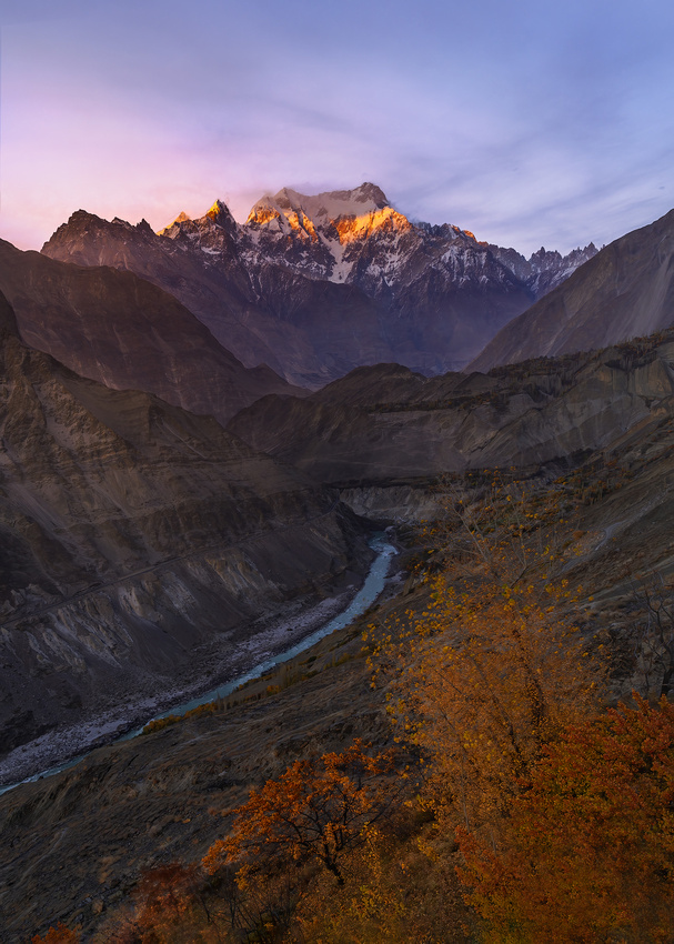
My November photography group never saw K2. It requires a seven-day trek at altitudes of up to 18,000 feet to get within visual range. However, we witnessed the majesty of Masherbrum (K1) on many occasions.
On November 3, we attempted to photograph Masherbrum at sunset. But the clouds shrouded the peak, making for poor photographs. Instead, we aimed our cameras at a pair of peaks in the distance.
The distant peak on the back upper right is called Grey Towers by the locals. The unnamed peak in the lower left is quite a bit closer and shorter. A telephoto lens compressed the apparent distance between the pair of peaks.
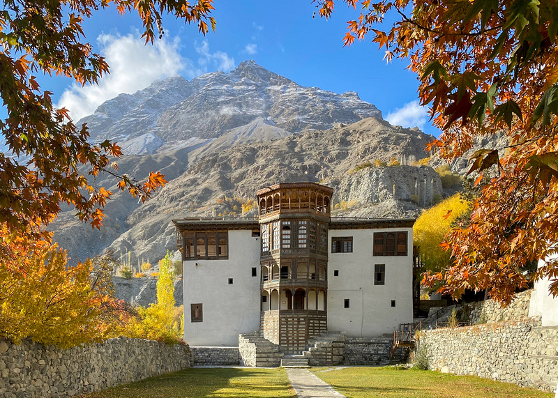
This was our last set of images for the day before heading back to our hotel room in Khaplu in the restored former royal residence of Baltistan.
Thanks for looking,
Chuck Derus
]]>
The River That Powers Civilizations
Pakistan is a country of 300 million people in an area only the size of Texas. Since time immemorial, water from the Indus River has sustained agriculture, life, and the birth of major civilizations.
The Indus was known to ancient Indians in Sanskrit as Sindhu and to Persians as Hindu. From the First Persian Empire, the name passed to the Greeks as Indós. It was then adopted as Indus by the Romans.
Interestingly, the name India is derived from Indus.
The Indus River begins humbly as a mountain spring. Fed by snowmelt, glacial meltwater, scant rain, and tributary rivers from the mountains of the Himalayas, Karakoram, and Hindu Kush, it flows almost 2,000 miles to the Arabian Sea.
The river’s course takes it from its origins in Western Tibet northwest through the disputed region of Kashmir. It then bends sharply to the left in a 17,000-foot-deep gorge after the Nanga Parbat massif (mountain). From there it flows south-by-southwest through Pakistan ending as a large delta emptying into the sea near the port city of Karachi.

The river’s statistics are impressive. It drains an area of about 430,000 square miles. With an annual flow of 58 cubic miles of water, it ranks as one of the 50 largest rivers in the world. It supports the ecosystems of temperate forests, plains, and arid countryside.
Ancient Civilizations
The river is historically important to many cultures in the region. The Indus Valley Civilization arose there during the third millennium BCE. It was one of the largest urban human habitations in the ancient world.
In the second millennium BCE, the Punjab region was mentioned in the Rigveda hymns as Sapta Sindhu and in the Avesta religious texts as Saptha Hindu (both terms meaning "seven rivers"). Other ancient civilizations in the Indus Valley include Gandhāra and the Ror dynasty of Sauvīra.
The Shot
Our group stopped several times to admire and photograph the Indus in November. The river was at its seasonal low for flow. We could only imagine what it looked like flooding its banks in the monsoon months from July to September.
The Indus River outside Skardu with rows of planted poplar trees on the right
We stopped outside the town of Kachura near Skardu to capture this small tributary winding its way to the mighty Indus in the background. I piloted my drone to several locations before settling on this composition.
Thanks for looking,
Chuck Derus
]]>

♫ And A Partridge in A Pear Tree… ♫
It’s the quintessential holiday tune. The Twelve Days of Christmas has a list of gifts associated with each day. From a partridge in a pear tree to twelve drummers drumming, the list is a holiday staple.
But don’t even think about adding them to your shopping list. It’s estimated the list would cost $47,844 this holiday season!
Where did the twelve days come from? If you view Christmas as a secular, commercial winter holiday, it’s the twelve days around December 25.
If you follow Western Christian traditions, the twelve days of Christmas mark the days between the birth of Christ and the coming of the Magi, the three wise men. They begin December 25 and run through January 6, the Feast of the Epiphany.
In the Eastern Orthodox Christian tradition, Christmas is on January 7. The twelve days begin on Christmas Eve (January 6) and conclude on January 19.
But why are there twelve days? And why is it in the dead of winter? Finally, why are there so many birds?
Ancient Lunar Influences
A full moon or a new moon signaled the start of another unit of time for our ancestors. Calendars based on the moon date to as early as 8,000 BCE.
Most ancient cultures also paid attention to the winter solstice. It’s the winter day with the least daylight and longest night of the year. The Sun is also at its lowest maximum elevation in the sky. It takes place December 21 or 22.
After the winter solstice, we look forward to increasing sunlight, warmth, and the promise of spring. It’s the start of a new year with the Earth beginning another 365.25-day journey around the Sun.
But twelve Moons only require 354 days. The lunar year is 11 days, or twelve nights, shorter than the solar year. To keep them synchronized, you must add 12 days to the lunar calendar. The song reflects this holdover correction to the lunar calendar.
The celebration of Christmas around the solstice also isn’t a coincidence. Northern latitude peoples celebrated the promise of light and new life in the longest, darkest days of winter well before the birth of Christ.
In 320 CE, Pope Julius I specified December 25 as the official date of the birth of Christ. It fits nicely into existing and ancient celebratory traditions.
Keeping animals alive became more difficult as food stores dwindled at the solstice. People often slaughtered some of their livestock. And they also relied more on hunting game birds. Swimming swans, calling birds, French hens, turtle doves, geese a’laying, and partridges all made it to the menu at that time of the year.
While Christmas has endured, the need to add twelve days to the calendar has gone away. Julius Caesar instituted the purely solar Julian calendar in 46 BCE. It eliminated the influence of the Moon and the need for a twelve-day correction.
In 1582, the more accurate Gregorian calendar, or Western Christian Calendar, replaced the Julian calendar. Eastern orthodox Christians still use the older Julian calendar, placing Christmas on January 7.
The Shot
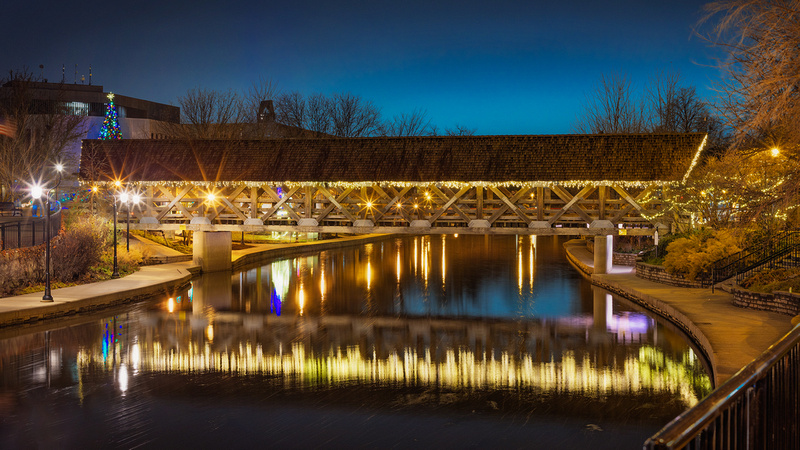
Riverwalk Park Covered Bridge, Naperville, Illinois
Photogenesis, the Naperville Camera Club, had a holiday photography outing a few weeks ago. We were challenged to photograph holiday lights.
Remembering the song, this drummer seemed to capture the holiday spirit.
Regardless of religious tradition, I hope we can all celebrate the twelve days as “a time of light amid darkness, a time of togetherness and peace, a time of feasts and celebrations, and a time of reflection.” *
I’ll be celebrating and taking the next twelve days off. I’ll post again after the new year.
Thanks for looking,
Chuck Derus
*From Atlas Obscura
]]>
Imagine a mountain range with eighteen summits higher than 24,600 feet (7,500 meters). And four of them are above 26,000 feet (8,000 meters)! Meet the Karakorum Mountain range.
Those highest four peaks include K2 at 28,251 feet. It’s the second highest, deadliest, and technically most difficult climb on Earth. One quarter of those attempting the climb die in the attempt. The other three highest peaks are Gasherbrum I, Broad Peak, and Gasherbrum II.
The Karakoram (kahr-uh-kawr-uhm) spans 311 miles beginning in Afghanistan to the west, through the Gilgit-Baltistan region of Pakistan and into Indian Ladakh, finally ending in Aksai Chin in China. It’s part of a complex of ranges that includes the Pamir Mountains, Hindu Kush, and Himalayas.

The Karakorum Range identified in white from Wikipedia.
Somewhere between 28 and 50 percent of the Karakorum is covered by glaciers, making it the most glaciated place on Earth outside of the polar regions. The Siachen Glacier (47 miles long) and Biafo Glacier (39 miles long) are the second- and third-longest glaciers outside the poles. During the last ice age, the glaciers reached 430 miles in length.
Ultar Sar
This 24,239-foot mountain isn’t one of the highest peaks in the Karakoram. But what it lacks in height is more than made up for by its dramatic appearance. It rises over 17,388 feet above the Hunza River near Karimabad, in only about six miles of horizontal distance. It’s a breathtaking peak.
During the 1980s and 1990s, fifteen expeditions made attempts without summiting the mountain. At least three climbers died during those attempts.
In July 1996, a duo from the Japan Alpine Club Tokai expedition summited the mountain for the first time. Sadly, the descent required eight days due to bad weather. One of the exhausted climbers developed high altitude sickness and died at Camp I.
The Shot
On the late afternoon of November 6, our photography group was in the area near the town of Minapin looking for compositions. Using a drone seemed to be the best way to frame the view of Ultar Sar majestically rising above the river valley.
We hovered in place, hoping for the setting sun to bathe the distant snowcapped peak in warm light. Suddenly, we were rewarded with about a minute of gorgeous light.
As my drone was returning, I thought why anybody would climb a mountain like Ultar Sar. A quote by Sir Edmund Hillary, who first climbed Mount Everest with Tenzing Norgay, came to mind. “It is not the mountain we conquer, but ourselves.”
Thanks for looking,
Chuck Derus
]]>

Traditional holiday décor? No way! Instead, it’s an enchanting ode to Taylor Swift.
Located in my hometown of Naperville, Illinois, there's no room left for additional decorations in front of Amy and Brian Scott’s home. References to the career of the Grammy-winning singer-songwriter and global superstar are everywhere.
Friendship bracelets are wrapped around a tree. An Eras poster hangs over the front of the house. There’s a cutout of Travis Kelce on the roof holding up a lighted sign reading "Taylor's version.” Images of album covers sit in the yard alongside a T-shirt that reads "A lot going on right now."
And that’s just part of what’s happening. The Scotts have brought Swiftie Mania to a new, alluring level this holiday season.
The homeowners haven’t been to a Swift Eras concert. But their two college age daughters, Emily and Rebecca, are Swifties.
Known for their playful elaborate outdoor decorations, the Scotts brainstormed the display and brought it to life in just a month. Brian fabricated many of the decorations and installed them. The Merry Swiftmas and taylor’s version signs were special order.
The lifelike Taylor Swift appears to be a statue. But it’s a metal cutout decorated with spoonsful of glitter applied by the family in their basement.
The Shot
I wasn’t sure what to expect when my daughter suggested visiting the Merry Swiftmas house. And it certainly exceeded my expectations! There must have been fifty people there at any given time while I was photographing the house.
I enjoyed the featured photo and these three additional photos the most.

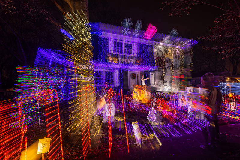

If you want to visit, it’s at 1228 Atlas Lane in Naperville.
Thanks for looking,
Chuck Derus
]]>
What should you eat for breakfast? What clothes should you wear today? What restaurant should you go to?
You make thousands of decisions each day. Do you really have the time to carefully think about every decision you make?
We rely on heuristics, or mental shortcuts to help us. They allow you to make decisions quickly and with minimal mental effort. Without them, we would suffer from analysis paralysis.
But heuristics can also lead you to overlook critical information or act on unjust biases. Therefore, it is important to be aware of the potential drawbacks of heuristics and to use them judiciously.
Pakistan
I recently returned from a nearly two week long photography trip to Pakistan. Everyone’s conventional wisdom, including my wife’s, was that it was a dangerous country. Fortunately, that heuristic bias was totally unfounded.
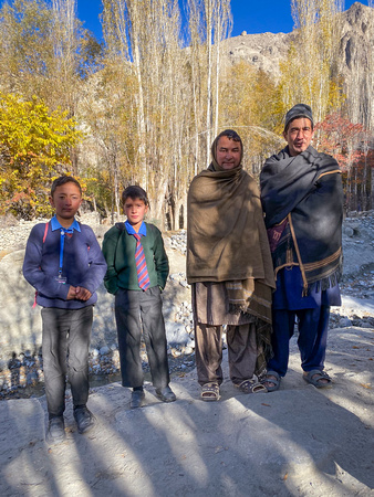
Pakistanis are welcoming and were eager to talk with our group of ten photographers. Unlike at home, we could knock on a door, walk through a property to reach a better location, visit a store or mosque, and fly our drones without any fear of being shot.
Many Pakistanis spoke English. Boys and girls all go to school, either in government schools or private schools. And other than the police and one elderly hunter with what appeared to be a century old rifle, there were no armed individuals.
I highly recommend visiting the north of Pakistan to see breathtaking 23,000-to-26,000-foot peaks with fall foliage at the lower altitudes. You won’t be disappointed.
A few villagers that were eager to practice their English with our group.
Curious schoolchildren returning home to their remote village.
The Shot
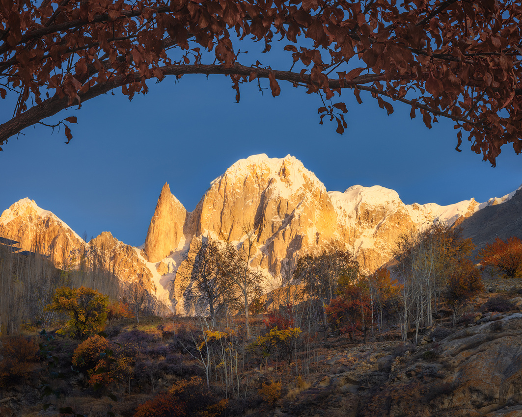
Photographers usually think of light as merely illuminating the subject being photographed. At times, the light itself can be the subject. That was the case on November 3rd.
Crepuscular rays, often called “God beams,” occur when sunlight passes through clouds or fog and the light is scattered. The atmosphere they create adds an element of magic to an image.
God beams beckoned us near the town of Saling along the Shyok River on the Khaplu Road in Baltistan Provence. We quickly found a location where two trees added needed foreground interest and launched our drones.
Situational awareness was critical. Soon there were ten drones in approximately the same tiny airspace! After taking several shots with slightly different framing, this one appealed to me the most.
Stay tuned for more stories and photos of my once-in-a-lifetime trip 11 time zones away.
Thanks for looking,
Chuck Derus
]]>
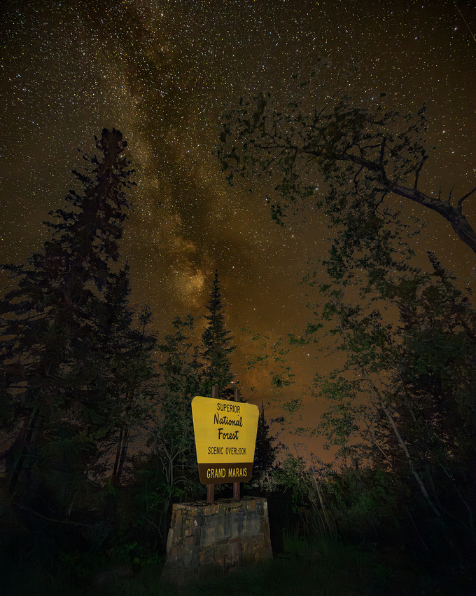
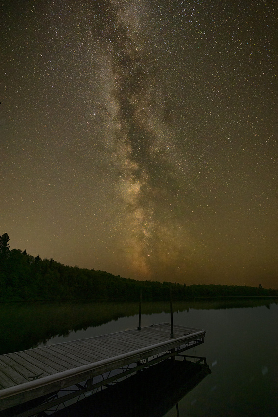
The Gunflint Trail, Cook County Highway 12, is a two-lane paved highway. The road begins in the small harbor town of Grand Marais, Minnesota.
It then winds northwest 57 miles through the wilderness, ending four miles south of the U.S./Canada border at Trail’s End Campground. Along the way are more than two dozen resorts and canoe outfitters.
The Gunflint Trail climbs 600 feet in the first few miles to Pincushion Mountain Overlook, a parking area with spectacular 180° views of Lake Superior. That’s where fellow photographer and friend Jon Christofersen and I ended our August night photography trip.
Framing
Every time we use a camera, we create a frame. But creating a frame within that frame can contribute to striking and powerful images. Framing can lead the viewer’s eye, imbuing balance and creating visual flow through the image.
The Shot
We were running out of time. Our weather apps and our eyes told us a thick layer of Canadian wildfire smoke was rapidly approaching.
After several unsuccessful compositions, I moved to the opposite end of the parking lot and looked around. The trees, aided by distortion from my wide-angle lens, seemed to nicely frame the Milky Way. I hurriedly set up my camera on the tripod and checked my composition.
I barely had enough time to recompose and take one additional photograph before the smoke moved in and totally obscured the Milky Way.
I hope you all have a wonderful Thanksgiving holiday.
Thanks for looking,
Chuck Derus
]]>
Do you want to truly get away? Try visiting the three-million-acre Superior National Forest. Located in Minnesota’s “Arrowhead,” it’s bordered by Canada, Lake Superior, and Voyageurs National Park. Established in 1909, it’s the largest National Forest east of the Mississippi River.
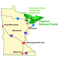
The Forest is the southernmost edge of the boreal forest ecosystem. You’ll discover thousands of clean lakes, rocky landscapes, iconic megafauna, and colorful fall foliage. Within lies the beloved one-million-acre Boundary Waters Canoe Area Wilderness (BWCAW).
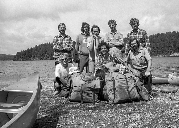
It's the perfect place to get away from it all. One of my trips to the BWCAW was in 1975 with my medical school roommates and several buddies. You’ll find me in the back row on the far left.
Nighttime
While the stunning sunrises, sunsets, paddling, portaging, and wildlife spotting are magnificent, it’s the night sky that excites me. This National Forest offers a welcome respite from urban light pollution for star gazers. The BWCAW was designated a dark sky sanctuary in September 2020 by the International Dark Sky Association.
It’s best to visit a week before or after a new (dark) moon. Late Fall or Winter are best because it gets dark early in northern Minnesota, plus there are no bugs! But any season works. You need to wait until about an hour after sunset.
It requires an additional ten to thirty minutes for your eyes to adjust to darkness. You will see a sky like no other sky you’ve seen from the city. Wear warm clothes in winter and bring lots of bug spray in summer (the mosquito is Minnesota’s unofficial state bird).
The Shot
Last August, I was with Jon Christofersen photographing the night sky at various locations along the Gunflint Trail Road in the Superior National Forest. We stopped at West Twin Lake at a boat launch.
At night, looking through the viewfinder is minimally helpful. You just see dark, vague shapes. It requires a photo to review on the camera’s LCD screen to determine your composition.
After fiddling with my camera height and location, this composition with the dock leading to the uprights pointing to the Milky Way was my favorite.
Thanks for looking,
Chuck Derus
]]>
It’s the quality of the light that makes or breaks our images.
Landscape photographers “chase the light.” It shouldn’t be a surprise. The word photography was coined from the Greek words “phos” (light) and “graphê” (drawing) in 1839 by Sir John Herschel. Together, they mean “drawing of light.”
Photographers are obsessed with both the quality and the direction of light. Lighting quality refers to the hardness or softness of the light. Soft light is low contrast with limited shadows and saturated colors. Hard light on the other hand, adds lots of contrast, heavy shadows, and washed-out colors.
Lighting direction refers to the direction at which the light strikes the subject. For instance, noontime sunlight hits the subject from above and evening sunlight hits the subject from the side.
Of the two, lighting quality stands out as more important. You can always experiment with different lighting directions for beautiful results. But if you fail to understand lighting quality, your images will be consistently mediocre or just plain bad.
Gold and Blue Magic
There are seven types of light ranging from the harsh overhead light of day to near total darkness at night. In between those extremes are the three stages of twilight (astronomical, nautical, and civil). Photographers want to chase the so-called magic hour light around sunrise and sunset.
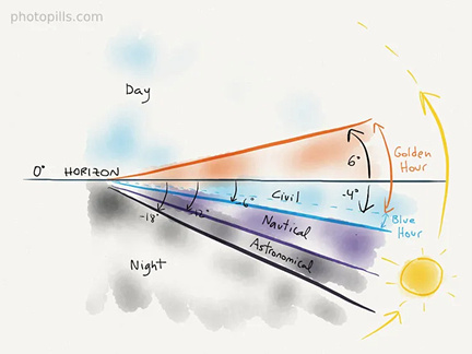
It’s called the magic hour because the soft, diffuse, and colored light magically transforms meh daytime scenes into outstanding photos. You need to be there early and to stay late.
At sunrise, golden hour begins before sunrise when the sun is four degrees below the horizon and continues until the sun is six degrees above the horizon. The light can paint the landscape with golden reds, oranges, and yellows. At sunset, it begins when the sun is six degrees above the horizon. It continues past sunset until the sun is four degrees below the horizon.
At sunrise, blue hour begins when the sun is six degrees below the horizon and ends when the sun is four degrees below the horizon. The light has an intense soft blue tone, with saturated colors. After sunset, blue hour begins when the sun is four degrees below the horizon and ends when it is six degrees below the horizon.
Their timing depends on the season and how far away from the equator you are. In Chicago this morning, blue hour begins at 6:48 am and ends at 6:58 am. Golden hour then begins and ends at 7:55 am. In the evening, golden hour begins at 5:13 pm and ends at 6:09 pm. Blue hour then begins and ends at 6:19 pm.
If it was June in Grand Marais, the sunrise would be much earlier and the sunset much later. And magic hour times would be approximately fifty percent longer.
The Shot
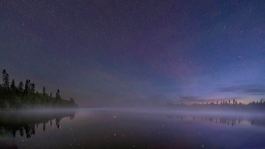
On July 8, 2021, I was photographing Cascade Lake near the Boundary Waters Canoe Area in Northern Minnesota. We were having such a great time photographing the night sky that we lost track of time.
Around 4:30 am, we noticed the beginning of the blue hour. With an air temperature of around forty degrees, a photogenic fog was hugging the lake. To me, the soft blue light, the stars, and the atmosphere made this a special moment.
There will be no Friday Photo for the next two weeks. I’ll be headed to a special location with views of the highest mountains on earth.
Thanks for looking,
Chuck Derus
]]>
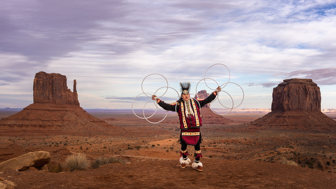
Westin mesmerized his audience. It takes a lot for photographers to put down their cameras, but we stopped frequently to simply admire his mastery of the hoops.
Without written language, Westin’s Diné (Navajo) ancestors passed on their traditions through storytelling, songs, and dancing. Hoop dancing incorporates all three. One, a handful, or up to dozens of hoops make it distinctive.
The dance is usually performed by a solo dancer who begins with a single hoop. This is symbolic of the circle of life. Then additional hoops are added that seemingly interlock and extend from the body creating static and dynamic shapes, poses, and moves.
The hoops represent the wind, water, earth, the seasons, and all living things. All the while, the dancer is maintaining his balance and moving to the rhythm of traditional indigenous music. Every dance is as individual as the person who choreographs it.
Because of its complexity, hoop dancing takes years of practice to master.
Origins
Hoop dancing dates back centuries to many tribes, each of whom claims to have created it. In the 1930s, a young man named Tony White Cloud created today’s modern hoop dance. He used 24-inch diameter hoops that he could get his body through.
He popularized the dance in the United States, performing in the 1942 movie Valley of the Sun. In addition, he traveled with Gene Autry across the U.S. and Europe promoting war bonds by performing the hoop dance. He also danced in Autry’s 1952 movie, Apache Country.
A Family Tradition
Westin is passing on the tradition to his young son and daughter.
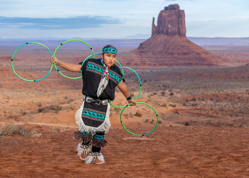
The Shot
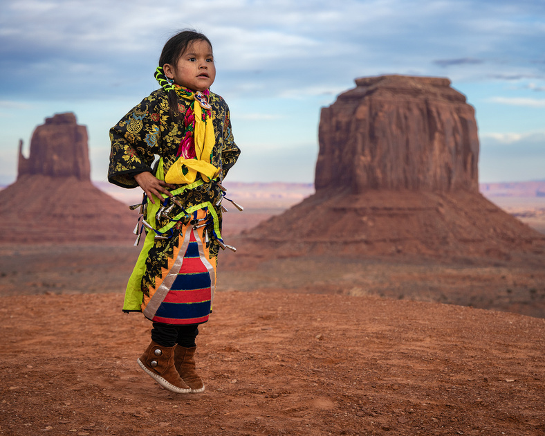
Last December, I was at a photography workshop in Monument Valley. Along with our usual landscape photography, several environmental portrait sessions with members of the Diné community were included in the itinerary.
I was fascinated by the athleticism of Westin and his family. And our entire group was captivated by this glimpse into the world of the Diné nation.
After taking hundreds of photographs, these three appealed to me the most.
Thanks for looking,
Chuck Derus
]]>
Do these soaring towers look familiar? You’ve seen them in numerous advertisements, magazines, and TV shows. They have also been featured in multiple movies including:
- Westworld – 2016
- John Carter – 2010
- City Slickers II – 1993
- Geronimo – 1993
- The Comancheros – 1961
- Wagon Master – 1949
Fisher Towers, east of Moab on State Route 128, is one of Utah canyon country’s most bizarre landscapes. It’s a maze of soaring fins, pinnacles, minarets, gargoyles, spires, and strangely shaped rock formations. The highest are about 1,000 feet tall.
They are soaring monuments to hundreds of millions of years of erosion. Over the eons, the soft rock has weathered into the spectacular shapes visible today.
There are two main layers. The caps are harder Moenkopi sandstone (245 million years old). Underneath lies the softer dark red Cutler sandstone (created 290 million years ago). The formations are draped with mud curtains.
Fisher Towers National Recreation Trail is a popular trail through the area. It was designated as a National Recreation Trail in 2007. It’s a hike worth taking.
The views of the Colorado River basin, including Castle Rock, Castle Valley, and the Book Cliffs to the north, are stunning. It winds for 2.2 miles around the base of Fisher Towers and climbs up to a 360-degree view. Bring lots of water as the trail is in the sun.
The Towers are a popular climbing location. I think I’ll stick to ground level with my camera!
Blogspot.com
The Shot
In March, we took a break from flying our drones to explore the trail. It had recently rained, so there were occasional puddles. A reflection shot came to mind and I found this puddle about a mile into the trail.
As usual, we were in position an hour before sunset. Just before the sun dipped below the horizon, the distant cliffs were glowing with sunset light. After that, it was time to hike back to the car and ride back to Moab for a well-deserved dinner and an early bedtime.
Thanks for looking,
Chuck Derus
]]>
Wotan—Deity, Summit, and Wednesday?
What connects an ancient Germanic deity, a Grand Canyon summit, and the third day of the week? It all started thousands of years ago.
Wotan was the chief god of Germanic paganism. His multiple names, including Wodan and Odin, all stem from the Proto-Germanic theonym Wōðanaz, meaning “lord of frenzy” or “leader of the possessed.”
Wotan was a prominent god in Northern Europe before Christianity took hold. Early historical records contain references to him beginning with the Roman occupation of Germania (2 BCE) and continuing into the Viking Age (8th to 11th centuries CE). In the modern period, the rural folklore of Germanic Europe continued to acknowledge Odin.
The Summit
It’s named after Wotan. Geologist François E. Matthes followed prolific U.S. Geologic Service field geologist Clarence Dutton's practice of naming Grand Canyon geographical features after mythological deities.
Wednesday
Why is the third day of the week named Wednesday? And why is the D silent? What the heck?!?
Just because you can’t hear the D doesn’t mean it isn’t there. So where did this D come from? And why don’t we pronounce it?
Wednesday has Germanic linguistic origins. It is derived from the Old English word, Wōdnesdæg, which honors the Germanic god Wodan (note the D).
Interestingly, Wōdnesdæg evolved to Wednesdei in the transition from Old English to Middle English. This may have been due to increased French linguistic influence. After roughly two thousand years of a silent D in Wednesday, it probably isn’t going away anytime soon.
The Shot
What a coincidence! On a Wednesday evening, the 26th of July, I was at Cape Royal admiring the sunset over Wotan’s Throne at the North Rim of the Grand Canyon.
The conditions quickened my pulse. There was gorgeous sunset light illuminating the sheets of falling rain to the west. In the south, a patch of blue sky was peeking through. And to the east, a captivating bit of refracted sunlight caught my eye. It was a sunset for the ages.
Thanks for looking,
Chuck Derus
]]>

The Chicago downtown is home to modern outdoor sculptures by Plensa, Calatrava, Picasso, Miro, Dubuffet, Calder, Chagall, and Kapoor. If you’re a Chicagoan (or a sculpture buff), can you match each artist with the name of their downtown Chicago masterpiece?
You can scroll down and check your answers.
Santiago Calatrava—Constellation at River Point office building, 444 W. Lake St.
Jaume Plensa—Crown Fountain at Millennium Park, 201 E. Randolph St., between Michigan Avenue and Columbus Avenue.
Pablo Picasso—The Picasso at the Art Institute of Chicago, 50 W. Washington St.
Joan Miro—“Miss Chicago” at the Brunswick Building Plaza, 69 W. Washington St.
Jean Dubuffet—Monument with Standing Beast at the James R. Thompson Center, 100 W. Randolph St.
Alexander Calder—Flamingo at the Federal Plaza, 50 W. Adams St.
Marc Chagall— The Four Seasons at the Chase Tower Plaza, 10 S. Dearborn St.
Anish Kapoor—Cloud Gate aka “The Bean” at Millennium Park 201 E. Randolph St., between Michigan Ave. & Columbus Ave.
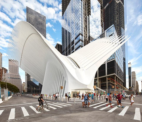
Calatrava’s Constellation
The Spanish-Swiss Calatrava is an architect and an artist. Even Calatrava’s buildings are sculptural. His Milwaukee Art Museum and The Oculus in New York City are both incredible works of art. Constellation is his November 2020 contribution to Chicago.

Milwaukee Art Museum by Calatrava from blogspot.com
The Oculus in NYC by Calatrava from designboom.com
Constellation was commissioned by Ivanhoe, Cambridge, Hines, and Levy Family Partners. Constructed in aluminum in Cleveland, the sculpture stands 29 feet in height and width. It twists in an outward reaching spiral of overlapping leaflike elements that decrease in size as it ascends.
When asked about the sculpture, Calatrava said his intention was to simply have it grow from the ground. And it certainly does. The massive, layered spiral connotes both depth and movement. It fits beautifully in the 1.5-acre River Point Park facing the arching façade of the 52-story, 730-foot River Point Tower.
The Shot
In the spring, I was in Chicago with my drone photographing the Polar Plunge. With one battery remaining, I relocated to Wolf Point, at the intersection of the East, North, and South branches of the Chicago River downtown.
Initially, the elevated trains on the Lake Street bridge seemed to be a good subject. But then I caught sight of the mesmerizing Constellation. My favorite image framed a pedestrian in one of the colorful loops.
Thanks for looking,
Chuck Derus
]]>
Hoodoo has three meanings. As a noun, it’s either a fantastical pillar of rock or a religion characterized by sorcery and spirit possession. As a verb, it means to bewitch or to cast a spell.
It’s fantastical rocks when visiting Bryce Canyon National Park in Utah. But at times, you also feel bewitched amongst the majestic hoodoos.
Utah, and specifically Bryce, has the largest number of hoodoos in the world. There are twelve hoodoo amphitheaters in the park with thousands of hoodoos to admire.
How Did They Form?
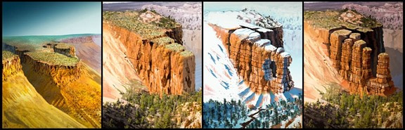
Paiutes lived in the park when Euro-Americans arrived in southern Utah. They explained the colorful hoodoos as “Legend People” who were turned to stone by a coyote. We now know that over millions of years, a plateau was transformed into the hoodoos of Bryce Canyon.
It was a combination of water, freezing and thawing, variations in the type of rocks, and slightly acidic rain that created Bryce. The area receives approximately 100 inches of snowfall and undergoes roughly 200 freeze/thaw cycles a year. Snowmelt seeps into joints and cracks in the rocks. When it freezes and expands, it forms an ice wedge that widens the space.
In time, it breaks the rock. Fragments of rock ranging in size from pebbles to Volkswagen-size boulders fall away to the canyon floor, slowly forming hoodoos. The undulating shapes are caused by the different erosion rates of the four types of rock in the spires.
Limestone, siltstone, and dolomite are the hardest rocks. It takes ice wedges to erode them. They form a protective caprock on most spires. Mudstone is the softest. It easily erodes when wet, running down the sides of the spires forming a protective mud stucco coating.
All the rocks contain abundant calcium carbonate. Even slightly acidic rain is enough to dissolve the calcium carbonate that holds these rocks together. Variations in the amount of calcium carbonate control how easily dissolvable (or how resistant) that rock layer is.
From a plateau, eventually the rocks break down into walls, windows, and then as individual hoodoos. Brian Roanhorse/NPS
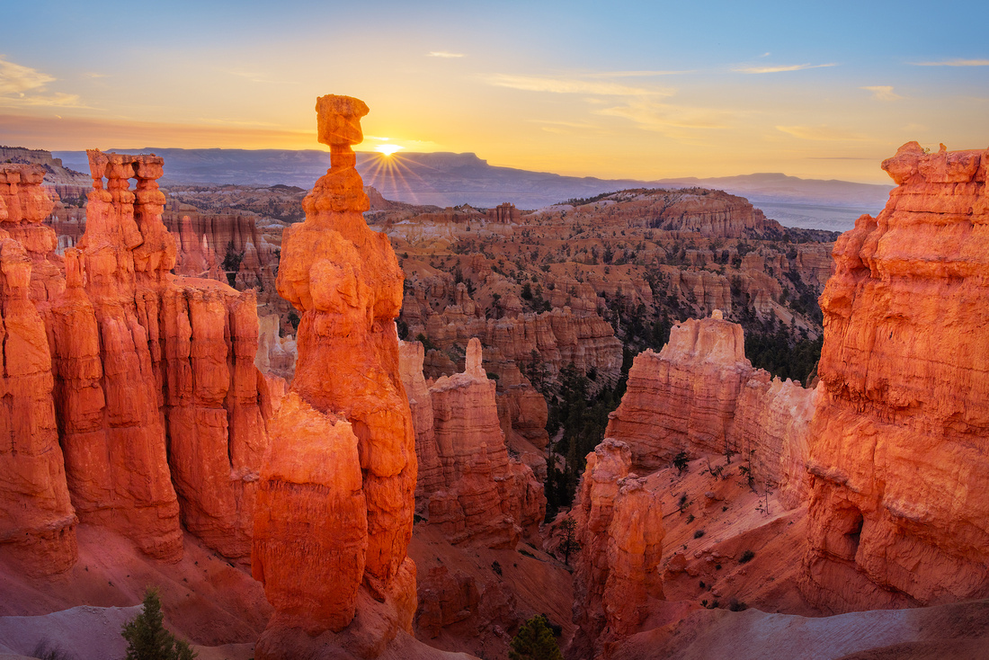
The Shot
In July, I joined three Naperville Camera Club members on a trip to the Southwest. Among our many stops was Bryce. I had been there about ten years ago but wasn’t satisfied with my images from that trip.
The morning sky wasn’t that interesting, so fellow photographer Steve Horne and I decided to hike the Queen’s Trail down to a distinctive hoodoo named Thor’s Hammer. It’s the one that clears the horizon in the picture.
Checking an iPhone app, we knew that the sun would rise just to the right of Thor’s Hammer. When the sun is peeking past an edge like the horizon, the light passing through the lens aperture blades can create a visually interesting sun star.
We tripped our shutters at just the right moment to capture a sun star. And at the same time, red reflected light made the rocks in front of us a radiant, glowing red.
Thanks for looking,
Chuck Derus
]]>
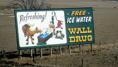
You read correctly. Two million visitors a year stop at a South Dakota drug store in a town with a population of only 640. I’m talking about Wall Drug Store, often shortened to Wall Drug, in the sleepy town of Wall, South Dakota.
You might think that nearby Badlands National Park attracts more visitors. But you’re wrong. On average, only one million people visit Badlands National Park every year.
The American Dream
Ted and Dorothy Hustead started with a humble dream in 1931. They purchased a drug store in the tiny town of Wall. It was the Great Depression, and they struggled mightily for the first five years.
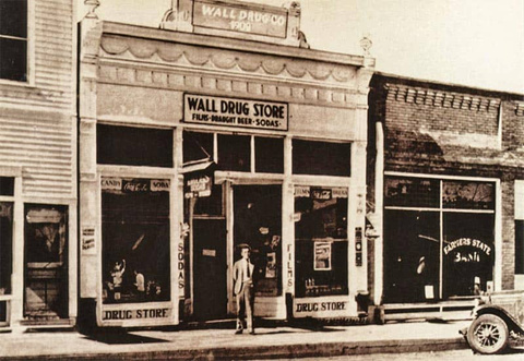
©Wall Drug
The town had a mere 300 residents, with few of them able to spend their limited income on pharmaceuticals. The couple and their son Billy slept in a room in the back of the store. It was a constant struggle to entice travelers and earn a living.
The family created new business by advertising free ice water. Their hand-painted signs along Highway US 14 (later Interstate 90) became a fixture in the landscape. Thirsty travelers in the summer heat seeking a cool drink of water created a steady influx of new customers.
From Stop at Wall Drug in South Dakota (yellowstonepark.com)
Over the years, the number of highway signs grew. While there are many unofficial signs scattered around the U.S., there are officially 300 paid signs in Minnesota, South Dakota, North Dakota, Nebraska, Montana, and Wyoming.
Wall Drug grew to become a collection of cowboy-themed stores, including a drug store, gift shop, several restaurants, art gallery, and an 80-foot brontosaurus sculpture. The New York Times has described Wall Drug as "a sprawling tourist attraction of international renown [that] draws some two million annual visitors to a remote town."

From The Quirky History of South Dakotas Wall Drug... | Culture Trip (theculturetrip.com)
The Shot
During my 2020 photography trip to Badlands National Park, pandemic precautions prevented me from visiting Wall Drug again. One of my fondest childhood memories is an early 1960s family road trip where this nine-year-old boy was in “heaven” admiring all the souvenirs for sale in this massive store.
My favorite times for photography are in the pre-dawn and dusk hours. This morning was no exception. After walking about a mile from the road, we came across this fascinating foreground curving past the hills into the pre-dawn light.
Thanks for looking,
Chuck Derus
]]>
Everybody says it. “Once in a blue moon…” But what does it mean? And is the moon actually blue?
It’s no surprise that the moon comes back every month. After all, that’s why it’s called a “moonth.” But the moon’s reliability belies the distinctive nature of each lunar cycle.
Winter moons are high in the sky illuminating freshly fallen snow. Fall moons create shadows from newly bare trees. And summer moons hang low in the sky appearing hazy from humidity.
There are also supermoons and micromoons. A supermoon is when the moon is at perigee, or its closest approach to the earth. Micromoons occur at perigee, when the moon is the furthest from the earth.
A blue moon? The moon orbits the earth every 29.5 days. And an average month is 30.4 days. Most of the time, we have just one full moon a month.
But every few years, a lunar cycle completes and restarts within the span of one calendar month, giving us two full moons. That second full moon in a month is called a blue moon.
A Lunar Spectacular
Last week, from August 30 into August 31, we had a full moon. But it wasn’t just any full moon. It was a full, super, blue moon, the only blue moon of 2023. We won’t see this lunar trifecta again until 2037.
The August 30 supermoon was only 222,043 miles from earth at its closest point. The average distance is 239,000 miles away. So, the moon was 14% bigger to the eye and brighter.
Blue moons aren’t blue. Moonlight is reflected sunlight and it appears white.
This moonrise looked orange, because of particles in the air and humidity. More of the moon’s reflected blue light was absorbed leaving the warm hues coloring it. It’s the same phenomenon that gave us red moons and suns when forest fire smoke blanketed the area.
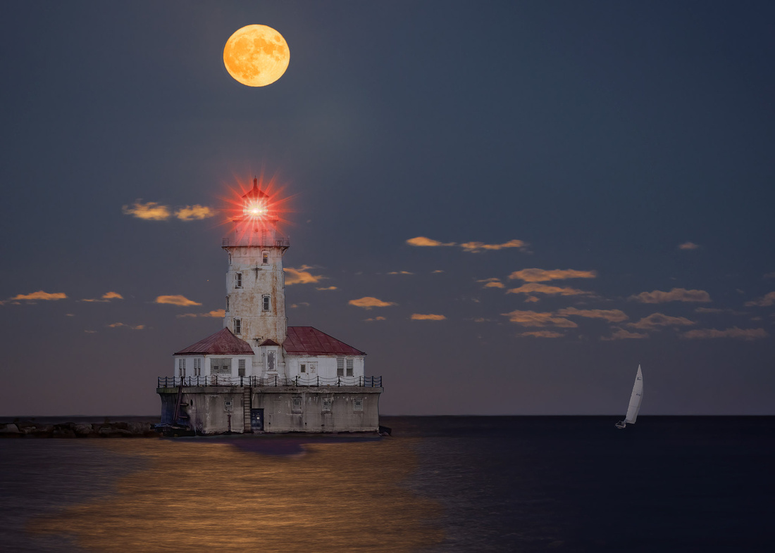
The Shot
I wasn’t surprised to find a half dozen photographers with telephoto lens setups at Navy Pier in Chicago. A moon carries a lot of visual weight in a photograph. Apps like The Photographer’s Ephemeris make it easy to determine how to line up interesting subjects to complement the moon.
One of my favorite subjects is the Chicago Harbor Lighthouse. I just needed to stand in the middle of the East end of the pier. The moon would do the rest by rising to the left of the lighthouse and then tracking up and over it. Perfect!
The wind was blowing hard, causing my camera to shake despite mounting it on a sturdy tripod. Around two thirds of my frames were ruined by motion blur.
But several frames looked sharp. I combined several exposures to capture the wide range between light and dark. In addition, I had to move the moon slightly down in the frame using Photoshop. It was just too high to fit my 5 by 7 crop.
Thanks for looking,
Chuck Derus
]]>
Who was the artist? 40,000 years ago, someone painted animals and geometric shapes that appear to be star patterns and the moon in a cave on the island of Borneo in Southeast Asia.
When people began drawing their world, the most common subjects were animals and the night sky. It was first assumed that these drawings were art. Later, others postulated they were painted for good luck hunting. In the 1960s, journalist Alexander Marshack proposed a more practical purpose for these drawings. They were created for telling time.
You can track the seasons by simply paying attention to the environment. For example, animals like deer and cattle are pregnant through the winter’s dark privation. They give birth when trees leaf out and grass grows tall.
But early humans needed a more precise way to time the seasons. It was important to know when to harvest fruit and berries, and when to migrate and hunt animals. The moon’s face and location on the horizon changes nightly. Along with the regularity of the seasons, the moon is a reliable marker of time.
So, the moon was a timepiece long before the first written language, the earliest cities, and organized religions. Early cave drawings likely combined time-reckoning with information related to the cycles of life.
The Shot
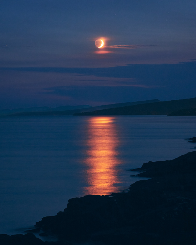
Friend and fellow photographer Jon Christofersen and I recently returned from photographing the night sky. We were in a premiere dark sky location: the Gunflint Trail in Northern Minnesota on the Canadian border.
Our base was Grand Marais on the shore of Lake Superior. During our last night of photography, smoke was blowing in from Canadian wildfires. While the stars would quickly disappear, it had a magical effect on the setting moon.
We set up on a rock on the shore of Lake Superior near the campground outside of town. Because of the smoky horizon, the moon and moonlight reflecting on the lake were a deep orange, beautifully pairing with the deep blue sky of twilight.
We watched and photographed as the moon disappeared into the distant haze. I couldn’t help but wonder how many people over the last 15,000 years watched the moon from this same rocky shore. And were they simply enjoying the view or “checking the calendar?”
Thanks for looking,
Chuck Derus
]]>
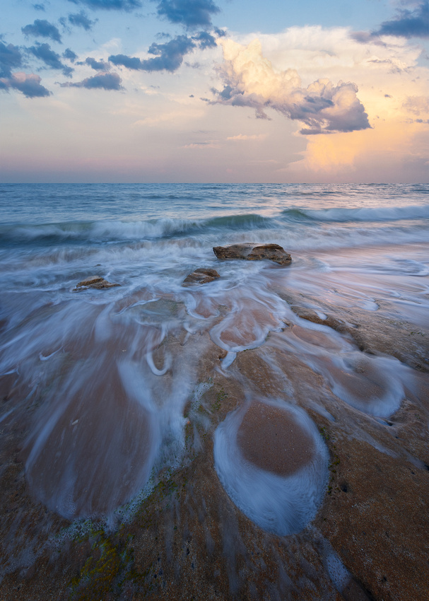
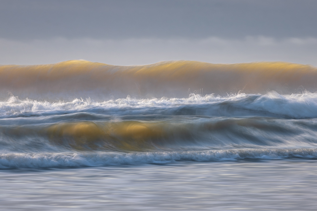 Catching the Wave
“The sea is a desert of waves,
A wilderness of water.”
Langston Hughes, Selected Poems.
It wasn’t surprising. The ephemeral nature of waves appealed to me as much as the ever-changing dunes of Death Valley, one of my favorite photographic subjects.
Have you ever noticed that a larger wave occurs every few waves? When waves traveling at different speeds interact, some waves become larger than the others. If the crest of a fast-moving swell arrives at the same time as a locally generated wave, it creates an even bigger wave.
Depending on the season, the big one might arrive every third wave. On another beach it might be every seventh, or somewhere in between.
The Shot
Last April, I was on the Palm Coast of Florida photographing waves. Arriving before dawn, I wanted the rising sun to backlight the wave crests.
I started counting the number of breaking waves between the biggest waves. After a few minutes, I could predict when the largest, most dramatic wave would roll in.
The experience was Zen-like: intentional, full of tranquility, and joyful. Before I knew it, I had taken over a thousand images in pursuit of the “perfect” wave.
This was my favorite shot, not only of the morning, but of the entire trip. I want to thank Mark Metternich for assistance in processing this image.
Thanks for looking,
Chuck Derus
]]>
The first day of our recent Grand Canyon North Rim trip was a doozy. In the last Friday Photo, I mentioned that it required almost eleven hours of travel to reach the Lodge. And it wasn’t until ten hours later that we put away our cameras.
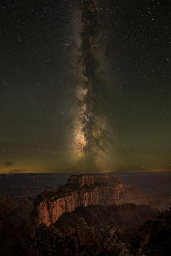
Why such a long day? The Milky Way.
On July 25, there was a magic two-hour window from midnight until two in the morning. In those two hours, the sky was as dark as it gets, with the visually interesting Milky Way core sufficiently above the horizon, and no moon to wash out the stars.
The Milky Way
Do you ever wonder where you are when you wake up? Here’s a hint.
You (our solar system) are in the Orion-Cygnus arm of the Milky Way. This top-down image clarifies our home. When we’re stargazing, we see our galaxy in a side view, as illustrated in the lower right corner of the graphic.

Image from where in the milky way are we - Bing images
What I photographed is part of the central bulge (core) above the horizon and part of the disk radiating away from the central bulge.
Think Big
The approximately hundred billion stars in the Milky Way may seem to be a big number. But there are an estimated 200 billion galaxies of various sizes in the universe. That adds up to an estimated 30 billion trillion (30,000,000,000,000,000,000,000) stars!
Visit An Atlas of The Universe if you want to better understand our cosmic neighborhood.
The Shot
As soon as we got out of our vehicle at Cape Royal, the four of us could see it! The core was on the horizon to the south and the disk stretched all the way over our heads disappearing on the north horizon.
The night was pleasantly cool, free of bugs. And a few clouds drifted across the horizon in the distance. Perfect! There were lots of “Oohs and aahs” as the Milky Way started to appear on our camera LCD review screens. The faint green is airglow (visible only to the camera), not the Northern Lights.
We returned the next evening to the same spot. Everyone took a photograph of the canyon about 45 minutes after sunset. That photograph was then blended with the previous night’s Milky Way exposure to create the finished image that captured both the canyon’s depths and the enthralling Milky Way.
Thanks for looking,
Chuck Derus
]]>
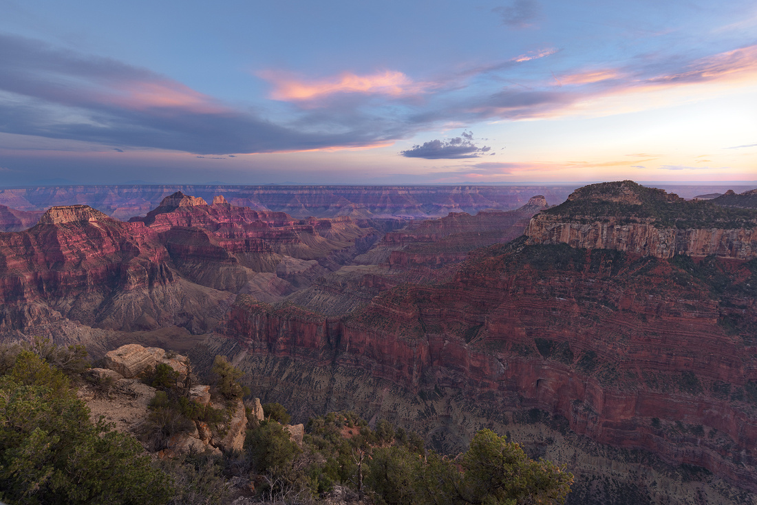
Bright Angel Point, North Rim, Grand Canyon National Park
The drive to the North Rim of the Grand Canyon from Las Vegas seems interminable. But your reward for patience is the breathtaking vistas encompassing both scenery and time.
The scenery is magnificent. From the North Rim, you can clearly see the South Rim ten miles away. And in between, the Grand Canyon seems to cascade endlessly over layers and layers of multicolored rocks to the emerald waters of the Colorado River far below.
An unimaginable display of earth’s timeline is also on display. In the barely visible depths of the canyon, the rocks are 1.7 billion years old. As you gain altitude, the multicolored rock layers become younger and younger.
These layers record the rise and fall of oceans and continents, and the evolution of plants and animals. There are fossils of trilobites (the first creatures with eyes}, giant dragonflies, and the wanderings of reptiles on ancient sand dunes.
The ten-mile gap between the Rims is the result of erosion from the Colorado River, floods, freezing, thawing, heating, cooling, and gravity. Over the past five million years, nature has carved a one-mile-deep canyon.
Tourism and the Lodge
The name “Bright Angel” originally comes from Major John Wesley Powell. The famous one-armed Civil War veteran explored the canyon by boat in 1869. He bestowed the name upon a sparkling creek that flowed into the Colorado River. Today, it applies to both natural and constructed features on both rims and within the canyon.
Bright Angel Point is a scenic viewpoint about 4,000 feet above Powell’s creek. Primitive tourism began around the Point at the turn of the 20th Century.
A rough road first reached Bright Angel Point in 1917. Originally Forest Service property, it became a national park in 1919. The National Park Service decided to mimic the South Rim model with a chalet, a road along the rim, and connecting trails to other points along the North Rim.
Gilbert Underwood designed the first North Rim lodge in 1928 for then-concessionaire Union Pacific Railroad. It included a massive Spanish-style exterior with a high front topped by an observation tower. It burned down just four years later in 1932.
The “new” 1937 lodge now sits on its footprint.
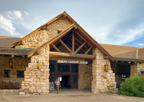
The “new” lodge
Camera Club Buddies
I’m a member of Naperville’s Photogenesis camera club. In February, one of the members began organizing a trip to the North Rim. When I was asked to join, I didn’t think twice before joining!
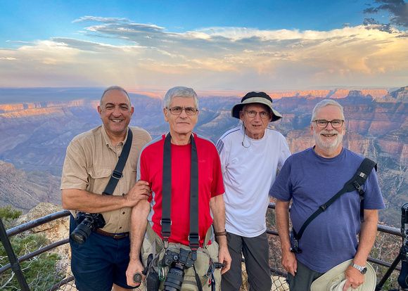
John Tarsha, Allan Fisher, Steve Horne, and me at Bright Angel Point
The Shot
July 25 was a long day. John and I left for O’Hare around 6:30 am. After arriving in Las Vegas, we met Allan and drove to St. George, Utah to meet Steve. It was about 4 pm when we finally arrived at the North Rim lodge.
Everyone rushed out on the balcony to photograph a monsoon storm over the canyon. That evening, we took the quarter mile hike from the lodge to Bright Angel Point to enjoy the sunset. This is my favorite photo from that evening, taken just after sunset.
After a late dinner, we headed out to photograph the Milky Way until 2:30 am. But that’s another story…
Thanks for looking,
Chuck Derus
]]>
The human eye and the camera may seem similar, but they see the world quite differently. For example, the “shutter speed” of the human eye is estimated to be approximately 1/50th of a second. These brief exposures are blended by our brain into a seamless “video” experience of the world around us.
One of the advantages of a camera is the ability to change shutter speed. I’ve taken images as long as four hours and as short as 1/8000th of a second.
Shutter speed is a creative choice. The decisive instant of catching a football requires a fast shutter speed of 1/1000th of a second or shorter. At the other extreme, a five-minute exposure can transform moving clouds into a pleasing ethereal blur above a static city skyline.
The Florida Coast
On my recent Florida coast trip, I played with shutter speed as a creative tool. Combining images taken at different shutter speeds in Photoshop can create pleasing images that the eye cannot see.
The Shot
This image is a composite of several photographs. The distant sky is a single image taken at a shutter speed of 1/60th of a second. The middle ground water and wave come from a single image taken at a much slower shutter speed of 0.4 second. This allowed for a slight blur that implied motion.
The foreground consists of six images taken at 0.6 second to enhance the blur of the receding surf. Parts of each image were blended in Photoshop to bring out the pleasing swirling shapes of receding surf.
Thanks for looking,
Chuck Derus
]]>
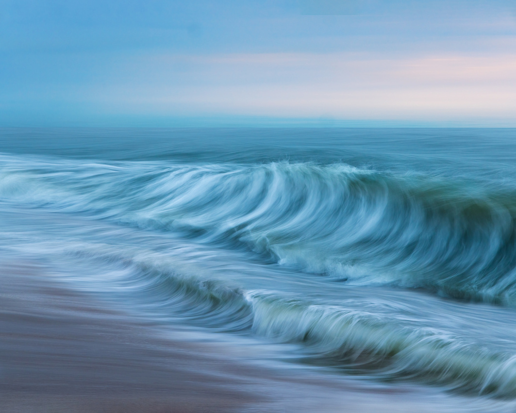
“If there’s heaven for me, I’m sure it has a beach attached to it.”
Jimmy Buffett
How often does the sight of a beach bring back memories? A beach isn’t merely a place. It’s a feeling.
My first ocean beach encounter was in the summer of 1973. I was attending college at the University of Minnesota. My good friend, John Hiemenz, invited me to visit his home in Daytona Beach, Florida.
The 1,700-mile drive with John over three days provided me ample opportunity to anticipate what I would experience. When I finally saw Daytona Beach, I was enthralled. The sun, sand, surf, and salt water were so unlike Minnesota beaches. And so was my subsequent sunburn!
Since then, I’ve been back to Florida on multiple occasions for vacations and work. But I never had the opportunity to recapture the magic of a Florida beach with my camera.
The Florida Coast
The opportunity finally presented itself in April. I contacted a photography friend to arrange a few days of instruction in Florida. Among his many talents is wave photography.
I anxiously flew to Jacksonville, Florida and drove the short distance to the coast. The next dawn, we were on the beach enjoying and photographing waves. The weather favored us during our four days together.
Unlike Minnesota in February or Death Valley in August, photography was so pleasant. You merely had to roll out of bed in the morning, slip on beach shoes, a swimsuit, a tee shirt, and occasionally a light jacket to be comfortable.
The Shot
Most people instinctively “freeze” wave motion using a very short shutter speed, such as 1/1000 of a second. You can see every drop of water and every bit of spray this way.
This photograph uses the exact opposite approach. A long shutter speed (perhaps a third of a second) along with subtle horizontal camera movement can impart a dreamy look to the image. It’s a look that very much appeals to me.
The downside is the hit or miss nature of the technique. Many of the images miss the peak of the action. Others are too blurry. And yet others are too sharp. Finally, sometimes the camera movement isn’t level.
I’m still culling over 5,000 wave images from that four-day trip. Every so often, the pieces come together. I hope you enjoy this first finished image. It certainly brought back memories of my first ocean beach 50 years ago.
I’ll be in the field frantically foraging for future Friday Foto fodder for a few days. Fear not, the Friday Photo will return in two weeks.
Thanks for looking,
Chuck Derus
]]>
“The land is flat, and the views are awesomely extensive; horses, herds of cattle, a white cluster of grain elevators rising as gracefully as Greek temples are visible long before a traveler reaches them.” Truman Capote (In Cold Blood)
Rural Kansas
What a powerful narrative. The featureless Great Plains offer an unhindered panoramic view of the horizon. Only those “Greek temples” that arise from the plains alert you to the presence of nearby towns.
During a week of storm chasing, you encounter numerous small towns. And every small town has one or more grain elevators, usually along the railroad tracks. Why is that?
In 1870, eighty percent of Americans lived in rural areas. In the pre-automobile age, people didn’t want to walk, ride a horse, or pull a wagon too far for goods and services. Rural areas typically spaced towns about 10 to 15 miles apart for that reason.
Many of those towns were located along railroads. One hundred and fifty years ago, railroads dominated transportation. Railroads delivered everything including the mail, merchandise for stores, and individual customer packages.
You could even deliver a house by railroad. In the early 19th century, Sears sold homes through their catalog. Primarily shipped in railroad boxcars, these kits included most of the materials needed to build a house!
Railroads moved crops from small towns to markets in large cities like Chicago. The town grain elevator held crops safe from moisture and contamination until they were shipped out.
When horses pulled wagons, it took a farmer all day to make a 10-to-15-mile round trip to town and back to deliver his wagon load of grain. Farmers needed to live within a 5-to-7.5-mile radius of town.
The Shot
Capote was describing Holcomb, Kansas in his book. We were storm chasing 45 miles south of Holcomb near Ulysses, Kansas on March 30. The heavy rain, clear air, and perfectly positioned clouds bathed the landscape in glowing, glorious yellow storm light.
Several “Greek temples” rose along the distant tracks above the otherwise featureless landscape. The grain elevators added visual interest. They also provided scale when comparing them to the massive shelf cloud ominously looming above us.
For a change, no rain, lightning, or hail was threatening to force us to relocate. We enjoyed a leisurely and exhilarating half hour photographing nature’s light show.
We started reviewing and sharing our images on our camera LCD screens after we returned to our van. Nobody seemed upset about the five-hour drive back to our hotel in Lubbock, Texas. Everyone was giddy after “getting the goods.”
Thanks for looking,
Chuck Derus
]]>
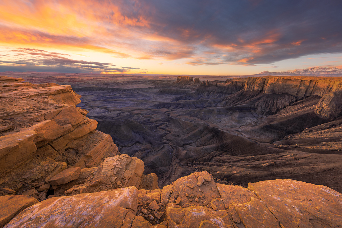
Glancing down, it’s a vertiginous 500-foot sheer drop to the badlands below. Ahead, the lunar-like Blue Valley with gray, black, and brown dunes stretch all the way to the horizon and the Henry Mountains to the South.
You’re at Moonscape Overlook looking East from the edge of Factory Bench Mesa near Hanksville, Utah. It’s a mind-blowing scene. At dawn, pinks, yellows, and oranges paint the landscape.
The website Photographers Trail Notes sums it up well: “Utah is one of the most photographically fertile areas in the American southwest - with ever ending abstracts, buttes, formations, striations, and jaw-dropping vistas. And this location, overlooking the astonishing badlands near Hanksville, Utah is just another example of the amazing natural beauty this area has to offer.”
Multitasking
It was a two-camera morning. I set up my big camera on a tripod in the pre-dawn darkness. After a few test shots, I felt good about my composition.
Getting my drone ready to fly was my next task. Because there were other drone pilots nearby, I moved about a hundred feet away to avoid radio interference.
The plan was to wait for the sky to light up just before sunrise and take several pictures with my camera. Then without any delay, I would run to my drone, launch, and fly over a mile into the photogenic badlands. The drone had to be on station ASAP to take advantage of the beautiful light just after sunrise.
The Shot
Everything went according to plan! Nothing seemed to go wrong with my camera in those few precious pre-dawn moments.
My drone paired with the controller, quickly acquired enough GPS satellites to safely launch, and I started flying to my distant location. After twenty minutes of drone photography, I pressed the “return to home” button due to a low battery warning.
Here’s a quick snap of what the drone saw on the return flight. The small red circle is me and the larger red circle is our cars near the edge of the mesa.
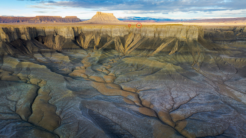
During the 10-minute return flight, I gathered my camera from the edge of the mesa. Scrolling through the images, I was relieved to come across this pleasing image. And while I was reviewing, the “return to home” function effortlessly landed my drone by itself about six inches from where it took off.
Thanks for looking,
Chuck Derus
]]>

It’s NASCAR weekend in Chicago. Parts of downtown Grant Park and DuSable Lake Shore Drive are now a temporary 2.2-mile race circuit. The event promised to be an irresistible photo opportunity.
Or at least it was until I saw the prices. Tickets started at $199, with an average price of $971! Where could I find a race in my price range?
Cheap Thrills
Luckily, nearby Joliet, Illinois is the home of the Dirt Oval at Route 66 racetrack.

As luck would have it, last Saturday was a demolition derby. Back in 1971, I went to my first and only demolition derby at the Minnesota State Fair. I was one of the 8,500 fans watching 87 hardy drivers vying for a share of the $2,000 purse. It was time for me to go to another one!
Fellow photographer and friend Jon Christofersen was crazy enough to join me. $30 was all it cost for admission to the pit, where the racers and cars were staged.
The cars are a sight to behold.

To say they are basic is an understatement.

Smaller full-sized cars of the late 1980s and 1990s are popular. These largely front-wheel drive vehicles can sustain considerable rear end damage before being immobilized.
Vehicles are stripped of interior fixtures, trim, plastic, lights, and glass. Sheet metal is removed from the wheel wells and from parts of bumpers. Most of the paint and lettering comes from low cost “rattle cans.”
The doors are welded shut, and the battery, gas tank, and radiator are relocated, often to the back seat. Roll bars, fire extinguishers, and other safety equipment are likely installed.
Engines are another matter. A racing engine, transferred from car to car, can cost upwards of $10,000.
Drivers and Fans
Jon and I were pleasantly surprised by how friendly the drivers are. Several of them graciously spent time explaining the rules and strategy to us. It must be a labor of love because winning drivers only receive $1,000.

The spectators were enthusiastic with tailgate parties in the parking lot. This trio welcomed having their photo snapped.

The Shot
Teams of four cars each competed against each other. Two cars were chasers trying to take out opponents by crashing into them. The other two cars were lappers trying to be the first to complete five laps around the track with the support of their chasers.
Disabled cars were unceremoniously removed by a forklift after each race. After salvaging the engines, they were mostly headed to the crusher.

By the time I got the hang of where the action was going to be, it was late twilight. The lead photo appealed to me because of the impact, the flames shooting out of the headers, and the attentive crowd.
Thanks for looking,
Chuck Derus
]]>
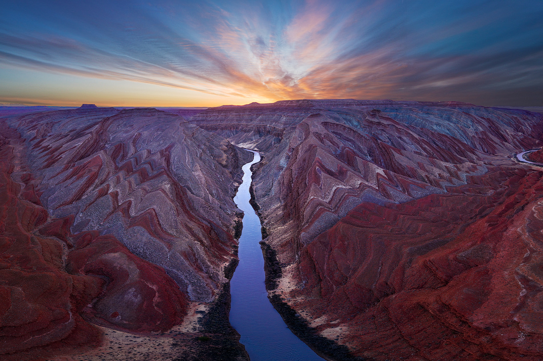
That’s how I felt when I finally saw it.
My drone was over 5,000 feet away and the entire flight had been over a nondescript desert. I began to doubt whether there was anything worth photographing at my destination.
Then my drone reached the Raplee Ridge in Southeastern Utah. Suddenly and unexpectantly, the land below me exploded into a “Navajo blanket” of multi-colored, zig-zagging triangular shapes. And the San Juan River bisected the scene leading my eye towards the promise of a glorious sunrise.
It was unlike anything I had seen in the last fifteen years of visiting the Southwest.
A Little Geology
How does this happen? Why is this patch of ground so `photogenic?
Raplee Ridge is the result of large-scale tectonic stresses dating back some 40–70 million years. East-west-directed compression and other north-south rock movements folded the underlying, multicolored rock layers into angular shapes below the ground.
The buried buff, reddish-brown, and grayish-colored rock layers awaited erosion to reveal their hidden patterns.
Rainstorms over millions of years provided that erosion. Water runoff cut valleys into the slopes exposing the underlying, zig-zag folded layers. And between those valleys were erosion-resistant, upward-pointing “flatiron” triangles of rock.
The Shot
Despite being fatigued from six straight days of little sleep, fellow photographer and friend Jon Christofersen and I added a seventh day to our trip. We wanted to revisit locations where we had been rained out and unable to fly our drones. Raplee Ridge was one of those locations.
We launched our drones in the pre-dawn towards an unseen destination on our drone’s map. The twilight flight there seemed long and nerve wracking.
Our drones arrived on location just before dawn. The soft, indirect pre-dawn light allowed the colors to “sing.” And the clouds were lighting up beautifully.
During the day, direct sunlight would have acted like bleach, washing out the colors and the drama from the scene.
We photographed furiously until our drones began sending us low battery warnings. Pressing the return to home button on our controllers, our drones began the long flight back to us. We rejoiced in the wonder of witnessing a landscape we never knew existed in beautiful light.
Thanks for looking,
Chuck Derus
]]>
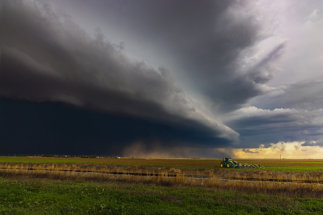
Chasing and safety seem to be contradictory goals. When the National Weather Service tells us to seek immediate shelter, “chasers” are looking to get closer. And if lightning bolts start hitting the ground, we’re attaching our special lightning triggers so our cameras can photograph the bolts.
But staying reasonably safe is necessary on every chase. During orientation, the co-owners of the chase company go over the rules.
They explain how they will not drive through the pouring rain of storm cores. Rain-wrapped, invisible tornadoes may lurk there, along with large damaging hail.
Also, there are one or more escape routes. Since supercells and tornadoes usually move northeast, we’re most often south of the storm with several “outs.”
In addition, they won’t drive on dirt roads. Rain quickly transforms them into slippery mud, potentially stranding you in a ditch.
And sometimes you aren’t allowed to cross the road to take pictures. A sudden uninterrupted stream of traffic moving away from the storm may trap you on the wrong side of the road for precious minutes.
Finally, we remain six miles or more away from lightning. And anytime you feel rain, we quickly head into the van because raindrops mean lightning risk.
“Get in the van…”
It’s important to know how fast you need to get back in the van. Sometimes it’s a routine location change. Other times, the situation has become dangerous, and we need to move quickly.
The three variations of “Get in the van…” provide that vital information. The first variation is a simple “Get in the van.” It means it’s time to calmly pack up your gear and to return to the van for a move to the next location.
The second variation is “Get in the van now!” This instruction means the situation is becoming dangerous. It’s time to grab your gear and make a bee line for the van.
The third variation is “Get in the f***ing van!!!” It means we’re in danger and need to leave NOW.
I’ve only heard variation #3 a few times. The first time was in 2016 when I saw my first tornado near Perryman, Texas. It was exhilarating. The twister dropped closer than anticipated. As we watched it move away, it just kept getting bigger and more impressive.
Suddenly, I heard “Get in the f***ing van!!!” and we sped away. Inquiring into the reason for variation #3, we were told the tornado was getting bigger because it decided to reverse course towards us. Oops…
The Shot
On May 28th, we were chasing a storm with an impressive shelf cloud near Hugoton, Kansas. We stopped where a piece of farm equipment would provide some context and scale to the scene. The brown cloud above the ground in the middle of the image is a small haboob, an intense sand-and-dust storm blown by the outflow winds of the approaching storm.
After about three minutes, we heard “Get in the van now!” Safely back in the van and on the move again, we asked what was going on. The latest weather service reports and radar had us located two minutes away from 78 mph winds and golf ball sized hail.
It was a good call to leave when we did.
Thanks for looking,
Chuck Derus
]]>
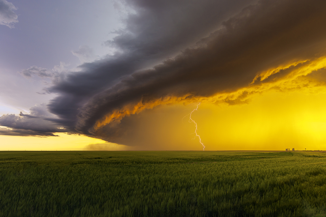
That’s a lot of driving. Storm chasing consists of seemingly interminable travel that sometimes ends with a storm. But the beauty and excitement of an epic storm over the wide-open Great Plains makes it all worthwhile.
On last week’s storm chasing tour, we visited parts of Colorado, Nebraska, Kansas, Oklahoma, Texas, and New Mexico pursuing storms. I don’t want to sit in the back seat of a van for another year!
Meeting The Twisted Sisters
A week’s worth of van riding creates the opportunity to meet new people and to make new friends. There were 35 chasers, drivers, and co-owners riding in five vans during last week’s tour.
Arrival day on the tour is usually quiet with orientation followed by dinner. But storm conditions looked promising on that day. Luckily, friend and fellow photographer Jon Christofersen and I arrived early enough to participate in the optional chase.
We were instructed to meet another chaser, Jeanette, at the airport and wait for a chase van to pick us up. After we met, we learned that Jeanette is one of three sisters that gather yearly from all over the country to go storm chasing.
Jeanette and her sisters were easy to spot in their red, “Twisted Sisters” custom shirts. It was a pleasure getting to know them during the tour.

Jeanette, Me, Amy, and Luann
The Shot
We were near Ulysses, Kansas on the late afternoon of May 30. A thunderstorm featuring a prominent shelf cloud was bearing down on us.
A shelf cloud is a low, horizontal, wedge-shaped cloud attached to the base of the parent thunderstorm. Rising cloud motion can often be seen in the leading (outer) part of the shelf cloud, while the underside can often appear as turbulent and wind torn.
The light was brilliant. At sunset, light must pass through much more atmosphere than when it’s overhead at noon. That extra atmosphere filters out the blue light, allowing reds, oranges, and yellows to paint the clouds and landscape.
Clouds also play a role in producing a colorful sunset. That's because certain clouds can reflect red and orange hues toward the ground. And rain can clear out larger haze particles that would otherwise dim the reds, oranges, and yellows.
It was one of several occasions on tour where brilliant yellows bathed the landscape. I composed the image to include a distant grain elevator and water tower on the horizon on the right for scale.
All thoughts of miles driven left my mind as we witnessed nature’s beauty on the plains.
Thanks for looking,
Chuck Derus
]]>
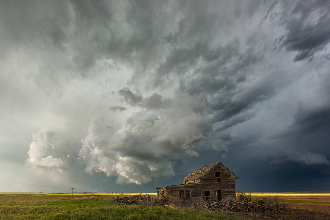
I’m headed to Denver tomorrow with Jon Christofersen to begin six days of storm chasing with Silver Lining Tours (SLT). With luck, the Great Plains will develop sculpted supercell storms and possibly tornadoes next week.
Where are we headed from Denver? Roger Hill, co-owner of SLT, is an accomplished meteorologist. He checks out what the Storm Prediction Center is discussing and then makes our travel plans. We could wind up anywhere from Texas to Saskatchewan.
There’s a lot of time spent driving to the forecast area and then waiting and fine tuning our final location. A typical travel day averages over five hundred miles with several hours of waiting. And that means two fast food meals (if we have time for lunch and dinner) per day because getting into position (or out of a bad position) is the priority. On a hectic chase day, even potty stops can be rare!
I opt for the photography tour option as opposed to the pure chaser tour offering. The photo van group tends to stay a little further away to capture more sweeping vistas. And we oftentimes pull over to enjoy photographically interesting foregrounds.
When you spend that much time together, you make new friends and have a lot of Type I fun! Here’s a group photo from my first tour back in 2016. Caryn Hill, Roger’s co-owner and wife, is on the right. I’m standing next to her, with Jon Christofersen third from the left in the yellow shirt.

The Shot
This abandoned farmhouse was one of those interesting foregrounds that hard-core chasers usually drive past without stopping. All six photographers in our photo tour van started clamoring to stop as soon as we eyed this old property.
We stopped, spread out, and looked for a pleasing composition. The storm clouds and the light seemed to frame the old home perfectly from this vantage point.
I’ll be on the road chasing next Friday, so the next Friday Photo will be June 2. If you don’t hear from me in June, I’ll be in the wind. 😊
Thanks for looking,
Chuck Derus
]]>
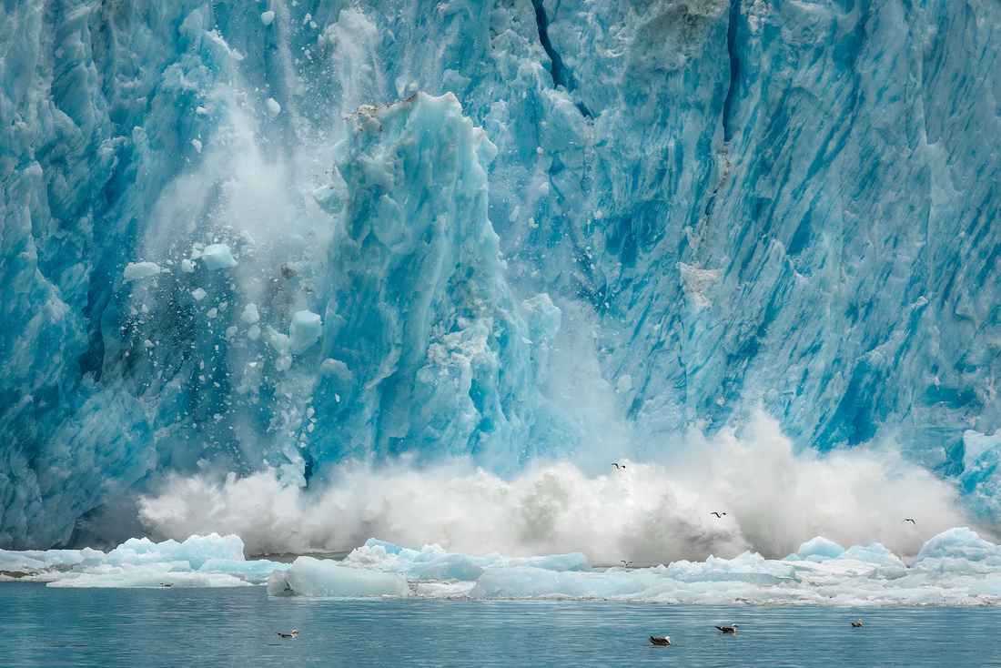
There are so many unique and stunning places to see in Alaska. The LeConte Glacier is right at the top of the list. And I had a chance to photograph it from a boat and from a helicopter during last summer’s Alaska trip.
The 21-mile long LeConte Glacier is the southernmost tidewater glacier in the Northern Hemisphere. It was named in honor of California geologist Joseph LeConte in 1887 by U.S. Navy Lieutenant-Commander Charles Thomas. The indigenous Tlingit called it “Huti,” which is derived from a mythical bird that produced sounds of thunder when it flapped its wings.
The glacier flows down from the massive 2,500 square mile Stikine Ice Field that straddles the border between Alaska and British Columbia along the Coast Mountains. It covers the crest of these mountains as far south as Ketchikan and as far north as the St. Elias Mountain range. It terminates in LeConte Bay, a sinuous, 15-mile-long fjord.
At the head of LeConte Bay, glacial ice towers 200 feet above the waterline. Another 500 feet is hidden from sight below the water. It flows into the sea at an astonishing 50 to 82 feet per day.
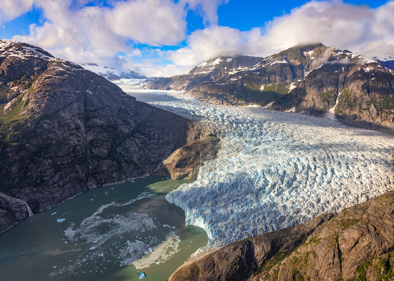
LeConte Bay and Glacier from the open door of my helicopter.
The glacier is known for its many "shooter" icebergs. Icebergs calve off underneath the water (LeConte Bay is 810 feet deep) and then shoot up and out of the water due to their buoyancy. Along with the icebergs that break off its face, the bay is frequently clogged, preventing boats from getting all the way to the head of the bay!
Historically, the nearby Petersburg fishing fleet used ice calved from the glacier to pack their catch. Since its discovery, the glacier has retreated nearly 2.5 miles. It appears to have stabilized its position.
The Shot
We stayed at the Tides Inn Hotel in Petersburg located next to and downwind from the fish processing plant. The fresh, bracing sea air felt wonderful as we boarded our boat and departed for the glacier.
Along the way, we noticed some other sightseers.
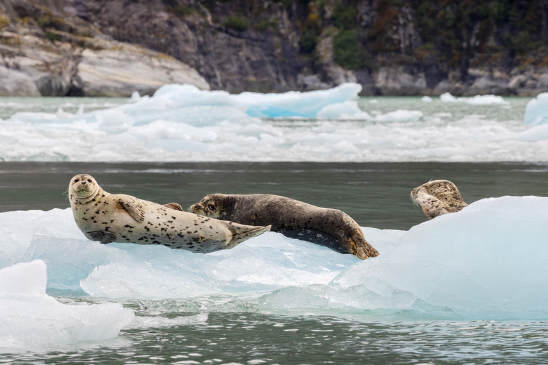
The next few hours were spent holding our heavy telephoto lenses pointed at the glacier. When we noticed some ice starting to move, we quickly pivoted and fired off a burst of photographs. Sometimes, I was too late to catch a decisive moment and at other times I failed to frame the shot correctly.
This calving iceberg image was my favorite.
Thanks for looking,
Chuck Derus
]]>
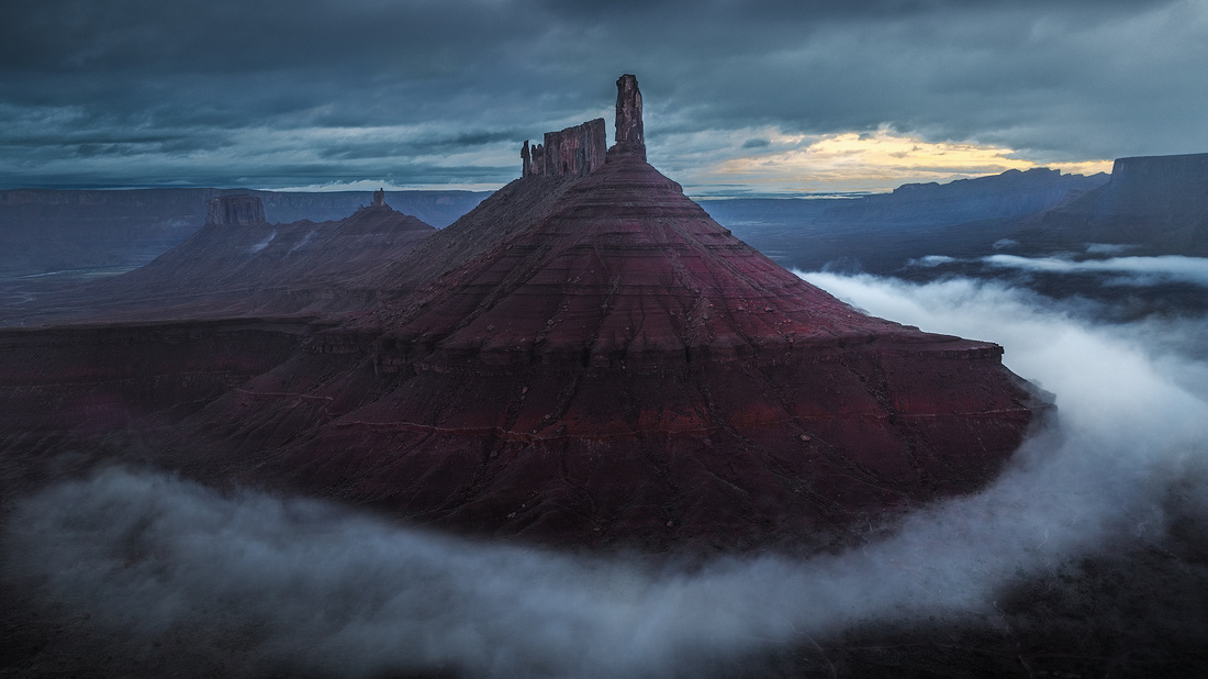
Fog in the desert is rare. In Utah, it only occurs two days per month on average. And fog is usually patchy and not widespread.
Fog can transform the right scene into a moody, mysterious, and compelling photograph. But what are the odds of being in the right place at the right time?
In March, I participated in a drone photography workshop. I’m new to the genre, so learning from an experienced instructor appealed to me.
The first two days were not promising. It was raining and you can’t wipe off your camera lens when your camera is a mile away in the air! So, we were grounded. Our days were spent scouting promising locations and hoping for a change in the weather.
What we least expected was fog the next morning. Just before dawn, the temperature and dew point were so close that fog was forming in the valley near Castleton Tower outside of Moab, Utah.
Castleton Tower
Castleton Tower (officially Castle Rock) is a 400-foot sandstone tower perched on a 1,000-foot cone above the northeastern border of Castle Valley, Utah. It’s a well-known photography subject and a classic rock-climbing destination.
The most famous Castleton climb is the Kor-Ingalls Route featured in Fifty Classic Climbs of North America by Steve Roper and Allen Steck. Every peak or route in the book had to appear striking from afar, have a noteworthy climbing history, and offer climbing of excellent quality.
The photograph below shows climbers rappelling down the side of the tower towards the cone-shaped base.
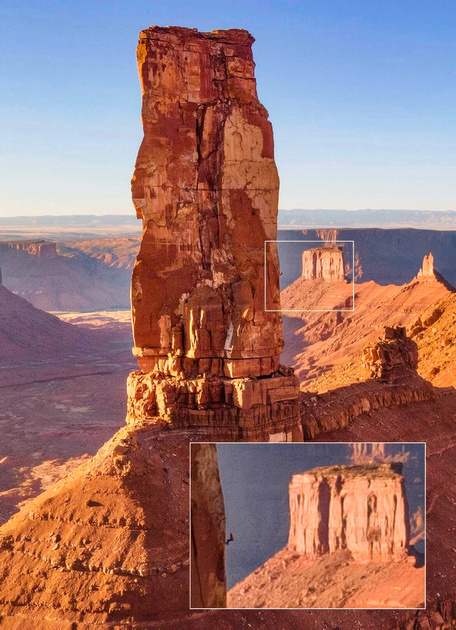
From Rappelling down Castleton Tower, UT : r/HumanForScale (reddit.com)
The view from the top looks amazing, but I’ll only see it if I’m helicoptered there!
From Views from the Top of Castleton Tower, Moab, UT — Steemit
The Shot
We started the morning thinking the rain wouldn’t end in time to launch our drones. But when the rain unexpectedly stopped, plans changed, and we diverted to Castleton. Arriving before dawn, we took to the air.
The view from above was stunning. The saturated sandstone was extra colorful from the rain. Beautiful big waves of fog were rolling towards the base of the Tower. I kept moving my drone trying multiple compositions.
We had about a half hour before the rising sun and temperature dissipated the fog. As the fog lifted, I thought “Right time, right place!” Within minutes, the scene lost its photogenic atmosphere.
This image is one of my favorites from that rare morning.
Thanks for looking,
Chuck Derus
]]>

I thought my coverage of the Villain Arts Tattoo Festival deserved more “ink.” So, this is part two of my impressions of the recent event in Rosemont, Illinois.
According to EarthWeb, here are some interesting 2023 tattoo facts:
- Over half of all Americans under 40 years old have tattoos.
- Over 145 million Americans have tattoos.
- Women who have tattoos outnumber men who have tattoos by 18%.
- Millennials represent 41% of all people with tattoos.
- 65% of fashion designers prefer employees with tattoos.
- $1.65 billion is the amount spent on tattoos yearly.
- 92% of people with tattoos have no regrets.
- By 2027, the tattoo removal industry will be worth $795 million.
- 56 hours and 36 minutes is the record for the longest tattoo session.
- Surprisingly, female tattoo artists make more than male tattoo artists.
There are many more statistics at EarthWeb: Tattoo Statistics 2023: Industry, Regret, Removal & Artist Facts https://earthweb.com/tattoo-statistics/
The Shots
The lead photo is a couple visiting the Festival. This pair graciously posed for several pictures. They were wandering the exhibit looking for inspiration for a new tat.

This gentleman seemed resigned to a very long 2-3 days to complete his new tattoo.

I guess this answers my question.

An artist waiting for his next appointment to arrive at his booth.
Let me know if you want me to go next year! Continued coverage of Tattoo Fest is dependent on popular demand. 😊
Thanks for looking,
Chuck Derus
]]>
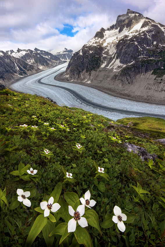
Five minutes. That’s the number of minutes of sunshine we had in eight days of wilderness camping during a photography workshop in the mountains near Juneau, Alaska last July. It was also the only time it stopped raining during those eight long days.
My January 27 blog post (https://cderus.zenfolio.com/blog/2023/1/type-2-fun-in-alaska) described Type II Fun. Type II Fun isn’t fun during the experience. It can become Type II Fun only when you reflect upon the experience weeks, months, or even years later.
Only taking two photographs during eight days when it was cold, dark, and rainy was not fun. But as we dried out and warmed up the next week, it turned into Type II Fun!
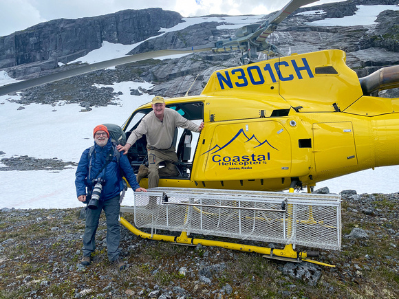
Getting dropped off by Wally, our pilot, just as the rain started. Note the doors are off for photography. It’s the third week in July in Alaska! We were surprised by how much snow was still on the ground.
Landscape photography is so exciting when the light and the atmosphere are special. The photograph in the January blog overlooking the Gilkey Glacier is one of those moments. And I had the experience of being in nature in stunning locations when the light wasn’t special. It isn’t just about getting the photo.
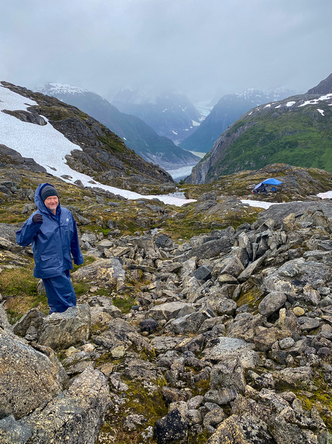
Friend and fellow photographer Jon Christofersen on his way down to the cooking/eating area (blue tarp in the distance). All the food and anything with a fragrance like toothpaste had to be stored here in bear-proof Kevlar bags 300 yards from our sleeping area.
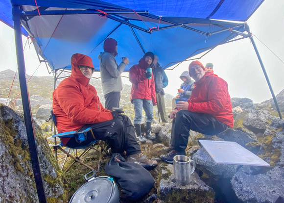
A typical morning at breakfast. The coffee was always warm, even if we weren’t.
Making the Five Minutes Count
On day six of eight living in a tent in the rain, a small clearing was headed our way. We hiked about a mile to a different glacier overlook and hoped for some much-needed light on the landscape. We didn’t know, but it was our last chance for photography until we returned to Juneau and Petersburg two days later.
The Shot
I was a little slow to arrive at the location. Going downhill on boulders and slippery ground proved to be more treacherous than it looked. My days as a gazelle are long over!
The spot of light was already fading by the time I found a composition and adjusted my camera settings. Because I wanted everything in focus from the flowers a foot in front of me to the distant mountains miles away, I took a series of photos focused at different distances.
By the time I finished my first series, the light had vanished. And the rain wasn’t far behind. I packed up my gear and headed back to my dry tent.
I initially overlooked this image. But I revisited my Alaska images recently and thought it might make a pleasing image and memory.
I’ll never forget that five minutes of amazing sunshine in the Alaskan wilderness!
Thanks for looking,
Chuck Derus
]]>
There were abstract compositions in every direction! I was overwhelmed by the possibilities. After clearing my mind, I decided to photograph everything I could before the light went away.
A month ago, I was in the badlands area of Arizona flying my drone. You might think it’s easy to fly in the desert southwest. But drones are prohibited in National Parks, most State Parks, Indian reservations, and other seemingly inviting locations. There are far fewer drone-legal locations than you might imagine.
A few areas in the 60-mile-wide by 120-mile-long Arizona natural wonder known as The Painted Desert are open to drones. I was in one of those legal locations not far from that famous corner in Winslow, Arizona last month.
The Painted Desert
Years ago, when I first visited the area, the name captured my imagination. Why is it called The Painted Desert? Once I saw it, I knew the answer. But where did the name come from?
The Spanish conquistador and explorer Francisco Vázquez de Coronado led a large expedition from what is now Mexico all the way to present-day Kansas between 1540 and 1542. He had hoped to reach the Cities of Cíbola, the mythical Seven Cities of Gold.

Francisco Vázquez de Coronado from The Search for Cibola, the Seven Cities of Gold | Ancient Origins (ancient-origins.net)
While he never discovered the Cities of Cíbola, his expedition recorded the first European sightings of the Grand Canyon and the Colorado River, among other landmarks. It was Coronado who named that section of present-day Arizona “The Painted Desert.”
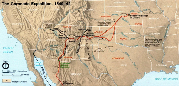
Coronado’s Route from Route of the Coronado Expedition (1540-1542): first recorded European contact with the Hopi, Zuni and Apache Nations. (USNPS) [1455 × 703] : r/MapPorn (reddit.com)
The Shot
This photograph was taken a few minutes before the Painted Desert image of two weeks ago. The sun was beginning to peek through the clouds on the horizon bringing pleasing light to the scene.
Thanks for looking,
Chuck Derus
]]>
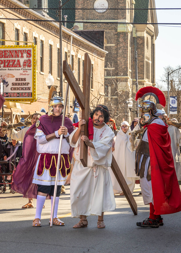
The living Way of the Cross, or Via Crucis in Spanish, comes to us from events two millennia in the past and from halfway across the world.
For the last 46 years, the parishioners of Providence of God Catholic Church at 18th Street and Union Avenue have reenacted the events that took place before and during the crucifixion of Jesus Christ.
Religious commemorations are some of the oldest festivals that have been observed over the centuries. In my own Christian faith tradition, I think of Easter, dating back to circa 30 BCE.
In the Jewish faith tradition, Passover comes to mind and dates to circa 1,445 BCE. For Muslims, the Hajj dates to 632 CE with Ramadan having a similar origin date. The Hindu Diwali festival is documented in ancient Sanskrit texts from the fourth century CE. The Hindu festival Navaratri may have originated around 6,000 BCE.
A Community Tradition
Organizers say the Via Crucis is a “neighborhood tradition and inspiration to the community” according to CBS News. Run by volunteers and featuring about 40 actors, it takes six weeks to plan.
This year, Ernest Rionaula played Jesus Christ. Eighteen-year-old Priscilla Bonilla portrayed Mary. Although the story was told in Spanish, everyone in attendance understood what was happening.
The day begins in the basement auditorium of the church. Volunteers act out scenes from the Last Supper through Jesus being crowned with thorns. They then form a solemn procession down 18th Street for a mile and a half to Harrison Park for the crucifixion. It ends at St. Pius V Catholic Church on Ashland Avenue with final prayers.
The Images

The Last Supper.
Being whipped after condemned to death.

Leading the procession proclaiming “Jesus King of the Jews.”

Simon of Cyrene helps Jesus to carry his cross.

The women of Jerusalem waiting to meet Jesus.

You always know you’re in Pilsen as you walk down 18th Street.

An overhead view from the Pink Line elevated stop.

The crucifixion scene before retreating to St. Pius V Catholic Church for final prayers.
It was a challenge to take good photographs. There were thousands of people in attendance. And every one of them seemed to be in front of me! Finally, the procession was surrounded by a rope line that you couldn’t cross.
Thanks for looking,
Chuck Derus
]]>
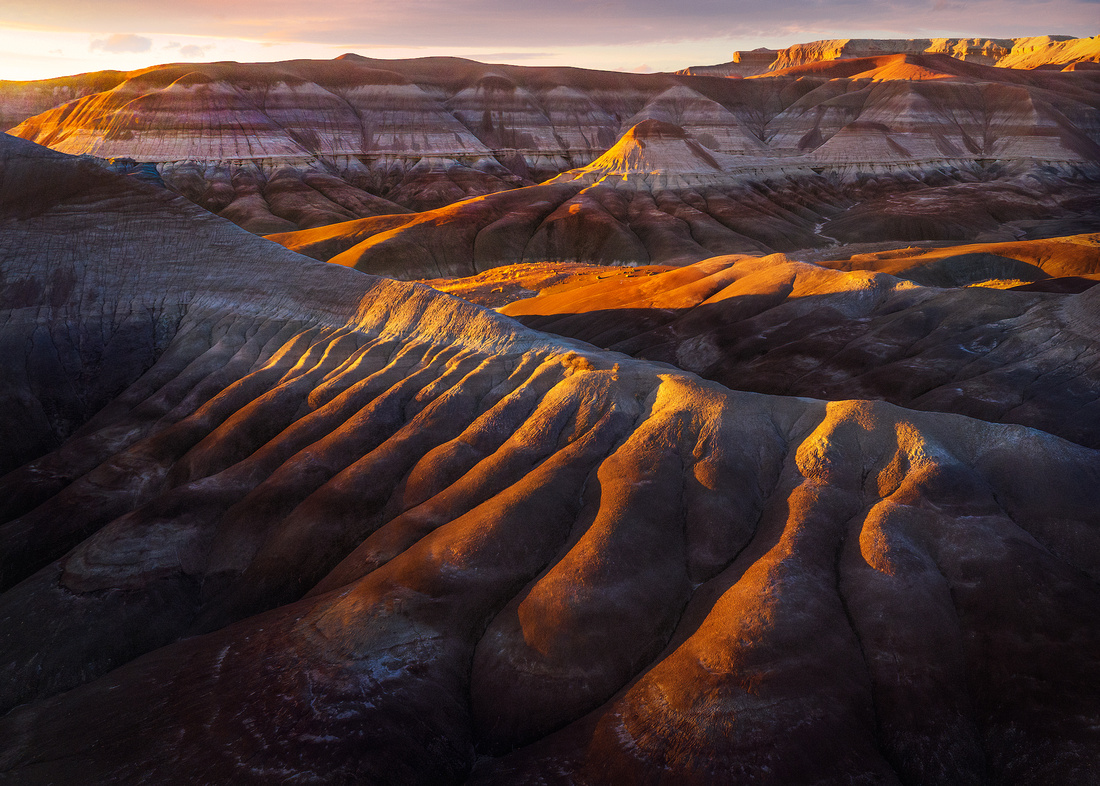
Not far from Winslow, Arizona lies the Painted Desert. And in case you’re wondering, this corner in Winslow, Arizona became famous because of the Eagles 1972 hit song, Take It Easy. The second verse goes:
“Well, I'm a standing on a corner in Winslow, Arizona
And such a fine sight to see.
It's a girl, my Lord, in a flatbed Ford.
Slowin' down to take a look at me.”
Standing on the corner last month. Photo courtesy of Jon Christofersen.
That reflection painted on the window behind me is the girl in a flatbed Ford.
Two and a half weeks ago I was in Arizona and Utah on a drone photography workshop. One of our stops was the Painted Desert.
There’s one good restaurant in Winslow. And wouldn’t you know, it was closed for a once-a-year deep cleaning. We had to scramble to find another decent, open restaurant. After finishing an early dinner, our small group of drone photographers headed to a nearby abandoned park at the edge of the Painted Desert.
Badlands
Badlands are defined as extensive tracts of dry, uncultivable land with little vegetation. They are made up of extensively eroded soft sedimentary rocks and clay-rich soils. Ravines, gullies, buttes, hoodoos, and other such geologic forms are common in badlands.
The Painted Desert took millions of years to create. The brilliant colors are the result of mineral contents slowly layered over millennia into the sedimentary rock. Deposits of iron, hematite, and aluminum cast a reddish hue as they mix with oxygen to create oxides ranging from vivid ochre to scarlet to soft rose.
Earthquakes, volcanic eruptions, wind erosion, and torrential flooding sculpted the soft stone and clay soil into a stark landscape with unique formations. Catastrophic events like flash floods and landslides stripped the layers in some areas and built-up layers in other areas. This is especially true in the darker purple areas commonly visible in the southern end of the Painted Desert.
Because it rained the first two days of our trip, the saturated soil held deep, saturated colors. And evaporation from the upper layers further varied the colors.
The Shot
On the late afternoon of March 20, I launched my drone towards some promising formations in the distance. It was overcast with the promise of clearing to the west and the setting sun.
My first photos in the flat, overcast light made wonderful abstracts. But when the sun peaked below the clouds just above the horizon, warm light swept across the formations.
This was my favorite photo from that evening.
Thanks for looking,
Chuck Derus
]]>

A Visit to the Villain Arts Tattoo Festival
Two weeks ago, friend and former Advocate Good Samaritan Hospital executive team member Laura Neiberg and I visited the Villain Arts Tattoo Festival. It was held at the Donald E. Stephens Convention Center in Rosemont, Illinois. In case you’re wondering, neither of us left with ink.
The event featured hundreds of the best tattoo artists from across the country. Thousands of attendees streamed in to be tattooed or to look for inspiration for their next tat.
Early Tattoo History
For thousands of years, humans have marked their bodies with tattoos. According to Cate Lineberry in the Smithsonian Magazine, “These permanent designs—sometimes plain, sometimes elaborate, always personal—have served as amulets, status symbols, declarations of love, signs of religious beliefs, adornments and even forms of punishment.”
The earliest documented tattoo dates back five millennia. Ötzi the Iceman, "Europe’s most famous mummy," was murdered in the Alps 5,000 years ago and discovered in a glacier in 1991.
He had tattooed dots and small crosses on his lower spine, right knee, and ankle joints. These locations corresponded to areas of strain-induced degeneration, raising the possibility they may have been applied to alleviate joint pain.
Egyptian female figurines and tomb scenes dated to c. 4000-3500 BCE had body and limb tattoos. Most are dotted patterns of lines and diamond patterns. Several female mummies c. 2000 BCE also had tattoos in the same locations.
These exclusively female tattoos may have played a therapeutic role. It’s possible they functioned as a permanent form of amulet during the very difficult time of pregnancy and birth.
Other ancient cultures used tattooing. Mummified remains of Nubian women south of Egypt were found to have blue tattoos. They sometimes featured the same arrangement of dots across the abdomen as Egyptians.
Ornate tattoos of mythical animals are seen in male and female mummies of the Scythian Pazyryk of the Altai Mountain region in central Asia. The Greek writer Herodotus c. 450 BCE wrote that among the Scythians and Thracians "Tattoos were a mark of nobility, and not to have them was testimony of low birth.”
Accounts of ancient Britons suggested they were also tattooed as a mark of high status. "Divers (more than one) shapes of beasts" were tattooed on their bodies and the Romans named one northern tribe "Picti," literally "the painted people."
Among the Greeks and Romans, the use of tattoos or "stigmata" seemed to have been used to mark someone as belonging to a religious sect. Tattooing spread across the Roman Empire until the emergence of Christianity. They were banned by the Emperor Constantine (306-373 CE) when tattoos were felt to "disfigure that made in God's image."
The Shot
The Tattoo Festival is the best place for an introverted photographer like me to take portraits. Only one of the approximately 75 people I asked declined my request. And everyone was extremely friendly and gracious.


Thanks for looking,
Chuck Derus
]]>
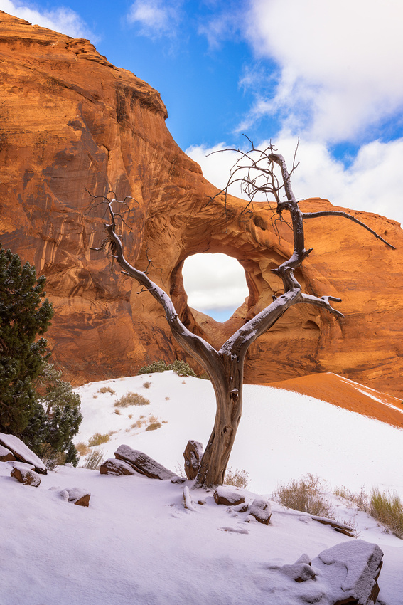
“We do not inherit the earth from our ancestors, we borrow it from our children.” Diné Saying
It’s the smaller, less visited scenes that really interest me as a photographer. When you’re in Monument Valley, you must photograph the grand landscape featuring the Mittens and Merrick Butte. But everyone has seen and photographed this icon of the West.
That’s why Ear of the Wind arch appealed to me. It’s off the beaten path on the self-guided loop drive through the Valley. Visiting this arch requires a Navajo guide. And Ear of the Wind is just one of several beautiful arches accessible only on a guided tour.
If you are wondering about the name, just look at the image a while longer.
This 121-foot-tall arch was formed by erosion of the brownish red DeChelly sandstone. DeChelly sandstone is a geologic rock layer up to 585 feet thick. It’s composed of multiple cross-bedded wedges with steeply dipping angles greater than 30 degrees. About 230 to 250 million years ago, these wedges were sand dunes.
The Shot
We were blessed with snow the day before. It helped simplify the scene by covering the busy foreground in a smooth blanket of white. And it helped define the branches of the old cedar tree.
The red sandstone contrasted nicely with the dead tree framing the arch. And the clearing storm contributed some needed clouds to add interest to the otherwise blue sky.
As I admired this beautiful scene, I wondered about the ancestral peoples who looked and listened to the sights and sounds of the desert through the Ear of the Wind over the millennia. What stories could they tell us?
I left hoping that we can all be stewards of the special places like this that we merely “borrow…from our children.”
I’ll be out in the field next week taking photographs, so the next Friday Photo will be in two weeks.
Thanks for looking,
Chuck Derus
]]>

What’s a CHIditarod? “It’s a food drive, a race for charity, a beauty pageant, a bar crawl, spontaneous street theater, and not for the faint of heart. It’s fast, furious, cold, creative, exciting, and very, very fun,” according to their website.
The CHIditarod is an annual urban charity shopping cart race that winds its way through Chicago’s West Town and Ukrainian Village neighborhoods. The date coincides with the Alaskan Iditarod® dogsled race.
In this race, shopping carts replace dogsleds. Teams consist of five people; four pull the cart (“dawgs”) and one directs the cart (musher). Each team has a unifying theme for their cart and costumes.
Every team must arrive with at least 69 pounds of donated food. Since its inception in 2006, the CHIditarod has donated over 257,419 pounds of food and more than $653,779 in donations to the Greater Chicago Food Depository. Over one thousand participants and spectators watch the race every year.
Race Day
Many of you ask if my wife accompanies me on my photo outings. She generally doesn’t, but last Saturday was going to be an exception. Friends Deb and Win Wehrli were going to join us and drive together downtown to experience the CHIditarod.
Unfortunately, my wife Christine came down with a nasty upper respiratory infection and had to stay home. Luckily, the Wehrlis were adventuresome enough to join me on this adventure anyway.
Nasty weather doesn’t stop the CHIditarod. Their philosophy is “There is no bad weather, just poor wardrobe choices.” We lucked out as Saturday was warm and sunny. We wandered the one-block fenced-off “yard” on Market Street west of Justine where the participants assemble for the start of the race. It was a great opportunity to meet and chat with the participants.

Deb Wehrli, a CHIditarod dawg, and Win Wehrli
My favorite team was the Dilly Parton cart that was passing out pickle samples to anyone who wandered by.

The Dilly Parton Team
Most of the participants were…interesting.

These three probably sampled adult beverages pre-race at the Cobra Lounge behind them
A few other teams caught my eye as well.

The Pleasure Paradise Team

Team 67
N'awlins Bourbon Street-style jazz music was provided by the CHIditarod Band.

The Trombone Player
Even spectators came dressed for the occasion.

You’re never too young to see your first CHIditarod!

Two of the more interesting spectators wandering the yard
The Shot
It was difficult to pick one photo for the Friday Photo. I finally settled on this picture of the start of the race. It seemed to capture the manic wackiness of the event.
Please let me know if you plan to enter next year’s CHIditarod. Fame and fortune surely await you as a 2024 Friday Photo feature.
And if you can’t put off being famous until next year, meet me at the Villain Arts Tattoo Festival on the 17th of March at the Stephens Convention Center in Rosemont, Illinois. You’re only a tat away from becoming a Friday Photo headliner! 😊
Thanks for looking,
Chuck Derus
]]>
On Tuesday, February 21, Roger Hill from Tornado & Storm Chasing Tours - Silver Lining Tours sent an email to his on-call storm chaser list. He had his eye on a potential storm kicking out of the southwest into western Kansas and western Oklahoma on Sunday, February 26.
With a deep snowpack over portions of Western Kansas, it could be a once in a lifetime opportunity to capture a supercell, possibly producing a tornado over a snow field. A snow field!!!
I was interested! I let Roger know and waited for an update.
On Thursday, February 23, Roger let us know that it looked very promising. He was 85 percent sure that it was a go. But before committing to a 1,300-mile round trip from Denver to possibly Texas and back, he wanted to see Friday’s forecast.
On Friday, February 24 he emailed us that it was a go. Seven chasers, along with Roger and our driver Connor McCarty, said “Yes!”
I quickly booked a one-way ticket using frequent flyer miles to Denver Saturday afternoon, February 25. By then the National Weather Service Storm Prediction Center had upgraded the chance of severe thunderstorms from Moderate to Enhanced.
On Sunday morning, we left the hotel at 6 am and made a quick stop at Dunkin’ for coffee and donuts to go (the hotel breakfast wasn’t open yet). Here I am with Connor, our driver and soon-to-be-graduating meteorologist at Dunkin’.

We jumped on the Interstate and started our 8-hour, 500-mile trip to Wheeler, Texas. Roger is already checking the weather radars from the passenger seat.
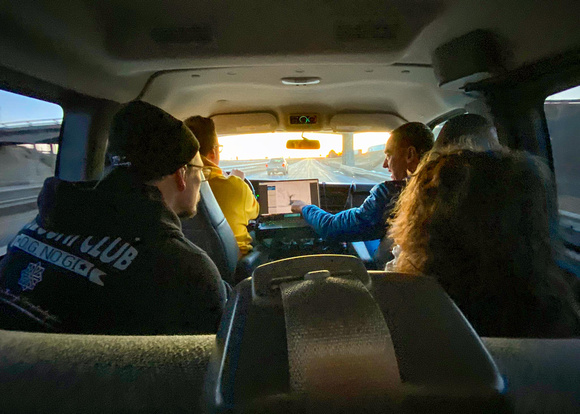
I was ecstatic! I scored a seat in the second row and not the back row over the rear axle. We settled in for the long ride, punctuated by only two bathroom breaks and a brief stop at a Subway for lunch.
We drove past Amarillo, Texas on I-40 (the old historic Route 66) to a rest stop. We waited there for about an hour and a half as Roger constantly checked the weather radars and looked at the sky.
The storms were forming to our south and west and heading northeast at 75 mph. There was no way that we could follow a promising storm moving that fast. We had to set up in a few fixed locations that appeared favorable and hope that something happened as the storms raced past.
If the spot was too early in the storm’s maturation, it wouldn’t be organized enough to drop a tornado. And since there were multiple storms forming, we had to pick a location where we could move a short distance north and south to observe several storms safely.
In late February, sunset is still relatively early at 6:33 pm. You don’t want to be chasing in the dark. We didn’t have much time.
Our first location was near Shamrock, Texas at 5:50 pm. The small blue circle is our location, and the red outlines are two tornado-warned areas. It was a location with great potential.

However the first storm cell “shredded” itself and became disorganized, failing to rotate and drop a tornado. The second cell should have lowered its base and potentially dropped a tornado due to encountering colder, moister air at our location, but it apparently failed to read the weather textbook. There was rotation near Lefors, but any tornado would have been wrapped in rain and invisible.
We had one more chance before the sun set and it was too dark to take pictures. Roger relocated us to Wheeler at 6:15 pm where it looked promising.

Unfortunately, the cloud base didn’t drop and produce a tornado. We hurriedly drove to the east about 6:40 pm to avoid a line of storms producing 1-inch hail and 75 mph winds. The “paved” road turned into dirt after a few miles and we had to turn around into the teeth of the storm. Fortunately, we “threaded the needle” between the storms and didn’t get hammered by hailstones.
The Shot
The only pictures I took were of the approaching Wheeler storm near sunset. We weren’t there long before the rotating base got too close for comfort and we had to bug out. I turned them into a short timelapse.
We decided to return to Amarillo and spend Sunday night instead of trying to drive back to Denver. Luckily, I was able to catch a flight from Amarillo to Chicago Monday afternoon instead of driving to Denver and then flying to Chicago.
So, would I go again? In a heartbeat! It was an exciting chase with a chance to learn from Roger, one of the best chasers in the business. And if the atmospheric conditions were more favorable and in a different location, a photograph of a tornado in a snow-covered field would have been worthy of National Geographic!
Thanks for looking,
Chuck Derus
]]>
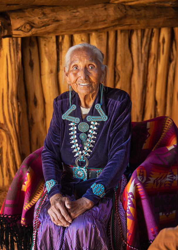
Meet Helen of the Diné. I had the privilege of photographing her in Monument Valley last December. Helen is 93 years old and has lived in the Valley her entire life. She only speaks Navajo, so smiles and hand gestures conveyed our appreciation at being invited into her life.
She was sitting in a family hogan on the reservation. A hogan is the primary, traditional dwelling of the Diné (Navajo) people. Hogans can be round, cone-shaped, multi-sided, or square. There may be timber post or stone walls packed with earth in varying amounts. The door faces east to welcome the rising sun for wealth and good fortune.
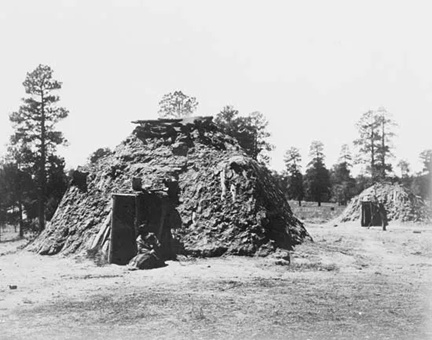
Traditional Navajo Hogan from Britanica.com
Life in the Valley is not easy. There are no utilities, running water, electricity, or natural gas. Everything from water to fuel must be brought into the Valley. Some homes have solar panels to generate electricity.
The Shot
The morning sun was streaming in from the east entry. Communicating with hand gestures, I tried having her look in different directions and shift her position on the chair.
After a few images with just Helen, I decided to include more of the hogan.
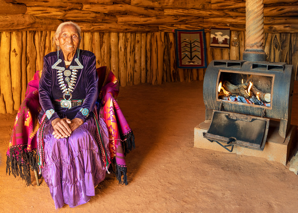
I marveled at her quiet dignity and perseverance. Leaving the hogan, I had the feeling that when she passed, the world would cry and that she would rejoice.
Thanks for looking,
Chuck Derus
]]>
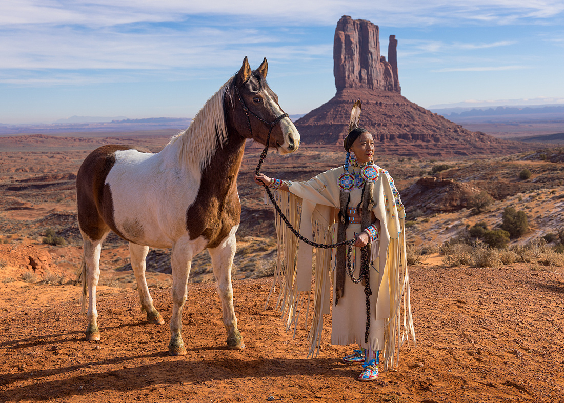
Before Christopher Columbus landed in the Americas in 1492, the Diné (Navajo) were already established in the Four Corners (the intersection of Utah, Colorado, New Mexico, and Arizona) area of the Colorado Plateau. However, they weren’t the first inhabitants of this land.
According to anthropologists, ice-age Paleo-Indian Hunters roamed the area from 12,000 to 6,000 B.C.E. They were followed by Archaic Hunter-Gatherers from 6,000 B.C.E. to 1 C.E. The Ancestral Puebloans followed in turn until they left around 1300 C.E.
Sometime between 1100 and 1500 C.E., the Diné migrated to the area from Canada. It wasn’t until 1581 that the Spaniards first made contact with them.
Today’s 300,000 Diné are the second most populous Native American tribe in the United States. Dine Bikéyah, or Navajoland, covers over 27,000 square miles of beautiful desert extending into parts of Utah, Arizona, and New Mexico. It's larger than 10 of our 50 states.
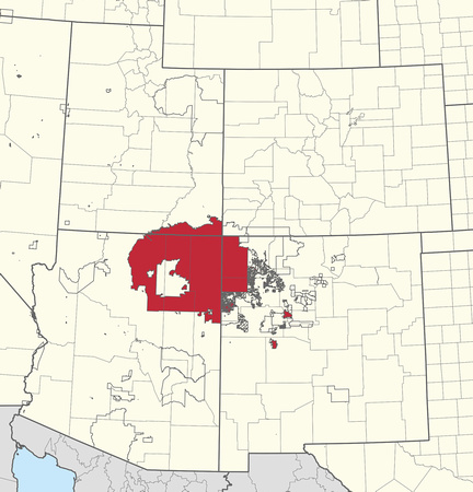
The Shot
During my December five-day trip to Monument Valley in the heart of Navajoland, we had a rare opportunity to photograph tribal members. These were environmental portraits, or photos taken of a person in a place that says something about who they are.
If you’re a Friday Photo regular, you know that I’m not a portrait photographer. But the combination of beautiful backgrounds and traditional Diné clothing made for a compelling experience.
Candace and her horse were our patient subjects on this chilly morning of December 10. The sun was still low, creating warm light and distinct shadows. And the West Mitten in the background spoke volumes about Candace and her people.
It was a scene that might have been photographed over a hundred years ago.
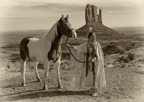
Thanks for looking,
Chuck Derus
]]>
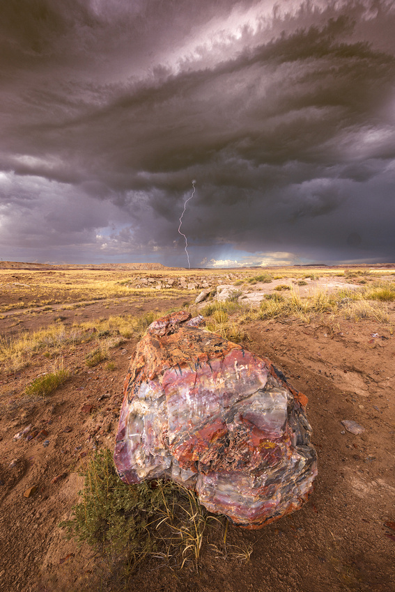
The lightning made me a bit nervous. I was closer than I preferred to be. But the fossilized tree trunk in front of me was nonplussed.
Our group was supposed to be chasing supercells and tornadoes in the Great Plains the last week of June 2022. The day I arrived, a cold air mass moved into the Midwest producing a storm photographer’s worst nightmare: severely clear skies for the next two weeks.
So, our small group of storm chasers drove from Denver, Colorado to the desert Southwest where the weather forecast was calling for isolated monsoon storms. It proved to be a wonderful consolation prize.
Petrified Forest National Park
One of the many beautiful places where we chased monsoon storms was northeastern Arizona’s Petrified Forest National Park.
The Petrified Forest is known for its tree fossils from the Late Triassic Epoch, about 207 to 225 million years ago. At that time, the park was a humid, sub-tropical forested plain near the equator.
Most organic matter either rapidly decays or is eaten by other organisms. But if it’s quickly buried in mineral rich sediments, such as volcanic runoff, the organic matter may become fossilized. The sediment that fossilized the Park’s logs into rainbow colors is part of the 800-foot thick Chinle Formation.
About 60 million years ago, the Colorado Plateau (which contains the park) was pushed upward by tectonic forces and exposed to increased erosion. All the park's rock layers above the Chinle were slowly removed by wind and water, revealing the logs.
The Shot
Photographing lightning always makes me jittery. That day was no exception. To be safe, we try to stay six or more miles away and retreat to our van whenever we feel rain.
After reaching the Park’s entrance, the gap to the storm slowly closed as we drove. Our van stopped at a small parking lot with a promising view. We hiked to a small rise, and I began looking for a foreground.
I paused in front of this log and set up the camera facing the receding storm. I first took a series of shots to blend in Photoshop to ensure sharpness from the nearest grains of sand to the distant horizon. Next, I focused on infinity and turned on my lightning trigger (it senses a bolt and triggers the shutter in milliseconds). I just had to wait and hope for a strike.
As I waited, I tried to imagine being there almost a quarter billion years ago surrounded by a jungle and admiring what must have been a splendid conifer tree.
Thanks for looking,
Chuck Derus
]]>
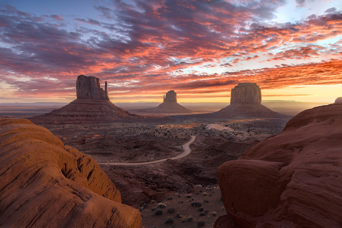
"The whole point of taking pictures is so that you don’t have to explain things with words." Elliott Erwitt, French-born American advertising, and documentary photographer
More of Monument Valley
I’ve written several recent Friday Photo blogs about Monument Valley on the Arizona-Utah border. This time, I’ll let my picture do most of the talking.
The Shot
During my five-day trip to Monument Valley in December, we had good light. The morning of Saturday, December 17 was a light show that photographers dream about.
The rising sun illuminated the high clouds in brilliant reds against a blue sky. Shafts of warm light broke through the distant peaks and painted parts of the valley floor. And the distant atmosphere created a glow around the rising sun just out of the frame.
The foreground takes advantage of the two big “Ansel Adams” rocks. Ansel Adams’s 1958 photograph, Monument Valley, Arizona, made the rocks famous with photographers.
Those two rocks anchor an inverted “V” double leading line to the West Mitten and Merrick’s Butte, and beyond to end at the East Mitten. The dirt road adds yet another leading line.
We all high fived as even the Navajo tribal members flocked out of The View Hotel to take cell phone pictures of this rare display of light over the valley.
Thanks for looking,
Chuck Derus
]]>
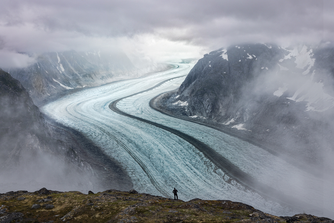
North to Alaska and Type 2 Fun!
Thirteen days in Alaska! It promised to be the landscape photography trip of a lifetime. Mountains, glaciers, endless twilight, and enchanting light from clearing storms awaited us.
The first eight days were scheduled in the remote wilderness, camping in mountains accessible only by helicopter. The next five days were in Juneau and Petersburg, with boat trips to the glaciers and doors-off helicopter flights into the mountains. Our small group was thrilled with the possibilities.
We went there during the last two weeks of July. After departing Juneau on a gorgeous partly cloudy, 60-degree morning, our helicopter dropped us off in a high alpine valley.
The temperature was 42 degrees and it started to rain. And it didn’t stop raining for the next ten days. The good news was that even the mosquitos refused to come out.
Within hours, all of us were cold and soaked. We wanted to change locations, but the helicopter was grounded for the next three days due to fog.
And when we finally changed locations, it continued to rain. It was so rainy for two days that we only left our one-man tents to go sit on a wet rock and eat our meals.
Type 2 Fun
It was day six when Scott, a member of our group, proclaimed over breakfast, “This is Type 2 fun!” We all gave him a puzzled look, so he elaborated. “Type 2 fun isn’t fun at the time, but after weeks, months, or even years, it becomes fun in retrospect.” Yes…Type 2 fun!!!
For the next four days, when we asked the leader for the weather report, he said “Type 2 fun without a chance of clearing.” We all laughed hysterically in the rain.
Scott later explained that that Type 1 Fun is fun at the time of your experience. Type 3 Fun? That’s never fun, but the experience might make a great story if you wait long enough. My long-ago internal medicine internship was definitely Type 3 fun.
Lots of Type 2 Fun Time in the Tent
Our second campsite had the advantage of a great view over the Gilkey Glacier.
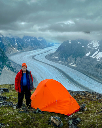
This was the only photo trip where I was well rested. My day consisted of naps followed by more naps. There was time to read five novels. In case you’re wondering what a day in a rainy tent looks like, see below.
The Shot
When you chase the light, sometimes you’re lucky, and sometimes it eludes you.
Our luck was bad. The weather didn’t cooperate for ten straight days. So, we enjoyed being there and tried our best to find images in the gloom. And we stocked up on potential Type 2 fun stories.
It wasn’t far from my tent to a stunning overlook above the Gilkey Glacier at camp two. Placing a person in the shot helped to provide a sense of scale to the massive glacier extending miles and miles into the mountains above us.
On the morning of our ninth day, we helicoptered back to Juneau. A hot shower, our first change of clothes in eight days, a cheeseburger, and a soft bed seemed heavenly!
Do you have a favorite Type 2 fun story to share?
Thanks for looking,
Chuck Derus
]]>
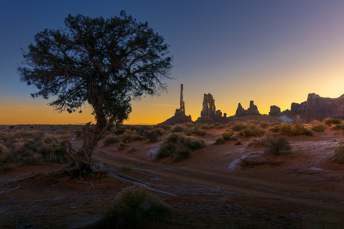
Clint Eastwood has starred in many great movies. The Eiger Sanction isn’t one of them.
Roger Ebert’s review read: “It has a plot…that we can’t believe…for much more than 15 seconds at a time, but its action sequences are so absorbing and its mountaintop photography so compelling that we don’t care…”
Eastwood learned to climb for the movie. He did all his climbing, even under dangerous conditions. Special equipment and handheld cameras were used to film the climbing sequences. Those sequences make the movie.
Like most 70s movies, don’t expect enlightened attitudes regarding race and gender.
The (Thin) Plot
Dr Jonathan Hemlock (Clint Eastwood) is an art professor and former government assassin. He is blackmailed out of retirement for one more “sanction” (assassination).
The target is someone on a team climbing the murderous north face of the Eiger Mountain in the Swiss Alps. It’s 5,900 vertical feet of the most challenging and deadly rock and ice in all the Alps. At least 64 climbers have died attempting the north face.
Hemlock’s only clue is that the man walks with a limp. He must determine his target and assassinate him during the climb.
He prepares by going to Arizona’s Monument Valley for training with his old climbing buddy Ben Bowman (George Kennedy). “Graduation” from training consists of Hemlock and Bowman climbing the incredibly difficult 18-foot diameter, 640-foot-high Totem rock spire in the Valley.
Who Brought the Beer?
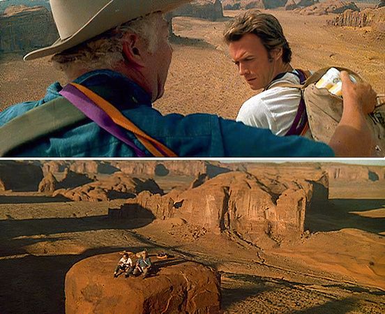
The scene when they reach the top is a classic. They are sitting on top of the Totem, miles from anywhere.
Bowman: “Wanna beer?”
Hemlock: (Hemlock looks at Bowman as if he’s nuts) “You gonna call room service?”
Bowman: “We got beer.”
Hemlock: “You haul beer up this rock, you’re insane.”
Bowman: (Reaches into Hemlock’s backpack and pulls out some beers) “I may be insane but I’m not stupid. I didn’t carry it, you did, in your pack!”
Hemlock: (Takes a beer) “Christ, I oughta throw you off this pillar – besides, it’s warm.”
Bowman: “I’m sorry, I thought you’d draw the line at haulin’ ice.”
The Totem
The Totem has religious significance to the Navajo. The crew was allowed to film only if they removed pitons and other climbing hardware embedded in the structure by previous climbers. Eastwood’s crew restored the monolith to pristine condition, and no one has climbed it since.
The Shot
I saw the Totem for the first time in December on my Monument Valley trip. We arrived for a dawn shoot. Instead of a closeup, we framed the distant Totem between a tree and the rising sun.
I knew I had to have a beer that evening with dinner. A cold one.
Thanks for looking,
Chuck Derus
]]>
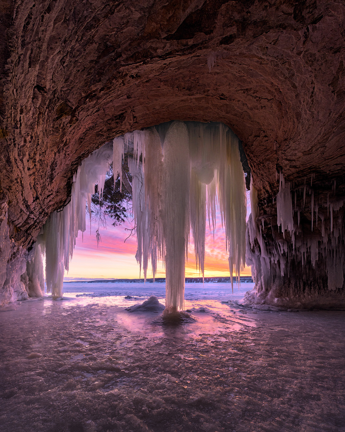
Over millions of years, rivers deposited layers of sand that fused into sandstone. Glaciers, water, and wind then transformed that sandstone into miles of dramatic cliffs and caves along Lake Superior’s shore near Munising in Michigan’s Upper Peninsula.
Pictured Rocks National Lakeshore preserves much of this beautiful stretch of shoreline for us as a national park. Wind, waves, and water continue to sculpt the area. During the summer, countless tourists view these dazzling formations by boat and by kayak.
But it’s winter that brings a stunning addition to the already beautiful lakeshore: ice.
Ice formations drape the red sandstone cliffs, waterfalls are frozen in place, and icicles glisten. Mineral deposits in the water and the warm tones of sunrise tint the ice with pleasing pastels.
When weather conditions are just right, the ice is thick enough for visitors to snowmobile safely across the bay from Munising to the shoreline and caves of Grand Island.
The winter of 2021-2022 was one of those winters. After four years of waiting, I was finally able to connect with a group of photographers making the crossing to Grand Island.
As we snowmobiled there in the pre-dawn in early March, we didn’t know what to expect. It wasn’t very cold; it was ten degrees above zero.
The Shot
As we neared the island, we know we were in for a treat. The ice was plentiful. High clouds to the east looked promising for a colorful sunrise. And we were the only group out that early morning.
Our first stop was a familiar looking cave. After a few moments, I realized I had been there before in the fall. Several compositions came to mind. After choosing one and setting up my camera, the sky lit up in warm, inviting colors. What a treat!
After a few hours, we packed up to head back to the Falling Rock Café and Book Store for hot coffee and breakfast.
If you want to visit the ice caves of Grand Island, check out Home | Ice Cave Tours (lakesuperioricecavetours.com). Remember, accessibility is very weather dependent. Let me know if you go!
Thanks for looking,
Chuck Derus
]]>
 Run Forrest, Run!
It’s a line that’s immediately recognizable. Forrest Gump is a lovable, familiar movie character ranking up there with the likes of Rocky and Maria in The Sound of Music.
Winston Groom published the book in 1986. A Mobile, Alabama man with a low IQ leads an extraordinary life of being in an interesting place at an interesting time. Told by his mother "You have to do the best with what God gave you,” he never thinks of himself as disadvantaged.
Forrest Gump falls in love with his first-grade crush – Jenny -- for a lifetime, becomes a college football star, fights in the Vietnam War, plays professional ping-pong in China, and becomes a shrimper.
The book didn’t sell. But the 1994 film based on the novel won six Oscars, including Best Picture, Best Director and for Tom Hanks, Best Actor.
Many of Gump’s best lines are etched in our memories. “My mama always said, ‘Life was like a box of chocolates, you never know what you’re going to get.’ ” And “What’s normal anyways?” But the movie’s signature line wasn’t uttered by Gump. It was Jenny who shouted “Run, Forrest, run!”
Midway through the movie, Gump is sitting outside his Alabama home feeling sad because Jenny has left. Overwhelmed, Gump rises and “for no particular reason” decides to “go for a little run.”
"My Mama always said you've got to put the past behind you before you can move on." After running for “…three years, two months, 14 days, and 16 hours” he finally made sense of all he experienced. It took him across America almost five times.
The iconic cross-country running scene wasn’t in the book, and it almost didn’t make the film. It only exists because Hanks and director Robert Zemeckis agreed with Paramount to personally foot the bill for the filming.
The reward for their perseverance is seven minutes of Gump running through some of the most beautiful locations in America.
The End of the Run
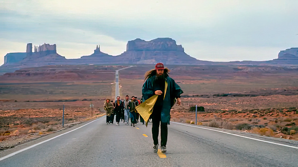
“I’m pretty tired…I think I’ll go home now.” Gump finally stops running at one of the most beautiful stretches of road in America. Utah Route 163 leads to incredible beauty of Monument Valley on the Navajo reservation.
The Shot
I dare you to visit Monument Valley without stopping to photograph this iconic vista. I certainly couldn’t resist. The recently completed Forrest Gump Scenic Overlook always has a few people there taking selfies.
A month ago, our small photography group had the location mostly to ourselves. With a lookout warning us about traffic approaching us from behind, we took turns going to the center line and photographing. When the sky looked its glorious best, I took my turn.
“That’s all I have to say about that.”
Thanks for looking,
Chuck Derus
]]>
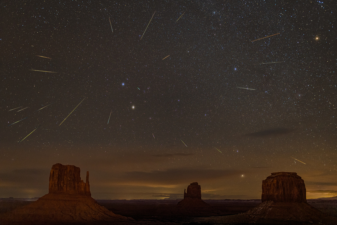
Most people don’t like dust. But to an observer of the night sky, dust can be transformed into a thing of beauty. We’re talking about meteors.
Meteors are high speed fragments and particles that burn up upon entry to the Earth’s atmosphere.
Comets and some asteroids leave a dusty trail behind as they orbit the Sun. Every year the Earth passes through these debris trails. When the debris enters our atmosphere, it burns up creating fiery, colorful streaks in the night sky.
Meteor or meteorite? If a meteor survives its trip through the atmosphere and reaches the ground, it becomes a meteorite. About 33,000 to 110,000 tons of meteorites reach the earth every year!
A Newcomer
December brings the Geminids meteor shower. It’s considered to be one of the best and most reliable annual meteor showers.
The Geminids first began appearing in the mid-1800s. The first showers weren’t noteworthy with only 10 to 20 visible meteors per hour. But since that time, the Geminids have grown to become one of the major showers of the year.
Most meteor showers originate from comets. The Geminids are unusual and originate from an asteroid, 3200 Phaethon. Due to its close approach to the Sun, Phaethon is named after the mythical Greek character who drove the Sun-God Helios's chariot.
It may be a "dead comet" that has lost all its volatile materials leaving only rock behind. During its very close approach to the sun, bits and pieces break off from the 3.7-mile in diameter asteroid adding to its dust trail.
During the December 13-14 peak, 120 Geminid meteors per hour can be seen under perfect conditions. The Geminids are bright, fast meteors that tend to be yellow in color.
Geminids travel 78,000 miles per hour, over 40 times faster than a speeding bullet. But don’t worry about being hit. Geminids burn up 45 to 55 miles above the Earth.
Why Geminids?
The shower owes its name to the constellation Gemini because the meteors appear to emerge from the constellation Gemini (twins). Our ancestors had great imaginations!
The two bright stars Castor and Pollux each mark a starry eye of a Gemini Twin. Image via AugPi/ Wikimedia Commons.
This depiction of the Gemini twins is from Urania’s Mirror, a set of cards containing astronomical star charts, first published in 1824. Image via Wikipedia.
The Shot
I was very fortunate to be in Monument Valley on the Navajo reservation December 9th through the morning of the 13th for a photography workshop. With the Geminids peak activity occurring that evening, I elected to stay an extra day.
It was the easiest night photography ever! My room at The View Hotel featured the view of the iconic West Mitten, East Mitten, and Merrick’s Butte from my patio. I framed the scene, set the camera to take continuous photographs, and stepped back into my cozy, warm room and enjoyed an adult beverage.
I captured 1,506 images at ISO 5,000, f1.6, and 8 seconds at a 35mm focal length between the beginning of astronomical twilight and the moonrise. After the moonrise, the meteors were washed out by the bright light of the moon.
Twenty-two images captured meteors! In Photoshop, I selected a base image of Monument Valley and the night sky. The Geminid radiant (the apparent point of origin with the radiating arrows) moved up and to my right (the curved line) as the evening progressed. So, I had to rotate and move each of the 22 meteor images to line up with my base image radiant. Only the meteors were then selected and pasted into the base image.
Several hours and about 40 Photoshop layers later, I had this composite of the evening’s meteor shower.
I was honored to be selected as the December 25, 2022, Astronomy Picture Of the Day (APOD). APOD is supported by NASA, the National Science Foundation, and Michigan Technological University. There are over a million views a day of astrophotography submitted from around the world.
I never thought I’d have one of my pictures accepted. Look for it in the archive dated 12/25/2022 (Astronomy Picture of the Day Archive (nasa.gov)).
Thanks for looking,
Chuck Derus
]]>
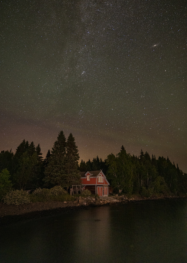
I’m from Minnesota. While my parents weren’t Scandinavian, many of my classmates were. In my high school class of 400, there were 29 Andersons, Johnsons (pronounced “yawn-son”) and Petersons. And the best man in my wedding was a Hendrickson from my class.
I was reminded of all those Swedes and Norwegians during a photographic trip last year. I was in Grand Marias, Minnesota, on the far North Shore of Lake Superior.
Nordic immigrants settled in Minnesota during the late 19th century. Some knew the land and came to farm. Others brought their fishing skills and settled along the lake.
Norwegian immigrants pose for a picture on the passenger and freight steamer America sometime between 1900 and 1910. They are on Lake Superior with Duluth is in the background. Photo courtesy of the Northeast Minnesota Historical Center, Duluth,
The first commercial fishing on Lake Superior began in the 1880s. By the 1920s, there was a thriving fishing community. More than 270 commercial fishermen and their families lived along the North Shore. Eighty to 90 percent of this group were Norwegian Americans. They sold their fish to the A. Booth Packing Company, headquartered in Chicago at the intersection of Lake and State streets.
Commercial fishermen along Lake Superior’s North Shore. https://northernwilds.com/lake-superiors-historic-maritime-locations/
Lake Superior proved to be challenging, even for those used to fishing the Norwegian coast. Storms appeared with very little warning and there were very few safe harbors.
The fishermen worked out of small fish houses, where they kept their nets and other equipment. Old nets were dried on net reels and new nets were seamed during slow periods. Corks were oiled and dried. And in good weather, rope and cord were laid out to dry.
Fishing proved to be difficult and not very lucrative. Catering to tourists became a way to supplement their income. Many of the North Shore’s original resorts were mom-and-pop operations operated by commercial fishing families.
As time went on, commercial fishing dwindled, but tourism thrived. Some of the original fish houses where the old timers worked either survived or have been recreated for historical displays in the area.
The Shot
Our group was north of Grand Marais at the ghost town of Hovland. We walked out on the old Hovland dock. It’s the last remaining vintage commercial dock on the Lake. Looking back towards shore, we saw a 21st century version of a Norwegian fantasy.
It was a 28-year-old, 618 square foot home that looked like an old Norwegian fish house. I could only imagine drinking coffee in the morning overlooking the lake through the picture window. And with a price of over $300,000, I was limited to imagining.
Despite being there in July, it was in the 50s that evening. The mosquitos were hunkered down, so we could take our time. A touch of low-level illumination helped bring out the home and its color.
The wispy, far edges of the Milky Way cut diagonally from top center towards the bottom left. And to the right of the Milky Way, we could see the Andromeda galaxy. At 2.5 million light years away, it’s the furthest visible object we can see.
You betcha, it was a wonderful night.
I’m taking the 16th and 23rd off for the holidays. The next Friday Photo will be December 30th.
Thanks for looking,
Chuck Derus
]]>
I always enjoy dawn in the desert southwest. In March, I witnessed a beautiful dawn in the Kofa National Wildlife Refuge with fellow photographers Mike Loebach and Jon Christofersen.
Kofa is in the southwest corner of Arizona. Its 665,400 acres of remote and rugged desert attracts wildlife enthusiasts, hikers, photographers, rockhounds, and stargazers.
A Little History
Very few people ventured into this remote corner of Arizona before 1896. That’s when Charles Eichelberger discovered gold in what would later become the Kofa National Wildlife Refuge.
His King of Arizona mine produced enough gold and silver to support a nearby town of 300. Because his mine workers stamped mine property with the initials “K of A,” the town adopted the name Kofa.
The mines petered out and the King of Arizona mine ceased operations in 1939. Around the same time, the desert bighorn sheep population began to dwindle. Local conservationists took note.
The honorary President of the Arizona Boy Scouts, Major Frederick R. Burnham led a campaign to save the bighorns. The campaign was successful, and land was set aside for a wildlife refuge in 1939.
Those plans were put on hold by World War II. Tanks and infantry under the command of General George S. Patton, Jr. trained for battle in the area. To this day, you can still find unexploded ordnance in Kofa. There are also several dangerous mineshafts and other mine-related hazards there.
The Shot
We drove into Kofa and made our way to Big Dick Canyon in the dark. Go ahead and snicker; that’s the name of the canyon. And I don’t know the story behind the name.
We set up looking south to the mountains that are about 17 miles away. I used a long telephoto lens that compressed the perspective, making objects appear to be very close together.
Moving around, I tried to arrange layers of desert flora in front of the mountains. Once the rising sun painted the distant mountains with warm light, I took the photograph.
Thanks for looking,
Chuck Derus
]]>
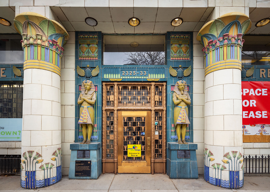
You never know what you’ll find wandering around Chicago. This time, I found an Egyptian-appearing building on North Clark Street. So, what’s the story?
In 1880, William C. Reebie founded a moving company with an assistant and a two-wheeled cart. Reebie Storage and Moving quickly went on to become a well-known and respected mover in Chicago.
Reebie designed and built Chicago’s first motorized moving van to replace his horse drawn carts. Reebie and his van, “The Moving King,” become the city’s most reliable moving company.
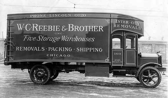
In 1922, architect George Kingsley designed a new Reebie storage warehouse located on North Clark Street. It is one of the country’s finest examples of academic-style Egyptian Revival architecture. William Reebie and his brother John are represented by the twin statues of Pharaoh Ramses II keeping guard at the entrance.
Accurate hieroglyphics and ancient Egyptian imagery add to the building’s appeal. The terra cotta ornaments were crafted by sculptor Fritz Albert.
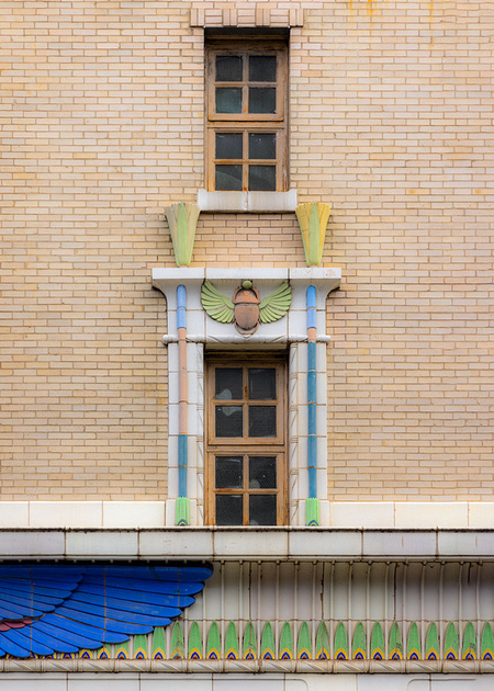
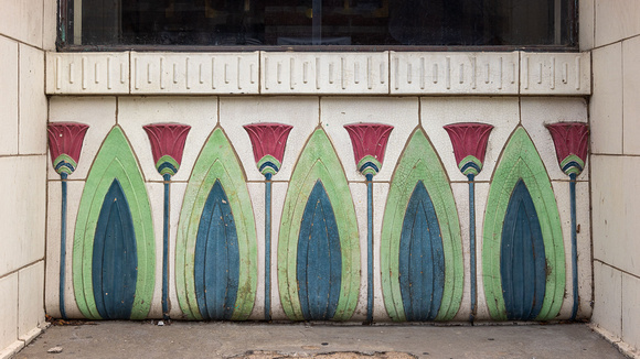
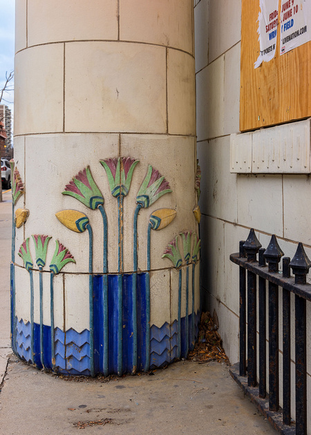
In 1928, Reebie Storage and Moving became one of the five original Allied Van Lines’ charter agents. It still ranks as Allied’s single largest consumer sales agency. And it ranks in Allied’s top 10 booking agencies for household goods revenue.
In 2001, Reebie Storage and Moving opened corporate headquarters in suburban Franklin Park. It now owns and operates four Chicagoland facilities and offers more than 400,000 square feet of storage space. And the Reebie fleet has grown to include over 100 local moving units and 30 interstate tractor-trailers.
The North Clark Street storage warehouse was named to the National Register of Historic Places on March 21, 1979. In addition, Mayor Richard M. Daley named it an official Chicago landmark in 1999.
The Shot
The Chicago Streets and Beyond (CS&B) Meetup Group recently held a photo walk with a dozen photographers on North Clark Street. Meetup is a social media platform designed to help you meet new people who share your interests through online and in-person events. CS&B is run by friend and fellow photographer Rich Kolar.
Our starting location was the Reebie Storage and Moving Company building. I didn’t find anything that interested me as much as Reebie did for the rest of the walk.
I was fascinated by the building. I hope you enjoy the architecture as well.
Happy Thanksgiving,
Chuck Derus
]]>
But how do you and your goods get there safely? In the early years following Chicago’s incorporation in 1837, it was likely by boat. And boats need lighthouses to safely navigate.
The first lighthouse in Chicago commenced operation on land near the mouth of the Chicago River in 1833. That’s Fort Dearborn in the center of the engraving.
First Chicago Lighthouse Constructed 1832
Northeasterly gales caused sand bars to form. The city constructed piers out into the harbor to control them. By 1847, the piers jutted out 3,900 feet into Lake Michigan to form a harbor. To help mariners navigate into and out of the harbor, several wooden pier lights were constructed.
A new tower was placed into service in 1859 near the mouth of the Chicago River. It was of the constructed from prefabricated cast iron pieces designed to hold up the lantern room.
The 1859 Pier Light
Growth of the city brought more and more factories. And the smoke from the factories started obscuring the tower light.
In 1893, a new lighthouse to mark the Chicago Harbor was constructed near the mouth of the Chicago River. Coincidentally, an award winning, red and white paneled third order Fresnel lens was on exhibition at the 1893 Chicago World's Fair. The Lighthouse Board kept the lens in Chicago after the Fair and installed it in the lantern room of the new lighthouse.
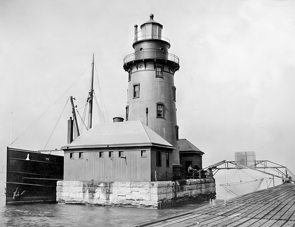
1914 View of the 1893 Lighthouse
Larger and larger ships made navigating the Chicago River increasingly difficult. This led to the development of the outer harbor. An area of Lake Michigan was enclosed with a protective break wall near the mouth of the Chicago River.
Boat Traffic Near Rush Street on the Chicago River Circa 1900
A municipal pier, known today as Navy Pier, was completed in 1916 to handle the loading and unloading of these larger ships. To finish the new outer harbor, the 1893 Chicago Lighthouse was moved to a concrete foundation at the end of the north pier to become the Chicago Harbor Lighthouse. A new attached fog signal room and boathouse were also built.
The lighthouse was listed on the National Register of Historic Places on July 19, 1984. In 2005, the light was declared excess by the Coast Guard. United States Secretary of the Interior Kenneth Salazar transferred the lighthouse to the City of Chicago on February 24, 2009.
The Shot
Fellow photographer Jon Christofersen and I drove downtown several weeks ago hoping to find a good drone shot. I flew my drone beyond the Chicago Harbor Lighthouse and turned 180 degrees to catch the setting sun glowing behind the skyline.
Thanks for looking,
Chuck Derus
]]>
What do you think it is? It’s certainly not my usual literal image of a landscape or cityscape. This image is an abstract.
According to the dictionary, one definition of abstract is “Having an intellectual and affective artistic content that depends solely on intrinsic form rather than on narrative content or pictorial representation: abstract painting and sculpture.”
Abstract images don’t create an immediate association with our physical world. They transform the world we see into an unexpected, often unrecognizable, image.
I fail more often than I succeed at capturing grand landscapes under colorful skies. There just aren’t that many moments when all the required elements come together.
On the other hand, we’re always surrounded by possible abstract images. But you need to train your eye to disregard the literal and pre-visualize the potential of intrinsic forms and shapes.
Creating abstract photographic images requires using perspective, close-ups, aerial shots, camera movement, and post-processing techniques to create interesting patterns, colors, light, and textures.
The Shot
So again, what is it?
I’ll start with a hint. It’s an aerial photograph taken from a doors-off helicopter in Alaska. Here’s a photograph of fellow photographer Chris VenHaus and me getting ready for the flight at the end of July near Petersburg, Alaska.
Yes, it’s July and we’re bundled up! It’s cold with the doors open.
Here’s hint number two. It’s low tide and we’re above the Stikine River. The skies were overcast with the normally majestic mountains obscured by low clouds.
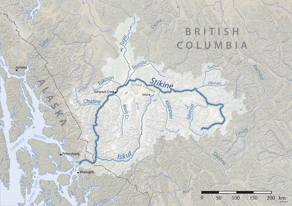
Here’s the answer. Today’s Friday Photo was taken at the western end of the Stikine River where it empties into the sea. The estuary contains interesting ribbons of water and land. With a little creative post-processing in Photoshop, I think it makes an interesting abstract.
Thanks for looking,
Chuck Derus
]]>
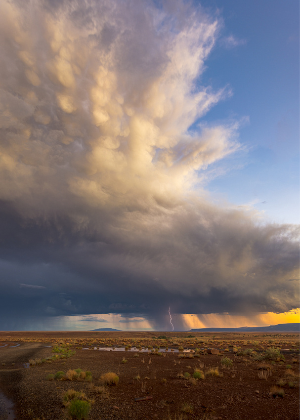
What is cloud nine? Have you ever wondered where that expression came from?
Before 1800, observers spoke of clouds as “essences” floating in the sky. Clouds had no names and were not well understood
In the early 1800s, clouds became a hot topic. Scientists and seafarers began to organize clouds into types.
Luke Howard (1773-1864) was an English pharmacist with an interest in clouds. As a hobby, he joined a group of scientists called the Askesians (searchers after knowledge). Members read their scientific papers to the other members.
Luke Howard’s turn to present came one night during the winter of 1802-03. His paper, “On the Modification of Clouds” was so well received that it was published. Today’s meaning of modification is classification.
We still use his basic scheme and the Latin names that Howard presented that night. They are cumulus, stratus, stratocumulus, nimbostratus, cumulonimbus, altostratus, altocumulus, cirrus, cirrostratus, and cirrocumulus.
0-9
The 1896 International Cloud Atlas (Hildebrandsson, Riggenbach and Teisserenc de Bort) introduced a universal language of cloud identification. In the Atlas, cumulonimbus, the greatest cloud in the world, was listed as Cloud 9. Zero represented the lowest clouds (stratus), and nine, the tallest clouds (cumulonimbus, or thunderstorm clouds).

Cumulonimbus (Cloud 9) from the 1896 International Cloud Atlas
The Shot
I always enjoy photographing storms at sunset. The low angle of the light and the warmth of the setting sun creates visual interest.
On this summer’s storm chase, we were following a small monsoon storm. When we ran out of passable road, we stopped the van and set up quickly for a few photographs of a Cloud 9 before the sun set and the light vanished.
The cloud type also mirrored our feelings as we watched this beautiful storm “spark” in the distance.
Thanks for looking,
Chuck Derus
]]>
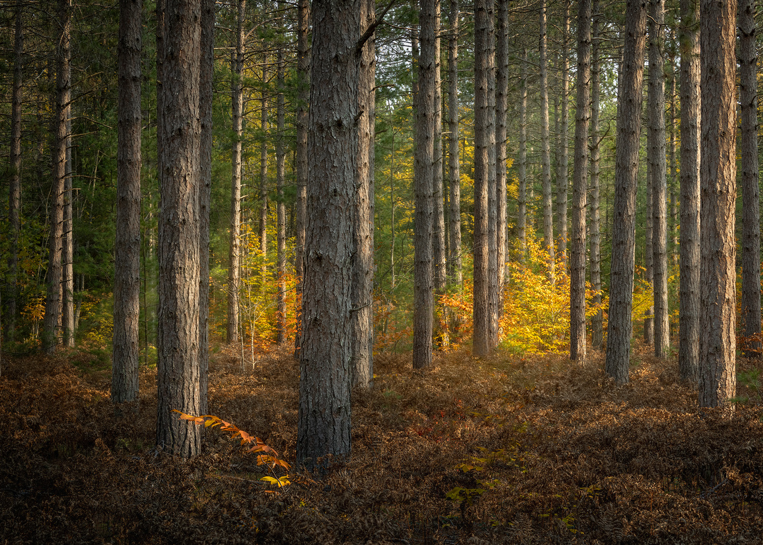
Under the trees light
has dropped from the top of the sky,
light
like a green
latticework of branches,
shining
on every leaf,
drifting down like clean
white sand.
A cicada sends
its sawing song
high into the empty air.
The world is
a glass overflowing
with water.
Pablo Neruda
The Shot
It’s fairly easy to capture the beauty of a forest in a video. The three-dimensional nature of your surroundings is readily apparent. Captivating shapes, lighting, and colors appear and disappear as you walk through the scene.
Photographing the forest is much more difficult. Without movement, you’re in a much less interesting two-dimensional world.
And the forest is filled with visual clutter. What are you supposed to look at? How do you find your way through the image?
The best advice I received regarding forest photography is to find the darkest part of the forest and to shoot into the light.
If you combine dark to light, big to small, and cool (blue tint) to warm (red tint) transitions, a forest can come alive in a photograph. But it’s difficult.
I spent over an hour wandering a random patch of woods near Munising, Michigan hoping to find that combination. This is as close as I could come.
Thanks for looking,
Chuck Derus
]]>
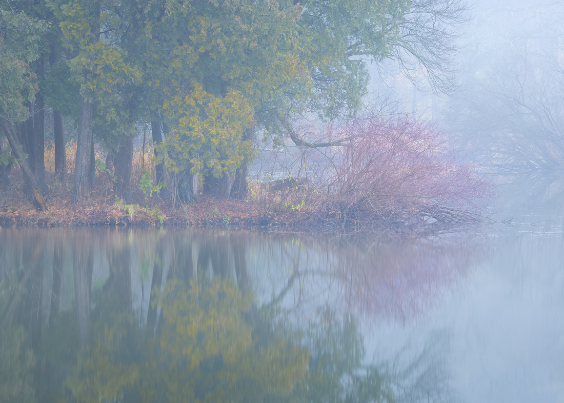
What are the best times for photography? Often, it’s the “edges of the day.”
The morning edge is the 45 minutes before and the 45 minutes after sunrise. The evening edge is the 45 minutes before and the 45 minutes after sunset.
When the sun is at a low angle, sunlight travels through a lot more atmosphere. This softens and reduces the intensity of the light. The absence of harsh shadow flatters most subjects.
And when light travels longer distances through the atmosphere, the blues are filtered out, resulting in warm, golden colors. Those inviting reds and yellows command your eyes’ attention.
Finally, the low angle of the light makes for long shadows that add depth and dimension.
When the sun is just below the horizon, it bathes the landscape with gorgeous soft, diffused blues and lavenders.
Mirrored Times?
You’d think that sunrise and sunset are mirror images of each other for photographers. But are they?
One obvious difference is that mornings start in darkness. You need a flashlight to find your way to your location.
Unless you’ve thoroughly scouted the day before, locating a promising composition in the dark is difficult. Almost always, you need to scout the day before and memorize or GPS tag your pre-dawn location.
And then there’s getting up in the morning. I’m still suffering from years of 6:30 am physician meetings. And don’t get me started on the orthopedic docs who wanted to meet at 6 am.
Setting up for sunset is easier. You’re awake and compositions are easier to locate.
But sunset shooting is often more crowded due to the added difficulties of sunrise photography.
Despite the difficulties, sunrise shooting increases the chances of enjoying the scene without crowds. And sunrise also offers the possibility of unique atmospheric conditions like fog or frost.
The Shot
Two years ago, I was with friend and fellow photographer Sherry Snyder at the Morton Arboretum. We were the first in line to enter when it opened at sunrise on a crisp, fall morning.
We hurried to the water as fog was drifting through the trees. I captured this image before the sun rose high enough to burn off the enchanting fog.
Thanks for looking,
Chuck Derus
]]>
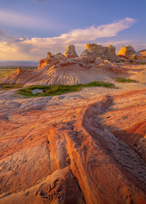
Dr. Ian Malcolm (actor Jeff Goldblum) in the 1993 science fiction film Jurassic Park.
Freshwater crabs in the desert? That’s about as likely as seeing a cactus grove at the Morton Arboretum in Lisle, Illinois.
Or is it?
The American southwest is full of surprises. In this case, the surprise was in the 280,000-acre Vermillion Cliffs National Monument.
The Monument bumps up against the Utah/Arizona border. Kaibab National Forest lies to the west and Glen Canyon National Recreation Area is to the east.
It’s remote and unspoiled, containing some of the most spectacular desert trails and views in the world. The area is hot with temperatures up to 140 degrees, and dry with only 4.7 inches of rain a year.
My favorite patch of Monument sandstone is the 100 by 800-yard psychedelic display at White Pocket. People come from all over the world to see and photograph the colorful swirls of cross-bedded sandstone.
Like most of the Monument, it’s not overrun by visitors. The sandy roads to reach it are treacherous, requiring high clearance 4WD vehicles.
Crabs in the desert?!?
After heavy rains, tiny creatures that look like small mini-horseshoe crabs with three eyes can appear in pools of water. They are a couple of inches long.
Photo by Jon Christofersen
The ancestors of these armored, tiny crustaceans evolved 419 million to 359 million years ago. They’re widely considered to be among the most ancient species on the planet.
Crabs need water, so how can they live in a desert?
Eons ago, the area was filled with lakes and waterways supporting aquatic life. Nearly all that life died off when the area transformed into a desert.
But it turns these crab eggs are incredibly tough, tolerating decades of dry, hot weather. Tim Graham, a biologist with the U.S. Geological Survey, stated: “Eggs of tadpole shrimp or fairy shrimp have been kept for 50 years in the lab, and were still viable.”
Heavy monsoon rains fill sandstone depressions with water. With enough rain, the temporary pools can last weeks before evaporating.
Young shrimp hatch in those watery potholes and “go to work.” In just a few weeks, they gorge, mature, mate, and lay another lot of eggs before their temporary homes dry up. Life finds a way.
The Shot
Jon Christofersen and I were in White Pocket in August of 2021. Our objective was night Milky Way photography, but the place is too beautiful not to shoot during sunset.
We hiked in from the parking area in the 100-plus degree temperature and scouted. I found this finger of rock that seemed to lead my eye to the formations in the distance. The green was an eye-catcher, as was the pool of water holding frolicking crabs.
Settling in to enjoy the scene, I waited until just before the sun set to take this image.
Thanks for looking,
Chuck Derus
]]>
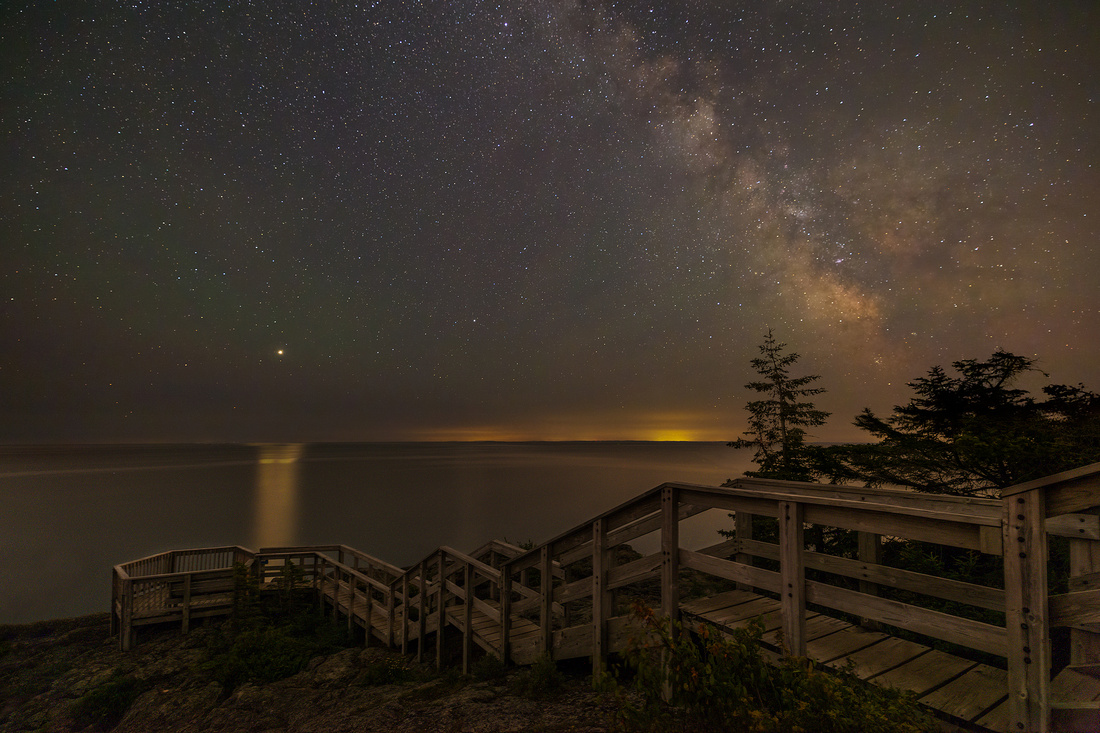
"There's a lady who's sure all that glitters is gold
And she's buying a stairway to heaven
When she gets there, she knows, if the stores are all closed
With a word she can get what she came for."

Stairway to Heaven lyric from Led Zeppelin IV
I was standing under the stars along the shore of Lake Superior near Grand Marais, Minnesota.
It was a perfect summer night in a park along the lake. And no mosquitos!
The stairs seemed to beckon me towards the heavens. Seeing them, Stairway to Heaven started playing in my head. It’s a song with three distinct sections.
The slow tempo of the song’s first section featuring acoustic guitar and recorder matched the quiet wonder I felt initially.
As my eyes adjusted to the dark, photographic possibilities quickened my pulse. And the song’s second section with electronic instruments seemed to fit my new mood perfectly.
After taking and reviewing several images, the third section started playing in my head. My excitement echoed the final section’s up-tempo hard rock arrangement and Jimmy Page's epic guitar solo.
I walked away from my camera to just be there in the moment. Robert Plant's plaintive a cappella ending line, "And she's buying a stairway to heaven," started playing in my head. I had the chills.
You can hear Jimmy Page describe how Stairway to Heaven was created in this BBC interview at https://youtu.be/DDo4CA13LbY. It’s well worth experiencing.
The Shot
This image was taken in July of 2021. A single camera image couldn’t possibly capture what I could easily see with my eyes. Three images, without moving my tripod, were needed for this scene.
The first shot is a 15mm single 20 second exposure of the night sky at ISO 6400 and f2.8. While that photograph worked nicely for the stars and Milky Way, the foreground was mostly black.
The only light illuminating the foreground was from the stars and the Milky Way! It required six-minutes at ISO 6400 and f4 to capture enough light on the foreground. I took two shots to reduce the noise (grainy appearance) during post processing.
The two foreground shots were blended and darkened to match what I remembered seeing. The sky was replaced with the single night sky exposure.
The resulting image is above. It’s very close to what I remember from that special night.
Thanks for looking,
Chuck Derus
]]>
“In nature, nothing is perfect. Trees can be contorted, bent in weird ways and they're still beautiful.”
Alice Walker
It was a frantic pre-dawn race. We were darting from location to location desperately seeking a suitable spot to capture sunrise illuminating the Sierra Nevada mountains in the Owens Valley in California.
There was no way to predict where the light would be favorable. The clouds were dissipating, sometimes just before drifting into the scene. Then the clouds would reform elsewhere leading us to yet another location.
And to make it more maddening, the sun on the Sierra Nevada mountains was being intermittently blocked by yet other fickle clouds.
At one of our hurried stops, the light on the mountains finally appeared. But finding a foreground was now the issue. This pair of trees framed the distant peak nicely.
Their contorted shapes didn’t initially appeal to me. They seemed so imperfect that I only took two images before running back in the car and racing to yet another area.
But friends Jon Christofersen, Mike Loebach, and I never found a better view. My only photograph with potential from that morning included those trees.
Alice Walker
Alice Walker is an American novelist, short story writer, poet, and social activist. Walker has published seventeen novels and short story collections, twelve non-fiction works, and collections of essays and poetry.
She is perhaps best known for her novel The Color Purple. The book led to her 1982 Pulitzer Prize for Fiction, the first for an African American woman.
While reviewing my two images from the morning, I began to understand and appreciate Walker’s view of nature. These trees did seem to possess a certain beauty in their imperfection.
The Shot
Once I reframed my thinking about the trees, the processing was relatively simple. But there were only a few small clouds in the original capture.
This is my first and only sky replacement using Photoshop. Normally, I only use the sky that nature provides. This is an exception, and I’m not sure if I’ll ever replace a sky again.
Thanks for looking,
Chuck Derus
]]>
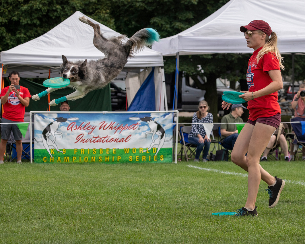
Who were the best athletes on the field in Chicagoland over the Labor Day weekend? My vote goes to the dogs.
Yes, the dogs. Specifically, the dogs at the Ashley Whippet Invitational K-9 Frisbee™ World Championship Series in Naperville, Illinois.
I wrote about Frisbees™ and the canine world championships last year on my blog at
https://cderus.zenfolio.com/blog/2021/9/disc-dog. You might want to revisit the blog to refresh your memory about the event.
I Need Your Help
One or more of these photos may wind up in a local photo contest. And a catchy title just might help my chances. So, please put on those thinking caps and help me out with suggested captions!
The Shots
New cameras are technological marvels. My Canon R5 tracks and focuses on animal eyes even as they run and jump around a large field. I picked these three as my favorites out of the hundreds of photographs I took that morning.
Photo #1 (the attached lead photo) called out to me because of the look on the dog’s face. And the color-coordinated turquoise Frisbee™, front leg wraps, and dyed tail brought a smile to my face. Finally, I could only imagine what was going through the dog’s head as it spun through the air.

Shot #2 caught my attention because of the body symmetry between dog and owner. If only the owner had a Frisbee™ in his mouth. That’s a lot of body English!
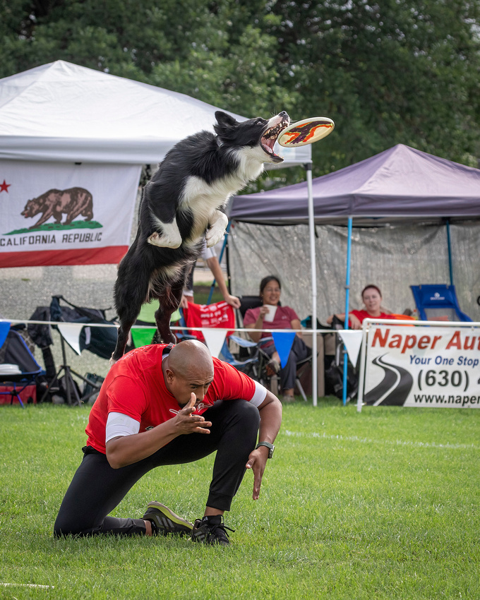
Shot #3 intrigued me with the ferocious concentration in the dog’s eyes along with the jaws ready to snap shut.
If you have a moment, please send me a suggested caption for any or all of the three pictures.
Thanks for looking (and captioning),
Chuck Derus
]]>
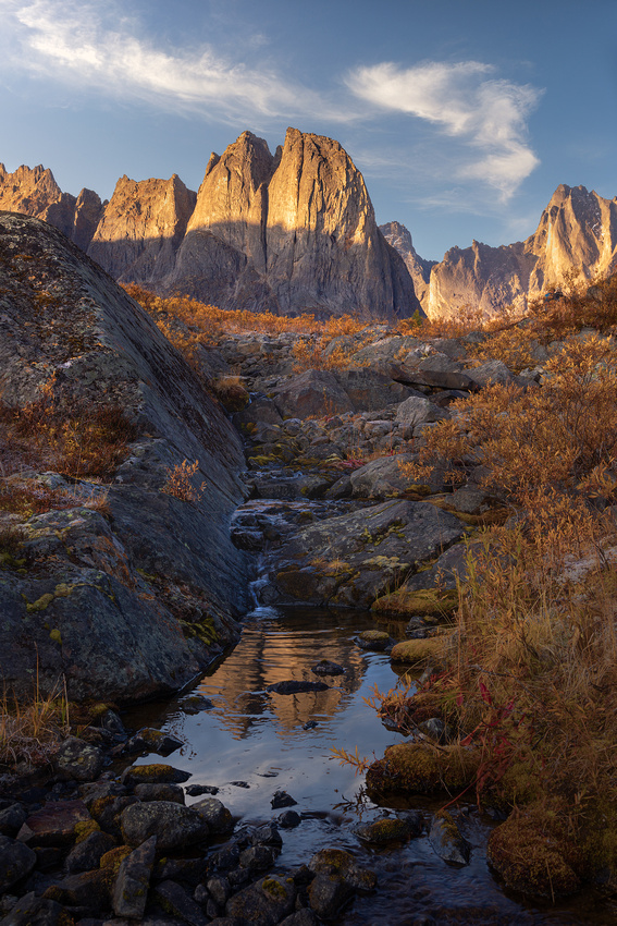
Selecting “keepers” is a quick process. Identifying the few images with potential usually occurs within days of taking them.
But when I have time, I like to browse through old images looking for new discoveries. Sometimes I find an overlooked keeper.
I recently looked back at my 2019 Yukon trip. You may recall that photographing the Aurora Borealis was my main reason for going to Tombstone Territorial Park, a protected wilderness area in Canada’s Yukon Territory.
The Tombstone Range is a small, remote, spiky mountain range that makes for dramatic backgrounds. And the treeless, windswept arctic tundra usually has clear skies.
Clear skies were paramount. After 29 consecutive cloudy nights (5 in Alaska and 22 in Iceland), I desperately wanted to see and photograph the Aurora Borealis.
Remote
Tombstone Territorial Park is located on mile 45 of the Dempster Highway, a rugged and neglected gravel road. It took less than an hour to realize the wisdom of purchasing windshield insurance for the rental car.
The traditional way into the park is hiking the one-way, seven mile long Grizzly Lake Trail. While seven miles sounds doable, the trail is more climbing than hiking. The elevation gain is nearly one mile. It’s like climbing the Willis Tower four times in four miles while carrying a 50-pound backpack.
Our photo group opted to be helicoptered into the park close to our first primitive campsite. 
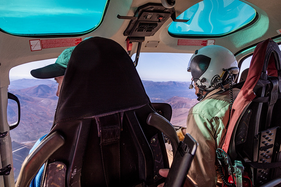
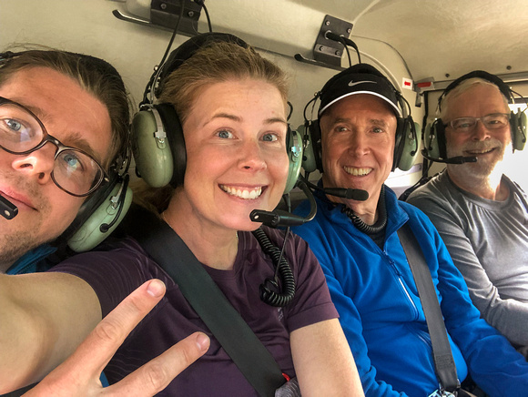
Looking clean and happy going IN before a week without a shower.
For the rest of the trip, we hiked about 13 miles with several thousand feet of elevation gain before returning to the extraction site. Our 50-pound backpacks seemed to get heavier with every step.
You couldn’t have asked for a more immersive wilderness experience. The campsites were truly primitive.
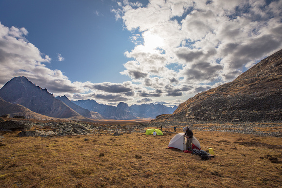

The #$%&@ 85-liter, 50-pound backpack that only seemed to get heavier with time!
The Shot
My initial image review in 2019 identified mainly Aurora Borealis and grand landscape shots. It was the quiet beauty of the Tombstones reflecting in a pool that caught my attention this time around.
Thanks for looking,
Chuck Derus
]]>

"…oh my God! -- it's full of stars."
The 1968 Stanley Kubrick film 2001: A Space Odyssey contains numerous memorable lines. “Open the pod bay doors, Hal” is usually the first that comes to mind.
But my favorite line is by astronaut David Bowman. Just before traveling through the star gate created by the monolith orbiting Jupiter and vanishing, he tells Mission Control: "The thing's hollow -- it goes on forever -- and -- oh my God! -- it's full of stars!"

Astronaut David Bowman before vanishing into the monolith in 2001: A Space Odyssey
Or your typical first timer witnessing a truly dark sky.
Chicago Skies
In Chicago’s night sky, you can only see a paltry 35 stars. Just 35. In a non-light polluted night sky, approximately 4,500 stars are visible. It’s no wonder that folks who venture out of the city and experience a true night sky for the first time are often overheard saying “My God, it’s full of stars.”
If you’ve never experienced the breathtaking beauty of a truly dark sky, head to https://www.darkskymap.com/nightSkyBrightness. The map will lay out our country’s remaining dark sky areas. If you’ve never experienced a sky with thousands of stars and the Milky Way, you’re missing out on one of the greatest sights in the world.
The Shot
I have a “thing” for landscape astrophotography. It’s a combination of a night sky and a landscape. Bringing heaven and earth together is another way to describe landscape astrophotography.
Last year I was fortunate to enjoy several evenings of clear dark skies near Grand Marais, Minnesota. It’s quite dark outside of town with a multitude of water features to tie the land to the sky.
The waters of Crescent Lake were calm, and the brighter stars were reflecting beautifully in the lake. Both the lake and the sky seemed “full of stars.”
The green glow in the background wasn’t the Aurora Borealis, it was airglow.
About 60 miles above the earth, air molecules and atoms release energy absorbed from incoming solar radiation. This results in a faint green and sometimes red luminescence of Earth’s upper atmosphere. It’s so faint that only a camera exposing for many seconds can capture the glow.
Even after many beautiful nights under dark skies, I still felt goosebumps as I stared at a sky filled with stars.
Thanks for looking,
Chuck Derus
]]>
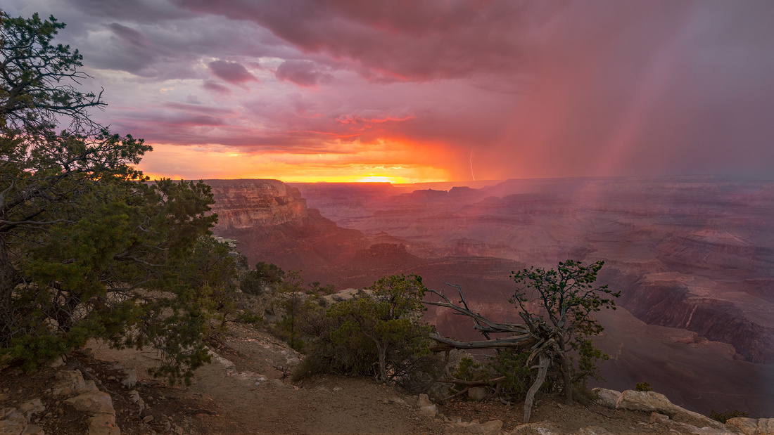
Elisabeth Kubler-Ross
You need to adapt. An unexpected, challenging situation may result in something beautiful, despite your difficulties in appreciating it at the time.
Such was the case with this year’s tornado chase. A severely clear, cold air mass blanketed the Great Plains, eliminating any chance of supercells and tornadoes.
Heading north from Denver to the Dakotas for non-existent tornadoes was not an option.
But our disappointment created the possibility to photograph other types of weather. In my years of visiting the Southwest, I’ve never been able to photograph the beauty of rain and lightning over the Grand Canyon.
So, our tour group headed south to Arizona, reframing our attitude from one of disappointment to the possibilities of photography in the Southwest.
Southwest Monsoon Storms
The Southwest Monsoon is a pattern of thunderstorm and rainfall over large areas of the southwestern United States and northwestern Mexico. The monsoon typically occurs between June and mid-September.
A cycle starting with daytime heating builds thunderstorms during the late afternoon and early evening. Typically, monsoon storms dissipate by late night with the cycle beginning anew the next morning.
But monsoon storms are spotty and can dissipate rapidly. You need to be in the right place at the right time. And the Grand Canyon is deceptively large, meaning you need to choose your shot location carefully.
The Shot
Photographing lightning is easy. Photographing lightning with an interesting foreground is quite a bit more challenging. So, when the forecast on June 29 called for the possibility of monsoon storms over the Grand Canyon, our group of storm chasers (formerly tornado chasers) was overjoyed.
We arrived in time to witness several storms during the afternoon featuring lightning and a rare hailstorm. A quick check of my camera LCD screen indicated that I had captured several lightning bolts over the canyon.
About an hour before sunset, it looked like the show was over. We started our long drive out of the park when the weather radar and a look out the window told us to head back to the Grand Canyon Village viewpoint.
What a fortuitous decision.
At sunset, the sky lit up with beautiful yellow storm light. The waning thunderstorm cell had one last lightning bolt left in it. Luckily, we all took the time to put down our cameras to just bask in the “beauty of their carvings.”
Thanks for looking,
Chuck Derus
]]>
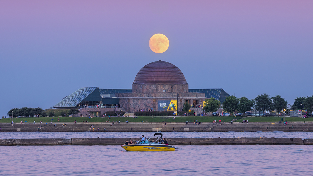
Escape to the Stars
These are heady times for astronomy and astrophysics.
The new James Webb telescope is rewriting galactic history by photographing a 13.5-billion-year-old galaxy. And it imaged a single star over 28 billion light-years away!
So, when I set about planning an August full moon picture, I wanted to include Chicago’s contribution to astronomy and astrophysics, the Adler Planetarium.
The Belt of Venus
The best time to photograph a rising full moon is the day before the full moon. The day before offers a pleasing balance between fading twilight and the light of a full moon. You can see and photograph the foreground and the moon isn’t a pure white orb.
And the other benefit of photographing the day before is including the Belt of Venus.
You may have noticed that the eastern horizon after sunset is awash with a band of pastel pinks and blues. On a clear evening, the horizon can look like a watercolor painting.
This delightful, subtle atmospheric phenomenon is the Belt of Venus.
The name has nothing to do with the planet Venus. Instead, it associated with the girdle or belt worn by the Greek goddess Aphrodite, the Roman counterpart of Venus.
The pink band is caused by the same scattering of light that warms the light of the setting sun. And the blue band is the shadow of the earth.
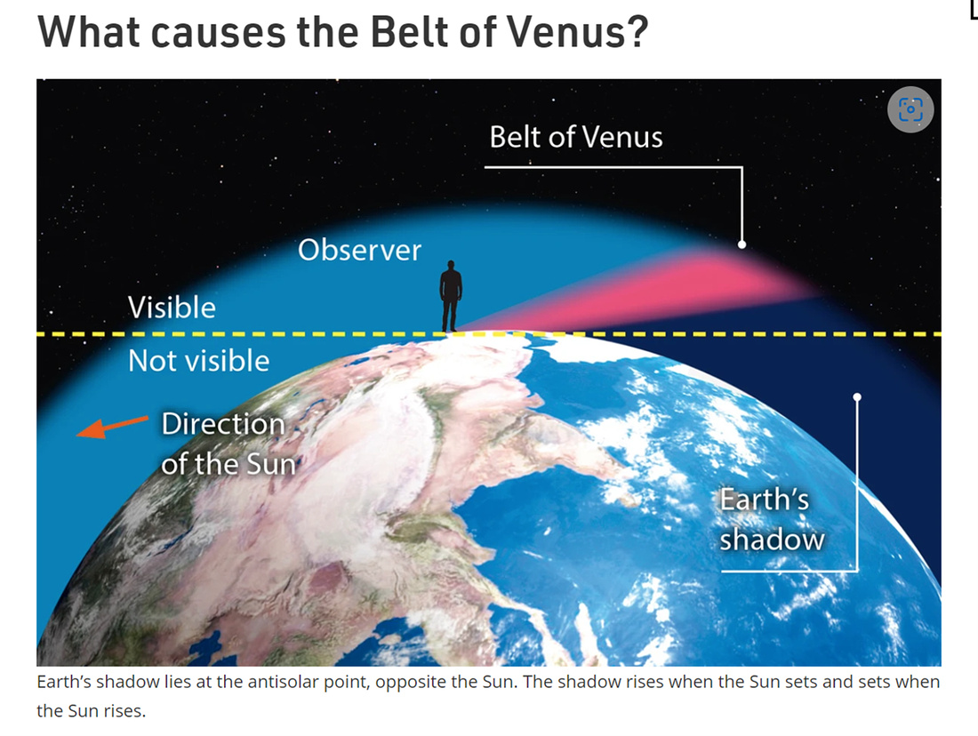
From the BBC Sky at Night Magazine
Sometimes the Belt can be quite striking, as this shot at twilight over Canyonlands National Park in Utah demonstrates.
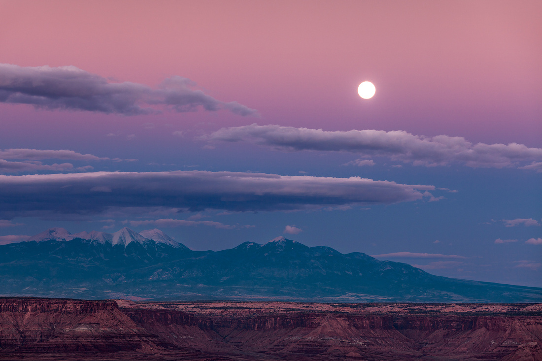 The Shot
Fortunately, a position on the Chicago lakefront south of Balbo Drive afforded the opportunity to image the rising moon over the Adler Planetarium. A 200mm telephoto lens framed the scene well.
Friend and fellow photographer Jon Christofersen and I were fortunate to catch the show. Five years ago, when I first attempted this shot, there were only a few photographers around. This time there must have been 50!
After photographing and appreciating the sight, we moved north to photograph the fireworks with our drones.
Thanks for looking and let me know if you spot “Aphrodite’s girdle”,
Chuck Derus
]]>
Sometimes I forget that I’m living near one of the greatest cities in the country. Chicago offers endless possibilities for the photographically curious.
Starting on Memorial Day, Navy Pier presents fireworks displays at 9 p.m. every Wednesday and 10 p.m. every Saturday, through Labor Day. The shows are synchronized to dramatic and popular music. It’s a delight for tourists and natives alike.
And in case you want to make it an extra special evening, consider renting a boat to get you closer to the action. Options range from a $65 kayak rental to a 68-foot private yacht that requires you to contact their event coordinator to obtain a price.
Please let me know if you need a seat filled if you rent the yacht!
The Shot
I hadn’t photographed the 4th of July or any other fireworks this year. So, I took a trip to the Pier this week with friend and fellow photographer Jon Christofersen to catch the show.
We started out by shooting the moonrise over the Adler Planetarium. But the real reason we went downtown was to photograph the fireworks with our drones.
We launched near Jackson and the Lakefront on a perfect summer evening. I chose this angle and shot dozens of pictures. Out of 50 shots, this was my favorite of the evening.
Thanks for looking,
Chuck Derus
]]>
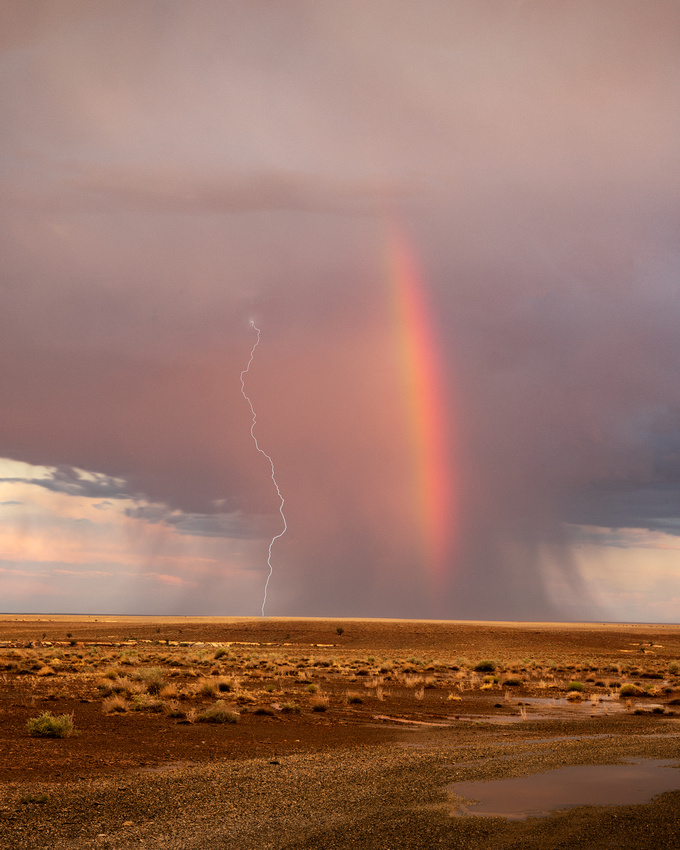
I was supposed to be chasing tornadoes in the upper Great Plains the last week of June.
My son-in-law, Blake Weis, joined me on the chase. For years he had yearned to chase tornadoes, but a wedding, a new job, and a baby took priority. After enduring a long wait, this was finally the summer to realize his dream.
But a cold front parked over the Plains eliminated any chance of severe weather for almost two weeks. No tornadoes in sight!
Enjoying landscape photography (and travel) means abandoning your expectations, looking for other opportunities, and enjoying just being there. So, our tour group headed to New Mexico and Arizona to photograph monsoon storms in some of the most scenic areas of the Southwest.
Making the Best of It
Blake and I were able to visit some beautiful locations including Canyon Du Chelly and the Grand Canyon. Please note his allegiance to the St. Louis Cardinals in all four pictures!
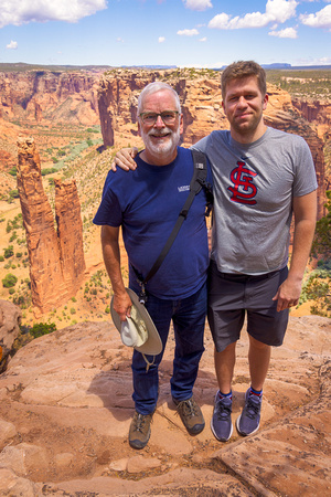
Spider Rock, Canyon Du Chelly
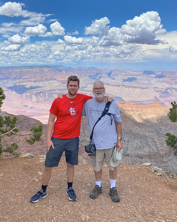
Grand Canyon
And we were able to see some famous locations (Blake’s Lottaburger from TV’s Breaking Bad and that famous corner in Winslow, Arizona).
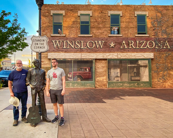
The Shot
Sometimes you find a photogenic subject when you least expect it. After a somewhat disappointing day for storms, we noticed a rainbow on our way to Shiprock, New Mexico.
I had hoped for a better foreground, but there just wasn’t one and the rainbow was quickly fading. I set up my camera with a lightning trigger attached and crossed my fingers.
Thanks for looking,
Chuck Derus
]]>
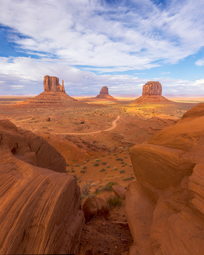
I was supposed to be chasing tornados in the upper Great Plains last week. But landscape photography doesn’t always go according to plan.
When I woke up in Denver on June 26th, it was only 47 degrees! A cold front was parked over the Plains that would eliminate any chance of severe weather for almost two weeks. So, what to do?
Luckily, warm, moist air from the southeast was flowing into Arizona and New Mexico. That meant short-lived, isolated monsoon storms were possible. And they might form over some of the more scenic areas in the region, including the Grand Canyon.
We piled into our van and headed 500 miles south to Monument Valley. The weather models looked promising for storms at one of the most photogenic sites on the planet.
Monument Valley
Why is it photogenic? Monument Valley (Tsé Biiʼ Ndzisgaii, meaning valley of the rocks) is on the Navajo reservation on the Utah/Nevada border. The location was burned into several generations of moviegoers beginning with Director John Ford’s 1939 masterpiece, Stagecoach.
Stagecoach brought together 47-year-old Ford and a 32-year-old B-movie actor by the name of John Wayne in his first lead role. Stagecoach was the beginning of a collaboration that would pair each other’s talents for two decades.
Stagecoach may seem formulaic to today’s moviegoers. But it was the first “Ark Movie” where a mixed bag of characters are thrown together by chance and forced to survive an ordeal. The movie is so well made that Orson Welles watched Stagecoach 40 times before he made Citizen Kane.
Top billing went to Claire Trevor, as Dallas, a lady of pleasure. John Wayne, the other lead, plays The Ringo Kid, a wanted murderer being taken to prison by a U.S. Marshall (George Bancroft).
Andy Devine is the driver, John Carradine is the elegant gambler, Thomas Mitchell is the alcoholic Doc Boone, Louise Platt is the pregnant soldier's wife, and Donald Meek is the effeminate traveling salesman.
Confined inside the stagecoach for most of the film, these gifted actors create a fascinating community. Gradually, their hidden reasons for traveling in great discomfort through hazardous Indian territory become clear.
The backdrop to the story is the impressive scenery of Monument Valley. Ford filmed much of the movie on location. It became a favorite of his and he returned again and again to film there.
The film’s attitude towards Native Americans is unenlightened. Only in Ford’s final 1964 film, Cheyenne Autumn, did he come around to a more humane point of view.
The Shot
Despite a great forecast by our tour leader, a storm never quite formed over Monument Valley. I had to be content lining up the major features (East Mitten Butte, West Mitten Butte, and Merrick’s Butte) under a partly cloudy sky and create a memory.
Perhaps I’ll make it back there some day for that photogenic storm over the Valley.
I’ll be back out in the field over the next two weeks, so no Friday Photo until July 29th.
Thanks for looking,
Chuck Derus
]]>
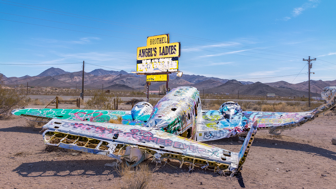
Why is there a plane wreck at the entrance to a Nevada brothel?
According to the Atlas Obscura, “In Beatty, Nevada there is only so much to do to keep yourself entertained…one of those things is enjoying the company of a lady of the evening for an hour or two.” Brothels have been legal in 10 of Nevada’s 16 counties since the middle of the 20th century.
You can’t miss the entrance to the former Angel’s Ladies brothel in Beatty. It’s the only one in the state with a plane wreck on the property.
Crash and Burn
Back in 1978, when it was Fran’s Star Ranch, the owners thought it would be a good idea to run a promotion to generate business. They settled on an interesting challenge with a very naughty prize.
If you could parachute (airplane provided) and land on a mattress sitting atop a large painted star on the property, you could spend one full evening with a lady of your choice, on the house!
As you might expect, things went horribly wrong. Scantily clad women combined with an inexperienced, distracted pilot dealing with heavy cross winds sent the plane crashing onto the property. Luckily no one was injured in the accident. The plane wreck stayed as a roadside spectacle to attract visitors.
New Owners
In 1997, Mack Moore, a former funeral home director, was looking for a ranch. He wasn’t looking for a brothel, but Fran’s Star Ranch had a 77-acre garden and mountain spring fed pool that he couldn’t resist.
He bought the ranch and the business. Interestingly, he renamed it Angel’s Ladies after his wife of 25 years, Angel Moore. At age 84 in 2014, he let the license lapse and closed the brothel.
The Shot
On our recent March photo trip, we found ourselves staying in Beatty rather than Death Valley National Park. Terrible rooms in Death Valley were running over $300 a night. Beatty was 60 miles away, but the room costs were substantially cheaper.
It was the middle of the day in Beatty, and we had three hours before we could check into our hotel rooms. Fellow married photographer Mike Loebach and I discussed and agreed that visiting a closed brothel was probably safe.
So, we piled into the car along with Jon Christofersen for the short ride to the entrance. The ranch is private property, but you can get out and walk around the plane and sign without trespassing.
After about an hour in the baking sun, we had our shots and gladly returned to check into our air-conditioned hotel to rehydrate and rest.
I’ll be storm chasing next week, so no Friday Photo until July 8th.
Thanks for looking,
Chuck Derus
]]>
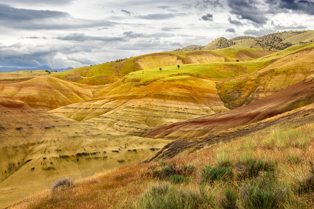 Vacation Photography
We hit the Oregon Trail last weekend. My wife Christine and I went to Sisters, Oregon for our nephew’s wedding. Since it was a long journey to get there, we decided to stay a few extra days and see some of the sights.
While on vacation, photography is not my priority. Many of you have asked “Does your wife go with you on your photography trips?” and the answer is “No.” Getting to Smith Rock, an iconic photo location, from our hotel in Bend would have meant getting up at 3:45 AM for a dawn shoot.
There are limits to spousal tolerance!
Instead, we marveled at Smith Rock like typical tourists in the middle of the day and had another tourist take a selfie.
John Day Fossil Beds
After Smith Rock, we headed to the Painted Hills portion of the John Day Fossil Beds. This section was called “The evil ice cream cone” by an Oregon native that we met at the wedding.
The area is a badlands featuring a “layer cake” of beautiful red, tan, orange, and black stripes.
Where did those stripes come from? From 44 million to 7 million years ago, volcanos deposited lava, ash, and dust accompanied by debris flows. The different layers had a variety of colors, resulting in the stripes. And the debris flows entombed plants and animals caught in their paths. Their fossilized remains are still there.
The Shot
The best time to shoot the Painted Hills is in the late afternoon when the sun paints the hills in warm colors. But I was determined to make the most of this opportunity during our mid-afternoon visit.
There were compositions everywhere, but the layers and overcast sky in this view caught my eye.
After that, we packed up and headed back to our hotel in Bend for a delicious dinner.
Thanks for looking,
Chuck Derus
]]>
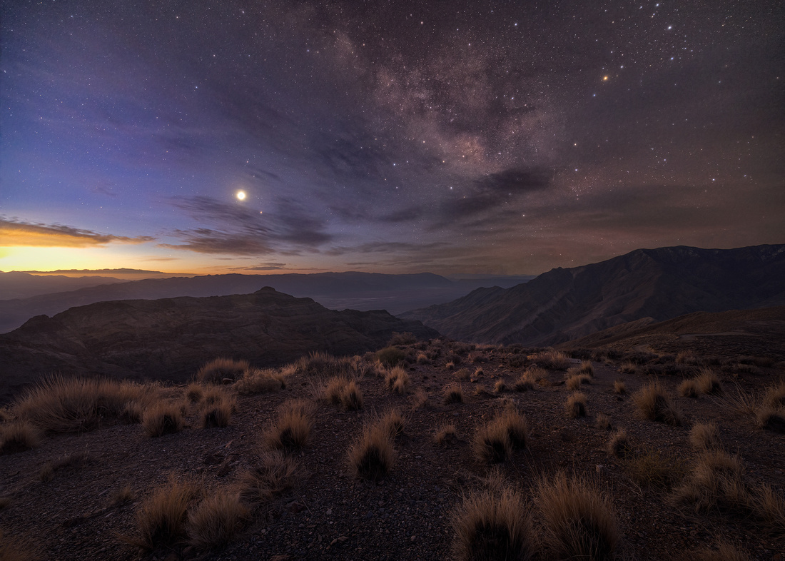
The Man Who Changed the Universe
The Hubble space telescope has brought us mesmerizing images of our universe. The most famous and awe-inspiring image is called Pillars of Creation.
Credits: NASA, ESA, and the Hubble Heritage Team (STScI/AURA)
These five light-year long towering tendrils of cosmic dust and gas sit at the heart of the Eagle Nebula. They are part of an active star-forming region within the nebula and hide newborn stars in their wispy columns.
So, why is the telescope named Hubble?
Less than a century ago, many scientists believed there was just one galaxy, the Milky Way. All that changed on December 30th, 1924, when American astronomer Edwin Hubble announced he had evidence that the Milky Way galaxy was just one of many galaxies in an ever-expanding universe.
Today we estimate that there are over two trillion galaxies in the observable universe.
NASA felt that naming their Large Space Telescope project for Hubble was a fitting tribute to a man who forever changed our universe.
The Shot
This photograph was taken March 14th in Death Valley, California. I’ve described Aguereberry Point and the horrible “road” to get there in two previous Friday Photos. At an elevation of 6,433 feet, it is the best location to view sunrise in the park.
That is, if you don’t mind violating nearly every rule of your rental car agreement.
Jon Christofersen, Mike Loebach, and I arrived in the dark around 5 AM. We photographed the sky as the Milky Way was just beginning to fade in the pre-dawn light. Venus (between the left edge and the Milky Way) was so bright it looked like the moon to the camera. Mars was just below and to the right.
The sun to our east (and light pollution from Las Vegas 150 miles away) was starting to light up the eastern sky and a few clouds. We moved slightly to our right for a better foreground and waited for enough light to take a quality foreground image.
Between photographs, I was spellbound trying to wrap my head around the universe that Hubble described with over two trillion galaxies besides our own Milky Way.
Later, in Photoshop, I combined the sky from the first image and the foreground in the second image. It looked just like what I saw and celebrated that beautiful morning overlooking the majesty of Death Valley.
Thanks for looking,
Chuck Derus
]]>
My grandparents on my mom’s side of the family emigrated from Poland to Minneapolis, Minnesota for a better life. I have many fond memories of Polish food, Polish relative gatherings, and events at the Polish White Eagle club while growing up.

My mom (left side) circa 1928 with four of her five siblings
The only downside was trying to remember how to spell my mom’s last name (Majkrzak) on all those forms that asked for “Mother’s Maiden Name.” And by the way, you’ll never pronounce it correctly without help, unless YOU’RE Polish, too!
Little did I know that when I moved to Chicago in 1978, it had the second largest population of Poles after Warsaw!
Solidarity Drive
Chicago’s Solidarity Drive pays homage to Poland’s Lech Walesa, whose Solidarity movement freed Poland from Communist rule in 1989.
Solidarity Drive connects Lake Shore Drive to the Adler Planetarium. As you walk along the north side of Solidarity Drive, the views of the city skyline to the north and to the west are simply spectacular. There’s a stepped walkway around the planetarium that allows you to dip your toes in Lake Michigan.
There’s also a statue of Thaddeus Kosciuszko, Polish hero of the American Revolution on the Drive. After arriving in America in 1776, Kosciuszko joined the Continental Army. A skilled engineer, he made significant contributions to the war by designing fortifications for several strategic locations including Philadelphia, West Point, and Saratoga. Kosciuszko later returned to Poland to lead his native military in a 1794 uprising.
The Shot
My hard-earned rule is to practice, practice, and practice some more before using a new piece of photo gear. Well, I violated my rule by not reviewing the camera settings for my new drone before heading downtown recently.
Accompanied by friends Jon Christofersen and Scott Fuller, we arrived about an hour before sunset to scout out locations near the Adler Planetarium. Jon and I were flying drones, and a composition looking down Solidarity Drive towards the city looked promising. And I liked the Polish connection.
The sky really cooperated, and I thought I had taken several nice photographs.
In reality, I mistakenly captured just two seconds of video footage.
This is a single low resolution video frame from that footage. While I can’t enlarge it and make a big print, it is large enough for social media and small screens.
Thanks for looking,
Chuck Derus
]]>
I recently returned from several days exploring California’s Owens Valley.

This week, I’m talking about the Bishop, California area. Bishop is the largest town in the Valley.
In 1861, Samuel Addison Bishop arrived with his wife, several hired hands, a herd of 600 cattle, and 50 horses to settle in the Owens Valley. He established the San Francis Ranch, alongside a creek that still bears his name today (Bishop Creek).
Within a year, a few miles east of the ranch, the frontier settlement of Bishop Creek became a town and is today the City of Bishop.
It’s an area well worth visiting. The Bishop Visitor’s Center describes it as follows:
“Sweeping views. Big mountains. Fresh air. Sunshine. Burbling streams. Blossoming woodlands. Trails that weave through alpine forests and around sparkling blue lakes. Rivers and streams that create verdant paths down rocky canyons and across high-desert plains. Boulders that can be climbed. Waters that can be fished. A canopy of stars that shines at night, brighter than at almost any other accessible place on earth. Home to the planet’s oldest living things.”
It lives up to the hype as “Halfway between heaven and, well … heaven!”
If you go, stay at the Creekside Inn. Bishop Creek runs through the beautiful property. And it features dozens and dozens of photographs taken by the late Galen Rowell, often featuring the area around Bishop.
Former longtime news anchor Tom Brokaw described Galen as “creating photographs as timeless, as stunning, and as powerful as nature itself.”
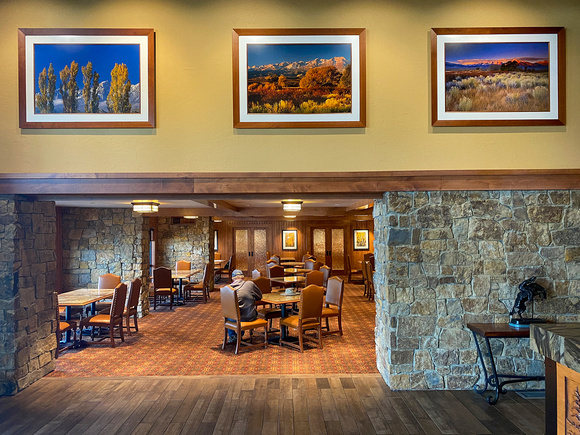
Creekside Inn entry to the breakfast area with three Rowell photographs
The Buttermilk Hills
The Buttermilk Hills, just outside of Bishop, are a well-known bouldering destination. You’ll see groups of climbers in all seasons working their way up the rock formations.
The area is known for large "highball" boulders. They don’t match the rest of the rock found in the area because they were carried by glaciers from far away.
The Shot
Fellow photographers Jon Christofersen, Mike Loebach, and I were in Mike’s car headed for the Buttermilks. At first, it was a pleasant ride on the dirt road with groups of climbers on the rocks.
We pulled off on a very sketchy side road to reach our destination. It was so steep and bumpy that we were unable to make it to the top. Spinning tires and the sound of a bottoming out suspension almost made us give up.
Fortunately, a fellow photographer who could care less about Mike’s vehicle, hopped into the driver’s seat and tore up the hill, making it to the top. From there it was a 15-minute scramble to a solitary picturesque tree.
We waited until the sun was ready to set behind the mountain and took several shots. To get the correct framing, we were standing on top of a small boulder with our cameras as high as we could hold them over our heads.
Thanks for looking,
Chuck Derus
]]>
I enjoy photography much more when I’m out with friends. And last Friday was no exception. Friend and fellow photographer Sherry Snyder and I went to the Morton Arboretum in Lisle, Illinois.
The weather that morning didn’t look promising. That’s because April turned out to be tied for second gloomiest in Chicago history. Rain and overcast skies dominated the weather pattern.
We both struggled to find a way to capture spring at the Arboretum. Towards the end of our walk, we came across a field of daffodils. We felt incredibly lucky. Daffodils at their peak can be fleeting.
The Shot
Sherry set out to find an interesting black and white image using the clumps and lines of flowers. I focused on the striking yellow colors.
After about 45 minutes in the daffodils, we headed back to the car and home. It had been a wonderful time enjoying the gifts of nature at the Arb.
This photo seemed to best capture the fleeting nature of spring that I experienced that morning.
Thanks for looking,
Chuck Derus
]]>
I recently returned from several days exploring California’s Owens Valley.

This week, I’m talking about the Lone Pine area.
How Many Westerns?
If the lead photo looks vaguely familiar, it should! Just west of the town of Lone Pine are the Alabama Hills. It was named after the Confederate ship, CSS Alabama, by prospectors who were sympathetic to the Confederate cause.
The Alabama Hills were the perfect silver screen backdrop for over 400 westerns made between 1919 and the 1960s.
The first known westerns filmed in the Alabama Hills are Water, Water Everywhere and Cupid, the Cowpuncher. Both were shot in 1919 and released in early 1920. Sadly, these films are lost. The oldest surviving film is The Round-Up (1920), starring Roscoe "Fatty" Arbuckle.
Other famous westerns filmed there include The Walking Hills, Yellow Sky, Springfield Rifle, The Violent Men, Bad Day at Black Rock, the Budd Boetticher/Randolph Scott "Ranown" cycle, How the West Was Won, Joe Kidd, and Django Unchained.
Nearly every major western actor of the 1930s, '40s, and '50s rode their horses in the hills. They include John Wayne, Gregory Peck, Gary Cooper, Gene Autry, Tom Mix, Randolph Scott, Robert Mitchum, William Boyd, Audie Murphy, and Roy Rogers.
Between 1949 and the late ’60s, more than 100 western television shows were on the airwaves. Many of them were shot in the hills. The Gene Autry Show, The Lone Ranger, Bonanza, and Annie Oakley are among those shot in the hills.
Once cowboy fever passed, other movies started to be filmed in the area. Blockbusters filmed here include Gladiator, Man of Steel, Iron Man, Tremors, Star Trek Generations, Disney’s Dinosaur, G.I. Joe, and Transformers: Revenge of the Fallen.
The Museum
If you’re in Lone Pine, be sure and visit the Beverly and Jim Rogers Museum of Film History located in town. The museum celebrates and preserves the diverse movie history of Lone Pine, Death Valley, and the Eastern Sierra.
Exhibits at the museum reflect the museum’s extensive collections and include early silent films, post-war films, science fiction and the many cowboy heroes who worked locally.
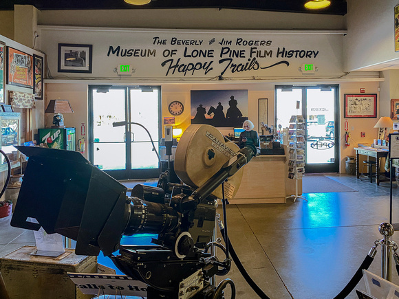
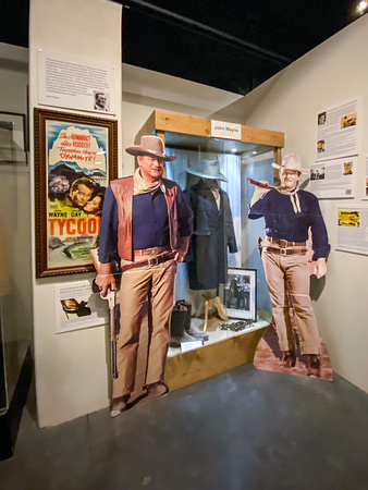
The Shot
This photograph is from my first trip to the Alabama Hills in 2009. It’s dawn and the low angle light of sunrise is painting the Sierra Nevada Mountains and Mount Whitney in brilliant orange alpenglow.
Thanks for looking,
Chuck Derus
]]>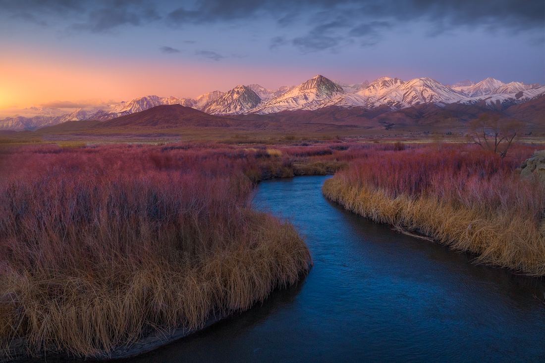
I recently returned from several days exploring California’s Owens Valley. Nestled between the 14,000-foot Sierra Nevada Mountains to the west and the White and Inyo Mountains to the east, it’s the deepest valley in the United States.
The indigenous name, Payahǖǖnadǖ, means "place of flowing water" after the 183-mile-long Owens River that flows through it. But the valley is in a “rain shadow” making it an arid environment. The river flows north to south terminating in what used to be Owens Lake.
The valley has some of the most breathtaking and iconic views of the Sierra Nevada Mountains. It’s well worth the trip on US Highway 395 to see the sights.
Water Wars
Owens Valley provides water to the Los Angeles Aqueduct. One-third of Los Angeles’ water comes from here. In the early 1900s, it was the epicenter of the California Water Wars.
That fight for water rights inspired parts of the 1974 movie Chinatown. Chinatown is set in 1937 Los Angeles. The movie portrays the manipulation of a critical municipal resource, water, by a cadre of shadowy oligarchs, as described by Wikipedia.
Owens Lake existed for over 800,000 years as a 108 square mile body of water. It was completely emptied by 1926, only 13 years after Los Angeles began diverting water. Now it’s a predominantly dusty, dry alkali flat at the southern end of the valley.
Towns in the Owens Valley include Mammoth Lakes, Bishop, Big Pine, Lone Pine, and Olancha. About 25,000 people live in the valley.
The Shot
On the morning of March 10, I was with fellow photographers Mike Loebach and Jon Christofersen near Big Pine. Our entire 7-day trip, except for one sunrise and one sunset, was severely clear (a photographer’s nightmare).
This was NOT one of those two opportunities with good clouds. We hustled to set up in the predawn because the barely photogenic clouds in this picture dissipated within minutes of our arrival.
I liked the S-curve leading to the distant peak along with the sunrise light to the left. Once the sun started hitting the mountains, the show was over. We packed up and drove back to Big Pine for breakfast and a long overdue cup of hot coffee.
This photograph took several hours of work in Photoshop to create the mood I wanted to share. It would have taken weeks or months of return visits for the perfect conditions to materialize. I only had one morning.
Thanks for looking,
Chuck Derus
]]>

Who’s Coming With Me Next Year?
So, how many Friday Photo readers are interested in going with me to next year’s Villain Arts Tattoo Festival? As Eleanor Roosevelt once said, “The purpose of life is to live it, to taste experience to the utmost, to reach out eagerly and without fear for newer and richer experience.”
An experience doesn’t get much newer or much richer than the Tattoo Festival! Let me know if you’d like to join me for next year’s wild walk through the world of ink. Coming home with a tattoo is optional.
And if you do get some ink, think about how many of your friends would love to see you featured as the Friday Photo!


Thanks for looking,
Chuck Derus
]]>

Kat Von D, Mexican American tattoo artist, model, entrepreneur and recording artist
Overcoming Fear
No, I’m not talking about getting a tattoo!
I’m an introvert, so walking up to a stranger and asking, “May I take your picture please?” is about as terrifying as it gets. Am I bothering that person? Will I be turned down?
One sure way to assuage that fear is to bring your camera to the Villain Arts Tattoo Festival. I had such good luck last year asking strangers if I could take their picture that I returned for the event on March 20th at the Donald E. Stephens Convention Center near O’Hare airport.
Accompanied by fellow photographer Scott Fuller and adventurous friend Paul Teodo, we walked over a mile in the exhibit hall observing the various tattoo artists, tattoo suppliers, and body modifiers at the exhibit. Everyone was eager to say “yes” to the picture question. And everyone thanked us for taking their picture!
It was an introvert’s dream come true.
The Shots
We had the impression that like Cat Von D., the customers and tattoo artists creating those tattoos wanted their story “read” by others. Since a picture is worth a thousand words, I’ll let the pictures do the talking.


Thanks for looking,
Chuck Derus
]]>
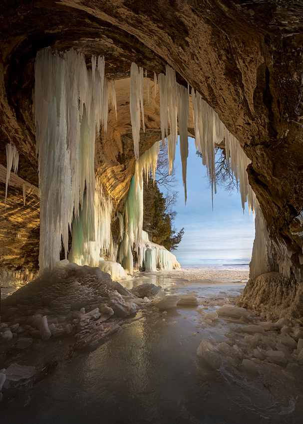
Lake Superior during winter is dazzling. Snow and ice transform the quiet landscape during winter into spectacular shapes and sights.
Along the shoreline, waterfalls flow down across the openings of red sandstone caves. In winter, freezing temperatures transform the water into stunning pillars of white, green, and red ice. And inside the caves, water oozes from the sandstone forming a seasonal frozen fairyland of stalactites and stalagmites.
As temperatures rise and fall, the Lake Superior frozen features change from chamber to chamber and from day to day.
Getting there isn’t always easy. 2022 was the first year in the last three years where the ice was thick enough for snowmobiles to make the journey safely from the Munising, Michigan harbor to the Grand Island caves.
Once you’re there, ice cleats are mandatory to stay upright. Lots of layers makes it possible to enjoy the sights without becoming hypothermic. And having a tour operator like Scott who brings a generator and a coffee brewer to make Starbucks coffee really helps with the cold!
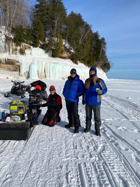
From left to right: tour operator Scott Cameron (with generator and coffee maker), photographer Ian Plant, and me (drinking coffee) at the frozen shore off Grand Island
The Shot
On Friday, March 4, sunrise was a relatively late 7:30 am. We wanted to arrive about 45 minutes before sunrise and the trip by snowmobile was about 30 minutes. So, I set my alarm for 5:45 and went to bed early.
The next morning, we were greeted by a beautiful sunrise and great conditions for photography for the next several hours.
I haven’t processed my absolute favorite photo, so this teaser will have to do for now.
Thanks for looking,
Chuck Derus
]]>

Chuck ♥ Minnesota
Minnesota is my home state. It’s the land of mythical Lake Wobegon, “Where all the women are strong, all the men are good-looking, and all the children are above average.” I miss it.
Growing up in Minnesota meant embracing winter. Our parents expected us to play outside on the weekends, regardless of how cold it was. We’d head to the sled hills, skating rink, hockey rink (every park had one), and friends’ houses to build snow forts and have endless snowball fights.
It meant Boy Scout campouts in January at -20 degrees. And there was the day spent cross country skiing at a wind chill temperature of nearly -100 degrees.
The only “Snowflakes” in Minnesota fell from the sky! School was only cancelled once from kindergarten through the end of medical school.
And it meant being ingenious. Back in the day, automobiles had carburetors, not fuel injection systems. Getting your car started in the bitter cold was an art. I used to take the battery out of my car and keep it in my warm apartment so it would produce enough juice to turn over the engine.
My Minnesota cars all had electrical plugs sticking out of the grill. Electric tank heaters really helped the car to start. As did putting a hot Weber Grill under the engine at night.
Grand Marais Adventures
Fellow photographers Scott Fuller and Jon Christofersen weren’t deterred by the weather during our recent trip to Grand Marais, Minnesota, just south of the Canadian border.
It was a “brisk” morning, but we were prepared with good boots and layers of clothing.
The Shot
We were at the Tombolo, the site of last week’s Friday Photo. Jon noticed it first, and then Scott and I were drawn to the heart-shaped ice feature along the shore.
After trying a horizontal composition, I flipped my camera 90 degrees and fired off this vertical shot. It seemed to sum up my love for Minnesota and the winters during my younger years.
Thanks for looking,
Chuck Derus
]]>
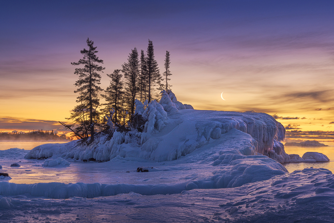
Terri Guillemets
Winter Photography
Winter seems to bring world class beauty to Lake Superior. While the lakeshore is appealing during other seasons, winter snow and ice combine with glorious skies creating superb scenery.
Fellow friends and photographers Jon Christofersen and Scott Fuller joined me recently for a long weekend of winter photography near Grand Marias, Minnesota. Located just 38 miles south of the Canadian border, snow and ice are a sure thing in February.
Photography can be a bit of a challenge in the winter. Just dressing for a zero-degree morning means multiple layers, a warm hat and gloves, and insulated boots. And don’t forget to wear ice crampons to avoid sliding into the lake.
Hand warmers were a godsend. Taking off your gloves to operate the camera controls can be painful. The warmed gloves felt SO good after setting the camera for a picture.
So, here I am enjoying photography on a brisk northern Minnesota morning on the lake.
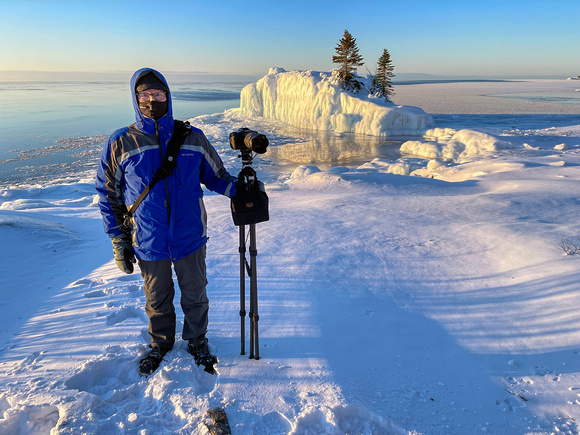
The Shot
This morning started at an iconic North Shore island near Grand Marais called The Tombolo. A tombolo is a sand or gravel bar connecting an island with the mainland.
Sometimes the island is connected to shore via a tombolo and sometimes water covers the path. On this frigid morning, it was connected to the mainland by ice.
We arrived about 45 minutes before sunrise. As luck would have it, we were greeted by a beautiful yellow glow on the horizon and a crescent moon.
There will be no Friday Photo next week. I’ll be on the road in the southwest for photography and hope to return with a batch of new Friday Photos.
Thanks for looking,
Chuck Derus
]]>
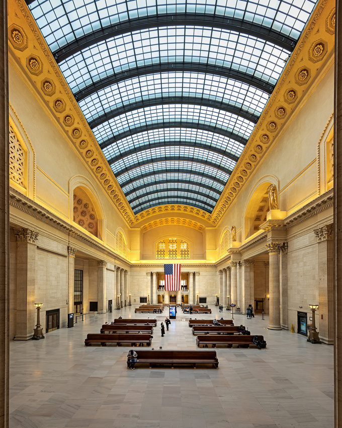
Trains used to dominate travel. Until the ascendency of commercial airlines in the late 1950s, you took the train.
And Chicago was the hub of our national rail network. Rail travelers from the east, west, and south all converged in Chicago to transfer from one railroad to another.
In its heyday, Chicago had seven major train stations.

Today, only three stations are in use. Chicago Union Station is one of them and remains a busy intercity and commuter rail terminal. Prior to the pandemic, about 130,000 commuters and 10,000 Amtrak passengers used the station on a typical weekday. By comparison, O’Hare hosts about a quarter million travelers a day.
The Station Site
On December 25, 1858, the Pittsburgh, Fort Wayne and Chicago Railroad built the first station on the west bank of the Chicago River at what would eventually become today’s Union Station.
On April 7, 1874, five railroads agreed to build and share a union (multi-railroad) station on that west bank site. The Pennsylvania; Chicago, Burlington and Quincy; Michigan Central; Chicago and Alton; and Milwaukee Road railroads built the original Chicago Union Station in 1881 at a cost of $1M ($27M in today’s dollars).
The present Chicago Union Station opened on May 16, 1925, replacing the original 1881 Union Station. Construction took 10 years, and the cost was $75M ($1B in today’s dollars). Including approach and storage tracks, it is a whopping nine and a half city blocks in size. The facilities are mostly underground, buried almost entirely beneath streets and skyscrapers.
An Architectural Gem
The 1925 station was envisioned by famed Chicago architect Daniel Burnham as a magnificent gateway to the West Loop. Designed by Burnham’s successors at Graham Anderson Probst & White, it features Bedford limestone Beaux-Arts facades, massive Corinthian columns, marble floors, and a magnificent Great Hall, all highlighted by brass lamps.
The Great Hall is a 110-foot-high atrium capped by a large barrel-vaulted skylight. The Chicago Tribune calls it “One of the nation’s most impressive indoor public spaces.” Arrayed around the Great Hall are numerous smaller spaces containing restaurants and services, and a wide passageway leading to the concourse.

1925 Dedication of Union Station in the Great Hall (Chicago Tribune Photo)
The Shot
I decided to take my camera along when I dropped off my wife, Christine, at the station. She was taking Amtrak to Champaign to visit and help out with our new grandson Leo and his sleepless parents. I wandered around the station taking shots until deciding to go for the wide-angle grandeur that epitomizes the Great Hall to this day.
In case you didn’t realize it, I stood in the same spot as the 1925 Chicago Tribune photographer.
FYI, I’ll be in the field over the next two weeks combing several locations for future Friday foto fodder. See you again in mid-March!
Thanks for looking,
Chuck Derus
]]>
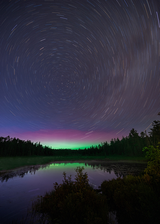
ser·en·dip·i·ty | \ ˌser-ən-ˈdi-pə-tē \
The faculty or phenomenon of finding valuable or agreeable things not sought for
A Night In Grand Marais, Minnesota
I spent several nights last July photographing the night sky near Grand Marais, Minnesota. Why Grand Marais? It’s because of the absence of light pollution.
In Chicago where I live, only bright planets and a handful of very bright stars are visible. The Bortle light pollution scale runs from 1 (no light pollution) to 9 (severe light pollution). Chicago is a Bortle 9, so you need to travel if you want to photograph the Milky Way and the stars.
The skies outside of Grand Marias are in a very dark Bortle 2 zone. And unlike similarly dark sky areas in the desert southwest, comfortable hotel beds, showers, and restaurants are nearby!
A Shot In The Almost Dark
During northern Minnesota summers, twilight can last for almost three hours. On July 8, the sun had set at 9PM. When I arrived at nearby Crescent Lake at 11PM, it was still twilight.
A test photo recorded the sky as too blue and too bright for a good Milky Way photograph. So, I decided to try a star trail photograph.
Star Trails
If you stare at the stars looking north, the stars appear to move in a counterclockwise rotation. This is due to the rotation of the Earth on its axis.
The center of the rotation in the northern sky is Polaris, the North Star. Polaris always remains nearly stationary, while all the other stars and constellations appear to slowly revolve counterclockwise around it.
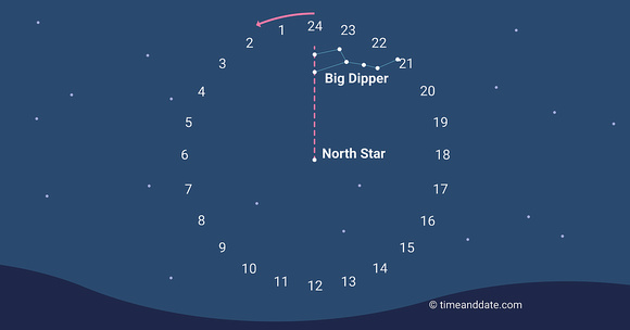
Capturing sharp, round stars means short exposure times of 30 seconds or less. Longer exposures turn the stars into streaks and then trails. You can use the earth’s rotation to capture distinct appearing star trail photographs.
The Shot
This photograph was sheer serendipity. The exposure of 27 minutes at f2.8 and ISO 400 was a pure guess. And other than an extremely faint luminosity at the horizon, the Northern Lights were invisible to the naked eye. But sometimes it’s better to be lucky than good.
Thanks for looking,
Chuck Derus
]]>

My photography is probably 99% color photography. But it wasn’t always that way.
I started in photography as a yearbook photographer. From 1968-1970, I took thousands of black and white images of my classmates at Patrick Henry High School in Minneapolis, Minnesota. Because color printing was so expensive, only the inside cover was shot in color.
There were so many people and events to photograph in my senior year that the yearbook editor, Lois Purdham, and I shared the Class of 70 Hall of Fame award for most service.

In college and medical school, I continued to use black and white film. But after marriage and children, color film became the norm.
A Different Take
Friend and fellow photographer Mike Loebach inspired this week’s Friday Photo. After viewing last Friday’s vintage railroad photograph, Mike converted it from color to a black and white version in Photoshop.
Wow! To me, the absence of color just seemed to compliment the image. Perhaps it’s time to return to my black and white roots and take advantage of a monochrome approach more often.
What Do You Think?
Which version do you prefer? The original color version is below.
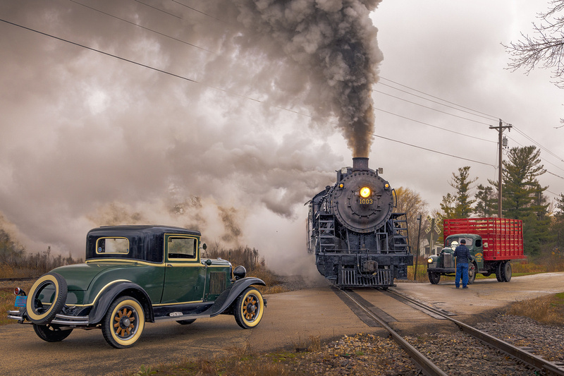
Thanks for looking and let me know your favorite of the two,
Chuck Derus
]]>

O. Winston Link (1914 – 2001) is famous for his black-and-white railroad photography. A commercial photographer by day, Link’s passion was documenting the end of steam engines on the Norfolk and Western railroad from 1955-1960. His images helped establish rail photography as a hobby.
He also pioneered night photography. His iconic image is Hot Shot Eastbound, photographed on August 2, 1956, in Iaeger, West Virginia. It’s a glimpse into the pivotal 1950s.
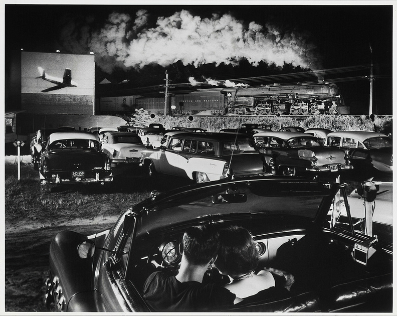
In the foreground, a young couple (the present) in Link’s 1952 Buick convertible takes center stage. In the background, a steam engine (the past) symbolically exits the frame. And in the midground, a U.S. Air Force Sabre jet (the future) from the 1955 Korean war movie Battle Taxi fills the movie screen.
Amazingly, he could imagine how a boring daytime scene might appear when illuminated at night for a fraction of a second with dozens of flash bulbs.
While his photos appear spontaneous, they were the result of elaborate preparations and darkroom manipulations. For Hot Shot Eastbound, Link used miles of wiring and 43 flashbulbs fired simultaneously to light his subjects. Later, in the darkroom, he added the jet from a second exposure.
My Own Attempts
I’ve tried to emulate Link and it’s difficult. Probably my best black and white nighttime effort is this image.
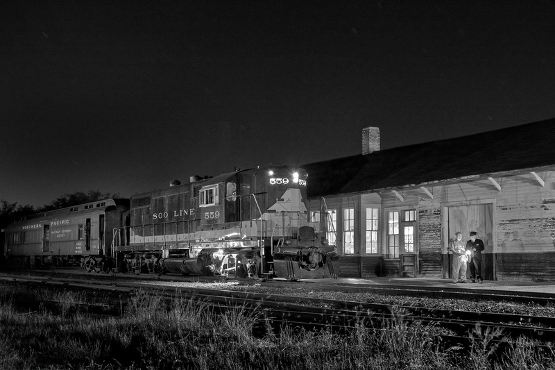
The Shot
I much prefer color and the ease of shooting during the day. On my recent chase of Soo steam engine #1003, the Trains Magazine team arranged for a vintage car, crossing guard, and truck at a rural crossing. I enjoyed the vintage vibe, tried a few compositions, and settled on this one as my favorite.
Thanks for looking,
Chuck Derus
]]>
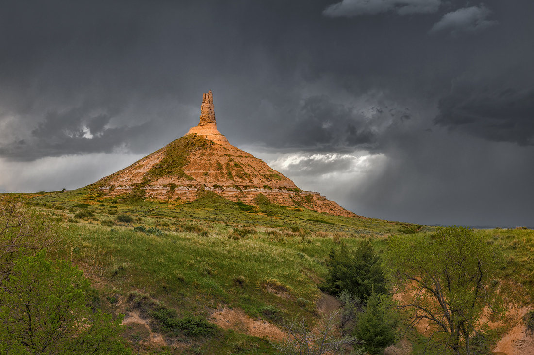
Where have I seen this landmark before?
There weren’t any supercells last May 21st. So our van of tornado chasers went looking for other, more sedate photographic opportunities. The closest attraction was Chimney Rock National Historic Site in western Nebraska.
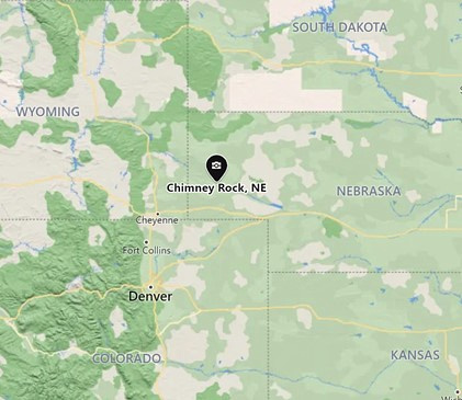
Chimney Rock is a hoodoo, a 325-foot vertical pile of rock layers (or strata). Between 37 and 23 million years ago, volcanos covered the Great Plains with ash. The ash blended with sands, silts, and clays.
Over millions of years, the plains became elevated, and then erosion revealed Chimney Rock’s current shape. A hard sandstone cap at the summit shields the softer, more vulnerable layers below from erosion.
The Great Western Migration
During the 1800’s, Chimney Rock was the most noted landmark for an estimated 500,000 emigrants who risked their lives traveling along the Oregon, California and Mormon Trails. Historian Merrill Mattes found more references to Chimney Rock than to any other landmark in her examination of over 300 pioneer journals.
Reaching this “lighthouse on the prairie” was cause for celebration. It marked the end of the first (and easiest) third of their arduous journey.
Names Through the Years
The Lakota Sioux called it Elk Penis. The name apparently wasn’t popular with early explorers and settlers, who instead called it “Elk Peak,” “Elk Brick,” “Nose Mountain,” “Smokestack” and “The Chimney.” While written descriptions date back to 1830, the “Chimney Rock” name didn’t appear in print until 1842.
Flashback
Finally, it hit me: Chimney Rock graced one of the most popular video games of all time! The Oregon Trail was extremely successful, selling over 65 million copies in ten iterations over forty years. It was ubiquitous in elementary schools worldwide from the mid-1980s to mid-2000s, as school computers came bundled with the game.
The Oregon Trail was the go-to video game for our three children. Caroline, John, and Lisa all guided parties of settlers from Independence, Missouri, to Oregon's Willamette Valley on the Oregon Trail via a covered wagon in 1848.
The game was conceived by Minnesota history teacher Don Rawitsch and his roommates in 1971. But the earliest editions didn’t include any of the landmarks that settlers would have seen along the Oregon Trail.
In 1984, Philip Bouchard was tasked with upgrading the game for the Apple II computer. To improve the aesthetics, he threw in some real-life natural wonders. “Chimney Rock was one of the most famous of all, and therefore an obligatory inclusion,” Bouchard told the Scottsbluff Star Herald in 2019.
The game weaves math, planning, discovery, improvisation, and historical simulations into gameplay. You had to prepare for the journey, hunt along the way, and avoid serious illness and death to score points.
The Shot
I tried a few compositions and settled on this view. After a few images, I attached my Lightning Trigger to hopefully capture a lightning bolt for visual interest. But no bolts appeared in my field of view.
Thanks for looking,
Chuck Derus
]]>
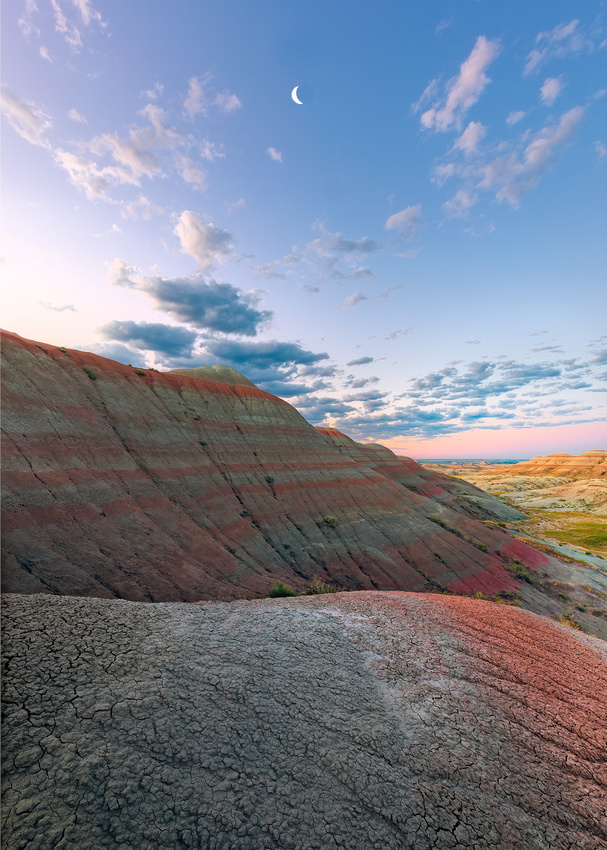
Amy Grant
Photographing Sunrise
Sunrise is often a special experience for photographers. For me, being there early and being there with very few people is part of the appeal.
The best light begins well before dawn and doesn’t last for long after sunrise. I’m often packing up my gear and leaving by the time other photographers and tourists are just arriving.
Photographing sunrise entails arriving at least an hour before sunrise. While interesting light often begins about 40 minutes before sunrise, I’ve been pleasantly surprised on occasion by a colorful sky an hour before sunrise.
And unlike sunset, there’s usually nobody around. A location that can be crowded with people at sunset is often nearly deserted at dawn.
Don’t get me wrong; I like people. But the peaceful solitude of being in the company of just one or two friends photographing the start of a new day is exhilarating to me.
Sunrise photography is not without its challenges. Photographing at dawn begins the day before with scouting. While several phone apps will provide the time and direction of sunrise, you still must imagine what it will look like at dawn.
And then there’s the matter of getting out of bed in the morning. I want to make the most of any location I’m visiting. And that means shooting every morning, every evening, and occasionally at night. The grind of getting up early and going to bed late takes its toll after a while.
It’s much easier in the winter. The days are short with late sunrises and early sunsets.
Summer can be a challenge. When I was in Badlands National Park in July of 2020, sunrise was at 5:20 AM. Catching good light meant arriving by 4:20 AM. And I was staying an hour away in Wall, South Dakota.
It was a week of 3 AM wakeups. With the late sunsets, bedtime was usually around 10:30 PM. Naps can be a wonderful things!
The Shot
July 15 was another beautiful sunrise in the Badlands. I had taken one potentially good photograph and started looking for a second composition.
Spotting the crescent moon, I turned ninety degrees towards it looking for a composition. I settled on this view, hopefully moving the eye from the foreground textured mound to the midground striped hills to the moon and back.
Thanks for looking,
Chuck Derus
]]>
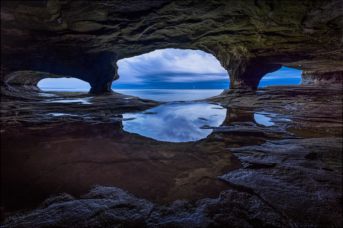
Pictured Rocks is the closest national park to Chicago. Located in Michigan’s Upper Peninsula, Pictured Rocks National Lakeshore includes a 33,550-acre shoreline zone and a 37,850-acre inland buffer zone.
And if you’re from Chicago, it’s well worth the six-and-a-half-hour drive to Munising, Michigan to enjoy the park. Over one million people visit every year.
Previous Friday Photo blogs described how intense wave action shaped the lakeshore’s sandstone layers. While some layers easily resisted the water, others slowly weakened, crumbled, and gave way. The result is a shoreline spotted with sea caves, stacks, chimney promontories, and arches.
The Shot
I was photographing Fall color in the park during October of 2020. Sea cave photography was on my wish list.
Luckily, I managed to take three trips to the sea caves on Grand Island in Greater Munising Bay. Each trip entailed a half hour boat ride to an offshore location, transferring to a small inflatable raft to get close to the cave, and finally, wading ashore in the mouth of a cave.
Wearing chest high waders was a necessity (not a luxury), given Lake Superior’s cold water and chilly Fall temperatures.
On two of the outings, we were blessed with calm water and beautiful, photogenic skies.
But one morning, bad weather almost canceled the trip. A storm was moving through the area with significant waves. In addition, lightning was striking about five miles away. The captain noticed that the worst of the storm had passed, so we continued to the sea cave.
“Bad Weather Makes for Good Photographs”
The saying is often true, and this morning was no exception.
The pre-dawn light made the sky appear blue and cold. The interior of the cave was softly lit with warm sandstone hues.
All three openings were visible through my ultra-wide-angle lens creating an interesting foreground. In the background, I could see flashes of lightning and the distant rumble of thunder. I took quite a few photographs hoping to capture a lightning bolt.
By sunrise, the interesting light had subsided. I lingered, simply enjoying the experience. Afterwards, while reviewing my photos, I noticed that one of my frames had captured a very distant lightning bolt. You’ll need to view the image on a large monitor to notice the bolt in the center opening.
Thanks for looking,
Chuck Derus
]]>
Take Highway 89 East from Kanab, Utah for about 33 miles. Just before the Paria River, there’s a dirt road that takes you to what geologist Hellmut Doelling calls “the most sublime geologic area in the world.”
225 million years ago in the late Triassic Period, ancient rivers and lakebeds deposited layers of sand, mud, clay, and silt. Over the eons, it was compressed into a 425- to 930-foot-thick layer of stone.
Dissolved minerals in the water percolated through the stone. The iron oxides, manganese, cobalt and other minerals created a breathtaking riot of colorful layers.
The flood plain of the Paria River later exposed those layers for us to enjoy.
This is also the location of the ghost town of Pahreah. The old cemetery is still there and contains about 20 graves. One can only imagine the hard life there in the 1870s until the town was abandoned in the late 1890s. But did they have a view!
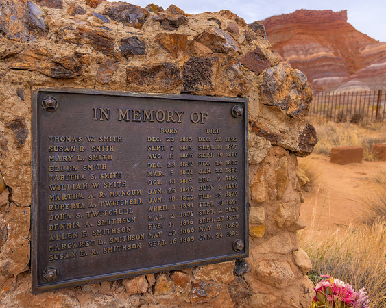
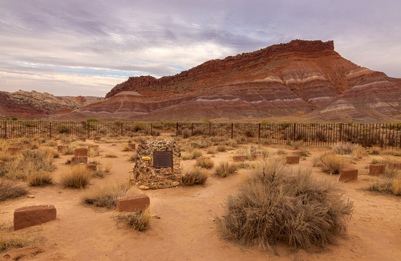
The Shot
Fellow photographer Jon Christofersen and I were there last August. We had the place to ourselves for the six hours that we walked around, gawked, and photographed.
Even though I had photographed the Gingham Skirts Butte (what a descriptive name!) on a previous visit, the colors made it impossible to ignore. Instead of capturing the entire Butte, I concentrated on a portion of it that I found pleasing.
With a little bit of help from Photoshop, the colors I remembered came to life on my computer display at home.
Thanks for looking,
Chuck Derus
]]>
Banff National Park is Canada’s first national park. Located west of Calgary in Alberta Provence, the park consists of 2,600 square miles of unparalleled mountain scenery nestled in the heart of the magnificent Canadian Rockies.
The terrain is largely rugged and mountainous, particularly in its western section along the Continental Divide. Most of the rest of the land is designated as subalpine or montane (moist, cool upland slopes below the timberline).
Many of the peaks rise above 10,000 feet. Over hundreds of thousands of years, glaciers have given the mountains a toothlike appearance.
Lakes with a Mountain View
The Vermilion Lakes are three large wetland lakes located immediately west of Banff, Alberta, in the park. The three lakes are in the Bow River valley, at the foot of Mount Norquay.
Vermillion Lakes Drive, just off Canadian Highway 1, affords spectacular views of Mount Rundle. Mount Rundle could actually be considered a small mountain range. Extending for over 7.5 miles, the mountain has seven distinct peaks.
The Cree Native Americans called it Waskahigan Watchi or house mountain. In 1858 John Palliser renamed the mountain after Reverend Robert Rundle, who performed Methodist missionary work in the 1840s in this area.
The Shot
In February of 2019, good friends Jon Christofersen, Mike Loebach, and I were on a winter photography workshop in the Canadian Rockies. Arriving in Banff a day early, we decided to squeeze in a morning sunrise shoot before joining the rest of the group later the next day for the start of the workshop.
We drove down Vermillion Lakes Road in the late afternoon and located a promising location for a dawn photoshoot. After dropping a GPS pin on our phone, we returned to Banff for dinner.
The next morning, well before dawn, we returned to our now very cold and very dark location. As twilight approached, we started making out the shape of Mount Rundle in the center of our composition.
A half hour before sunrise, we were rewarded with a fiery sky full of clouds. And the reflections of Mount Rundle and Sulphur Mountain to the right could be seen in the still waters of Vermillion Lake. We moved around furiously trying to improve our compositions.
By the time the sun peeked above the mountain, the show was over. We packed up our gear and headed back to Banff for hot coffee and breakfast.
Thanks for looking,
Chuck Derus
]]>
"It is the life of the crystal, the architect of the flake, the fire of the frost, the soul of the sunbeam. This crisp winter air is full of it. "
John Burroughs, American naturalist, and nature essayist
Winter Photography
Winter brings to mind gray skies, long nights, snow, and cold. You might think I’d put my camera away until spring. But for many, winter is a wonderful season for photography.
A landscape is often visually “busy.” In our three-dimensional world, there are so many elements that capture our attention. Our eyes tend to wander around the scene, enjoying everything.
A photograph is limited to two dimensions. And a busy image just doesn’t work. To capture the viewer’s attention and create visual flow on a flat surface, a photograph has to be simple, with a clear path to the subject.
Snow simplifies the landscape beautifully. It covers distracting elements in a soothing blanket of white allowing our eye to focus on the subject.
The Shot
Last winter I visited the Morton Arboretum with fellow photographer Scott Fuller. We had a wonderful time hiking the loop around one section of the grounds in the freshly fallen snow.
Early on, this tree attracted my attention. It never seemed photogenic in other seasons because it was surrounded by ground clutter. But in a snowy landscape, it seemed to stand out and call to me.
Happy Holidays
I wish all of you Season’s Greetings and a Happy New Year. I’ll be taking next week off and the next Friday Photo will go out on New Year's Eve.
Thanks for looking,
Chuck Derus
]]>
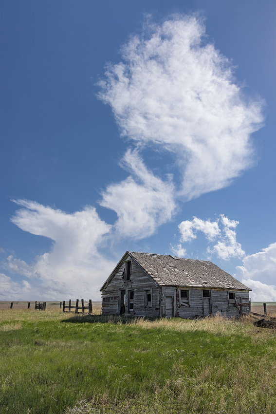
Jeb Dickerson
So, what do you do on a storm chasing tour when there are no storms that day? My last tour in May didn’t yield any tornados or classic supercells. In fact, several days were downright nice weather days. The four of us on the tour were disappointed about the good weather.
But that didn’t stop us from finding photographs.
A “rule” of photography is when you have a great foreground, look for a complementary background. And conversely, when you have a great background, look for a complementary foreground.
On this afternoon, the background clouds created playful shapes just begging for a complementary foreground. When we spotted an abandoned homestead while driving near Siebert, Colorado, we all shouted “Stop!” in unison. Piling out of the van, the four of us started searching for a foreground.
The Shot
The clouds were slowly drifting across the sky from right to left. Anticipating a composition, I set up my tripod and waited about 10 minutes for the clouds to drift into position above a dilapidated structure.
In less than a minute, the opportunity had passed with the clouds. My favorite cloud shape was on the left, near the horizon. Does it remind you of a mythical animal?
Smiling, I returned to the van knowing that I captured a pleasing interpretation of the clouds that Dickerson described above.
Thanks for looking,
Chuck Derus
]]>

"The smoke and the fire and the speed, the action and the sound, and everything that goes together, [the steam engine] is the most beautiful machine that we ever made, there's just nothing like it..."
O. Watson Link, pioneer, and inspiration for the hobby of railroad photography
Steam locomotives almost seem "alive," like a living, breathing organism. There’s a raging fire that instinctively draws us in. And most of the moving parts are visible, making it fascinating to watch. Also, the chuffing and plaintive wail of the whistle create a symphony of appealing sounds. Finally, the smoke and aroma of burning coal seem irresistible.
The last steam locomotives plied the rails in the late 1950s. They were scrapped and replaced by more reliable, but mundane diesel-electric locomotives. A few steam locomotives were donated to local communities for display instead of being scrapped.
Soo Line No. 1003 was one of those engines that escaped the scrapper’s torch.
No. 1003 was built in 1913 as part of an order for 10 engines (1001-1010) by the American Locomotive Company. The engine powered mainline freight trains for the Minneapolis, St. Paul and Sault Ste. Marie Railroad (Soo Line) until it was taken out of active service in 1954. It was maintained in standby service until 1959.
Argonne, Wisconsin in 1934. Ed Wilson photo, Bill Raia collection.
In December 1959, the railroad donated the locomotive to the city of Superior, Wisconsin where it was put on public display, slowly deteriorating.
In the mid-1970s, efforts began to restore the locomotive to operations. I remember donating money in 1984 for the restoration effort. 1003's first public excursion after restoration occurred in 1997.
The locomotive made its final journey under its Federal Railroad Administration mandated 15-year boiler certificate on November 13, 2010. Shortly afterwards, the operators raised funds to have the engine overhauled and certified for another 15 years. No. 1003 returned to service in November 2014.
The Shot
Trains Magazine sponsored a railfan photography day featuring No. 1003 on November 14 of this year. Photo buddy Jon Christofersen and I chased the train to a dozen locations in Wisconsin. After reviewing all my shots, this was my favorite.
The cold made for a great display of steam. And the snowflakes just added to the feel of a late fall day. That almost living, breathing machine seemed to be on a perfect stage.
Thanks for looking,
Chuck Derus
]]>
"Over three centuries ago, our forefathers in Virginia and in Massachusetts, far from home in a lonely wilderness, set aside a time of thanksgiving. On the appointed day, they gave reverent thanks for their safety, for the health of their children, for the fertility of their fields, for the love which bound them together, and for the faith which united them with their God."
Proclamation 3560 issued by President John F. Kennedy on November 5, 1963
I hope all of you enjoy a wonderful day of thanksgiving tomorrow. And thank you for the kind words of encouragement as I share my photographs and stories with you.
This picture was taken last week in the local forest preserve. Just a half mile from my home, it’s my “go-to” location when I feel the urge to head outside to take a photograph.
I was very thankful that the high clouds with a clearing to the west produced this colorful sky.
Thanks for looking,
Chuck Derus
]]>
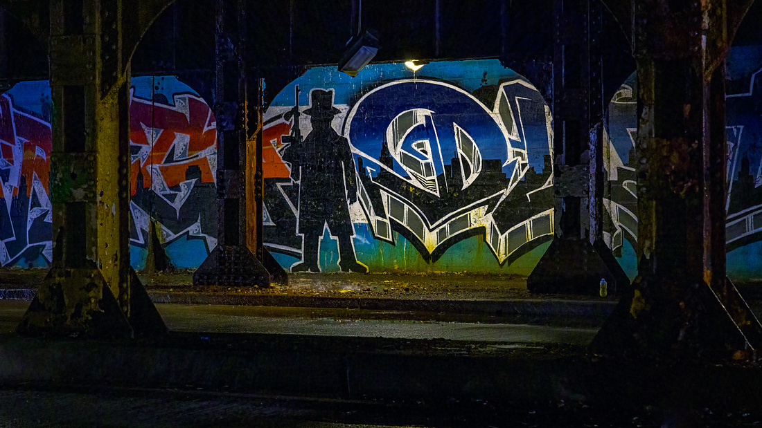 Neighborhoods
One of the more interesting Chicago neighborhoods is Pilsen. Sensational murals add character and visual interest to the community. The neighborhood is bounded by Halsted Street on the east, Cermak Road on the south, Western Avenue on the west, and the West 16th Street railroad viaduct on the north.
The Irish
Irish immigrants first turned a tall grass prairie into a neighborhood. They arrived by the hundreds in the 1840s. Settling in what is now Pilsen, they built the Illinois and Michigan Canal, the Southwestern Plank Road (today’s Ogden Avenue), and the Burlington Railroad tracks.
Pilsen flourished, attracting factories, stockyards, breweries, and lumberyards. But frequent floods and poor sanitation (the poor couldn’t afford indoor plumbing) led to disease. Cholera outbreaks in the 1850s and ’60s claimed hundreds of lives. The residents that could afford to leave fled to higher ground and better living conditions elsewhere in the city.
The Czechs
After the Great Chicago Fire of 1871, many Chicago industrialists rebuilt along the river in Pilsen. Cyrus McCormick’s factory (later International Harvester), located at 22nd Street and Western, employed 800 men. The Pilsen Yards, at 22nd Street and Blue Island, became the largest lumber distribution center in the world.
Malleable Iron Works from 24th Street and Western Avenue. Courtesy of Roosevelt University’s Archives
New waves of immigrants arrived from Czechoslovakia, Germany, Poland, and Italy in the 1870s. The Czechs dominated, with thousands fleeing the Austrian Empire for political and religious freedom.
A Bohemian resident opened the At the City of Plzeň restaurant to honor the fourth largest city in what is now the Czech Republic. After that, residents began to refer to the neighborhood as Pilsen. The subsequent naming of the post office as Pilsen Station institutionalized the nickname.
The neighborhood continued as a home for mainly blue-collar Bohemians for decades. After Czechoslovakian independence in 1918, the rate of immigration markedly slowed.
18th & Loomis, ca. 1910s | Chicago photos, Chicago history, Pilsen (pinterest.com)
The Mexicans
Labor shortages during World War I brought over two dozen different immigrant groups to Pilsen, including a modest number of Mexicans. But it was the forced relocation of an estimated 5,000 people in 1960 to make way for the new University of Illinois at Chicago that changed Pilsen again.
Several Mexican families moved south to nearby and affordable Pilsen. By 1970, most of Pilsen’s population was Mexican or of Mexican descent.
Current Day
Rich in Latino culture, Pilsen is home to award-winning restaurants, iconic music venues, art studios, trendy bars, and sensational murals. It was named one of “The 12 Coolest Neighborhoods Around the World” by Forbes in 2018.
The Shot
I joined the Chicago Streets and Beyond Meetup Group for a photo walk in Pilsen recently. It was a target-rich photographic environment! I really enjoyed the way the murals were framed in the Wood Street viaduct under the railroad tracks. These two were my favorites from the walk.
Thanks for looking,
Chuck Derus
]]>
“In order to reflect, think and plan, you must quiet yourself. You can't see your reflection in churning waters. Water must be still to see your reflection.”
Karen Hantze Susman
In thought and in photography, stillness is an integral part of reflection.
In case you’re wondering, Karen Hantze Susman won three Grand Slam women's doubles titles, all with Billie Jean King. She also won the 1962 women's singles title at Wimbledon.
The Shot
This year’s trip to Michigan’s Upper Peninsula (UP) featured overcast skies and intermittent rain. That combination makes for wonderful waterfall images. But reflection photographs require sunshine and still air. I waited and waited, but the weather just didn’t cooperate to create reflections.
Last year was different. In 2020, the sun made multiple appearances during my visit to the UP’s Pictured Rocks National Lakeshore. One of those appearances occurred when I was exploring the Sand Point Marsh area. After a short hike, I came across a beautiful viewing area near the shoreline of a small pond.
As the sun set and the wind abated, I cleared my mind to capture this reflection. And I paused frequently to reflect on my good fortune at being in the path of such beauty.
Thanks for looking,
Chuck Derus
]]>
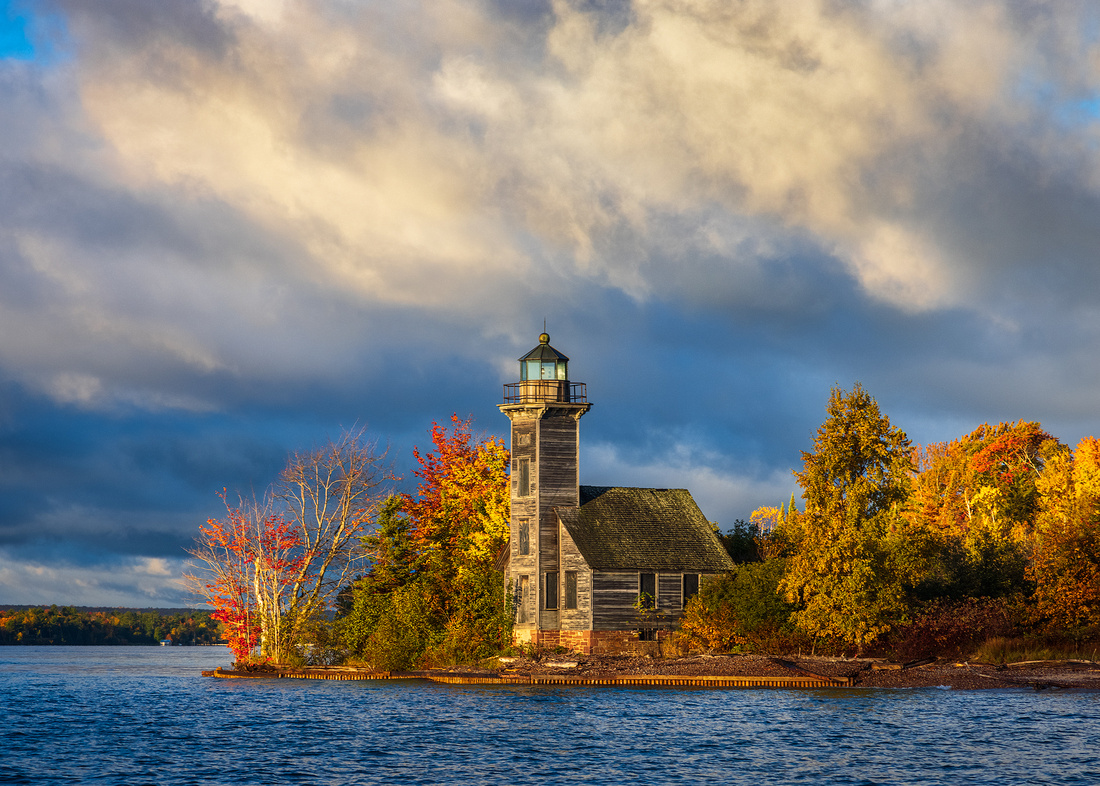
Grand Island East Channel Lighthouse
Shipping by water was common in the mid-18th century. There was no road system, and the railroads were still being built.
Strong markets for grain and lumber before and after the Civil War resulted in a shipbuilding boom from the mid-1850s until the late 1860s. Several hundred Lake Superior three-masted schooners were built during this period. Most of these ships were 150 to 160 feet in length.
Source: http://images.maritimehistoryofthegreatlakes.ca/63344/image/10170
Getting to Port Safely
Grand Island is on Lake Superior, just north of the town of Munising, Michigan. The island has two harbors in the South Bay, well sheltered and affording good anchorage for vessels of all sizes. One of them is on the south side of Grand Island, and the other is opposite, on the mainland. Other than the harbor at Marquette, Michigan, the South Bay is the only safe anchorage along 180 miles of rocky, inhospitable coastline.
Reaching those anchorages was tricky, especially at night and in bad weather. A light or set of lights was needed to allow vessels to reliably use Munising Harbor as a major harbor of refuge.
In 1866, Congress appropriated $16,000 to the Lighthouse Board to build one or two beacon lights at the entrance to Grand Island Bay and Harbor. Those funds were spent to build the square tower and attached one-and-a-half-story keeper’s dwelling from 1868-70.
Range lights were installed in 1908 and proved to be a superior navigational aid. Range lights are a pair of light beacons used to indicate a safe passage for vessels entering a shallow or dangerous channel. The wood framed lighthouse was closed in 1913.
The abandoned lighthouse was in danger of being lost forever. But a few years ago, a group of private citizens, including the owner, decided to preserve the structure. The stone foundation was repaired, and the tower was supported with a series of cables.
The unpainted wood has weathered to a dark gray and the square tower is capped with a dome of green copper roofing.
The Shot
Last fall, I had the opportunity to photograph Grand Island and Pictured Rocks from a private boat. We waded ashore from the boat and photographed the structure from the shoreline. But my favorite photo is from the boat, placing the historic structure in beautiful fall colors.
Thanks for looking,
Chuck Derus
]]>
Literally, to be attached only by single thread, strand, or something similar.
To be perilously close to failing, dying, or resulting in a bad outcome.
Source: https://idioms.thefreedictionary.com
One feature of Pictured Rocks National Lakeshore epitomizes “hanging by a thread.” It’s the lone pine tree atop Chapel Rock.
Life finds a way even in precarious places. Chapel Rock on Lake Superior has a single mighty pine tree perched atop its column. But how can it survive? The small amount of land and soil on the top of the rock is insufficient to sustain this sizable tree.
The “rope” stretching from the edge of the rock spire to the main bluff isn’t a rope. It’s actually a root. It branches out and taps into the abundant nutrients and water on the bluff.
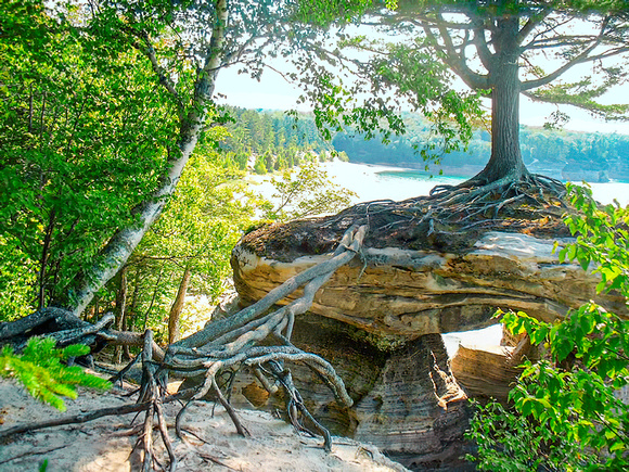
Source: www.kuriositas.com
How Can This Be?
Trees don’t grow roots in thin air. So, how did a tree root come to hang in midair and connect the mainland?
The type of stone making up the Chapel Rock spire holds the answer. It’s made up of relatively soft 500-million-year-old Cambrian age sandstone. Sandstone erodes easily.
Around 7,500 years ago, this was the shoreline of prehistoric Lake Nipissing. Over the millennia, wind and water sculpted the cliffs into wonderful shapes ranging from caves and arches to formations that look like human faces to turrets.
Chapel Rock is one of those wonderful shapes along the cliffs. The 5 to 6-foot-thick dome of Chapel Rock is supported by five pillars 25 feet tall and 4-6 feet thick. And it used to be connected to the mainland by an arch.
In the original 1831 description of Chapel Rock by Douglass Houghton, “The span of this arch is 32 feet, as viewed from the water…The strength of the roof thus upheld must be considerable since it is clothed with timber, and from the very centre shoots, spire-like, a lofty pine.”
That lofty pine began as a seedling 250 years ago. Living at the edge of a cliff, it naturally sent roots across the arch to an inland source of water and nutrients.
One day in the 1940s, the sandstone arch had eroded to a point where it could no longer bear its own weight. The entire archway collapsed leaving only a pillar behind. The connection to the mainland was lost.
Yet somehow, the roots somehow managed to survive the collapse and continue to nourish the tree to this day.
The Shot
The photograph was taken from a Pictured Rocks boat cruise out of Munising, Michigan several weeks ago. I highly recommend taking a cruise if you visit the park.
Thanks for looking,
Chuck Derus
]]>
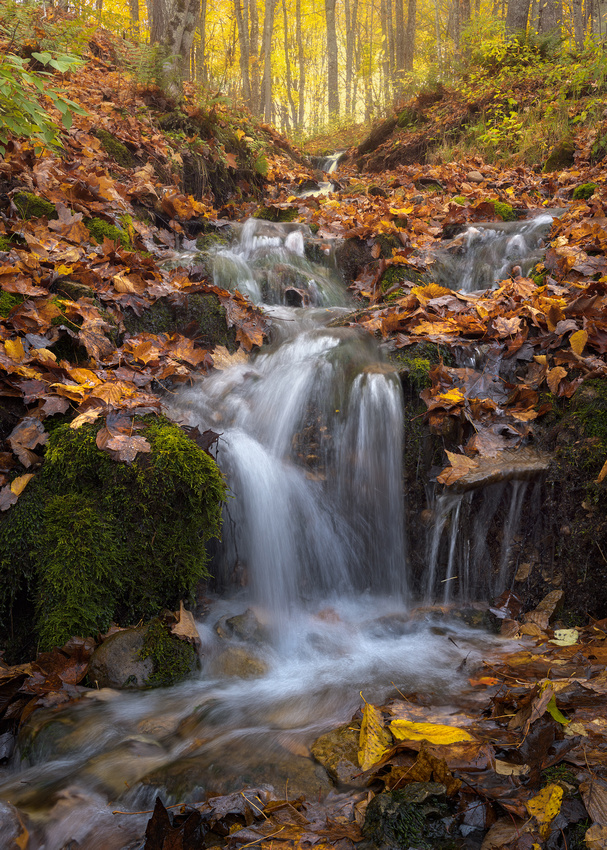
Sometimes it’s the little scenes that make you the happiest. While walking towards a large waterfall in Michigan’s Upper Peninsula (UP) last week, this small cascade caught my eye.
It was a mere 20 feet in length and only a foot wide at the base. Last year, the slope was dry, and I walked right past it. But it was raining last week, and numerous little streams were running.
I stopped in my tracks and set up my camera. I enjoyed this small scene so much that I spent almost no time photographing my intended subject, Laughing Whitefish Falls, Michigan’s highest waterfall.
The Shot
One of the advantages of my 2017 trip to Iceland was learning how to take pictures in the rain. On my last 11-day trip there, it rained non-stop, only pausing long enough to mock me on the way to the airport to fly home.
So, when the week’s forecast for the UP called for rain every day, I was prepared. Thanks to my Iceland experience, I can photograph in heavy rain, medium rain, light rain, drizzle, and mist!
The rain actually helped by saturating and boosting the colors. And the overcast conditions evened out the light, making it more flattering for running water. All it took was a polarizing filter on my lens to remove the glare and the beautiful fall colors began to pop.
I experimented with several different shutter speeds to blur and simplify the water. After picking my favorite speed, I wiped the water droplets off my lens and took several pictures from different angles. This image was my favorite.
Thanks for looking,
Chuck Derus
]]>
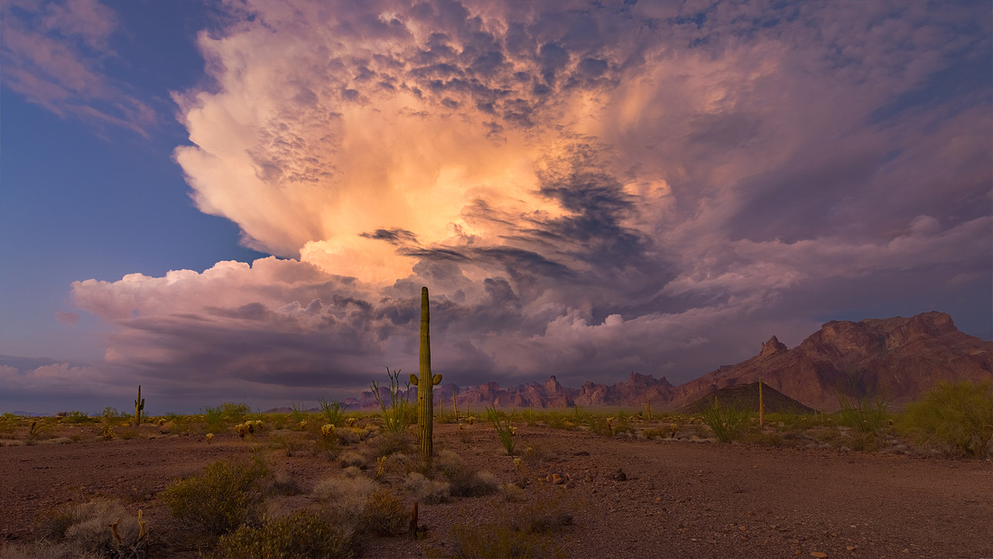
Wide open spaces. That’s what’s so appealing to me about photographing storms on the Great Plains and in the desert southwest. There is nothing to block your view of a glorious, towering thunderstorm.
If At First You Don’t Succeed…
Jon Christofersen and I were lucky to photograph last week’s Friday Photo of a monsoon sunset. We decided to return the next morning to the Kofa Wildlife Refuge, south of Quartzite, Arizona for a dawn shoot. High, photogenic clouds were forecast.
It was a total bust. Severely clear skies meant there was zero visual interest in the sky. We decided to head back to Quartzite for pizza at Silly Al’s, the best (and apparently the only) pizza restaurant in town.
The pizza was excellent, and the beer was cold. It definitely had a local vibe with cowboy decorations and a gun hanging from the ceiling. No chain restaurants for me!
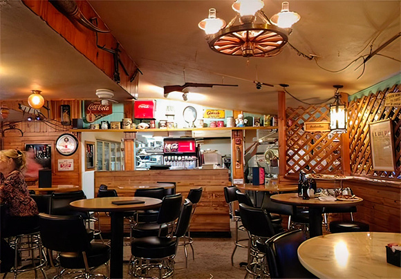
Courtesy of Silly Al’s
We continued to check the forecast and headed back to Kofa when scattered storms around sunset appeared likely.
The Shot
When we arrived about an hour before sunset, we could hear the rumble of distant thunder. A storm slowly made its way towards us.
After sunset, it finally moved close enough to photograph. At first, the light was flat and boring. And there was no photogenic cloud-to-ground lightning.
Suddenly, the light became exhilarating. A narrow band of warm light broke through and illuminated the middle of the cloud. We couldn’t believe our good luck and just kept shooting until it was gone.
Leaving well after dark, we crossed our fingers that the Jeep track was again passable back to the highway. Flash floods and washouts often make dirt roads impassible. We were lucky and had an uneventful ride back to our hotel room in Quartzite.
Next Week Off
I’ll be in the field next Friday, so no Friday Photo on the 15th.
Thanks for looking,
Chuck Derus
]]>
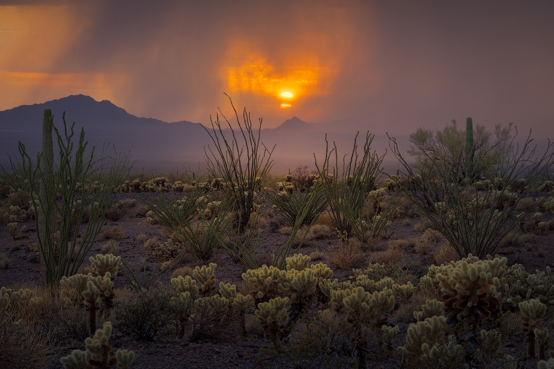
India comes to mind when you mention a monsoon. But a monsoon in Arizona? Are you kidding me?
Actually, Arizona has a monsoon season just like India.
The word "monsoon" is derived from the Arabic word "mausim" ("season" or "wind-shift"). Fundamentally, a monsoon is linked to a shifting wind.
The Arizona Monsoon is a meteorological event that occurs during the summer months. During the monsoon, wind patterns shift bringing moisture from the Gulf of California and the Gulf of Mexico into Arizona.
Strong summertime surface heating (typically 105 degrees) along with that moisture creates intense atmospheric destabilization leading to powerful outbreaks of thunderstorms.
The Shot
Jon Christofersen and I were in Arizona this August, hoping to position ourselves to photograph a monsoon storm. We stopped for two days in the Kofa Wildlife Refuge, south of Quartzite, Arizona.
The Refuge is 660,000 acres, and as near as we could tell, we were the only visitors. There were no other people and not even any new tire tracks on the dirt road. Perhaps the blistering 105-degree heat and total lack of shade explained why we had the place to ourselves.
On our second day, conditions looked promising for a monsoon storm in the Refuge. We set up our cameras only to be forced into the car by heavy rain. While we waited, the sun was quickly dropping towards the horizon and a beautiful yellow color was suffusing the sky.
As soon as the rain stopped, we scrambled to find a shot during the 10 minutes that the sun was still visible. The cholla cactus needles caught the backlight beautifully in the foreground. And the storm and distant mountains created an interesting background.
After the sun set, we crossed our fingers that the Jeep track was still passable back to the highway. Flash floods and washouts often make travel dicey on dirt roads. We were lucky and had an uneventful ride back to our hotel room in Quartzite.
Thanks for looking,
Chuck Derus
]]>

Where did the Frisbee™ come from? And how did dogs catching Frisbees™ become a thing? Read on!
The Frisbie Baking Company was established in Bridgeport, Connecticut in 1871. They sold pies until 1958. The pie tins were stamped “Frisbie’s Pies.” College students soon discovered that you could toss and catch the empty tins as a game or sport.
Los Angeles building inspectors Walter Morrison and Warren Franscioni created a plastic version of the Frisbie pie tin in 1948. It flew further and could be aimed more accurately. But Morrison and Franscioni split up before commercializing the idea.
After the split, Morrison produced a plastic model called the Flying Saucer. UFOs were a hot topic at the time because of a highly publicized 1947 event in Roswell, New Mexico. It was later renamed the Pluto Platter.
Morrison’s design became the basis for all Frisbie designs. The outer third of the disc is even described as the "Morrison Slope" in the patent.
Wham-O Toy Company
Wham-O Toy Company bought the rights for the Pluto Platter in 1955. It was renamed Frisbee™ (a variation of the baking company’s name) and marketed as a sport.
Frisbees™ “flew” out of the factory and Morrison received over one million dollars in royalties. New sports such as Ultimate Frisbee and Frisbee golf added to the demand.
Wham-O eventually sold the rights to Mattel after selling over one hundred million units.
Disc Dog?
47 years ago, on August 5, 1974, disc dog was introduced to the world on national television during a Monday Night Baseball game.
Near the end of a 6–3 Dodgers victory over the Reds, Ashley (a Whippet) and owner Alex Stein made their way onto the field. They were uninvited and unannounced.
According to Los Angeles Times reporter Jeff Prugh, “The crowd got impromptu entertainment before the ninth inning when a pet dog scampered into left field and repeatedly made leaping catches — with its teeth — of a blue Frisbee™ tossed by two youthful male fans. Four catches — and a near miss later, the dog and fans were escorted back into the left-field seats.”
The crowd cheered for minutes, and the players actually sat down during the short exhibition. And yes, Alex was later arrested.
Not long after, Alex and Ashley Whippet were invited to perform during halftime at the Rams vs. Bills NFL game. The rest is history.
International Championship
The fur was indeed flying at the recent Labor Day weekend Ashley Whippet Invitational competition in Naperville. This is the original and longest-running disc dog competition in the world, dating back to 1975.
Naperville has played host since 2003, thanks to resident Tom Wehrli, a member of the Ashley Whippet Hall of Fame. Tom is a three-time World finalist in this competition.
Tom was kind enough to provide background on the sport for my blog. Be sure to visit his site at Ashley Whippet Museum for everything Ashley Whippet.

A few of the Hall of Famers gather at the museum.
Ron Ellis, Ed Jakubowski, Alex Stein, Tom Wehrli, and Chuck Middleton. Source: ashleywhippetmuseum.com
The Shot
Normally, if it’s man-made or it moves, I don’t photograph it. But this event sounded like an enjoyable challenge. It took hundreds of shots before I even got close to anticipating and catching a “decisive moment.” This shot is my favorite.
Thanks for looking,
Chuck Derus
]]>
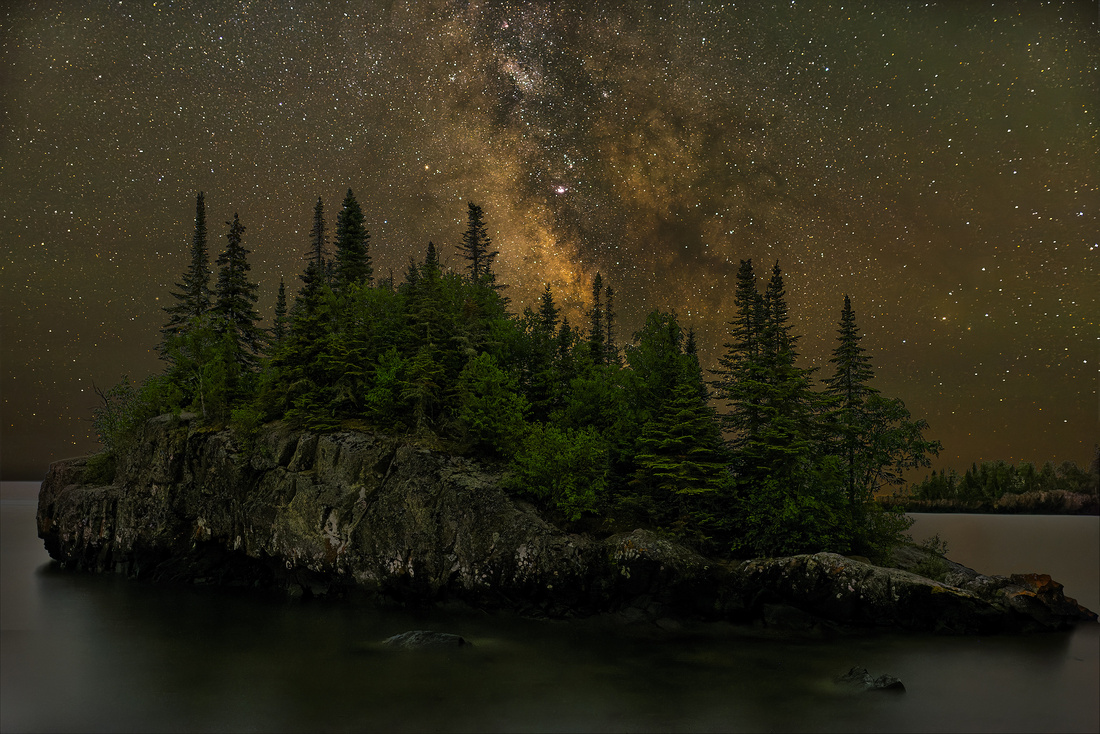
Home of Heavenly Skies and the Best Donuts
Seeing the Milky Way is always thrilling to me. In fact, I drove 9½ hours to Grand Marais, Minnesota last July just to experience and photograph our galactic home.
But if you’ve never seen the Milky Way, you’re not alone.
This river of stars once dominated the heavens and human imagination for millions of years. But now, it’s merely a fading memory to one-third of humanity and 80 percent of Americans. The reason? Light pollution.
And Wait; There’s More!
Grand Marias is also the home to World’s Best Donuts. Ranked #2 by Travel Advisor out of 26 restaurants in town, it’s a must-stop destination for every donut lover. Between the night sky and the donuts, it’s downright “heavenly” being there!

The Great Rift
Once you drive a few miles out of town, the sky is truly dark. Looking up, you’ll see that famous river of stars arcing 180 degrees across the night sky.
But what should be an unbroken river of stars is split down the middle by a dark lane known as the Great Rift. You can see part of the Great Rift in my photograph of the Milky Way core rising over a small island near Horseshoe Bay in Lake Superior outside Grand Marias.
The Great Rift is dark because starlight is being blocked by interstellar dust. But it’s not the dust you think of around the house. This dust comes from dead stars.
Incredibly tiny grains of silicates, iron, and/or carbon are blown into space when a sun dies. The grains then accumulate hydrogen, oxygen, and nitrogen forming an icy mantle of water ice, methane, carbon monoxide, and ammonia.
Interstellar dust is the size of a mere particle of smoke. And there’s only one interstellar dust particle per million cubic meters of space. That’s the equivalent of a few dust motes floating around the entire 107,544-seat Ohio Stadium.
Over the incomprehensible distances in our galaxy, there’s enough dust to block the light from the stars in the middle of the Milky Way.
"…all are of the dust, and all turn to dust again." Ecclesiastes 3
As I appreciated the Great Rift that July evening, I was reminded that our Sun, Earth, and entire Solar System were formed from that dust 4.5 billion years ago. And in another 5 billion years or so, our Sun will die giving rise to countless particles of interstellar dust to begin the process anew.
Thanks for looking,
Chuck Derus
]]>
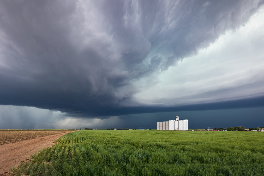
I enjoy storms. And there’s nothing like the beauty and fury of supercell storms on the Great Plains in the Spring and early Summer.
Last May, I joined Silver Lining Tours on a weeklong photography-oriented tour. They are experts in knowing where to find storms and how to approach them safely. We drove over 3,000 miles through four states during the weeklong tour.
On May 24, we were in Kansas chasing a storm. While it looked promising, it never started spinning enough to become a tornado threat. And it never produced much cloud-to-ground lightning.
At 7:11 PM near Deerfield, Kansas we spotted a grain elevator and started shouting “Photo op!”
Our driver pulled off the road at the location tagged in the orange ellipse at the bottom of the map below. Wolf Grain (red ellipse) looked to be a perfect subject to provide a sense of scale to the towering clouds above us.
The Shot
Landscape photography is usually a slow paced, contemplative process. That isn’t always possible with storms. You might have to “bug out” at a moment’s notice. Approaching lightning, hail, rain, high winds, and tornadoes all demand your attention.
The road leads to the updraft area of the storm. The streamers at the end of the road are rain shafts.
The entire dark cloud bank stretching across the middle is a "shelf" cloud. The interface between rising air in front of the storm and descending rain-cooled air behind the cloud line creates the shelf.
Radar indicated that large hail was headed our way. We only had two minutes to pile out of the van, compose, and take the shot. After that, we hustled back into the van and drove to a safer location.
It was a week without any pictures of beautiful, sculpted supercells or tornadoes. But it was a week of dramatic clouds over a variety of Great Plains structures. Of all the shots I took during the week, this one turned out to be a favorite.
Thanks for looking,
Chuck
P.S. I want to thank Allan Fisher, Storm Preparedness Consultant Meteorologist, and fellow Naperville Photogenesis Camera Club member for his assistance in identifying the cloud structures.
]]>
A “Butte” Of A Morning
Normally, you can easily see the Las Vegas strip and surrounding mountains through the airplane window as you taxi to the terminal. But when Jon Christofersen and I landed there on August 7, this was the view.
Smoke from the Northern California wildfires had blown into the region. Air quality in Las Vegas and much of the southwest was rated as “unhealthy” to “very unhealthy.” The visibility dropped to 2 miles in many locations.
Best Laid Plans…
After a quick survey of where the smoke was headed, we scrapped our plans to drive North to Utah. Instead, we headed East to Tuba City, Arizona and hopefully clearer skies. After smoke ruined our sunrise and sunset shots, we drove three hours South to Sedona, Arizona. Air quality readings there looked more conducive to photography.
Our challenge was to quickly scout locations. Neither of us had been there before. Pressed for time, Jon identified a promising sunset location. Here he is scouting in the late afternoon.
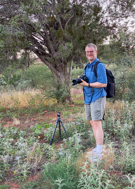
Sunset turned out to be a bust because it was severely clear. While tourists love clear blue skies, it’s a photographer’s nightmare.
On the way back to the hotel, Jon identified Bell Rock butte as a possible sunrise location. It’s just north of the Village of Oak Creek, Arizona, south of Sedona. With an elevation of 4,919 feet, it stands out nicely from the surrounding area.
We took the hike that reaches a small plateau on the northwest face of the butte at twilight. Along the way, I snapped an iPhone scouting photo and planned to return to this spot well before sunrise the next morning.
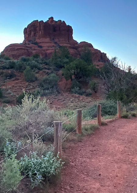
The Shot
The morning and the location turned out to be a “butte” (sorry). The difference between the scouting photo and the Friday Photo is a good illustration of why the quality of the light and the sky is so important in landscape photography. Besides the pretty light, we lucked out with a few clouds that drifted by at an opportune time.
Thanks for looking,
Chuck
]]>
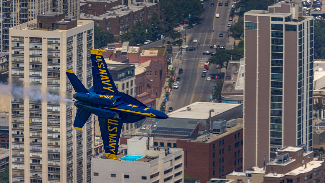
75 Years of Blue Angels
Established in 1946
The Blue Angels were established as a Navy flight exhibition team in April 1946 by Admiral Chester Nimitz. It’s the second oldest formal aerobatic team in the world, after the French Patrouille de France formed in 1931.
Admiral Nimitz had several motives. He wanted to boost Navy morale, demonstrate naval air power, maintain public interest in naval aviation, and help the Navy generate public and political support for a larger allocation of a shrinking defense budget.
Today’s Squadron
Five Navy pilots and one Marine Corps pilot fly the six Boeing F/A-18 Super Hornets in the squadron. It takes an additional 134 active-duty Sailors and Marines support the six aircraft and pilots.
Now in their 75th year, the Blue Angels have thrilled over 450 million spectators worldwide. But they also work quietly between airshows. The squadron spends time visiting hospitals, schools, and community functions in each air show city.

Source: Dayton Children’s Hospital
According to commanding officer Commander Brian C. Kesselring, “At schools across the country, the team takes time to interact with students and discuss the benefits of military service and the excitement of naval aviation across the country, hoping to inspire others to pursue their own dreams.”
Why Blue Angels?
The squadron was originally formed as the Navy Flight Exhibition Team. After a visit to The Blue Angel nightclub in New York City, they were renamed and introduced for the first time in July 1946 as the Blue Angels. I wish I knew more of the details behind the name change!
The Photo
I became aware of an opportunity at 875 North Michigan Avenue (formerly the Hancock Tower) to photograph the Blue Angels rehearsal for the truncated Chicago Air and Water Show last Friday. The observation deck on the 94th floor was reserved for photographers from 10 AM to 1 PM.
I drove downtown with fellow photographer and Naperville resident Rich Kolar. After a quick elevator ride of nearly 1,000 feet, we stepped out onto the observation deck. It was a magnificent vantage point to view the city and the Blue Angels rehearsing for Saturday’s show.
We were thrilled watching and photographing the planes. It was a lot harder than I thought. Distant dots quickly became “blue streaks” whizzing past the windows. Out of all the shots I took that day, I enjoyed this frame with a jet superimposed against the city.
Another thrill was to see CBS2 Meteorologist Mary Kay Kleist feature the image in her weather cast the same day!
Thanks for looking,
Chuck
]]>
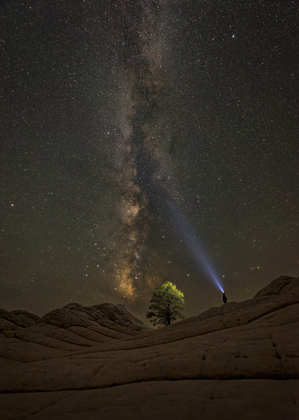
“A still more glorious dawn awaits. Not a sunrise, but a galaxy-rise. A morning filled with 400 billion stars. The rising of the Milky Way.”
― Carl Sagan, Cosmologist
The previous six days were tough. Smoke from the California wildfires greyed out the skies in the north. And severely clear skies south of the smoke were boring. Fellow photographer Jon Christofersen and I were hopeful that conditions would be favorable on Friday.
Where Am I?
The location is a 100- by 800-yard section of the Paria Plateau in the Vermillion Cliffs National Monument near Page, Arizona. Known as White Pocket, this small area features awe-inspiring slickrock with layers of orange, yellow, and white formations created over eons by mineral deposits and shaped by the elements. It’s a photographer’s dream.
There’s one reason the place isn’t overrun by visitors. The road there is downright gnarly. It rates a 5 on a scale of 1-5 (with 5 being most difficult). You need a high clearance, 4WD or 4X4 vehicle and about 2.5 hours to drive the 36 miles from highway 89 to White Pocket. If you get stuck, there’s usually no cell service and tow charges start at $1500.
There are plenty of signs telling you there is no shade, no water, no food, no cell service, and no direction signs at White Pocket. The best “no” is no light pollution. It’s incredibly dark at night making it an ideal location for landscape astrophotography.
We had the place completely to ourselves that evening.
What Is That?
At the bottom of the photo is an upwards sloping sandstone formation. It leads to, and frames, the only tree in White Pocket.
From left to right on the horizon are sandstone hills, the lone tree, our Milky Way galaxy over the tree, and me aiming a headlamp at the heavens from another hill.
We set up for the shot after moonset around 10:30 PM. By 12:30 AM, the Milky Way had moved from left to right directly over the tree. The dense core of stars (the galactic center) was clearly visible above the horizon and over the tree. I climbed the slope to the right of the tree, aimed my headlamp at the sky, and had Jon take the picture.
The cool, blue light of my LED headlamp contrasted nicely with the natural red browns of the Milky Way. And it illuminated part of the tree and surrounding hills. We switched places and I took a photo of Jon.
We spent another few hours photographing and staring at our galaxy. It spanned 180 degrees over our heads from the South in front of us all the way to the Northern horizon. Here we were staring at 400 billion neighboring stars with countless unseen planets orbiting those stars in a galaxy that formed13.2 billion years ago.
After finishing our photography, we hiked out to the parking area and curled up in our tent. It was 2:00 AM and we had a 5:45 AM wakeup alarm to catch the sunrise at White Pocket.
Thanks for looking,
Chuck
]]>

“When I got the tattoo, I knew I was drawing a crooked line between myself and society.”
― Warren Ellis, Crooked Little Vein
Here’s part two of my adventures at the Villain Arts Tattoo Festival. Be sure to mark March 18-20, 2022, on your calendar to visit the 12th Annual Chicago Tattoo Arts Convention at the Stephens Convention Center in Rosemont. Check out Tattoo Conventions. Top tier Tattoo Artists from around the world (villainarts.com) for details and additional tattoo conventions around the country.
You might just come home with more than a memory. And if you do, you’re eligible to be featured in a future Friday Photo!
There’s no Friday Photo next week as I’ll be on the road in the southwest taking pictures for future posts.
Thanks for looking,
Chuck

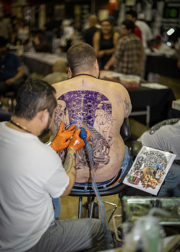


]]>
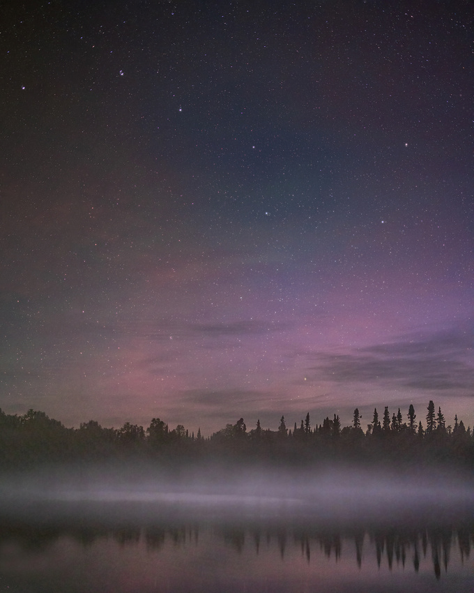
Asterism [ˈastəˌrizəm]
Astronomy—A prominent pattern or group of stars, typically having a popular name but smaller than a constellation.
The Big Dipper is a large asterism consisting of seven bright stars of the constellation Ursa Major. Four stars define a "bowl" and three define a "handle.” This distinct grouping has been recognized for millennia.
By http://en.wikipedia.org/wiki/User:B00P & me (SAE1962 10:04, 2 April 2008 (UTC)) - English Wikipedia, but modified it., CC BY-SA 3.0, Source: https://commons.wikimedia.org/w/index.php?curid=3815568
In ancient Hindu astronomy, the Big Dipper is known as Sapta Rashi or The Seven Great Sages. Each of the seven stars represents one of the seven rishis of ancient India. In ancient Arabic astronomy, the stars of the Big Dipper symbolized a funeral procession. The Big Dipper’s bowl represents a coffin, and the three stars marking the handle are mourners following it.
According to Scandinavian mythology, the stars of the Big Dipper are called Odin’s Wain or Wagon. In Japan, the Big Dipper is called the “North Dipper.” These seven bright stars belonged to Ame-no-Minakanushi, the very first or one of the first deities that created heaven and earth.
And in Korea, the constellation of Ursa Major is referred to as the “seven stars of the north.” In a related myth, a widow with seven sons found comfort with a widower, but to get to his house they had to cross a stream. Each of the sons placed steppingstones in the river. Their mother, not knowing who put the stones in place, blessed them and, when they died, became the constellation.
Dad’s Astronomy Lessons
Some of my fondest childhood memories are going outside with my dad to explore the night sky. As an Air Force navigator on B-29 bombers and then C-130 cargo planes, his knowledge of astronomy kept the crew safely on course during long ocean crossings. There wasn’t any GPS back then! He used a timepiece and a sextant, like this Bausch and Lomb model A-8A to take a sight of Polaris, the North Star, to locate his position.

I was probably 7 or 8 years old when he pointed out the Big Dipper to me for the first time. He taught me that by extending an imaginary line through Merak and Dubhe, you can find Polaris, the North Star, in the Little Dipper. And finding north is the first step in staying “found” as a navigator.
The Shot
On July 9, at 3 am, I was on the shore of Cascade Lake near Grand Marais, Minnesota photographing the night sky. The “brisk” 41-degree temperature help form fog over the lake and simplify the scene. It also kept the normally ravenous mosquitos stupefied rather than hyperactive.
In addition, there were just a few interesting clouds and some color from the Northern Lights in the distance. Noticing the Big Dipper, I decided to make it the “star” of the show.
Just a half hour later, the best light had passed. I drove home exhausted and full of joy at experiencing such a special night sky. An hour later, I was back to the hotel for some much-needed sleep in a warm bed.
Thanks for looking,
Chuck
]]>

“Show me a man with a tattoo and I'll show you a man with an interesting past.”
Jack London
If it moves, I generally don’t photograph it. I’m much more comfortable and interested in landscape and architecture. But it’s good to get out of your comfort zone occasionally.
So, what’s a better challenge for a nature photographer than attending a tattoo festival?
Last Saturday I drove to the Stephens Convention Center in Rosemont, Illinois to see and photograph the Villain Arts Tattoo Convention. I certainly got my $20 dollars’ worth!
The convention featured 400 of the World’s Best Tattoo Artists. They were tattooing live, sometimes working two days to complete a complex design. And the sideshow acts featured live human suspension, burlesque and more!
In case you’re wondering, I only came home with photographs. The artists and tattooed attendees were all happy to be photographed and chat about their works of art.
Instead of writing more, I’ll let the photographs tell the story!
Part 2 is next week.
Thanks for looking,
Chuck


]]>
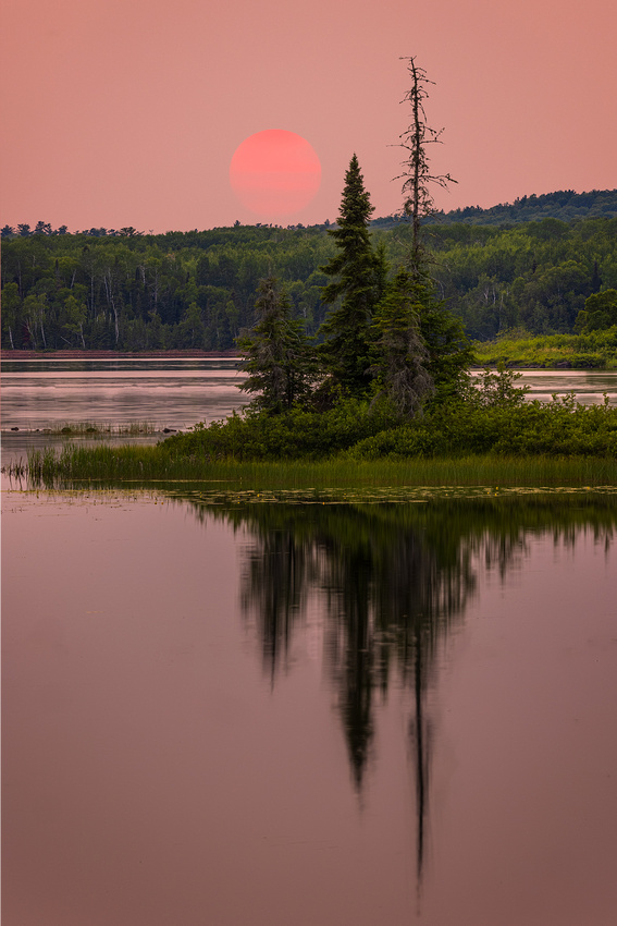
“There is nothing more musical than a sunset.” Claude Debussy
I just returned from five nights of photographing the night sky in Grand Marais, Minnesota. Why Grand Marais? It’s away from light pollution and the dark skies are filled with stars.
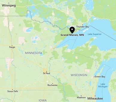
Control What You Can Control
Photographers pride themselves on controlling as many aspects of a photograph as possible. We carefully work the light, composition, and exposure in the field along with the processing afterwards in Photoshop to create an image. But some things are just out of our control.
Sky conditions are one of those things that are out of our control. I had hoped to capture a few sunsets along with the night skies. But the first three evenings in Grand Marais were “severely clear,” lacking any clouds. While that’s great for night photography, it makes for boring sunset images.
On the fourth evening, the winds started blowing in smoke from a massive forest fire in Saskatchewan, Canada. The sky became so hazy that you could barely see the sun and the clouds were invisible.
The Shot
My usual lens is a wide-angle that captures a wider field of view than our vision can. But that would have meant including a large expanse of boring, featureless sky. Instead, I pulled out my telephoto lens and concentrated on a small, distant part of the scene.
The smoke worked to my advantage turning a normally blinding sun into a soft pastel orb. And the telephoto lens allowed me to concentrate on an island with several visually interesting trees and reflections.
Thanks for looking,
Chuck
]]>
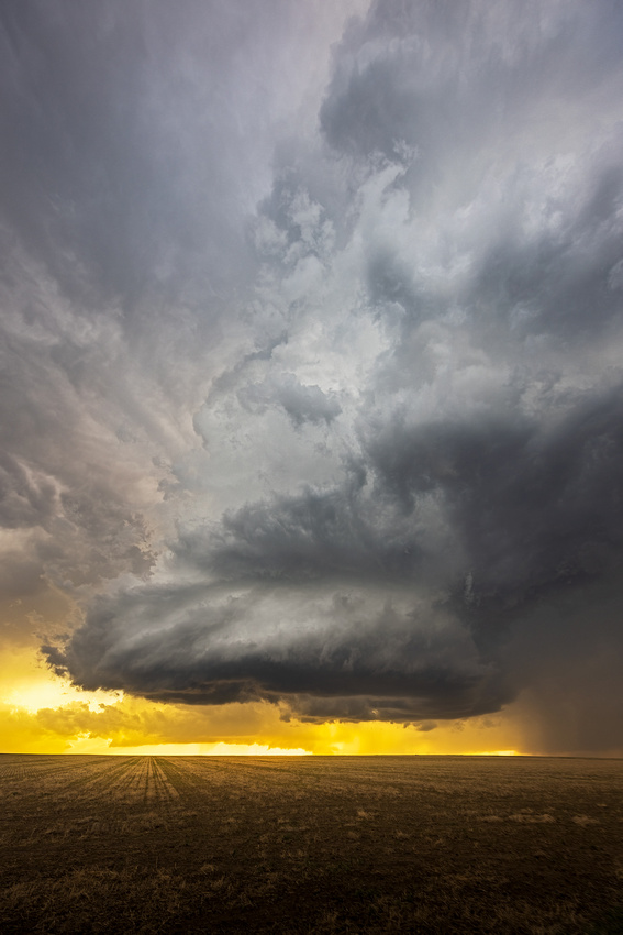
The Supercell Thunderstorm
Who doesn’t enjoy looking at storm clouds? Chances are that you’ve looked up on a May, June, or July day and seen a very tall storm cloud with an anvil shaped top that stretches east as far as you can see. If so, you’ve probably seen a supercell thunderstorm.
Supercells are the least common type of thunderstorm. But supercells can produce severe weather, including damaging winds, large hail, and sometimes tornadoes. The recent Naperville tornado that passed two blocks south of my home was spawned by a supercell.

Mary Mahoney in front of a downed tree in the Winding Creek subdivision in Naperville. Photo by Dennis Mahoney.
What makes a supercell unique from all other thunderstorm types is that it contains a deep and persistent rotating updraft called a mesocyclone. Wind shear sets the stage for a supercell. Differences in wind speed or direction over a relatively short distance in the atmosphere (red arrows) start the air spinning.
By Vanessa Ezekowitz - Meso-1.PNGSupercell02.jpg, CC BY-SA 3.0, https://commons.wikimedia.org/w/index.php?curid=4446779
The rising of large volumes hot, wet air (blue arrow) then bends the rotating updraft upwards.
By Vanessa Ezekowitz - Supercell02.jpgMeso-2.PNG, CC BY-SA 3.0, https://commons.wikimedia.org/w/index.php?curid=4446798
Finally, you have a rotating updraft or mesocyclone, the hallmark of a supercell.
By Vanessa Ezekowitz - Supercell02.jpgMeso-3.PNG, CC BY-SA 3.0, https://commons.wikimedia.org/w/index.php?curid=4446808
Under the right conditions, the mesocyclone can spawn a tornado.
The Shot
On my May tornado chase, supercells started to form several times, but dissipated rapidly. This Kansas supercell looked promising, but started dying off around sunset. As we photographed it, the rotation slowed and the possibility of a tornado went away. But it still looked photogenic to me in the warm light of sunset.
Thanks for looking,
Chuck
]]>
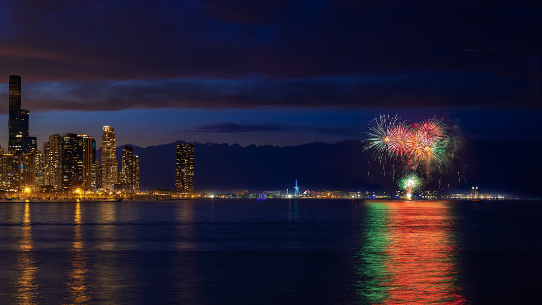
“That these United Colonies are, and of right ought to be, free and independent States, that they are absolved from all allegiance to the British Crown, and that all political connection between them and the State of Great Britain is, and ought to be, totally dissolved.” Virginia delegate Richard Henry Lee’s resolution to Congress
Officially, the Colonies’ Second Continental Congress declared independence on July 2, 1776, when it adopted this resolution.
The Declaration of Independence draft was written by John Adams, Roger Sherman, Robert Livingston, Benjamin Franklin, and Thomas Jefferson. Congress made 86 changes and approved the document just two days later on July 4, 1776.
The Declaration wasn't actually signed until August 2. John Hancock, President of the Congress, signed first, in the middle, with an unmistakable flourish. The 55 others signed by state delegation in five columns arranged from the northernmost state (New Hampshire) in the upper left to the southernmost (Georgia) in the lower right.
July 2 or July 4?
Should Independence Day be July 2 or July 4?
John Adams thought July 2. In a letter to his wife Abigail, he wrote: “The second day of July 1776, will be the most memorable epoch in the history of America. I am apt to believe that it will be celebrated by succeeding generations as the great anniversary festival. It ought to be commemorated as the day of deliverance, by solemn acts of devotion to God Almighty. It ought to be solemnized with pomp and parade, with shows, games, sports, guns, bells, bonfires, and illuminations, from one end of this continent to the other, from this time forward forever more.”
Other Founders thought July 4, the day currently recognized as a federal holiday. And still other Founders thought “What Independence Day?” since the holiday wasn’t widely celebrated until many of them had passed away.
The late historian Pauline Maier said in her 1997 book, American Scripture: Making the Declaration of Independence, that no member of Congress recalled that it had been almost a year since they declared their freedom from the British. They finally remembered the event on July 3, 1777, and July 4 became the day that seemed to make sense for celebrating independence.
Maier also said that arguments over the how to celebrate the Declaration arose between the Federalists (of John Adams) and the Republicans (of Thomas Jefferson). The Declaration and its anniversary day weren’t widely celebrated until the Federalists faded away from the political scene after 1812. Interestingly, Jefferson and Adams both passed away on the Fourth of July in 1826.
On June 28, 1870, Congress created the first four Federal Holidays which included Independence Day on July 4.
Oooo…Ahhh…
Fellow photographer Jon Christofersen and I visited the Adler Planetarium spur Wednesday to photograph the Navy Pier fireworks. It was a gorgeous summer evening. Our large cameras attracted several tourists who handed us their phones asking us to take their pictures!
During prior visits, the fireworks were in front of the Pier. With that in mind, we set up for a timelapse. Unfortunately, the fireworks started going off east of the pier and out of the frame of our cameras.
We quickly panned our cameras to the east and captured the display. Later, in Photoshop, I moved my best fireworks frame to a location in front of Navy Pier. I normally don’t manipulate photos, but I decided to make an exception.
Thanks for looking and have a wonderful holiday weekend,
Chuck
]]>

Life At The Old Joliet Prison In 1951
According to the October 27, 1951, issue of the Saturday Evening Post, Old Joliet was “America’s Toughest Prison.” See 18915626.pdf (saturdayeveningpost.com) for a fascinating read about prison life at the time.
“A lot of people have the idea that to go to prison means merely to withdraw from free society. They think it might be a rather monkish experience. Nothing could be more mistaken. Going to prison is not merely withdrawing from free society; it is entering caged society. There is no peace in prison.”
Here’s a typical day in 1951:
- Wakeup bell in the cellhouse at 6:15 AM
- Clean your cell and stand at the door to be counted by 6:45
- Step out onto the gallery and line up with the other prisoners at 6:45
- Move down the iron stairs of the four tiers to a short tunnel and into the big circular dining room for breakfast
- Eat quickly; you have 20 minutes to eat before being marched back to your cell and locked in at 7:15
- At 7:45 you march to your job
- By 11:15 you march to the dining room
- Back to your job at 12:15 PM
- At 3:30, back in your cell
- March to dinner at 4:00
- Dinner is over and you march back to your cell at 4:30, get counted, and locked in for the night.
- Lights out at 9:00.
Losing Privileges and Going to The Hole
Breaking any of the 111 rules had consequences. Having your hands in your pockets in line, walking out of step and going to the toilet during a movie usually meant being deprived of movies or other privileges.
Possessing a betting slip tacked on another 27 months before you could appear before the parole board. And you also lost all privileges during those 27 months including smoking, going to the commissary, spending money, and going to shows and ball games.
Carved into the floor as you walk into solitary confinement.
Sometimes you were sent to The Hole (solitary confinement) for breaking the rules. Solitary meant sleeping on the concrete with only a single blanket. In addition, you were behind double doors with bars and solid wood.
Also, the window was a small slit. And while there was a water faucet and a rusty cup, you didn’t get a toilet. You just got a bucket that was emptied every 12 hours. Finally, there was only one meal a day. When you went back to your regular cell, it must have felt wonderful.
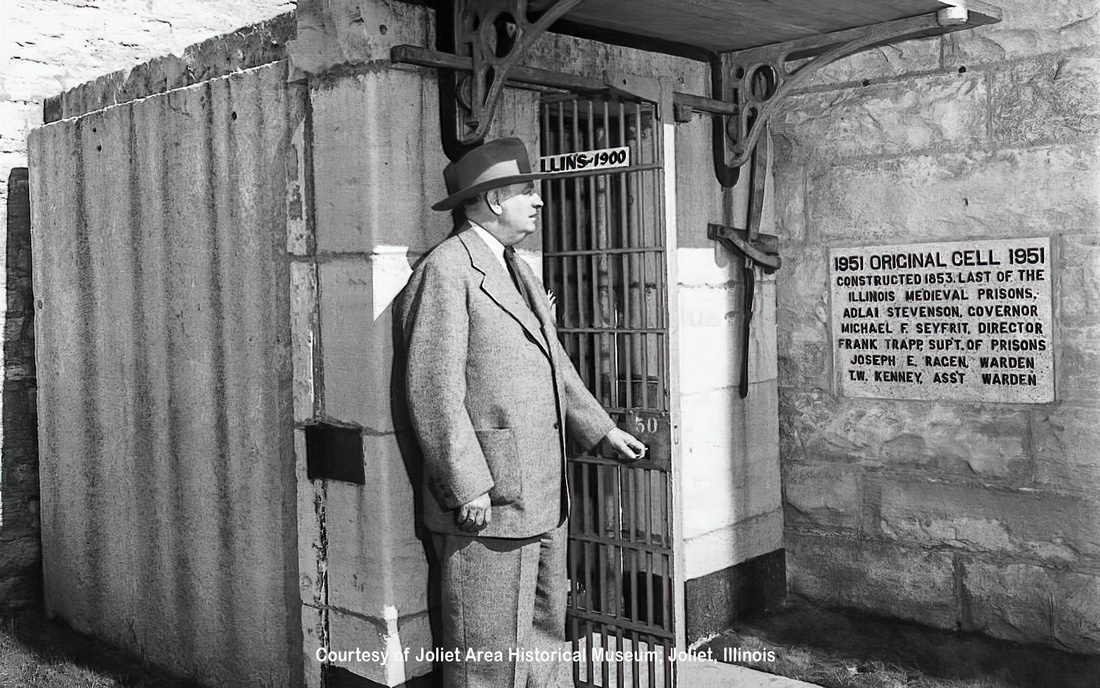
Original “Medieval” cell in 1951 (see wall plaque). Copyright Joliet Area Historical Museum
“Hoop Dreams”
I don’t know when the basketball court was installed at the prison. It must have been a welcome relief from prison routine to be able to get out and shoot hoops outside.
The photograph was taken on my recent tour of Old Joliet. It was eerie to imagine playing basketball with concertina wire marking the out of bounds.
Thanks for looking,
Chuck
]]>
Do You Want to Go to Prison?
It was a tempting offer. Friends Dave Fox and Paul Teodo were going to prison. And not just any prison; this was the Old Joliet Prison in Joliet, Illinois. We were going on a tour.
The Old Joliet Prison is probably best known for its most popular, yet fictious inmate, “Joliet Jake” from the 1980 movie The Blues Brothers.
Closed in 2002 and heavily vandalized, the City of Joliet finally received permission to take over the prison in December of 2017. The Old Joliet Prison Preservation Coalition has worked on stabilizing the site since then. The Coalition has benefited from over 6,500 volunteer hours, one million dollars in in-kind labor and donations, and nearly $200,000 in fund raising.
Self-guided tours are $20. For an extra $10, you can take the guided tour. And for $40, a former guard can be your docent.
A Famous Architect
The prison’s iconic castellated Gothic architecture was designed by Chicago architect W.W. Boyington. You can also see a similar design in his famous Chicago Water Tower. The use of Joliet limestone was a trademark of his designs. The stone was quarried locally in Joliet and used to erect structures all around the country.
Interestingly, just below the topsoil of the prison is Joliet limestone. That ruled out tunneling as a means of escape.
“The Pride of Her Citizens”
After opening in 1858, the Chicago Tribune wrote “We came away fully impressed with the belief that the important trusts at Joliet are in good hands, that there is growing a State work which will be for long years to come the pride of her citizens.” That was just six years after Joliet was incorporated.
Over time, the Illinois State Penitentiary, Joliet, became simply known as the “Old Joliet Prison.” It replaced Illinois’ first state penitentiary in Alton, built in 1831. Alton had been privately managed.
Conditions at Alton were horrendous. After an inspection in 1847, noted reformer Dorothea Dix personally petitioned the Illinois General Assembly to construct a new penitentiary.
The Assembly agreed, and on May 22, 1858, fifty-three inmates arrived in Joliet to begin construction of the new Illinois State Penitentiary. They built the prison around themselves, supplying the labor which included quarrying the local limestone.
Prison discipline was severe. Male prisoners were only allowed out of their cells on Independence Day during the early years of the prison. And the women weren’t allowed out at all.
An Independence Day Celebration
Built with the promise of better conditions, the situation quickly deteriorated. By 1878, the Prison was well over capacity with nearly 2,000 inmates. By 1905, the reports of unsanitary and dangerous conditions prompted a call for the prison to be closed.
The 1926 construction of Stateville Penitentiary five miles north of Old Joliet Prison was intended to close Old Joliet. But it took until 2002 for then-Governor George Ryan to close the 144-year-old prison for budgetary reasons.
The Shot
The regular self-guided tour is largely restricted to the exterior. But you can go a few feet into the East Cellblock for a look down the row of cells. To me, it was the most interesting photograph I took that day.
Thanks for looking,
Chuck
]]>

A Thunderstorm by Emily Dickinson
The wind begun to rock the grass
With threatening tunes and low, —
He flung a menace at the earth,
A menace at the sky.
The leaves unhooked themselves from trees
And started all abroad;
The dust did scoop itself like hands
And throw away the road.
The wagons quickened on the streets,
The thunder hurried slow;
The lightning showed a yellow beak,
And then a livid claw.
The birds put up the bars to nests,
The cattle fled to barns;
There came one drop of giant rain,
And then, as if the hands
That held the dams had parted hold,
The waters wrecked the sky,
But overlooked my father's house,
Just quartering a tree.
Being There and Landscape Photography
The weather doesn’t always cooperate. And if you allow yourself to be frustrated, you’ll never get a good photograph under less-than-ideal conditions.
It was one of those weeks recently while storm chasing. Just as a storm appeared to be on the verge of becoming a classic supercell, the atmospheric conditions caused it to die. And without supercells, you don’t get tornadoes. Even the day the National Weather Service issued a moderate warning (it’s rare) for severe storms, nothing within hundreds of miles of our “perfect” location became severe.
So, when you don’t get what you’re looking for, look for something else! You need to enjoy just being there to “see” other possibilities.
The Shot
With that in mind, my three van mates on the storm chasing tour all started yelling “abandoned house” one afternoon. In the distance was a classic abandoned, weathered, and decrepit farmhouse on a hill. Dark, ominous clouds were racing towards the structure.
We stopped on the side of the road, piled out of the van and hurriedly took pictures as the storm approached. Within minutes, the light changed, and the storm’s hail was getting too close for comfort.
We piled back in the van, just avoiding the rain and hail, savoring our chance to witness the scene. Later in the day, Caryn, the co-owner of the tour told us it was the only time in over ten years of chasing that the photogenic farmhouse was framed by interesting clouds.
I’m glad we choose to “be there” and see the moment.
Thanks for looking,
Chuck
]]>
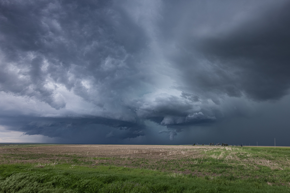
What’s That Roar?
Last week I was storm chasing on the Great Plains. I went with the Silver Lining Tours (https://www.silverliningtours.com/) photography tour. We traveled almost 3,000 miles of Colorado and Kansas backroads in search of thunderstorm supercells and the tornadoes they sometimes spawn.
You may be wondering if it’s dangerous. Staying safe on my own would have been very chancy. But the tour’s co-owners Roger and Caryn Hill are a formidable meteorological team. Roger earned a spot in the Guinness Book of Records by witnessing over 850 tornadoes.
I felt safe. The real danger is eating fast food for a week. I’ve actually sworn off French fries since I got back.
Back to the Roar
No tornado is present in this photo. There’s a small, barely rotating supercell in the right center with a wall cloud (where tornadoes form) hanging down from it. What appears to be a tornado below the wall cloud is SCUD (strata-cumulus under deck). On the left is a shelf cloud ahead of a new storm.
I never saw a tornado last week. But I heard a sound I had never heard before standing in that field near Winona, Kansas. It was a continuous low rumble like thunder. But it wasn’t thunder because it was occasionally punctuated by the sharp crack of actual thunder. What was it?
Caryn answered my question. We were standing under the precipitation-free anvil a few miles away from the updraft base in the path of the storm. The hail, heavy rain, and light rain were approaching us.
What I was hearing was hail roar. In the cloud’s updraft, millions and millions of suspended hailstones were colliding. Their collective grinding tens of thousands of feet above us was what I was hearing.
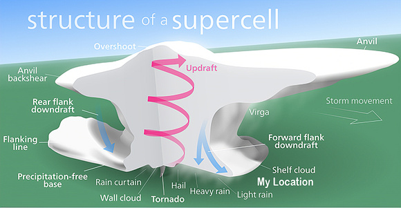
By Vanessa Ezekowitz - Supercell02.jpgMeso-3.PNG, CC BY-SA 3.0, https://commons.wikimedia.org/w/index.php?curid=4446808
Hail
Hail is a form of precipitation consisting of solid ice that forms inside thunderstorm updrafts. Raindrops carried upward by the updrafts into extremely cold areas of the atmosphere then freeze. Hailstones can grow by colliding with liquid water drops that freeze onto the hailstone’s surface.
Hail falls when it becomes too heavy to be suspended by the strength of the thunderstorm’s updraft. Smaller hailstones can be blown away from the updraft by horizontal winds, so larger hail typically falls closer to the updraft than smaller hail.
How fast it falls depends on several factors, including size. Small hailstones (diameter <1-inch), fall between 9 and 25 mph. The 1-inch to 1.75-inch diameter hailstones seen in a typical severe thunderstorm fall between 25 and 40 mph. Strong supercells produce 2-inch to 4-inch diameter that can fall at speeds between 44 and 72 mph.
Exceptionally large hailstones with diameters exceeding 4-inches can fall at over 100 mph. The largest hailstone recovered in the United States fell in Vivian, South Dakota, on June 23, 2010, with a diameter of 8 inches and a circumference of 18.62 inches. It weighed 1 lb. 15 oz!
The Shot
Most of a storm chasing trip is driving. Typically, you get to a safe, photogenic location and have minutes to take a picture before driving to a new location. Very occasionally, you get a slow-moving supercell that you can watch for an hour or so.
This cell was moving at 45 mph se we only had a few minutes to appreciate the hail roar and the storm’s beauty before leaving. This supercell was dying, and we needed to drive 50 miles to our next location to pick up a new line of storms that were forming.
Thanks for looking,
Chuck
PS Thanks to Allan Fisher for reviewing my meteorology!
]]>
25 Or 6 To 4 By Robert Lamm of the Band “Chicago”
Waiting for the break of day
Searching for something to say
Flashing lights against the sky
Giving up I close my eyes
Sitting cross-legged on the floor
25 or 6 to 4
Staring blindly into space
Getting up to splash my face
Wanting just to stay awake
Wondering how much I can take
Should I try to do some more
25 or 6 to 4
Feeling like I ought to sleep
Spinning room is sinking deep
Searching for something to say
Waiting for the break of day
25 or 6 to 4
25 or 6 to 4
Early Morning Wakeup
My alarm was set for 3:34 am last Saturday morning. I was headed to 360 Chicago, the observation deck atop the 100 story 875 North Michigan Avenue building (formerly known as the John Hancock Center). The deck was opening at 4:30 am to a limited number of photographers with tripods.
I realized I woke up at the same time as Chicago’s hit song, “25 or 6 to 4.” Written by founding member Robert Lamm, it was recorded in 1969 for their second album. Sung by lead vocalist Peter Cetera, the double album was released in January 1970. Edited and released as a single in June, it climbed to number 4 on the US Billboard Hot 100 chart. It was the band's first song to reach the top five in the US.

I just about wore out my copy of that album. And for years I speculated about the meaning of 25 or 6 to 4. In case you weren’t around in the 60s and 70s, finding hidden messages and double meanings in rock lyrics was rampant. Think Lucy In The Sky With Diamonds, for example. "25 or 6 to 4" could have meant anything from a quantity of illicit drugs to the name of a famous person in code.
Mystery Solved
It wasn’t until 2013 that an interview cleared things up. Lamm said “The song is about writing a song. It’s not mystical.” The song's title is the time at which the song is set: 25 or 26 minutes before 4 AM.
Looking at the lyrics, many of same thoughts crossed my mind during the countless “all-nighters” in medical school, residency, and moonlighting. And it seemed to apply to my photographic early wake-ups.
The Shot
I arrived about 4:40 am and walked into a dark and silent 360 Chicago with about 25 other photographers. I set up looking South and waited for some sunrise color. There was a band of color on the horizon, but the hoped-for light show never materialized.
This shot was my favorite, taken around 5 am. I spent the next hour wandering around and admiring the view before heading back to Naperville and home.
Thanks for looking,
Chuck
]]>
Land of Fire
An Icelandic volcano is in the news. After nearly 800 years of inactivity, the Fagradalsfjall volcano erupted on the Reykjanes Peninsula on March 19, 2021.
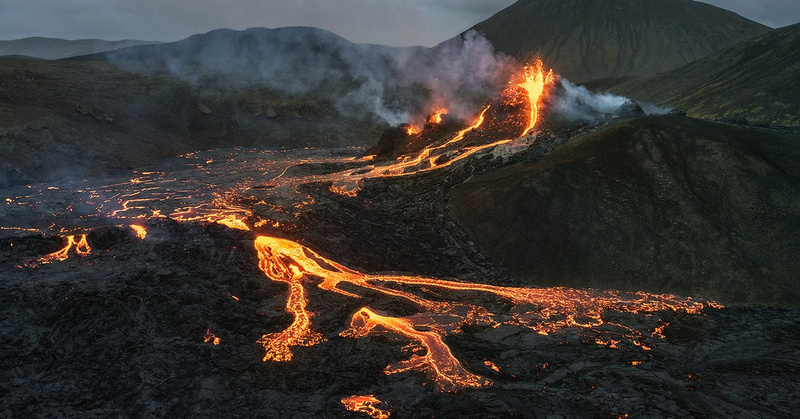
Source: Semi-private 5-Hour Tour to Fagradalsfjall Volcano | Witn... (guidetoiceland.is)
This isn’t unusual. Iceland is quite volcanically active. On average, eruptions occur roughly every three years.
Notable eruptions have included Eldgjá, the world's largest basaltic eruption ever witnessed in the year 934. Laki, in 1783, was the world's second largest. Several eruptions have occurred beneath ice caps creating devastating glacial bursts.
In 2010, Eyjafjallajökull erupted causing massive meltwater floods forcing 600 people to flee their homes. You may remember when the ash cloud grounded air travel in northwest Europe for six days.
Part of the reason for all the volcanism is Iceland’s location. The island is bisected by the separating North American and Eurasian tectonic plates.
Source: https://commons.wikimedia.org/wiki/File:Iceland_Mid-Atlantic_Ridge_map.svg
After a Volcano
According to Atlas Obscura, “In Iceland, you can’t just have a stunning lake. No, it also has to be inside of a volcanic caldera. And sometimes that’s not even enough, so the showiest country in the world provides something like Kerið Crater Lake, which is a nearly neon blue lake sitting in a volcano surrounded by rare red volcanic rock.”
Kerið is in southern Iceland. While most crater lakes are created from a caldera explosion, Kerið didn’t. It’s thought to have formed 3,000 years ago when the magma in the center simply depleted itself and the empty chamber beneath caved in.
The perfectly oval-shaped caldera is approximately 180 feet deep, 560 feet wide, and 890 feet across. Now filled with 45 feet of bright, sapphire-colored water and surrounded by a rainbow of colors, it looks out of this world.
The Shot
This quick shot of Kerið was taken in 2017. It rained almost constantly for my 10-day trip there in the month of February. Fortunately, it stopped raining long enough to wipe off my lens and take this picture. Soon afterwards, the rain restarted, and we had to put our cameras away.
Thanks for looking,
Chuck
]]>
Badlands Part Two
Weather is a fact of life. Photographers love a fiery sky with warm sunrise light bathing the landscape. But no matter how well you plan, you really don’t know what nature will provide until you’re in the moment.
I was tired. Sunrise was at 5:18 last July when I was in Badlands National Park in South Dakota. It was the fourth morning I’d set my alarm for 3:15 to get up in time to drive an hour into the park, walk to my location, and arrive a minimum of 45 minutes before sunrise.
On multiple occasions, my early morning alarm has gone off and I’ve been greeted by solid cloud cover or rain. Once, in Iceland, it rained for 10 straight days without ever stopping. On those days, instead of nature’s light show, you get a gloomy progression from a featureless dark sky to a featureless gray sky. It’s a photographer’s nightmare.
When my alarm went off that morning in the Badlands, I could hear rain falling outside. I’ve heard that sound enough to know that the morning would likely be a photographic bust. But sometimes, the transition from rain to clearing skies produces storm light with brilliant reds, yellows, and oranges that take your breath away.
The strong temptation, after three days of early wakeups and late nights, was to roll over and go back to sleep. Telling myself that I could always take an afternoon nap, I rolled out of bed and got ready to leave.
The Shot
The rain was rapidly diminishing as I walked from the road into the backcountry. And to the east, a thin sliver of clear sky appeared. After waiting a while, the rising sun lit up the underside of the clouds overhead bathing the area in a radiant magenta.
After taking the shot featured in last week’s Friday Photo, I moved a few feet to this location.
Using Photoshop, I had to tone down the reds in this image. The morning light was so intensely red that you wouldn’t believe it unless you were there.
Walking back to my car, I was so grateful that I opted to take a chance and show up rather than sleep in. I would have missed one of the best sunrises I’ve ever experienced.
The morning reminded me of Cheryl Strayed’s line in the movie Wild. “There’s always a sunrise and always a sunset and it’s up to you to choose to be there for it…Put yourself in the way of beauty.”
Thanks for looking,
Chuck
]]>
Badlands Memories
My wife and I saw the Oscars’ Best Picture Nomadland in a theatre last weekend. After a year of streaming, watching a movie on the big screen was exhilarating. And the scenes shot in South Dakota’s Badlands National Park brought back memories of my trip last July.
While viewing the movie, I recognized many of the scenic overlooks that were featured. The park’s 244,000 acres of sharply eroded buttes, pinnacles and spires, blended with the largest protected mixed-grass prairie in the United States, are beautiful.
But there is so much more to see besides the overlooks. Exploring the less visited backcountry is a way to appreciate more of the park’s beauty.
Snake Warnings
The Badlands are unique in many ways. One of them is the number of rattlesnake warning signs. They are everywhere.

Source: Trip Advisor
The only venomous snake in the Badlands is the prairie rattlesnake. Their range extends through the Great Plains, stretching from Canada to Mexico. Dusty-colored with dark, white-edged markings, prairie rattlesnakes can reach 5 feet in length.
Like the park’s other snakes, this species typically targets small mammals. Unlike the others, it hunts its prey using heat-seeking pits near the eye and kills victims with venom pumped through its fangs. They are typically nocturnal and hibernate during the winter.
Most visitors to the Badlands never see snakes. They almost always stay out of the way of people, spending the day in burrows and moving about mostly at night. Despite their reputation, rattlesnakes are timid. Their rattling and hissing noises serve to ward off potential predators. The best hiking advice is to keep an eye and ear out for snakes and watch where you place your feet and hands.
The Shot and the Snake
Despite the signs, we were comfortable walking through the grasslands up to several miles each way to find photo locations. On our second to the last day, a storm front was predicted to clear out around sunrise. An opening for the sun at the eastern horizon shining through miles of clean air held the possibility of lighting the underside of the clearing storm clouds a brilliant red color.
Our small group went into the back country (and past the rattlesnake signs) in search of a composition a good hour and a half before sunrise. We stopped at a promising location with leading lines in the foreground and a pinnacle in the background and waited.
Everything came together. The clouds overhead exploded with magenta colors about a half hour before sunrise. It was a rare “high-five” photographic morning light show. Afterwards, we retraced our steps back to the cars.
About 10 feet from the car, I heard air escaping from a tire. But after another few steps I froze in my tracks realizing it was a rattlesnake. About 6 feet away, coiled under the passenger side door, was a prairie rattlesnake.
Hastily retreating, we had no idea how to safely get into the car. The snake wasn’t budging. We tossed a few pebbles in the snake’s direction, but that seemed to strengthen the snake’s resolve to defend its position. And the other car doors seemed way too close to the snake for comfort.
We decided to back off across the road and come up with Plan B. I glanced back at the car and noticed the snake was thankfully gone. After taking the next five minutes carefully looking for the snake while slowly crossing the road, we got into our cars and drove back to the hotel for a well-deserved nap.
Thanks for looking,
Chuck
]]>
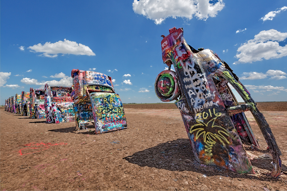
You Can Smell It Before You Can See It
Not every tornado chasing trip is storm after storm. There are down days to fill with side trips to roadside attractions. May 20, 2016 was one of those “severely clear” days.
It was a hot Texas morning just west of Amarillo on Route 66. I could smell it way before I saw it. The odor of spray paint permeated the air.
Cadillac Ranch
I was at Cadillac Ranch, a public art installation. Ten Cadillacs are half-buried nose-down in a field at the same angle as the Cheops Pyramid. It has been stopping visitors since 1974. Go anytime; it’s open 24/7/365 and there’s no admission.
Texas millionaire Stanley Marsh, 3 was an eccentric. Down to earth, he felt the “III” was too pretentious and changed it to a simple “3.”
In 1973, Marsh invited a San Francisco artists’ collective called the Ant Farm to help him create a unique work of art. He wanted something for his sprawling ranch just west of Amarillo.

The Ant Farm bought ten used Cadillacs from junkyards. They represented the “Golden Age” of American automobiles. Costing an average of $200 each, the cars ranged in model years from 1948 to 1963. They were half buried along the tattered remains of historic Route 66 on Marsh’s ranch.

The project was completed in 1974. In no time at all, visitors began to come from all over the world, leaving their mark on the ever-thickening graffiti-covered cars.
Graffiti
At first, the cars displayed their original paint jobs – turquoise, banana yellow, gold, and sky blue. The monument was barely complete when people started scratching or painting their names in the cars. Over time, vandals and souvenir hounds smashed the windows, made off with all the chrome, radios, speakers and even some of the doors. The wheels have since been welded to the axles to prevent more theft.
Marsh’s opinion? “We think it looks better every year…Art is a legalized form of insanity, and I do it very well,” he said. He died in June 2014 at the age of 76.
Changes
In 1997, the Cadillac Ranch was exhumed and replanted about two miles to the west. This placed it further away from the encroaching city of Amarillo. Marsh even ordered the old site’s trash and clutter to be gathered and spread around the new location.
In May 2002, the cars were restored to their original colors. In June 2003, the cars were painted flat black as a memorial, albeit temporary, to the passing of the founding member of the Ant Farm.
The Photo
This is a public sculpture and visitors are encouraged to participate. So, I picked up a couple of cans of Krylon spray paint lying on the ground and added my own graffiti. Afterwards, it was time for a picture and a break from the noxious fumes.
Thanks for looking,
Chuck
]]>
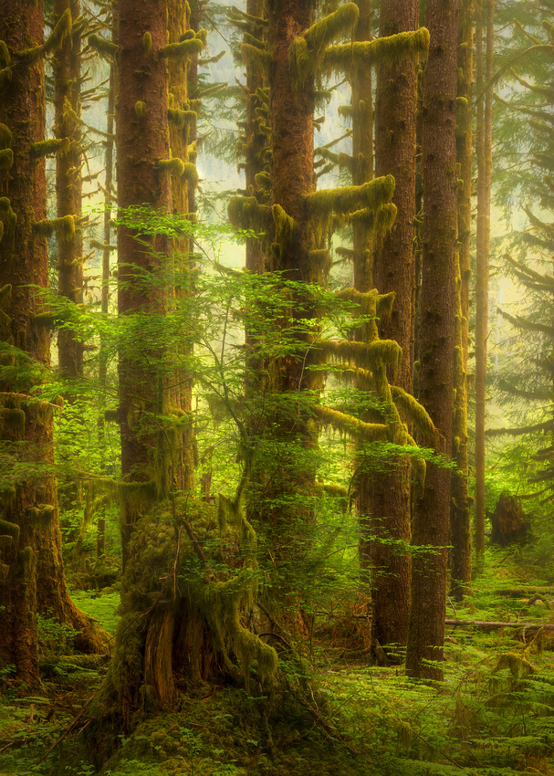
Trees by Joyce Kilmer
I think that I shall never see
A poem lovely as a tree.
A tree whose hungry mouth is prest
Against the earth’s sweet flowing breast;
A tree that looks at God all day,
And lifts her leafy arms to pray;
A tree that may in Summer wear
A nest of robins in her hair;
Upon whose bosom snow has lain;
Who intimately lives with rain.
Poems are made by fools like me,
But only God can make a tree.
Joyce Kilmer
Alfred Joyce Kilmer (1886-1918) was considered the leading American Roman Catholic poet and lecturer of his generation. He is best remembered for this short poem, with its famous opening couplet: “I think that I shall never see / A poem lovely as a tree.” Kilmer was killed at the Second Battle of Marne in World War One on July 1918, aged just 31.
The Shot
The forest was stunningly beautiful. Kilmer’s opening lines came to mind as I started to admire the majestic trees.
Five years ago, on April 29, I was wandering in the Hoh Rain Forest in Olympic National Park in Washington with camera buddies Jon Christofersen and Mike Loebach. While beauty surrounded us, a composition that would do it justice remained hidden. As I mentioned in a previous post, the rain forest was like an explosion in a green spaghetti factory.
It seemed impossible to exclude enough of the chaos to create an orderly sense of visual flow in a composition. I remember reviewing my images that evening and feeling totally frustrated. It wasn’t until five years later that I revisited those images.
I recently processed this photo. This is the closest I’ve come to making photographic sense of this complex ecosystem.
Thanks for looking,
Chuck
]]>
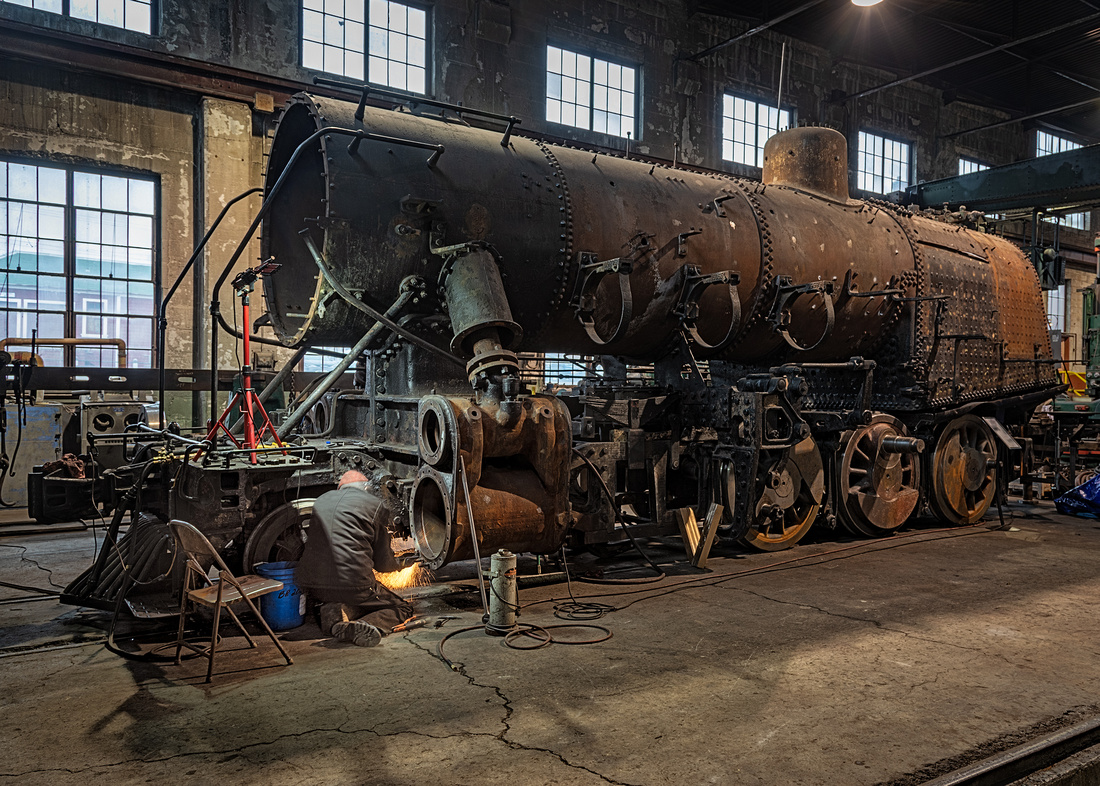
High Tech
What’s high tech? In 1917, high tech was the Nevada Northern Railroad’s newest steam locomotive, No. 81.
The Nevada Northern primarily hauled copper ore from the mines near Ely, Nevada south to the transcontinental network. It also served passengers and towns along the line.
With 36,200 pounds of pulling power, No. 81 was designed to be powerful enough to handle a freight train while being fast enough to handle passenger loads. A century later, modern microprocessor-controlled diesel locomotives have roughly 60,000 pounds of pulling power.
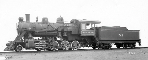
Baldwin Locomotive Works 1917 Builder’s Photo
No. 81 operated in mixed freight and passenger service between Ely and Cobre until 1951. After 41 years of service, it was retired and put on display at the White Pine Public Museum where it sat in the elements for over 30 years.
Moved back to the Nevada Northern engine house in 1990, No. 81 patiently waited for a turn at restoration. In 2014, after a thorough inspection, it was deemed to be an excellent candidate.
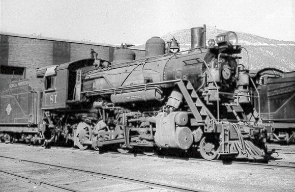
Ray Christ photo, September 1956 at the Ely engine house before retirement
The engine originally cost $23,700 ($487,000 in today’s dollars). The restoration budget is $1.2 million.
All the work is being performed at the 1907 Ely engine house. Using a blacksmith forge and massive, 114-year-old tools, a team of volunteers is still at work seven years later restoring No. 81 to its former glory. Here’s a recent progress photo from the Nevada Northern Facebook page. Check out the monster lathe in the lower left.

The Photo
A year ago, photo buddy Jon Christofersen and I were at the Nevada Northern’s winter steam photography weekend. In a quiet moment, I wandered into the part of the engine house where No. 81 was being restored.
There was a solitary volunteer creating showers of burning steel grinding part of the cylinder. Amazed at how many parts needed restoration, I finally started to comprehend how a restoration could consume most of a decade.
Thanks for looking,
Chuck
]]>
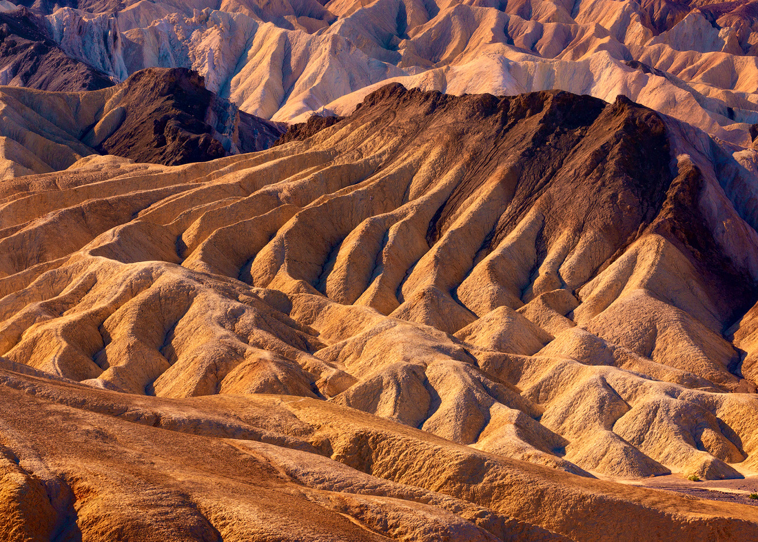
Childhood Memories
I was seven years old on January 15, 1960. My Dad was at a Minneapolis firehouse working a 24-hour shift. That evening, my Mom and I sat down to watch The Twilight Zone on TV. I was lucky; not every kid on the block got to watch this popular, but scary, show.
It was Season 1, Episode 15, that evening. The title is the opening line of Henry Wadsworth Longfellow’s poem The Arrow and the Song.

Rod Serling’s opening narration is “Her name is the Arrow 1. She represents four and a half years of planning, preparation, and training, and a thousand years of science, mathematics, and the projected dreams and hopes of not only a nation, but a world. She is the first manned aircraft into space, and this is the countdown. The last five seconds before man shot an arrow into the air.”
Space travel was still a dream in 1960. It wasn’t until April 12, 1961 that Soviet cosmonaut Yuri Alekseyevich Gagarin became the first human in space.
This episode’s script is the only one based on a purchased idea. Serling met industry outsider Madelon Champion at a party where she outlined the plot. He paid her $500 for the idea and listed her as a writer in the closing credits.
The story is about the first manned space flight with eight crew members. They crash land on what the astronauts believe is an unknown asteroid, in an area of desert and jagged mountains. Only four of the crew survive the crash. One severely injured crew member quickly dies, leaving three men in a desert with only enough water for three days.
Order breaks down between three surviving crew members. One member of the crew murders the other two for their water. Ironically, the sole survivor discovers that they have been on Earth the whole time.
The idea of astronauts thinking they had crashed on an unknown planet, only to discover they had been on Earth all along, should seem familiar. Serling adapted it for his initial screenplay of the 1968 movie Planet of the Apes.
My Memory
What I vividly remember from the episode is the desert. The location truly looked “out of this world”. And this one image of that alien-appearing desert really stuck in my mind.
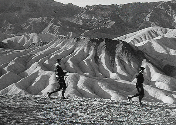
The Photo
I had no idea in 1960 that much of this episode was filmed in Death Valley National Monument (now a National Park). The area around Zabriskie Point is prominently featured.
Despite a couple of earlier trips to Death Valley, my trip a year ago was different. As I climbed up the ridgeline from the Zabriskie Point viewing area, memories of that episode flashed into my head. I realized I was looking at the background of a scene from a 60-year-old TV show!
The prominent formation behind the two men is nicknamed “The Manifold.” I marveled at the fact that after all these years, I was actually seeing that “alien” desert location. And it brought back warm memories of evenings with my Mom as we waited for my Dad to return home safely the next morning after his 24-hour shifts.
Thanks for looking,
Chuck
]]>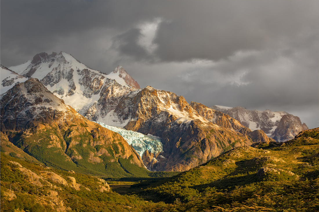
Waffles and Ice Cream
How does this photograph of a glacier in the Andes Mountains relate to waffles and ice cream? I promise we’ll make the connection eventually.
Fellow photographer Jim Reitz posted a memory on Facebook recently. It reminded me that seven years ago this week, I went with photo buddy Jon Christofersen on a trip to Patagonia and met Jim and several other photographers.
Patagonia is a sparsely populated region at the southern end of South America, in Argentina and Chile. This beautiful region includes the southern Andes Mountains, lakes, fjords, glaciers, tablelands, and steppes. It’s a vast area with relatively few inhabitants and visitors.
The city of El Chalten, Argentina, sits inside Los Glaciares National Park. It’s close to the base of Patagonia’s “signature” Cerro (meaning mountain) Torre and Cerro Fitz Roy mountain peaks.
The Laguna Capri Trek
Laguna (Spanish for body of water) Capri is a crystal blue alpine lake. The 2.5-mile trail to get there begins at the north end of El Chalten, at the end of San Martín Ave. For the first 45 minutes, the trail is steep, gaining 656 feet in elevation.
After another 60-90 minutes, you come to a sign that shows a footpath bifurcation to Laguna Capri (left) or to Cerro Fitz Roy (right). Arriving at the laguna you have a spectacular view of the Fitz Roy massif and its surrounding needles. You won’t want to leave; it’s a place that invites you to stay and is one of the classic postcards of Patagonia and El Chalten.
The Photo
Jon, Jim, and I started the trek to Laguna Capri with the rest of our photography workshop group at 4:45 am, 3 hours before dawn. It was cold that morning, but we warmed up quickly and shed layers of clothing as we climbed.
We couldn’t see much beyond what our headlamps illuminated. When we arrived, it was still dark. After about a half hour, it was exciting to see the first glimmer of dawn.
While we didn’t get a blazing sunrise, the clouds and sun played nicely on the mountainsides. We could see the distant, beautiful Piedras Blancas glacier descend through the glacial cirque of the North Fitz Roy massif flanked by Cerro Madsen and Cerro Eléctrico. Even from a distance, the house-sized seracs (blocks or columns of glacial ice, often formed by intersecting glacial crevasses) were clearly visible.
We spent several hours photographing at this location. This was my favorite shot.
The Tasty Reward
I promised to connect this back to waffles and ice cream. Right at the end of the trail and the beginning of the trek is La Wafleria restaurant. They offer everything you ever wanted on a waffle. After the early wake-up call and an exhausting trek, waffles and ice cream seemed in order. Few breakfasts have ever tasted this good.

Source: Tripadvisor
Thanks for looking,
Chuck
]]>

Winter Morning Poem
Winter is the king of showmen,
Turning tree stumps into snow men
And houses into birthday cakes
And spreading sugar over lakes.
Smooth and clean and frosty white,
The world looks good enough to bite.
That's the season to be young,
Catching snowflakes on your tongue!
Snow is snowy when it's snowing.
I'm sorry it's slushy when it's going.
Ogden Nash (1902-1971)
Snowshoes Jinx?
Back in September, I started to think about getting out in the snow more often. So, I purchased a pair of snowshoes and anxiously waited for winter to arrive.
And I waited. And I waited some more. By the end of January, I was convinced that my new snowshoes were the reason behind the snow drought in Chicago.
Luckily, February proved me wrong. The snow arrived and I finally had my chance to try them out.
On February 2nd, I drove to nearby Springbrook Forest Preserve with my camera and my snowshoes. I discovered two things. The first was that snowshoes allowed me to get into areas that normally would have been off limits due to deep snow.
I also discovered a lot of muscles I had forgotten about since medical school. I was so sore the next day that I forgot to download my photos to my computer.
Last week I discovered them and found this shot. It brought back the joy of a walk in the woods after a beautiful snowfall.
Thanks for looking,
Chuck
]]>
What the Heck Is That?
Conditions looked promising. My favorite weather app, Windy, predicted a cloud-free sky east to the rising full moon. And clouds to the north looked encouraging for a colorful sunset sky in that direction. So, fellow photographer Scott Fuller and I decided to meet at the Chicago Museum Campus last Sunday evening.
We arrived an hour before sunset. It didn’t look good. There were clouds on the horizon to the east and no clouds to the north.
After 20 minutes, hope gave way to reality. We started scrambling to find something, anything, to photograph. Scott looked up towards Lake Shore Drive and pointed out a sculpture I had never seen before.
It was a piece by Ewerdt Hilgemann named Habakuk [Homage to Max Ernst]. The work was completed in 2014 and installed in Chicago’s Museum Campus in September 2015. It held promise as an interesting foreground.
Walking around the sculpture, I noticed some high clouds to the southwest that might catch some sunset color along with several striking condos in the background. It was serendipity.
The Artist
German-born, Amsterdam-based sculptor Ewerdt Hilgemann began as a strict adherent of rigid, mathematical sculptures. His approach changed in the early 1980s when he decided he liked the idea of bringing a natural power, implosion, to his work.
Since 1985, Hilgemann has been vacuuming the air out of welded-steel cubes and rectangles to create his iconic “Implosion” sculptures.
Habakuk [Homage to Max Ernst] was fabricated from heavy, stainless steel plates divided into three parts. The perfect, geometrically pure stainless-steel forms were meticulously welded and polished to satin gloss. Using a vacuum pump, outside air pressure then “shaped” (imploded) the piece.
In a delicate balance of planning and chance, each piece acquires an individual character and shape. The final name of Hilgemann’s work is always decided after the vacuum process is over. It depends on the associations it brings to the artist. In this case, the birdlike beak form recalled the sculpture Habakuk by Max Ernst.
So, Who Is Max Ernst?
Max Ernst (1891–1976) was a prolific German painter, sculptor, graphic artist, and poet. After his traumatic service on both the Eastern and Western fronts in World War I, he was concerned that a civilization claiming the moral and intellectual high ground could produce something as base and sickening as trench warfare.
He expressed his concerns by mocking social and artistic conventions. His statue Habakuk takes aim at the minor Jewish prophet, Habakkuk (spelled with one “k” in German).

Habakuk by Max Ernst. Source: max-ernst-habakuk.jpg (470×470) (artnet.com)
In chapter 2, verse 18 of the book of the Old Testament that carries his name, the prophet condemns those who make sculptures: “Of what use is the carved image, that its maker should carve it? Or the molten image, the lying oracle, that its very maker should trust in it, and make mute idols?”
According to art historians, Ernst’s ironic homage to the critic may be depicting Habakkuk as a molten bronze idol.
Or perhaps there is a second, more ominous meaning? In the book of Habakkuk, the prophet has a vision of the end of the world: the rise of a fierce and ruthless army and the destruction of animals, land, and city. Ernst lived in Germany during the 1930s at a time when the Nazi party was on the rise. Hitler seized control of the country in 1933 and Ernst sculpted Habakuk just a year later. An army was indeed gathering, and the “End of the world” was not far off.
Soon after the German occupation of France, Ernst was arrested by the Gestapo, but managed to escape and flee to America. He later moved to Sedona, Arizona and was a founder of the colony of artists in that town.
Thanks for looking,
Chuck
]]>
 Pictured Rocks National Lakeshore
Pictured Rocks National Lakeshore was established as a National Park in 1966. It preserves one of the most beautiful freshwater coastal landscapes in North America. The rugged Michigan coastline between Munising and Grand Marais on Lake Superior features soaring sandstone cliffs awash with natural pink, green, and brown pigments.
The park’s sandstone comes from quartz sand and gravel deposits that were shed from a regional mountain range in the north. 500-800 million years ago, these sediments were deposited in the shallow seas and near-shore deltas that covered what is now northern Michigan.
With time and pressure, they became the exposed sandstone layers along the shoreline. There is a second layer of sandstone that formed a mere two million years ago.
The only place to see these layers is near Lake Superior. Everywhere else, they are covered by a veneer of glacial drift.
Why “Pictured?”
The name "Pictured Rocks" comes from the streaks of color that decorate the cliffs. When groundwater with dissolved minerals oozes out of cracks and trickles down the rock face, stunning colors are left behind. Iron (red and orange), copper (blue and green), manganese (brown and black), and limonite (white) are among the most common color-producing minerals.
The best way to see the geologic layers and colors of the cliffs is from a boat. Late afternoon or early evening sunlight brings out the richest colors.
The Shot
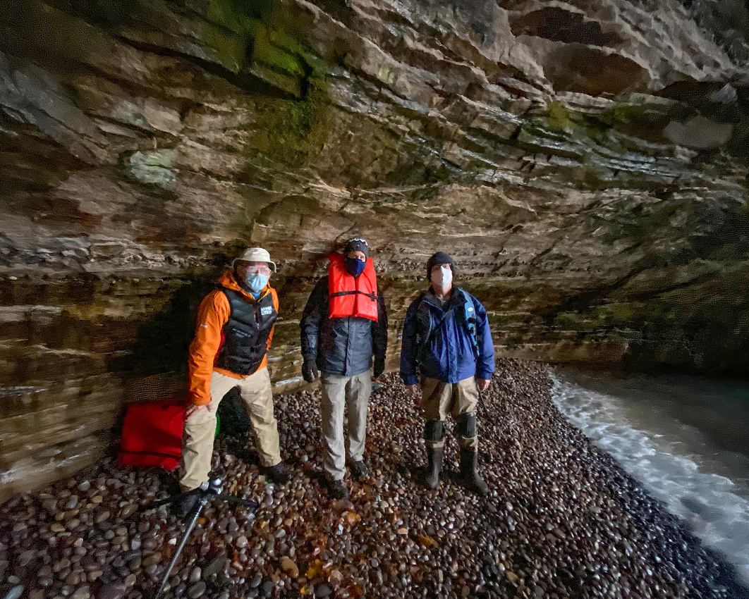
I’m behind the mask on the right.
Last October, I met two other photographers on a fall colors photo workshop in Pictured Rocks. After spending this particular morning photographing a sea cave, we returned to our boat on a small Zodiac. Since the lake conditions were forecast to deteriorate over the next few days, we decided to cruise along the shore while the weather was good.
We happily spent the next few hours as tourists appreciating the reason the Park was established. We motored up and down the 15 miles of coastline enjoying the shapes and colors of the famous sandstone cliffs.
Thanks for looking,
Chuck
]]>
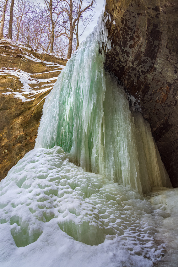
Motivation
Sleeping in, staying home, and being warm is currently rather appealing. Between COVID travel worries and the frigid Midwest weather, it takes a lot of effort to get out and photograph. Having a few crazy friends is one of those motivators.
Fellow (crazy) photographers Scott Fuller and Jon Christofersen decided that despite the polar vortex, we were going out. We met last Sunday at Matthiessen State Park. Ninety minutes from home, the park is near Oglesby, Illinois. It was one below zero at 9 am when we arrived.
Geology
The park is centered on a mile-long stream that flows from Matthiessen Lake to the Vermilion River. Flowing water partially eroded the layers of sandstone creating a long narrow canyon with beautiful sandstone features. At the end of the 19th Century, these formations were called “dells,” a name that remains to this day.
The Upper Dells begin at Matthiessen Lake with Lake Falls, dropping into the canyon below. It continues downstream to the 45-foot Cascade Falls where the Lower Dells begin.
The canyon’s interesting coloration is the result of groundwater minerals. As the water seeps out along the sandstone canyon walls, it evaporates leaving behind beautiful colors on the rocks.
The Shot
We all donned our microspikes over our boots. These slip-on miniature spikes provide much needed grip and traction on snowy and icy hiking trails. They came in handy on the stairs (22 flights total) in and out of the canyon. Several flights were 45-degree sheets of ice with no discernable treads.
Multiple layers of clothes and handwarmers kept us warm for the next four-and-a-half hours. It also helped that it warmed up to a balmy two degrees above zero.

Chuck Derus, Scott Fuller, and Jon Christofersen
Unlike most waterfalls, the choice of shutter speed didn’t matter this time! There was no choosing between silky smooth or razor-sharp water. After spending about an hour here, we moved on to the Upper Dells.
After several more hours, we decided it was time to get warm. Packing up our gear, we trudged up what seemed to be endless flights of stairs. Finally arriving at the parking lot, we headed for our vehicles and a nice warm trip home.
Thanks for looking,
Chuck
]]>
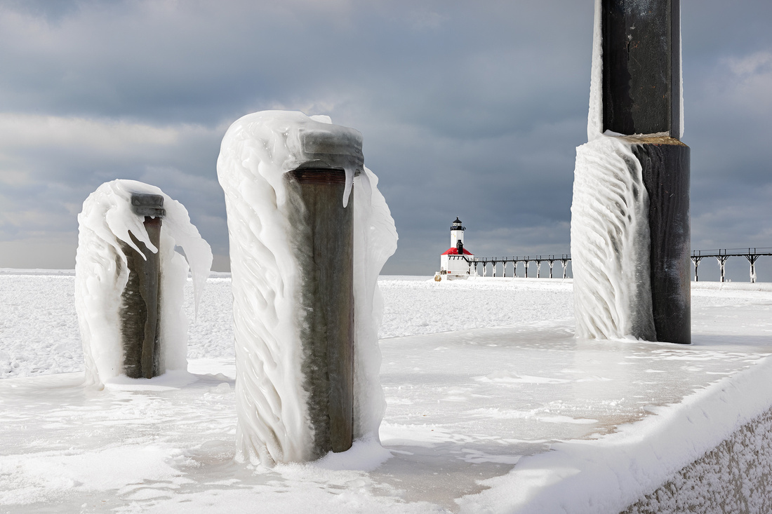
The Polar Vortex
My objective last Sunday morning was to photograph icicles. Not just any icicles; I was going for icicles on a Michigan lighthouse. And there were plenty of them because of the polar vortex.
According to the National Weather Service, “The polar vortex is a large area of low pressure and cold air surrounding both of the Earth’s poles. It ALWAYS exists near the poles but weakens in summer and strengthens in winter. The term ‘vortex’ refers to the counterclockwise flow of air that helps keep the colder air near the Poles.”
The polar vortex often expands in winter, sending cold air southward with the jet stream. The latest shift began last week sending dangerous, bitter cold into the north-central United States.
More Than One Color of Ice
Luckily, fellow photographer Scott Fuller was also interested in photographing lighthouses last Sunday. We arranged to meet at the St. Joseph, Michigan, North Pier Outer Lighthouse in the morning.
It was a frigid -12 degrees and sunny when I left Naperville. As I crossed into northwest Indiana near Lake Michigan, it warmed up to 9 degrees and the sky clouded over. Soon after that, lake effect snow started to fall. Road conditions deteriorated as the plows couldn’t keep up with the snowfall.
Slowing to 40mph, I noticed several cars in the ditch ahead. A few seconds later my car changed lanes without warning. I was on a patch of black ice.
In case you’re from California or Florida, black ice is a transparent glaze of ice on the road. All you can see is the black road surface beneath it. You only know it’s there when your car starts skidding.
The Shot
I was very awake when I arrived at St. Joe and met Scott. We got a few nice shots, but the light wasn’t great. We decided to backtrack to Michigan City and try a second lighthouse.
It was better there. Beams of light intermittently broke through the clouds providing much more visual interest. Despite a wind chill temperature of -5 degrees, we forced our numb fingers to work our cameras for about an hour and a half.
I liked this shot of the lighthouse framed by two capped 4-inch pipes on the left and a catwalk support on the right. The winds had covered them with frozen spray adding foreground interest and context to the lighthouse in the distance.
Thanks for looking,
Chuck
]]>
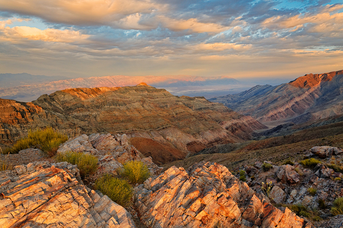 Second Chances
It’s rare to get a really good shot the first time. Landscape professionals sometimes visit the same location dozens of times until the conditions are perfect. I usually have one or two days at a particular spot.
Such was the case in 2014 when I visited Death Valley with fellow photographers Jon Christofersen and Mike Loebach. We only had a few days to explore Death Valley before returning to Las Vegas to fly to a rafting trip down the Colorado River.
We made the most of those few days. It was hot (110 degrees), dusty and severely clear. But we had a chance to try Lobotomy Bock Beer. Their motto: I’d rather have a bottle in front of me than a frontal lobotomy. We also wanted to scout Aguereberry Point.

John Pierre Aguereberry
"Pete" Aguereberry was a renowned Death Valley prospector and gold miner for more than 40 years. After striking gold with partner Frank Harris in 1905, Aguereberry won a legal battle in 1909 and assumed control of the claim.

He transformed the claim into the Eureka Mine. Working it from 1907 until the early 1930s when his health deteriorated, Eureka produced an estimated $175,000 at a time when gold was only $20 an ounce. At current gold prices, that’s over $16,000,000!
Aguereberry lived in his two-room cabin near the Eureka mine and mill. The cabin was built in 1907, and he lived there until his death in 1945. There were two other cabins in the mining camp. One was a guest cabin and the other’s purpose is unknown.
Pete delighted tourists by showing them “The Great View of Death Valley.” He discovered a magnificent 6,433 feet elevation viewpoint perched on the west side of Death Valley National Park.
He built a 4.5-mile-long road there by pick, shovel, barrow, and blasting powder from the mining camp. Now known as Aguereberry Point, it offers breathtaking views of the Panamint range, Mount Charleston, Furnace Creek, and the salt flats of Badwater Basin.
The First Try
Back in 2014, Jon Christofersen volunteered to drive the 6.4 miles from the highway to Aguereberry Point. The road is extremely rugged and not for the faint of heart. Feel free to look it up at www.dangerousroads.org And don’t tell your car rental agency where you’re going.
We enjoyed a decent sunset, and I came away with the photo above.
The Second Try
We returned to Death Valley last February 27th. And again, Jon volunteered to drive in total darkness for another chance to photograph “The Great View,” this time in the pre-dawn.
I think the better conditions and experience paid off. The result was a prior Friday Photo that you can view at https://cderus.zenfolio.com/p1026313732/he6db50fd#he6db50fd
Thanks for looking,
Chuck
]]>
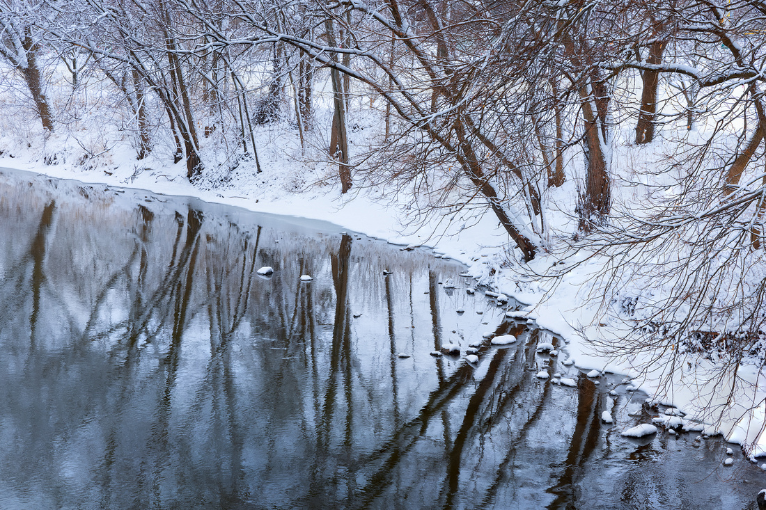
Photographing Locally
There is beauty everywhere, including close to home. Before the pandemic, heading to a wildly photogenic, far away location like the desert Southwest, the California coast or the Pacific Northwest was easy. Now that travel is difficult or impossible, we’re learning to “see” the possibilities in our backyards.
Landscape photographers call the Midwest the “flyover” states. You are forced to fly over them to arrive at a much better location closer to the coasts.
Sheltering in place has prompted us to get out and explore our local landscapes. In addition, books like Mike MacDonald’s My Journey Into The Wilds Of Chicago, with its 240 pages of city and suburban forest preserve photographs, are causing us to take a second look at the local scene.
Changing plans
For two years, my cold weather plans focused on the Lake Superior ice caves near Munising, Michigan. But for the last several years, it hasn’t been cold enough. It was time to think locally.
So, when the snow started falling in Chicago Monday evening, I made plans to head out Tuesday morning and photograph. My wife Christine suggested downtown Naperville’s Riverwalk.
According to the city website, “Considered the ‘crown jewel’ of Naperville, the Riverwalk is a place of beauty and tranquility along the West Branch of the DuPage River. It features 1.75 miles of brick paths, fountains, bridges, meeting and event places, outdoor sculpture and artwork, recreational facilities, and celebratory memorials.”
Normally a bustling place, I was virtually alone for three hours. The snow added a wonderful simplicity to the usual visual chaos of trees, bushes, and pathways.
Near the west end of the Riverwalk, my eye was drawn to an interestingly shaped shoreline and reflections in the water. I paused there for about 10 minutes to work the scene.
It isn’t the Big Sur, Horseshoe Bend, or the Rockies, but it is close to home and close to my heart.
Thanks for looking,
Chuck
]]>
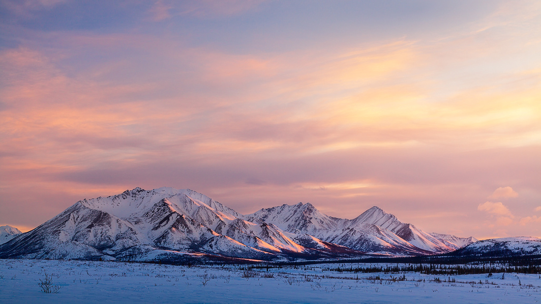 The Road to Alaska
It was February of 2013. I was headed to the Alpine Creek Lodge in Alaska with a small group. Why Alaska? To photograph the Northern Lights, of course!
Winter at the Lodge promised long nights, dark skies and proximity to an ideal location to view the Northern Lights, also known as the Aurora Borealis. And 2013 was a year of maximum solar activity, meaning the Aurora was more frequent and intense.
After flying to Anchorage, we met and drove five hours north on Highway 3 to Cantwell. Cantwell is the western terminus of the Old Denali Highway, with the Lodge at mile 68.
In Cantwell, we stopped to transfer vehicles at the beginning of the Old Denali Highway. I texted this snapshot to my wife, Christine.
You’re going where!?!
It didn’t take long to get the reply above. I must admit to having second thoughts, especially when I saw few, if any, signs of vehicular traffic beyond the barricade. I wondered how we would get there.
A special kind of cat
Things got even more interesting when our transportation arrived. It was a snow cat guided by skies on the front and driven by caterpillar tracks on the rear. The driver reassured us that although it was a new design, it should work fine.
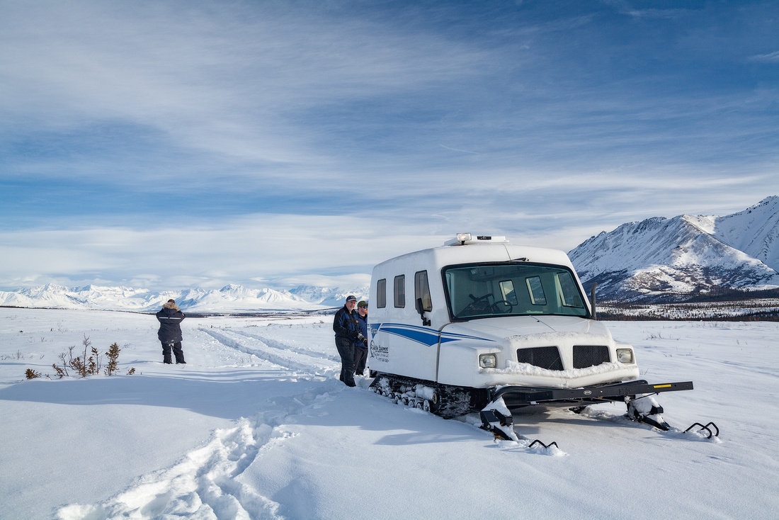 The journey
As you can see from the photo, we had the road to ourselves. Well, not entirely to ourselves. We were passed once by a dogsled team. It was slow going at 15mph, but we finally arrived at the Lodge, excited at the prospect of finally seeing the Northern Lights.
The shot
You may be wondering why the Friday Photo is a random shot of an Alaskan mountain at sunset rather than a Northern Lights photograph. As they say, “It’s the journey and not the destination.”
All five nights in Alaska were totally overcast. We never saw the night sky, let alone the Northern Lights. So, I went to Iceland a few years later and all 11 nights were overcast.
Thinking that the third time’s the charm, I returned to Iceland. It rained for 11 straight days and nights. No Northern Lights for a third time.
It wasn’t until a trip to the Canadian Yukon six years later in September of 2019 that I finally saw and photographed the Northern Lights. I think the challenge of finally realizing my dream made it much more rewarding.
Thanks for looking,
Chuck
]]>
Cypress Knees
Some name them knees,
those roots of the cypress
trees in that murky swamp,
rising up out of the water,
though their legs beneath
them, the feet, the toes,
even the bodies down there
at the mud’s bottom still
haven’t shown up yet.
So far, it’s only those bold
knees that point the way.
Some say perhaps they rise
up just for balance, or
for air; I’ve heard of both.
But it’s probably not true
at all in that swamp where
alligators kill for play
and snakes live for poison.
Instead, those knees probably
rise because bones never
will stay down for long
where they are buried and
like to rise up out of their
watery graves to rattle us.
I know those knees are
that first awakening, that
restless beginning of how
the dead find their way back.
Sue Owen
What kind of tree is that?
It’s certainly a distinctive tree. The Bald, or Swamp, Cypress tree is the defining feature of a southeastern United States swamp. This conifer is deciduous, losing its lacy needles every fall.
The russet-red fall color of the needles is one of its appealing characteristics. The other is its knee.
The knee is that distinctive structure just above the roots. Their function is unknown, but they’re generally seen on trees growing in swamps. The knee might help aerate the roots, create a barrier to catch sediment and reduce erosion, assist anchoring the tree in swampy soil, or some combination of those possible functions.
The Shot
Last October I was scanning a Georgia swamp from the boat launch for compositions. I imagined the three large trees in front of me as some sort of guardians of the swamp. Since the water in front of the trees was full of chaotic flotsam, I took two different photographs.
The first shot was a short exposure to minimize the movement of the branches in the breeze. The second was a several minute exposure to turn the floating debris into appealing swirls. The long exposure also seemed to intensify the reflections.
Both images were brought into Photoshop and combined. To my eye, the swirls in the foreground water are a welcome invitation to journey into the rest of the image.
Thanks for looking,
Chuck Derus
]]>
I’ve waited years to use this word. Forty-six years in fact. I first ran across this word studying for the Medical College Admission Test.
It’s pronounced par·ei·do·lia | per-ˌī-ˈdō-lē-ə
According to Webster, it’s the tendency to perceive a specific, often meaningful image in a random or ambiguous visual pattern. Read on; I’ll use it near the end.
A night under the stars
Last August 11th, I met fellow photographer Rich Kolar near Morrison, Illinois to photograph the Perseid meteor shower. We had hoped to shoot from Morrison-Rockwood Park, but it was closed due to downed trees from the recent derecho.
We settled for a park in Morrison. I had two cameras going. The first was aimed at the meteor shower radiant, the spot in the sky where the meteors appear to originate.
The second camera was on a portable star tracker. Without a tracker to counteract the motion from earth’s rotation, the stars record as curved trails in the sky. It was aimed at a specific part of Milky Way overhead near the star Deneb.
I wanted to see if I could photograph the North American Nebula.
What’s a nebula?
A nebula is formed when ionized gases glow like a neon sign. The most common source of ionization is high-energy ultraviolet photons from a nearby hot star. Newly formed hot, massive stars in this area are causing interstellar hydrogen atoms to glow red. Since the distribution of interstellar gas is irregular, the shape of the nebula is irregular.
The North American Nebula is about 1,800 light years distant. It covers a region more than ten times the area of the full moon. But because its surface brightness is low, the unaided eye normally can’t make it out.
Why the name North American?
Astronomers commonly suffer from pareidolia (finally!) when viewing celestial objects. Nebula photographs suggest the outline of the North American continent. And just to the right of “Florida” is the Pelican Nebula. Separating the two nebula and below the two nebulae are dark, obscuring dust lanes.
Astrophotography images must be heavily processed to bring out the nebulosity. I’m a newbie, but it was fun pulling the finished product out of 20 stacked images that look like this straight out of camera.
 Thanks for looking,
Chuck Derus
]]>
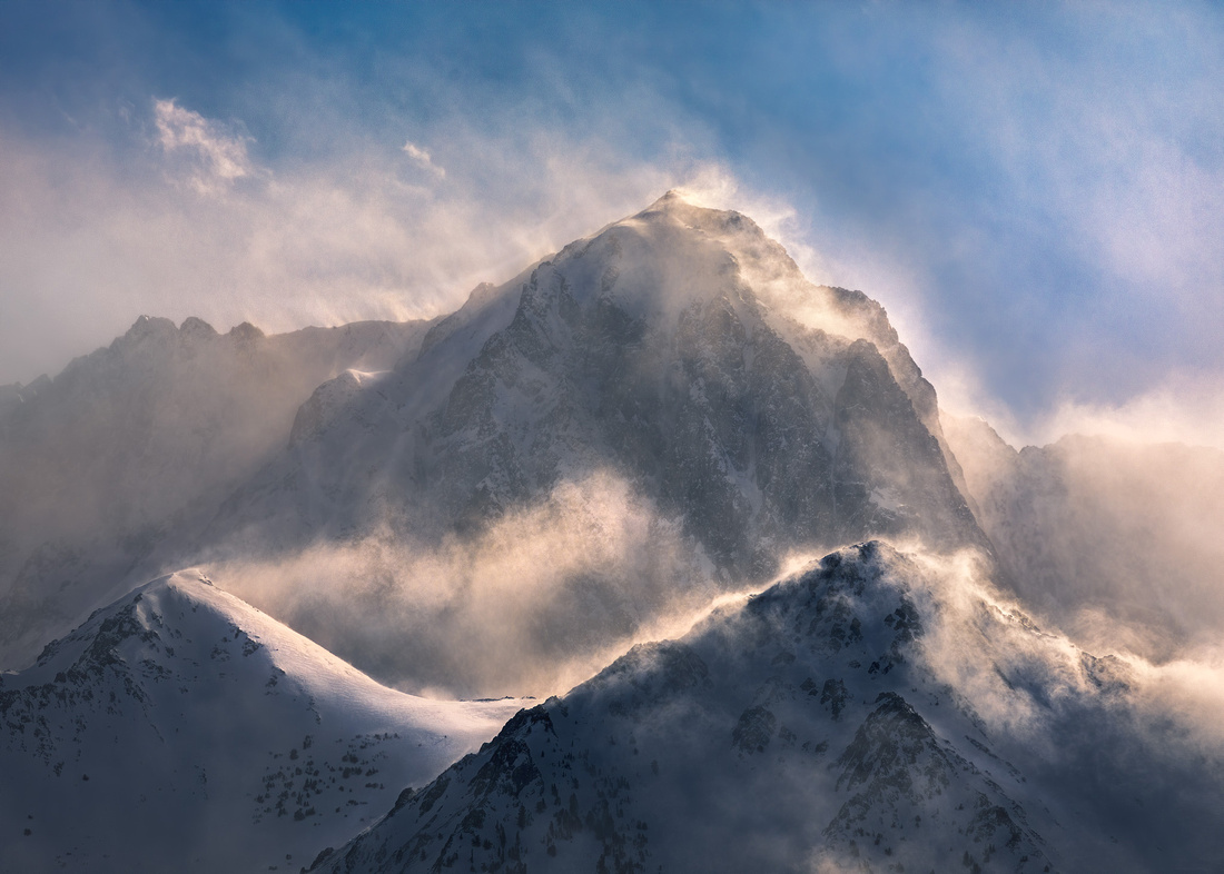
The Snow-Storm
Announced by all the trumpets of the sky,
Arrives the snow, and, driving o'er the fields,
Seems nowhere to alight: the whited air
Hides hills and woods, the river, and the heaven,
And veils the farm-house at the garden's end.
The sled and traveler stopped, the courier's feet
Delayed, all friends shut out, the housemates sit
Around the radiant fireplace, enclosed
In a tumultuous privacy of storm.
Come see the north wind's masonry.
Out of an unseen quarry evermore
Furnished with tile, the fierce artificer
Curves his white bastions with projected roof
Round every windward stake, or tree, or door.
Speeding, the myriad-handed, his wild work
So fanciful, so savage, naught cares he
For number or proportion. Mockingly,
On coop or kennel he hangs Parian wreaths;
A swan-like form invests the hidden thorn;
Fills up the farmer's lane from wall to wall,
Maugre the farmer's sighs; and, at the gate,
A tapering turret overtops the work.
And when his hours are numbered, and the world
Is all his own, retiring, as he were not,
Leaves, when the sun appears, astonished Art
To mimic in slow structures, stone by stone,
Built in an age, the mad wind's night-work,
The frolic architecture of the snow.
Ralph Waldo Emerson
The Mountain
In March of 2018, I was in a weeklong photographic “marathon.” Our small group traveled nearly 3,000 miles of the Southwest. Starting in Las Vegas, we visited over a dozen photogenic locations in Utah, Arizona, Nevada, and California.
The last day was special. Just 48 hours earlier, we had been sweating in the 80-degree heat outside Phoenix. Now we were in California’s Sierra Mountains. The temperature that last morning was 10 degrees and there were six inches of fresh snow on the ground.
After photographing Hot Creek in the early morning, we drove along Benton Crossing Road near Mammoth Lakes, California. The late winter winds were howling. Suddenly the peaks of the Sierra Nevada mountains were enveloped in swirling snow. We slammed on the brakes and pulled off on the side of the road.
For the next half hour, we joyfully photographed the fierce intersection of wind, snow, and rock. When the winds began to subside along with the feeling in my fingers and toes, we hopped back into our cars, turned up the heat, and headed for breakfast.
Thanks for looking,
Chuck Derus
]]>
A conjunction occurs when two astronomical objects appear close to each other. Conjunctions aren’t rare. It’s common to see the moon, planets and stars close to each other at times in the night sky.

A Great Conjunction is quite uncommon. By definition, a Great Conjunction only occurs when the planets Jupiter and Saturn appear closest together in the sky. This occurs approximately every 20 years when Jupiter "overtakes" Saturn in its orbit. Despite appearing close, they are 456 million miles apart.
Taking a Memory Photo
The Great Conjunction of 2020 occurred December 21. The two planets were only one-tenth of a degree apart (about 1/5 the diameter of the moon). This was the closest, most easily visible conjunction since March 4, 1226.
While drifting apart in the sky, they will remain close for the next few days. If you miss this one, the next observable Great Conjunction is March 15, 2080. So, I’d recommend viewing it now.
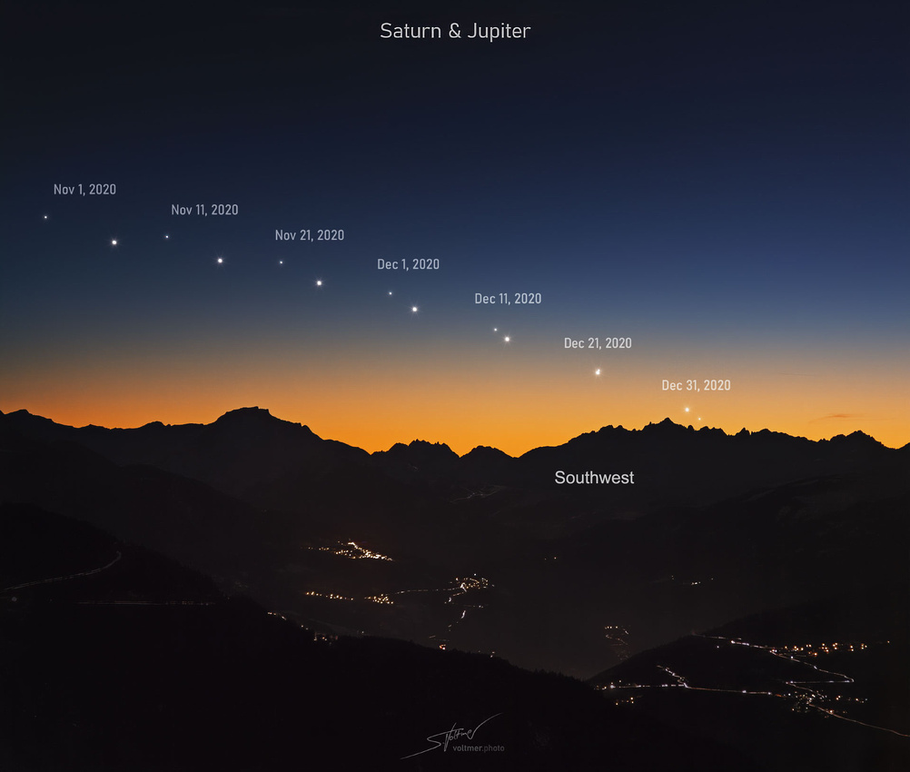 Illustration Credit & Copyright: Sebastian Voltmer
This week’s photo was intended to be a memory. Truly striking photographs of the conjunction are found on places like NASA’s Astronomy Photo of the Day (APOD). Check out APOD: 2020 December 20 - A Volcanic Great Conjunction (nasa.gov).
I set up on the hill in Naperville’s Springbrook Forest Preserve. December 21st was forecast to be overcast, so I went out on the evening of the 20th. I was far from alone; there must have been 50 people waiting in the cold evening twilight for the planets to appear.
Since the earth rotates 15 degrees an hour, photographs of planets and stars can appear streaked. I used a portable star tracker that rotates at the same rate as the earth making for rounder stars and planets.
As I photographed, it became apparent that Jupiter was far brighter than its moons and Saturn. Taking longer exposures allowed more of the moon’s and Saturn’s faint light to register on the camera sensor. I returned home chilled but excited to have seen this celestial event.
The finished photograph used several different exposures blended in Photoshop. I was pleasantly surprised to make out the four Galilean (named after their 1610 discoverer Galileo) moons. From left to right are Europa, Ganymede, Callisto, and Io orbiting Jupiter. The blue object second from the left is a star and not a moon of Jupiter.
The rings of Saturn, also discovered by Galileo, were visible as well. One of Saturn’s moons, Titan, was even visible.
To those of the Christian faith tradition, Merry Christmas.
Chuck Derus
]]>
Who was he? Why were the falls named after him?
Alger Falls is hard to miss. It’s located at the junction of Michigan highway M-94 and M-24 just outside of Munising in Michigan’s Upper Peninsula.
People are attracted to the falls. It’s close to town, easy to see, and features a series of beautiful cascades.
Russell Alger
Alger in 1900, in a portrait by Percy Ives
Roger Alger was born in Ohio in 1836. Orphaned at twelve, he supported his two younger siblings. Alger worked on a farm, attended school, taught for two winters, studied law, and began practice in Cleveland, Ohio in 1859.
He moved to Grand Rapids, Michigan in 1860 where he married Annette Henry in 1861 and started in the lumber business.
From Private to General
Alger enlisted as a private in the Union Army 1861. He was commissioned and served as a captain and then major in the 2nd Michigan Cavalry Regiment. At the Battle of Boonesville in 1862, Colonel Phil Sheridan sent him to attack the enemy's rear with ninety men. The rebels were soundly defeated. Despite being wounded and taken prisoner, he escaped the same day.
Alger was promoted again to lieutenant colonel of the 6th Michigan Cavalry and then to colonel of the 5th Michigan Cavalry. Alger’s was the first command to enter Gettysburg on June 28, 1863. He was specially mentioned in General Custer’s report on cavalry operations.
A little over a week later, he was severely wounded. Alger recovered and went on to participate in General Sheridan's 1864 Virginia Valley Campaign. His brilliant cavalry charge at Trevilian Station captured a large force of Confederates.
In just three years, Alger had fought in 66 different battles and skirmishes. He resigned from the Army on September 20, 1864. In 1867, he was awarded the rank of Brevet Major General.
Businessman and Politician
After the war, Alger settled in Detroit as head of Alger, Smith & Company, and the Manistique Lumbering Company. His 100 square mile pine forest produced more than 75 million board feet of lumber annually.
Elected governor of Michigan from 1885–1886, his ardent support of then candidate William McKinley led to his appointment as Secretary of War in 1897.
Alger was criticized for the inadequate preparation and inefficient operation of the department during the Spanish-American War. Of note is the Army beef scandal.
He hurriedly arranged a low-cost meat contract to feed Army soldiers in the Spanish-American war. Chicago’s "Big Three" meatpacking corporations, Morris & Co, Swift & Co, and Armour & Co took advantage of Alger's inattention and favorable attitude to the industry. The “embalmed beef” product they shipped was so poorly preserved, chemically adulterated, and spoiled that it was dangerous to consume.
"Algerism" became a synonym for venality and incompetence. He resigned at President McKinley’s request in 1899.
In 1901 he was appointed to serve out the unexpired term of a deceased US Senator. Alger was elected in his own right and served from 1903–1907. He died in January 1907.
In a memorial, Senator Spooner of Wisconsin said of Alger: "No man without noble purpose, well-justified ambitions, strong fiber, and splendid qualities in abundance could have carved out and left behind him such a career."
The Photo
I felt Alger deserved more than a commonplace photo from the road. So, I decided to climb up through the mud and work on a section of the falls near the top. I waited for the sun to barely peek above the horizon in order to capture a sun star.
Thanks for looking,
Chuck Derus
]]>

The sky held promise for a colorful Sunday morning. So, I called fellow photographer Scott Fuller to meet me an hour before dawn at Wolf Point, the confluence of the east, north, and south branches of the Chicago River. We anticipated a colorful sky to compliment an “urban canyon” cityscape photo looking down the east branch of the river.
With cityscapes and landscapes, the sky is everything. Without a good sky, pictures are usually disappointing. That’s why you see serious photographers heading indoors with their cameras when it’s “severely clear.”
Like most things in life, plans change. The morning color was almost non-existent. It was time for Plan B.
Delayed by What?
After months of delays, Santiago Calatrava’s new sculpture Constellation had just been completed. Calatrava is a world-renowned architect and artist. If you don’t know Calatrava’s work, here’s his Milwaukee Museum of Art’s Quadracci’s Pavilion.
 Source: Milwaukee MOM website
You may recall that Calatrava’s last Chicago project was the canceled 2,000-foot-tall Chicago Spire. The twisting skyscraper would have been the tallest building in the Western Hemisphere if construction hadn’t been halted due to the recession of the late 2000s.
So, why the delays? The Constellation was supposed to be completed in August. Unfortunately, two large rocket fuel tanks for NASA took precedence at the Ohio company fabricating the sculpture. Work on Constellation installation didn’t resume until October.
What’s That?
Luckily, Scott and I were near the Constellation in the 1.5-acre River Point Park in front of the striking 52-story River Point Tower. It’s near the intersection of West Lake Street and North Canal Street.
The sculpture is a breathtaking, vibrant, red vortex design that overlooks the Chicago River’s confluence. This is my shot of the sculpture looking west towards the sculpture in front of River Point Tower.
 Sunday morning’s Plan B was the Constellation. Part of the fun of photography is that the eye and the camera see differently. Scott and I spent the next two hours photographing different angles and perspectives. My favorite was this one looking straight up with a wide-angle lens.
Thanks for looking,
Chuck Derus
]]>
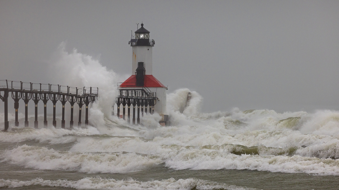
An afternoon at the beach. What could be more pleasant? That’s what I thought while driving to Michigan City, Indiana on Monday.
The forecast was for temperatures in the low 30s, 20 mph winds with gusts up to 38 mph, and a “wintery mix” of rain and snow. Oh, and the waves could be as high as 22 feet!
OK, so only photographers are going to get out of their car on a day like that. I was headed for the Michigan City Lighthouse.
Michigan City
The town served as the principal grain market for northern Indiana between 1837 and 1844. In the 1850s, railroads came bringing their repair shops with them.
The Haskell & Barker Car Company was established in 1852. Manufacturing up to 15,000 railroad cars a year, it quickly became the city's largest employer. The lumber market also boomed.
Cheap convict labor became available to manufacturers when the Northern State Prison opened in the early 1860s. Harbor construction began after the Civil War. By 1868, the Michigan City Harbor could accept large vessels.
The town’s fortunes began to wane after 1900. Convict labor was outlawed. The lumber trade died out. The Michigan Central Railroad moved its rail shops at the close of World War I. Hoosier Slide, the town's once-towering sand dune, was completely mined out by the 1920s.
The Lighthouse
There has been a lighthouse at the harbor for 183 years. The first was an 1837 brick & stone lighthouse built at the edge of Lake Michigan. The second lighthouse, built in 1858, is now a museum near the entrance to the park.
The current lighthouse was built in 1904. It uses the old lantern, lens, and light from 1858. Seven lighthouse keepers and 14 assistant keepers served here from 1837-1940. From 1904 until 1933, keepers had to walk across an elevated iron walkway, or “catwalk”, to reach the lighthouse.
In 1933, the lighthouse was electrified. In 1939, the U.S. Coast Guard took over the service. The now unused catwalk was at risk of demolition.
In 1960, the lighthouse was deemed surplus by the Coast Guard. The General Services Administration sold it to Michigan City in 1963 for $18,500. The catwalk was placed on the National Register of Historic Places in 1974.
The Shot
I knew when I arrived that this was going to be interesting. I had to lean into the wind just to inch my way from the parking lot to the beach. And when I started kneeling to set up my gear, a powerful gust of wind knocked me over backwards.
The wind stung me with a mix of snow, rain, and sand. It turned out that crouching behind a concrete handrail stanchion offered a little protection from the wind. And if I positioned my lens perfectly, it stopped getting covered with rain and snow.
I hope you feel the power of a Great Lakes storm from the photograph. And if you’re a little daring, head out there for yourself when the next wave forecast says to stay away.
Thanks for looking,
Chuck Derus
]]>
How do you meet a meteorologist? Purely by chance for me. Over five years ago, I was at Four Lakes Ski Area in Lisle, Illinois at a Meetup outing.
Meetup groups are a way to “connect with others who share your unique interests and passions.” On that cold Saturday morning in February, the Naperville Photo Meetup was photographing a special event featuring skiers in Halloween costumes.
A woman who looked familiar walked up and handed me her card. It was Mary Kay Kleist, CBS2 Chicago Meteorologist.
She was looking for photos of a costumed skier to run on her weather report that evening. In addition, her teenaged son was snowboarding, and she asked if I had taken his photograph.
She only handed out cards to two other photographers. Puzzled, I asked why she didn’t hand out more cards. It turned out that we were the only three photographers using big telephoto lenses.
I was thrilled to see my costumed skier photo on the evening weather segment. And I sent Mary Kay a picture of her son in midair coming off a mogul. Ever since, when subject matter and timing work out, I send her a Chicago area photo.
Bare trees
Travel is great, but I’m usually at home in Naperville. Finding local photo opportunities is important.
Springbrook Forest Preserve in Naperville is my favorite. Last Thursday, conditions looked promising for a colorful sky at sunset. And the Preserve’s bare trees can produce stark images with interesting, high contrast shapes.
I set up with a telephoto lens to isolate a line of trees against the horizon. Springbrook is seldom crowded, but there were numerous photographers with serious telephoto lenses there.
A couple walking by told me about a rare owl alert posted on a bird watcher’s network. They were at Springbrook along with numerous others to find and photograph an elusive owl.
When they walked away, I noticed they were headed in the direction of my composition. I turned my exposure down to produce a silhouette and waited.
The couple stopped momentarily in a small gap and I pressed the shutter. Since it was only 4:40 pm I had enough time to process the photo and email it to Mary Kay for possible use on the 6:00 pm weather.
It’s still a thrill to see one of my photos on television.
Part of my Thanksgiving is to thank each one of you for taking the time to view the Friday Photo.
Chuck Derus
]]>
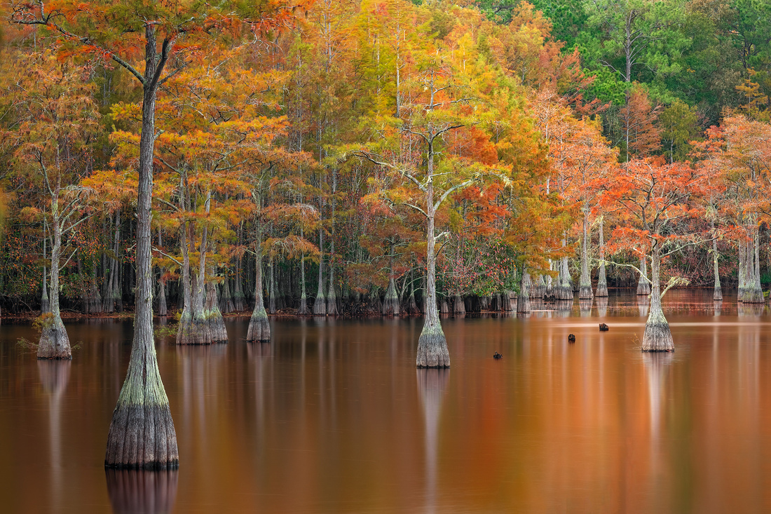
Taking last week’s Friday Photo was a unique experience. I found myself paddling a kayak to various locations on a 400-acre pond in Southeast Georgia. Once I found a promising composition, I used my paddle as a depth gauge.
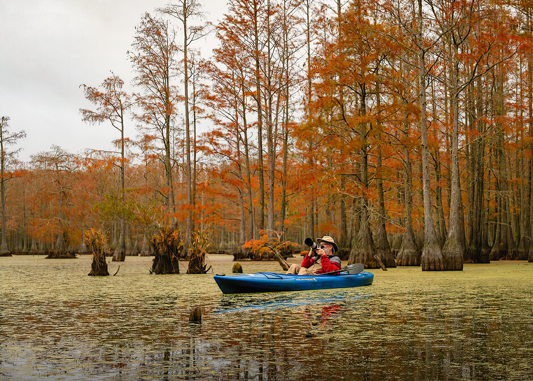 My hope was to hit bottom with a few inches of paddle to spare. If it did, I knew the top of my tripod would be above water.
If the location was shallow enough, I jammed my tripod legs into the unseen muck on the bottom. If I was lucky, the tripod ended up above the surface. Next came attaching my camera to the tripod.
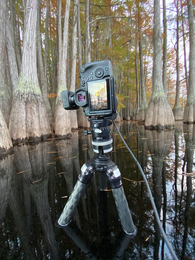
I have to admit that my trepidation never lessened. I kept worrying about seeing my expensive gear drop into the murky depths. After that, I needed to fine tune the composition. Trying to move a heavy, waterlogged tripod with a camera on top from a kayak was sometimes maddening.
Finally, it was a matter of trying to keep the kayak close enough to my gear to take the pictures.
A much easier shot
Today’s Friday Photo was easy compared to the kayak. This one was taken from a dock with a telephoto lens. There was no problem moving slightly to improve a composition. I didn’t drift away from my gear.
And best of all, I could see my tripod on solid ground.
Thanks for looking,
Chuck Derus
]]>
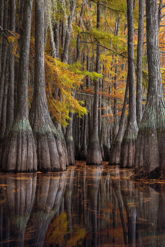
This will be short today. I just returned home from Georgia last night after driving 964 miles in two days. I only had time to process one photograph.
What made the long drive worth it? It was the opportunity to photograph a swamp. Yes, I said swamp.
What made the swamp special were the Georgia cypress trees. Unlike the year-round green of Florida cypress trees, the Georgia cypress were ablaze with fall colors in mid-November.
After nearly three hours of paddling my kayak, I settled on this location for my sunset shot. What made the photograph even more rewarding was finding my way back to the launch site in the dark!
Thanks for looking,
Chuck Derus
]]>
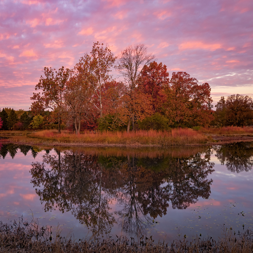
Meadow Lake is the first feature Morton Arboretum visitors usually see. It’s on the east side, adjacent to the Visitor Center parking lot.
The lake appears timeless. But it’s only 61 years old. Back in 1959, Route 53 was being widened from two lanes to four lanes. The county needed gravel for road construction.
The gravel came from the meadow behind the Arboretum’s Administration Building. The meadow dated from 1939-1941 when it was defined by plantings around its irregular edges.
The meadow was excavated in May of 1959. After it was filled with water, those same plantings defined a new shoreline.
 1959 Meadow Lake construction. Source: Morton Arboretum Website
The Arboretum’s first director, Clarence Godshalk, choose the lake’s name. Taking the place of the former meadow, it was renamed Meadow Lake.
Mr. Godshalk seemed especially proud of this transformation. He wrote to the Board of Trustees: “The new Meadow Lake has given me more of a thrill in its creation than anything I have done in the Arboretum development... The first thing in the morning and the last thing at night I find great pleasure in looking at this body of water as it grows, now that the lake is being filled.”
By 2004, the six-acre lake needed major attention. Water levels fluctuated. The banks were eroded, and it needed shoreline replanting.
Contractors moved over 100,000 cubic yards of soil to reshape and stabilize over 3,800 feet of shoreline. Over 100,000 native plants were installed. And an underground conveyance system now connected it to a supply lake over 1 mile away. The cost was $3M.
“I didn’t see that!”
Part of the fun of taking a photo walk with others is what they “see.” Despite walking together through the same terrain, the images are seldom the same. When you share images afterwards, it’s common to admiringly exclaim “I didn’t see that!”
It proved to be true again last Friday.
I joined fellow photographer Sherry Snyder for a photo walk at the Arb. Arriving at 7AM, we had a wonderful time photographing and talking. Sherry suggested starting at Meadow Lake where I took this photo just before sunrise.
After moving on to a different location, Sherry found this lovely composition. When she shared with me it a few days ago, I mentally retraced our steps through that Oak Grove. I didn’t see that!
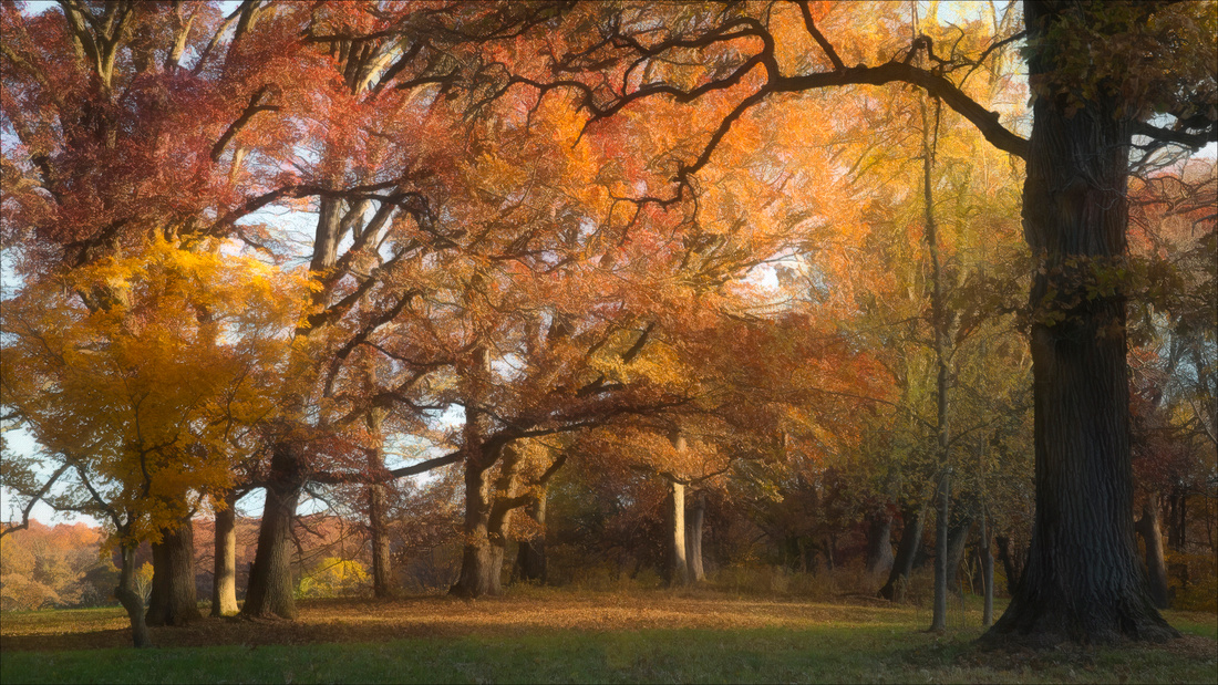 Copyright Sherry Snyder
Thanks for looking,
Chuck Derus
]]>
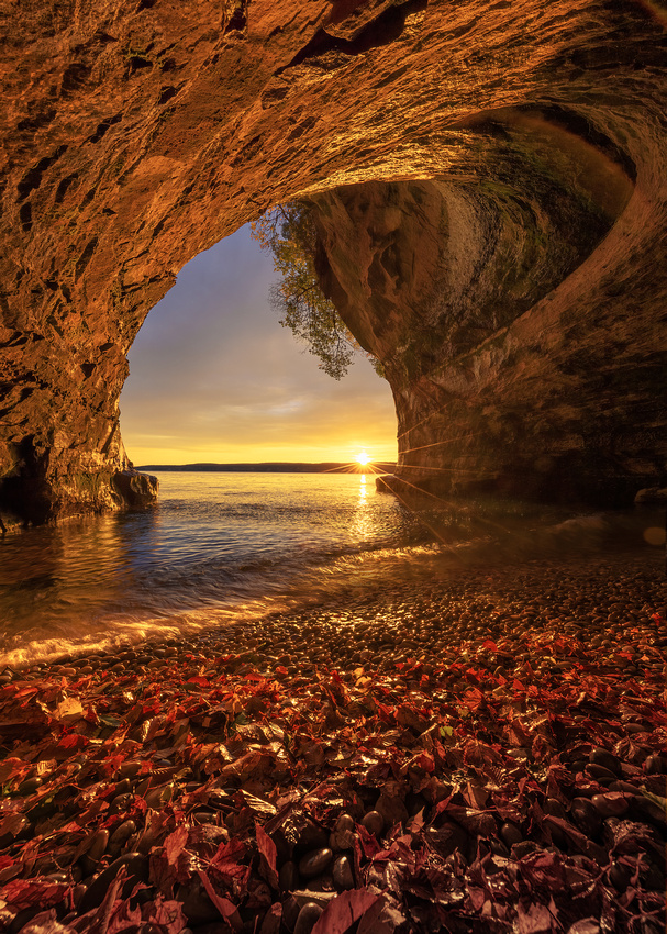
The plan was to arrive 45 minutes before sunrise. We boarded the boat an hour before sunrise. The boat ride to this sea cave on Grand Island near Munising, Michigan takes 10 minutes. After anchoring, it’s another 5 minutes in a small Zodiac to reach the cave.
On this morning, it took a lot longer. The Zodiac, towed behind the boat, tried to capsize whenever the boat accelerated. Slowed to a crawl, the boat ride to the cave took 45 minutes.
Expectations
The sky conditions were promising. According to my favorite weather app Windy, the high clouds overhead had a good chance of creating a brilliant magenta sunrise. This was because of a break in the clouds to the east.
Halfway to the island on our slow journey, the sky did explode in beautiful pinks and magentas. By the time we stepped into the sea cave, all the color had drained from the sky. It looked downright dreary just before dawn.
It would have been all too easy to return to shore for coffee and breakfast. We were hungry, cold, and wet. But it was time to let go of expectations and embrace whatever the rest of the sunrise had to offer.
In the words of photographer Don Smith, “…those who rely on perseverance will more often than not come away with awesome images.”
Sunrise
To our astonishment, the distant clouds and lake turned a brilliant yellow. The cave started to fill with warm light. When the sun peaked above the distant ridge, warm reds flooded the cave with color. And that tiny bit of sun above the horizon created a sun star that added a nice touch to the photo.
I’ll take this moment over coffee any day.
Thanks for looking,
Chuck Derus
]]>
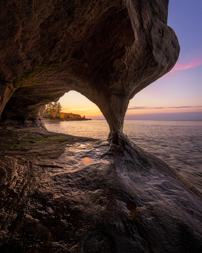
Pictured Rocks National Lakeshore
This National Park is only 6 hours north of Chicago. Located in Michigan’s Upper Peninsula, it runs along the Lake Superior shoreline from Munising to Grand Marias.
The park’s most spectacular geologic formations are the 50-200 ft. sandstone cliffs that extend for more than 15 miles along the shoreline. Sea caves, arches, blowholes, turrets, and stone spires were sculpted from these cliffs over the centuries by unceasing waves and weather.
A sea cave is a cave formed in a cliff by wave action of an ocean or lake. Softer layers of sandstone erode faster that harder layers. These weak zones in the cliff form fissures due to the battering force of the waves.
As the water reaches into the fissures, they widen and deepen due to the tremendous force within a confined space. Abrasion from rock particles in the surf and air compression also contribute to progressive enlargement. After a few thousand years, you have a sea cave.
Grand Island
Grand Island National Recreation Area is just north of Munising. Two weeks ago, I boarded a boat with two other socially distanced and masked photographers to Paradise Point. After dropping anchor, it was a short Zodiac ride from the boat to the caves at that location.
A pair of fishing waders made it easy (and dry) to get off the Zodiac and explore in and around the cave area. We were there in plenty of time to find compositions and set up for sunset.
Sunset
This was our fourth try for golden hour cave light. Six-foot waves cancelled our first boat trip. On the second try, we arrived late and missed the best light. On our third try, it was overcast and stormy. We had to leave the cave early due to waves pounding their way to the very back of the cave.
On this evening, we were treated to warm light illuminating the distant shore. A few yellow and pink clouds decorated the sky. And the framing with the cave pillar seemed to work nicely.
After taking the Zodiac back to the boat, the captain pulled out a bottle of New Zealand red wine. We kicked back to Sinatra playing on the speakers and simply enjoyed the last of the sunset colors gently rocking at anchor.
Thanks for looking,
Chuck Derus
]]>
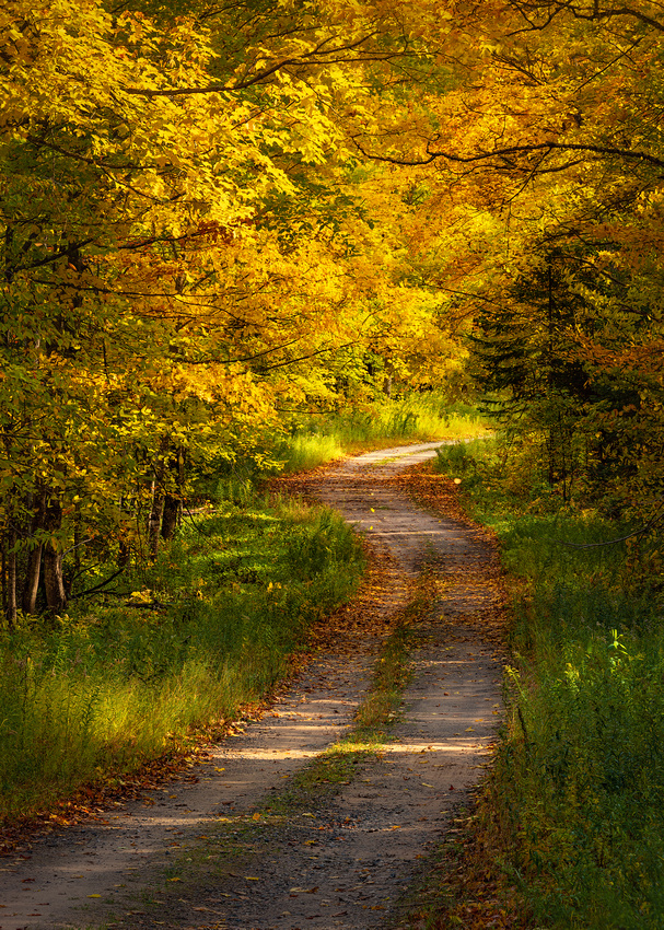
By Robert Frost
Two roads diverged in a yellow wood,
And sorry I could not travel both
And be one traveler, long I stood
And looked down one as far as I could
To where it bent in the undergrowth;
Then took the other, as just as fair,
And having perhaps the better claim,
Because it was grassy and wanted wear;
Though as for that the passing there
Had worn them really about the same,
And both that morning equally lay
In leaves no step had trodden black.
Oh, I kept the first for another day!
Yet knowing how way leads on to way,
I doubted if I should ever come back.
I shall be telling this with a sigh
Somewhere ages and ages hence:
Two roads diverged in a wood, and I—
I took the one less traveled by,
And that has made all the difference.
The Road
I was scouting fall foliage photo opportunities in Michigan’s Upper Peninsula near Munising last week. A decision lay ahead. A sketchy dirt road diverged to my left. The car’s navigation system told me it didn’t exist.
My interest was piqued. Since the road wasn’t posted “no trespassing,” I elected to explore.
The forest was at the peak of autumnal beauty. But the three-dimensional scene lacked the elements to successfully translate into an interesting two-dimensional photograph.
I crept along for a few miles until I saw this tunnel of backlit foliage. The camera and tripod were soon out of my bag.
For the next half hour, I enjoyed the solitude of the woods ablaze with colors, the warmth of the sun, the smell of fall, and the rustling of leaves in the breeze.
Thanks for looking,
Chuck Derus
]]>
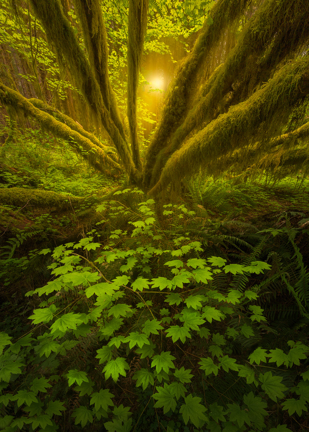
The Hoh Rainforest (pronounced "Hoe") is in Washington State’s Olympic Peninsula. It’s one of the finest remaining temperate rainforests left in the country. Pacific Northwest rainforest formerly spanned the entire Pacific coast from southeastern Alaska to the central coast of California.
During the winter season, frequent rains contribute to the average 140 inches of yearly precipitation. According to the National Park Service, “The result is a lush, green canopy of both coniferous and deciduous species. Mosses and ferns that blanket the surfaces add another dimension to the enchantment of the rainforest.”
The name "Hoh" comes from Native American language. One possibility is the Quileute tribal word "Ohalet" which means "fast moving water" or "snow water" from glacial runoff. Another possibility is from the Quinault tribal word "Qu," meaning "boundary." The Hoh river creates a formidable boundary.
Yet another possibility is that "Hoh" translates to "man with quarreling wives." Feel free to pick your favorite.
Green Spaghetti
An explosion in a green spaghetti factory. That was my first impression of the Hoh Rainforest.
The scene was incredibly chaotic. Ferns and groundcover were everywhere. Multi-limbed trees arched overhead in all directions. Moss grew on anything that didn’t move.
I wandered dazed through the rainforest. The overwhelming chaos of the scenery left me in despair searching for a composition. I remembered other photographers telling me it often took a week to find a good photograph on their first visit to a rainforest.
I almost gave up.
After three fruitless hours, I came across this scene. The groundcover formed an inverted “V” shape leading to “V” shaped vine maple tree branches. I took several shots that I dismissed and never processed.
Since I took this picture in 2016, my abilities to bring out what I saw and felt in the rainforest have improved. I revisited this file recently and was able to bring out more of its potential in Adobe Lightroom and Photoshop.
Thanks for looking,
Chuck Derus
]]>
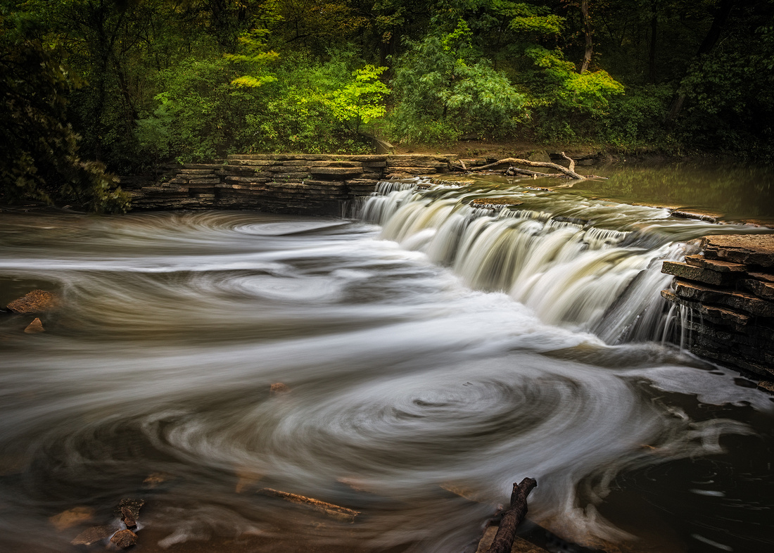
Sigourney Weaver
Waterfall Glen Forest Preserve
It’s very easy to overlook what’s in our backyard. Sheltering in place affords us the opportunity to explore locally and discover beauty close to home. Two weeks ago, fellow photographer Scott Fuller called and suggested meeting at a local waterfall.
It was a perfect day. Perfect to a waterfall photographer means overcast and even rainy. Bright, sunny days lead to blinding white water and dark featureless shadows in case you’re wondering.
Waterfall Glen Forest Preserve in Darien is a donut-shaped forest preserve encircling Argonne National Laboratory. Sawmill Creek runs through the Preserve on the way to the Des Plaines River. In the 1930s, the Civilian Conservation Corps built a 5-foot limestone dam (waterfall) on Sawmill Creek in the relatively new park.
This one’s for you, Bud
The park wasn’t named for the waterfall. Ironically, it was named after Forest Preserve District President Seymour "Bud" Waterfall.
After a short hike, we arrived at the waterfall. The recent rains created a nice flow. Long, several second exposures turned bubbles turned into beautiful streaks and ovals.
I don’t think I gave this waterfall a second look several decades ago when I moved to Chicago. But now that I’m older, I can take the time to “drink in” the beauty and joy of scenes like this.
Thanks for looking,
Chuck Derus
]]>
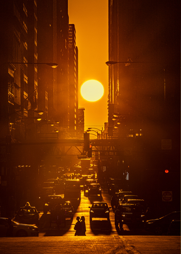
The equinox is near. On September 22, the sun rises and sets due east and west in Chicago. Day and night are each 12 hours.
After the September equinox, the sun rises and sets progressively southward. Days get shorter and nights get longer. By the December 21 solstice, the sun is as far south as it will go. It’s the shortest day of the year.
The sun then starts moving north. By the March 20 equinox, the sun again rises due east and sets due west. Daytime and nighttime are again 12 hours each.
After the March equinox, the sun continues northward. The days get longer, and the nights get shorter.
By the June 20 solstice, the sun is as far north as it will go. It’s the longest day of the year. After the solstice, the sun begins moving south and the days get shorter again.
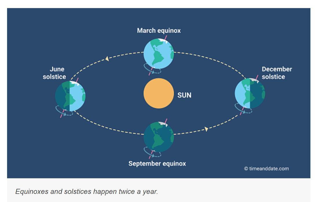
Woodhenge
Ancient henges are structures perfectly aligned to frame the sunrises and sunsets of the equinoxes and solstices. The closest example is near downstate Collinsville, Illinois in Cahokia Mounds State Park.
There were a series of five circular wooden henges built on the site by the Mississippian culture. Woodhenge III was built around 1,000 AD.
It contains 48 postholes to hold red cedar logs, considered sacred by many Native American groups. Thought by archaeologists to be a solar calendar, it’s capable of marking equinox and solstice sunrises and sunsets to time agricultural and religious observances.
During the equinoxes, the sun rises due east of the timber circle. From the center of the circle, the sun emerges from in front of Monks Mound roughly a half mile away.
Source: https://www.mexicolore.co.uk/aztecs/home/skywatchers-of-cahokia
Chicagohenge
The Chicago street grid is laid out east-west. An equinox is a chance to photograph the rising or setting sun between skyscrapers in an urban henge.
Fellow photographer Scott Fuller and I ventured to downtown Chicago last September for our first try. Despite arriving two hours early, the classic location at Washington Avenue in Millennium Park was overrun with photographers and news crews.
We hiked south to a median strip on East Monroe next to the Art Institute. It was a clear view to the west. Eventually there were a dozen photographers crowded on that thin strip of concrete in the middle of pre-COVID traffic.
The experience of being there was better than the photo. I felt a bit of the same magic that the Mississippian peoples must have experienced as they marveled at the sun rising in front of Monk’s Mound. Nobody said a word as we watched the sun set between the skyscrapers.
Thanks for looking,
Chuck Derus
]]>
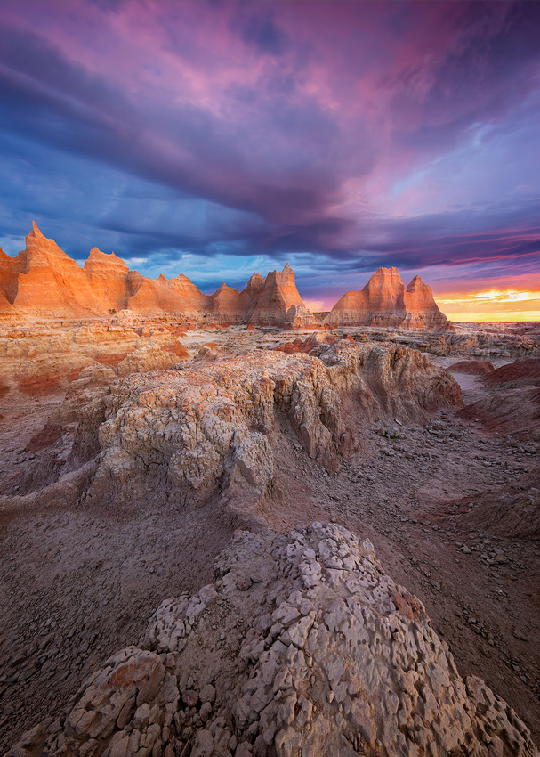
“Let sculptors come to the Badlands. Let painters come. But first of all, let architects come…the aspects of the Dakota Badlands have more spiritual quality to impart to the mind of America than anything else in the country.”
Frank Lloyd Wright
A COVID “silver lining” was my recent trip to Badlands National Park. Without the current travel concerns, I would have been in the Southwest again this summer.
But the safety of driving to Wall, South Dakota opened an entirely new National Park experience for me. And I can’t wait to return.
Why bad?
Why would you name a park “bad” if you’re trying to entice people to visit? Because the name is rich in history. The Lakota people called this area mako sica, which translates to “bad lands” for hundreds of years.
The early French fur trappers called the area les mauvaises terres a traveser which translates to “bad lands to travel across.” It’s quite possible the French name comes from the Lakota name.
But why is travel difficult? When it rains, the wet bentonite clay becomes incredibly slick and sticky, making travel difficult. The up-and-down canyons and buttes also make it hard to navigate. In addition, it’s cold and windy in the winter and hot and dry in the summer. Finally, water sources are usually muddy and unsafe to drink.
These environmental factors and early records of human activity point to seasonal hunting in the Badlands rather than permanent habitation.
Good PR?
Somebody must have had second thoughts about the historic name when the park was first proposed in 1922. The initial suggestion was to name it Wonderland National Park.
I’d be fine with that proposed name. Like Mr. Wright, I felt the spiritual quality of the park. On my last morning there, I ventured on the Door Trail past the usual overlooks.
A clearing storm at sunrise painted the formations in the background a golden color along with pinks and blues in the clouds above. It was a spiritual moment to be there.
Thanks for looking,
Chuck Derus
]]>
A child’s interest in drawing led his mother to suggest that he study architecture. That child was Chicago born architect Adrian Smith of Skidmore, Owings, and Merrill (SOM). Chicago-based SOM is one of the most prominent architectural firms in the world.
Mr. Smith is the primary architect responsible for more than 40 remarkable projects, according to Wikipedia. They include the 2,722-foot-tall Burj Khalifa (tallest building in the world) in Dubai, Millennium Park in Chicago, and the Waldorf Astoria Beijing, to name a few.
Mr. Smith also designed the Jeddah Tower in Jeddah, Saudi Arabia. When completed, it will be the tallest building in the world at an astounding 3,281 feet!
He was the principle designer when Chicago’s Trump Tower project was announced in July 2001. It was originally planned to be the tallest building in the world at 2,000 feet. The plans were scaled back that same year after the September 11 attacks on the World Trade Center.
When finished in 2009, it was the second-tallest building in the U.S at 1,362 feet. It edged out the John Hancock Center as the highest residential unit in the world. Not much later, the record transferred to the Burj Khalifa in Dubai.
Home with a view
According to Chicago Real Estate magazine, “Perched on the 86th floor… Unit 86B sits in almost rarefied air. But dizzying views of the skyline aren’t the only mark of high living in this 2,400-square-foot penthouse unit. The two-bedroom condo, currently asking $2.2 million, also boasts sleek new finishes, hardwood floors, and a master bath flush with Calacatta marble. Plus, it comes with a parking spot.”
Nice touch that parking space.
River with a view
Dave Fox, Paul Teodo, and I picked a steamy Thursday last week to take the Chicago Architectural Boat Tour. Chicago changes so much that taking the cruise every year or two brings new sights. And the docents seem to have a fact or two you’ve never heard before.
Just before boarding below the Wrigley building, I looked up into a cloudless sky and thought black and white. This shot seemed to capture a bit of the genius that Mr. Smith’s mother noticed so many years ago.
Thanks for looking,
Chuck Derus
]]>
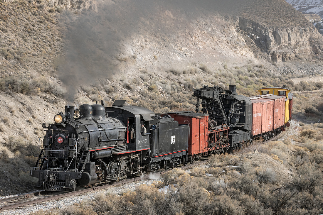 A work train is a non-revenue train used by the railroad for a specific purpose. Work trains perform inspections, track maintenance, maintenance of way, wreck cleanup, revenue collection and crew member transport.
Most of the cars in work train service are old rail cars that can’t be used in revenue service. These relics of a bygone era soldier on in work service for decades.
Photographic beginnings
My interest in photography started when I was asked to be the high school yearbook photographer during my junior and senior years. Yes, that’s me in the sideburns.

Source: Minneapolis Patrick Henry High School Yearbook 1970
In case you’re wondering, those two machines in front of us are typewriters. Feel free to Google what they do.
My first work car photo was taken in February of 1970. I decided to photograph the high school yearbook staff standing in two 1880s-era Soo Line work cars.
I still remember the bitter cold. The average Minneapolis temperature that February was 0 degrees!
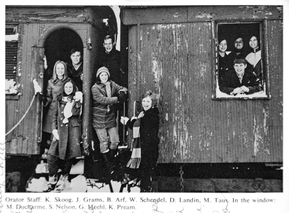
Source: Minneapolis Patrick Henry High School Yearbook 1970
Nevada Northern Railway in Ely, Nevada
My latest work train picture was taken 50 years after that first picture. In February of this year, fellow photographer Jon Christofersen and I were at the Nevada Northern Winter Steam Photo Weekend. One of the highlights was photographing a period-correct steam era Nevada Northern work train.
The work train consisted of steam Engine #93, a Crain tender, steam wreaking Crain A, two supply boxcars, the caboose, and a crew car. The supply boxcars dated from 1912, while the crew car was from the late 1800s.
Jon and I were dropped off at several locations. The train then backed up and did several runbys for the photographers at each location. I remember being thankful that it was a balmy 40 degrees.
This is my favorite shot. The engine is working hard upgrade, and the track makes a nice S-curve. In addition, I had just been riding in the cab of #93. But that’s another story…
Thanks for looking,
Chuck Derus
]]>
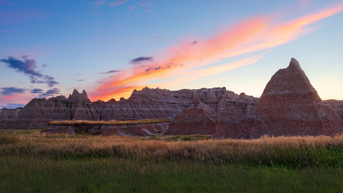
Always we are following a light,
Always the light recedes; with groping hands
We stretch toward this glory, while the lands
We journey through are hidden from our sight
Dim and mysterious, folded deep in night,
We care not, all our utmost need demands
Is but the light, the light! So still it stands
Surely our own if we exert our might.
Fool! Never can'st thou grasp this fleeting gleam,
Its glowing flame would die if it were caught,
Its value is that it doth always seem
But just a little farther on. Distraught,
But lighted ever onward, we are brought
Upon our way unknowing, in a dream.
Amy Lowell - 1874-1925
Light is at the heart of an image. Sublime light can infuse an image with emotion, shape and meaning, turning a snapshot into a photograph.
Subject matter, camera settings, and composition are all important. But light is the catalyst for transforming an image into more than the sum of its parts. So, photographers chase light.
Chasing light can entail travel. Over the past four years, the three weeks I spent storm chasing covered over 8,000 miles of travel in the Midwest.
Time is another way to chase the light. I’ve been to the local forest preserve over 100 times in search of light. Other times, you just need to wait minutes or hours for the light to change.
A turnaround
Perhaps the simplest way to chase the light is to turn around. On the afternoon of July 14th, I was scouting locations near the Door Trailhead in South Dakota’s Badlands National Park. The view to the Southeast featured impressive formations that just needed the right light at sunset to bring them alive.
As the sun went down, the right light never arrived. And the few promising clouds dissipated as well. I shifted focus to simply being there to enjoy the moment.
But remembering an old lesson to always turn around, I spotted this view in the opposite direction. I ran about a quarter mile to quickly set up this shot in the waning light. A minute later, the light was gone.
Thanks for looking,
Chuck Derus
]]>
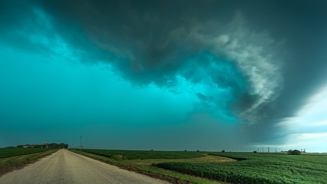 Derecho [dāˈrāˌCHō]
Derecho is a Spanish term meaning “straight ahead.” Iowa meteorologist Gustavus Hinrichs first used derecho as a weather term in 1878.
By definition, a derecho is a long-lived complex of intense thunderstorms that travel at least 250 miles. Additionally, wind gusts along its path must exceed 58-mph with at least several reports of gusts over 75-mph. The winds are straight line.
Derechos can appear on weather radar as a concave or bowed shape. Here’s a composite radar image of Monday’s derecho.
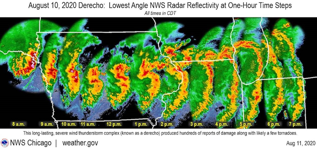 It traveled 800 miles in 14 hours from the South Dakota/Nebraska border through Iowa, Illinois, and finally dissipated in Indiana and Michigan. The characteristic bow shape is clearly visible.
The damage was widespread and devastating. One third of Iowa’s crops were flattened. Buildings were damaged and hundreds of thousands of people lost power. It spawned 12 tornados in Illinois. Dixon, Illinois reported a 92-mph wind gust.
Heading into the storm
The National Weather Service report looked favorable for severe storms Wednesday afternoon in the Chicago area. I decided to drive west to intercept the front as it moved through farmland near Genoa.
I found a nice spot just south of a tornado-warned area in Sycamore County. But I got there a little later than I wanted to arrive.
I hopped out of the car and only took a few photos before I felt the first rain drops. I hustled back to the car and threw my gear on the seat. Then the wind hit and I had to use both hands to strong arm the driver’s side door shut.
Just as my door closed, I was engulfed in horizontal rain and hail driven by fierce winds. Conditions moderated after about 10 minutes and I drove back home amid downed trees and power lines.
You may be wondering about the green sky. One theory is that large amounts of water and ice in the updrafts of a severe thunderstorm scatter green light, making the clouds appear green.
Thanks for looking,
Chuck Derus
]]>

Reflections
Photographers like the edges of the day at sunrise and sunset. The warm, soft light with long shadows sets the stage for compelling images.
Bright, midday sun is challenging for photographers. The harsh shadows and bleached out colors on a sunny day generally work against a pleasing image. Many photographers go inside to rest when the skies are bright, solid blue. Interestingly, tourists are often headed in the opposite direction.
Reflections are a way to take advantage of “bad” midday light. Reflections can completely alter an image. Something straightforward can be transformed into something new, mysterious and artistic.
So what is it?
I’m learning to take advantage of whatever light is present. Last year, I captured this “rainbow” during midday at the Pritzker Pavilion in Millennium Park. Reflections of the sky, lawn and chairs filled a panel of the building with colors. I like the fact that most people have no idea what this is without an explanation.
Thanks for looking,
Chuck Derus
]]>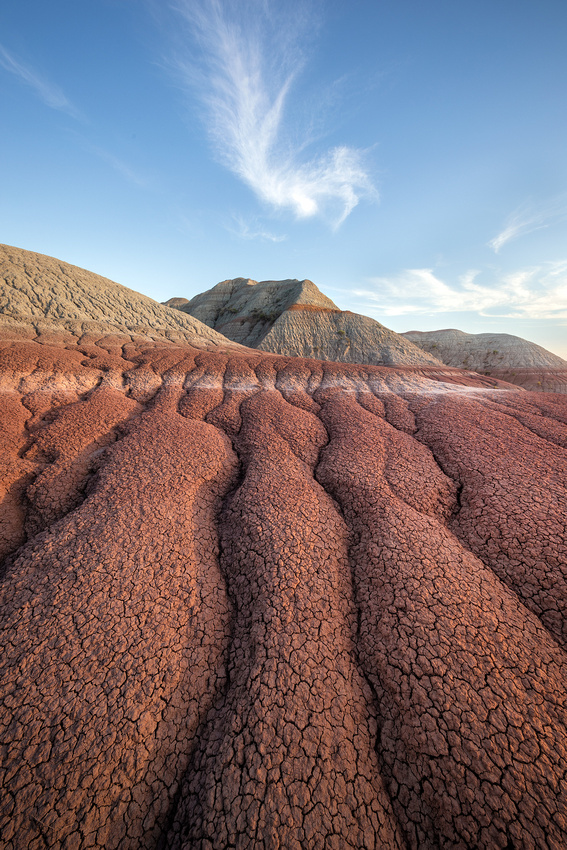
The Badlands
Badlands is a geologic term. They are characterized by soft sedimentary rocks that erode easily. Besides South Dakota, badlands are found in Wyoming, Utah, North Dakota, Colorado, Arizona and Nebraska.
Deposition and then erosion created the formations in South Dakota’s Badlands National Park. Rocks were gradually built up in layers through deposition. Shallow inland seas, rivers and wind created this geologic “layer cake” starting 75 and ending 28 million years ago,
The rocks then gradually wore away through erosion. Roughly half a million years ago, the Cheyenne River and White River began flowing through the area. Running water cut through the layers creating the narrow channels, canyons, and rugged peaks of the Badlands.
Erosion is still occurring. The rocks in the Badlands lose one inch per year. That’s pretty fast compared to the nearby Black Hills where it takes 10,000 years to erode one inch of granite. Visit soon; we only have a half million years before the Badlands are completely eroded away!
Lots of rocks
The Badlands’ formations contain sandstones, siltstones, mudstones, claystones, limestones, volcanic ash, and shale. The formations start with the oldest layer at the bottom and then move upwards in space and time. The youngest layer is on top of the formations.
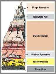
The bottommost layer is Pierre Shale deposited 75-69 million years ago. It comes from a shallow inland sea known as the Western Interior Seaway.
After the Seaway drained, the shale weathered into soil. That soil fossilized and became the Yellow Mounds.
Light gray claystone, the Chadron Formation, was deposited about 37-34 million years ago from an ancient floodplain.
The pale pink Brule Formation, deposited 34-30 million years ago, is next. It’s a mixture of claystones, mudstones, siltstones, freshwater carbonates, volcanic ash and sandstone.
At the top is the Sharps Formation, deposited 30-28 million years old. The base of the Sharps Formation is Rockyford volcanic ash. The upper layers are siltstone deposited by wind and water.
Leading lines
Photographs are two dimensional. Lacking depth, you need something to draw the eye through the scene. One method to direct the eye is leading lines.
The arid, clay rich soil dries into popcorn shapes and gives rise to photogenic erosion channels. The channels can become foreground leading lines to the formations and layers in the distance.
While wandering off the beaten path on my first visit to the Badlands earlier this month, this particular collection of channels seemed to line up well with the peak behind it. I waited about 20 minutes for the distinctive cloud to drift over the peak.
After that, I carefully moved on to other compositions as the sun started to set. Why carefully? That’s for another Friday Photo story about meeting a rattlesnake.
Thanks for looking,
Chuck Derus
]]>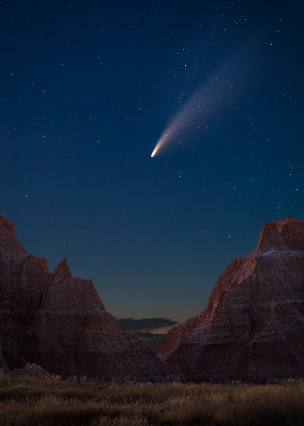
Comets are ancient. They are leftovers from the primordial material that formed the solar system about 4.6 billion years ago. Composed of ice, rock and dust, they are often referred to as “dirty snowballs.”
Comets come from one of two places: the Kuiper Belt or the Oort Cloud. Comets with orbits of less than 200 years come from the Kuiper Belt. The Belt is a collection of these cosmic relics located about 2.8 to 4.6 billion miles from the sun.
The Oort Cloud is the home to comets with orbits of greater than 200 years. The Oort Cloud stretches from about 186 billion to 18.6 trillion miles from the sun.
Every so often, a gravitational interaction knocks one of these cosmic relics towards the sun. As it slips closer to the sun it warms up and gases sublimate (going directly from solid to a gas) from the ice. Dust is often pulled away as well creating the sweeping trail seen in most comet images. Comets also have an ion tail made up of ionized gas blown back by the solar wind.
Comet NEOWISE
If you discover it, you get to name it. NASA space telescope NEOWISE first spotted the comet on March 27, 2020. It’s a visitor from the Oort Cloud. NEOWISE is one of the few comets visible to the unaided eye. It’s the brightest comet since Hale-Bopp in 1997.
NEOWISE is estimated to be three miles in diameter. It’s covered with dark sooty material. There’s enough water in the ice to fill about 13 million Olympic swimming pools.
The comet survived a very close approach to the Sun inside Mercury’s orbit on July 3, 2020. The very close passage is cooking the comet's outermost layers. Gas and dust are erupting off the icy surface and creating a bright, large tail of debris visible to the naked eye. It’s now racing back to the Oort Cloud.
Sky watchers in the Northern Hemisphere can spot the object after sunset, to the northwest just under the Big Dipper constellation. A simple telescope or pair of binoculars can reveal more details.
Watch it now
NEOWISE won't be back in our neighborhood for another 6,800 years, so get out now to observe this remarkable sight. It should be visible until the end of July.
I took a socially isolated trip to Badlands National Park last week. One of the highlights was photographing NEOWISE on July 15. The Badlands are dark sky territory with minimal light pollution. Comet NEOWISE was easily visible to the naked eye.
On that evening, it was 71 million miles away moving at 144,000 miles per hour. The coma (“fuzzy” ball) was 37,000 miles in diameter.
I could only find one spot in the park with a view to the Northwest with any sort of Badlands foreground. After taking a few photographs, I settled in to simply enjoy the view.
Thanks for looking,
Chuck Derus
]]>