The Supercell

The Supercell Thunderstorm
Who doesn’t enjoy looking at storm clouds? Chances are that you’ve looked up on a May, June, or July day and seen a very tall storm cloud with an anvil shaped top that stretches east as far as you can see. If so, you’ve probably seen a supercell thunderstorm.
Supercells are the least common type of thunderstorm. But supercells can produce severe weather, including damaging winds, large hail, and sometimes tornadoes. The recent Naperville tornado that passed two blocks south of my home was spawned by a supercell.
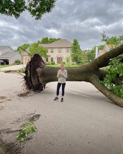
Mary Mahoney in front of a downed tree in the Winding Creek subdivision in Naperville. Photo by Dennis Mahoney.
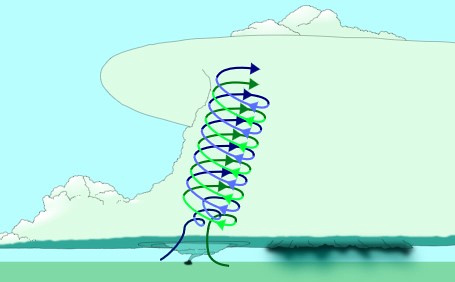
What makes a supercell unique from all other thunderstorm types is that it contains a deep and persistent rotating updraft called a mesocyclone. Wind shear sets the stage for a supercell. Differences in wind speed or direction over a relatively short distance in the atmosphere (red arrows) start the air spinning.
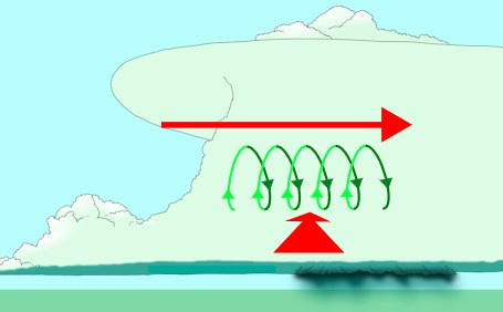
By Vanessa Ezekowitz - Meso-1.PNGSupercell02.jpg, CC BY-SA 3.0, https://commons.wikimedia.org/w/index.php?curid=4446779
The rising of large volumes hot, wet air (blue arrow) then bends the rotating updraft upwards.
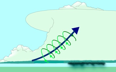
By Vanessa Ezekowitz - Supercell02.jpgMeso-2.PNG, CC BY-SA 3.0, https://commons.wikimedia.org/w/index.php?curid=4446798
Finally, you have a rotating updraft or mesocyclone, the hallmark of a supercell.
By Vanessa Ezekowitz - Supercell02.jpgMeso-3.PNG, CC BY-SA 3.0, https://commons.wikimedia.org/w/index.php?curid=4446808
Under the right conditions, the mesocyclone can spawn a tornado.
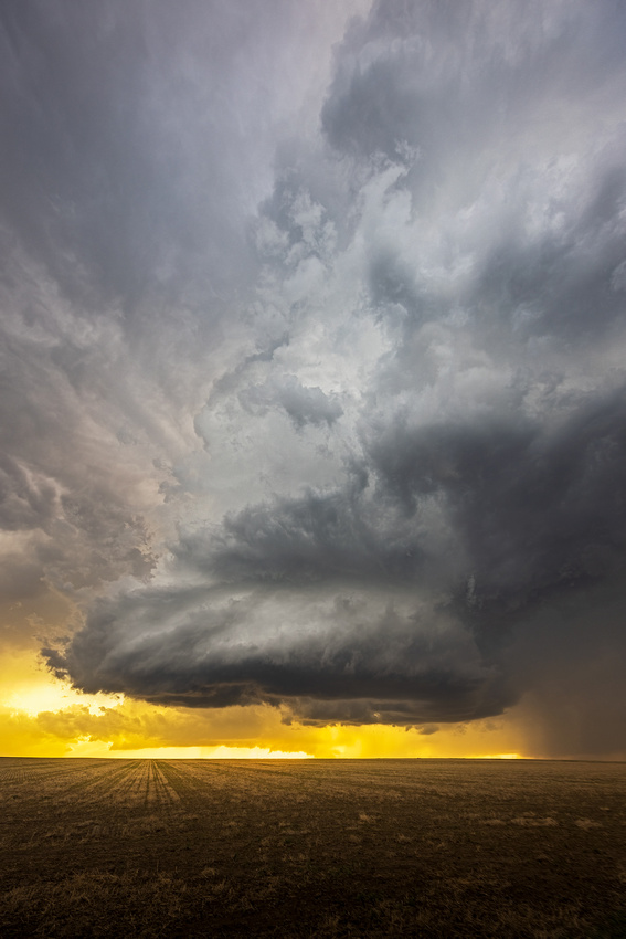
The Shot
On my May tornado chase, supercells started to form several times, but dissipated rapidly. This Kansas supercell looked promising, but started dying off around sunset. As we photographed it, the rotation slowed and the possibility of a tornado went away. But it still looked photogenic to me in the warm light of sunset.
Thanks for looking,
Chuck