Doorway to Heaven
This evocative phrase opens chapter two in Peter Zuckerman’s book, Buried in The Sky, about climbing K2. The K stands for Karakoram and the 2 for the second of 32 numbered peaks in the towering Karakoram Mountain range of Northern Pakistan.
The Karakorum is the Earth’s youngest mountain range. It was born a mere 65 million years ago at a time when the dinosaurs were facing extinction.
The Indian continental tectonic plate was speeding North at six inches a year, “a reckless pace in geologic time” according to Zuckerman. It ploughed into Eurasia wedging itself under the larger continent. The Karakorum Mountains, like Mount Everest, rose from the sea and are still rising today.
This 500-mile-long Karakoram range has the world’s largest concentration of peaks more than five miles high. It contains eighteen summits higher than 24,600 feet in elevation. Four of them are above 26,000 feet: K2, the second-highest peak on Earth at 28,251 feet, Gasherbrum I, Broad Peak, and Gasherbrum II.
Harsher than the Himalayas, the Karakoram is the most glaciated place on the planet outside of the poles. And unlike older mountain ranges, erosion has barely smoothed the jagged edges of the Karakorum.
Kara means black, and koram means gravel or rock. Central Asian traders originally applied the name Karakoram to a pass in the range. At an elevation of 18,176 feet, the Karakorum pass is the highest pass on the ancient silk road.
The pass connects Leh in Ladakh (Kashmir in Northern India) and Yarkand in the Tarim Basin (the Chinese gateway to Central Asia). Shawls, indigo, tea, corals, and muslin went North, while silk, precious metals, costumes, and jewelry went South.
Early European travelers, including William Moorcroft and George Hayward, climbed the pass in the 1820s and applied the name Karakorum to the range of mountains west of the pass.
K1 to K32
British Lieutenant Thomas Montgomerie was part of the Great Trigonometric Survey of British India that set out to measure the shape of the Earth in the 1850s. His porters labored for four days to haul a plane table, heliostat, and theodolite up Mount Haramukh in the Himalayan foothills to measure the peaks. Montgomerie was rewarded by a panoramic view of multiple spires.
Two peaks towered among the others 130 miles to the Northeast. He labeled the tallest peak K1. K stood for Karakorum and the 1 signified the first peak in his survey. He labeled the second highest peak K2. He eventually logged 32 peaks in total.
But Montgomerie’s initial visual measurements proved to be incorrect. K2 is actually taller than K1 by 2,592 feet. That makes K2 the second highest mountain on Earth and only 781 feet less tall than Mount Everest.
K1 quickly reverted to its native Balti name of Masherbrum. K2 has retained its alphanumeric moniker. But its actual name is Chogori, a Tibetan name meaning “Doorway to heaven.”
The Shot
My November photography group never saw K2. It requires a seven-day trek at altitudes of up to 18,000 feet to get within visual range. However, we witnessed the majesty of Masherbrum (K1) on many occasions.
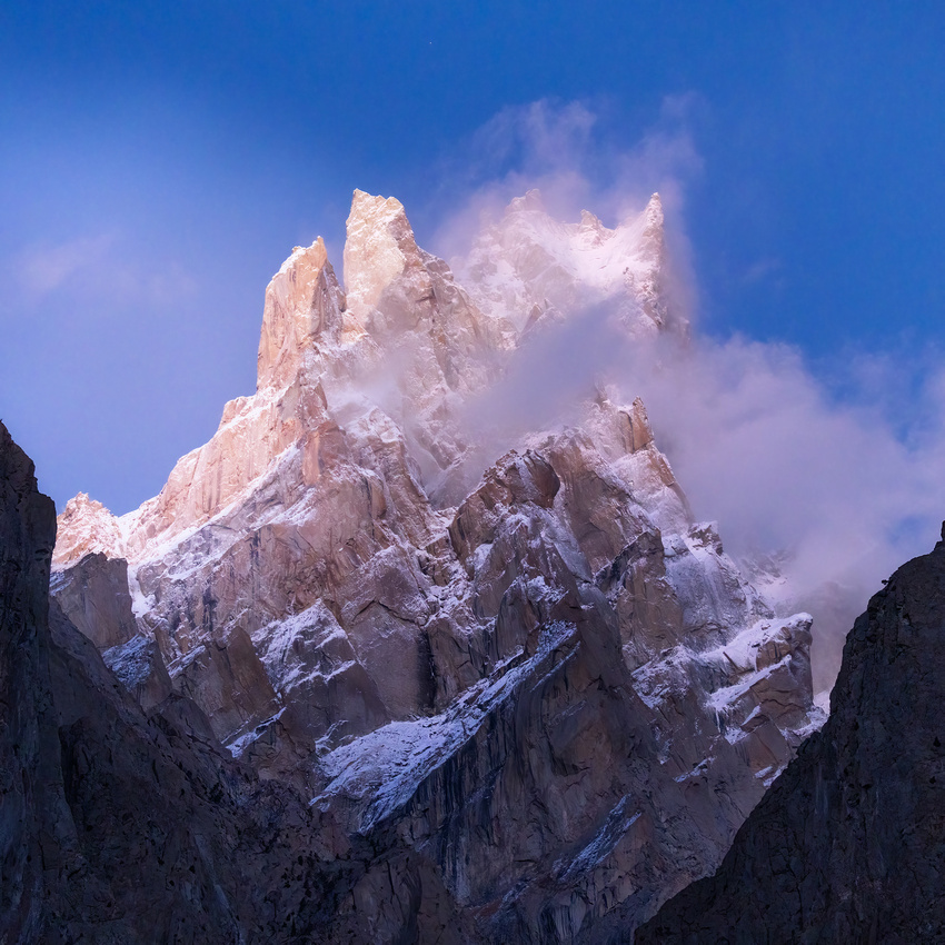
On November 3, we attempted to photograph Masherbrum at sunset. But the clouds shrouded the peak, making for poor photographs. Instead, we aimed our cameras at a pair of peaks in the distance.
The distant peak on the back upper right is called Grey Towers by the locals. The unnamed peak in the lower left is quite a bit closer and shorter. A telephoto lens compressed the apparent distance between the pair of peaks.
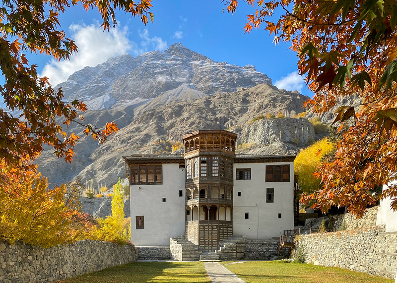
This was our last set of images for the day before heading back to our hotel room in Khaplu in the restored former royal residence of Baltistan.

Thanks for looking,
Chuck Derus
Comments
Take care!!! If you ever do the ice caves again, let me know, and I might pop up!!!
Mark