Derecho

 Derecho [dāˈrāˌCHō]
Derecho is a Spanish term meaning “straight ahead.” Iowa meteorologist Gustavus Hinrichs first used derecho as a weather term in 1878.
By definition, a derecho is a long-lived complex of intense thunderstorms that travel at least 250 miles. Additionally, wind gusts along its path must exceed 58-mph with at least several reports of gusts over 75-mph. The winds are straight line.
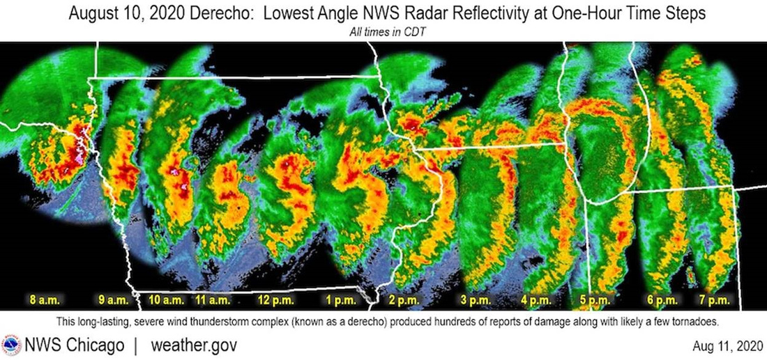
Derechos can appear on weather radar as a concave or bowed shape. Here’s a composite radar image of Monday’s derecho.

 It traveled 800 miles in 14 hours from the South Dakota/Nebraska border through Iowa, Illinois, and finally dissipated in Indiana and Michigan. The characteristic bow shape is clearly visible.
The damage was widespread and devastating. One third of Iowa’s crops were flattened. Buildings were damaged and hundreds of thousands of people lost power. It spawned 12 tornados in Illinois. Dixon, Illinois reported a 92-mph wind gust.
Heading into the storm
The National Weather Service report looked favorable for severe storms Wednesday afternoon in the Chicago area. I decided to drive west to intercept the front as it moved through farmland near Genoa.
I found a nice spot just south of a tornado-warned area in Sycamore County. But I got there a little later than I wanted to arrive.
I hopped out of the car and only took a few photos before I felt the first rain drops. I hustled back to the car and threw my gear on the seat. Then the wind hit and I had to use both hands to strong arm the driver’s side door shut.
Just as my door closed, I was engulfed in horizontal rain and hail driven by fierce winds. Conditions moderated after about 10 minutes and I drove back home amid downed trees and power lines.
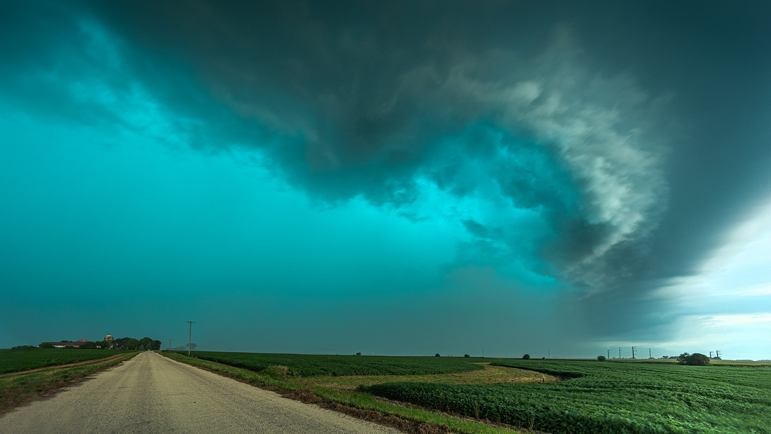
You may be wondering about the green sky. One theory is that large amounts of water and ice in the updrafts of a severe thunderstorm scatter green light, making the clouds appear green.
Thanks for looking,
Chuck Derus