My Close Call

Spring has the potential for ferocious storms. April 1-4 of this year was no exception. The southeastern United States was pummeled by torrential rain, high winds, damaging hail, and deadly tornadoes.
I signed up for a very last-minute storm chase and spent those days primarily in Tennessee, Arkansas, Louisiana, and Texas. Starting in Denver and ending in Oklahoma City, our group of eight drove 2,686 miles over four days pursuing supercells with tornadic potential.
Despite following numerous supercells with tornado warnings, funnels either never developed, were wrapped in rain and invisible, or occurred in the dark of night.
Our toughest day choosing a location was April 2 near Memphis, Tennessee. Conditions were favorable for violent storms with an astonishing 60% potential for tornadoes. Since there are very few Mississippi river crossings, our leader Roger Hill had to decide whether to chase in eastern Arkansas or western Tennessee.

Roger chose western Tennessee. There were several promising discrete storm cells forming there, while nothing was happening in eastern Arkansas. After chasing a half dozen supercells with tornado warnings that never produced, we called it quits after sunset.
The next day, we chased southwest Arkansas and northwest Louisiana. Storms formed southwest of us near Ida, Louisiana and a tornado warning was issued. But as they approached and crossed the front into wet, cool, stratus cloud-filled skies, they petered out.
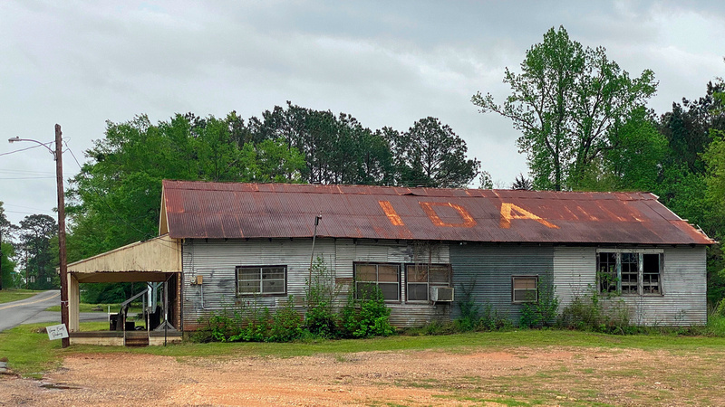
There’s not much in Ida, Louisiana.
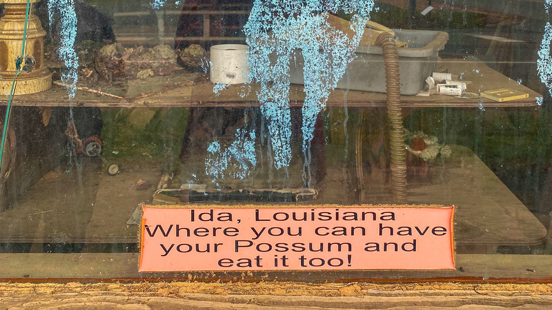
An interesting city promotion in Ida, Louisiana
On our last day, Roger had another difficult call between northeast Texas and the Little Rock, Arkansas area. The models looked better towards Little Rock to produce isolated supercells, so we sped in that direction.
Nearing Little Rock, several supercells emerged in northeast Texas, and we turned back around. We intercepted a violent supercell between Texarkana and Douglassville, Texas. A tornado was reported, but it was buried in heavy rain and invisible, so we kept our distance.
The Shot
Chasing in the southeast is challenging because of the trees and valleys. To be safe and to take pictures, you need an unobstructed horizon to see what’s coming.
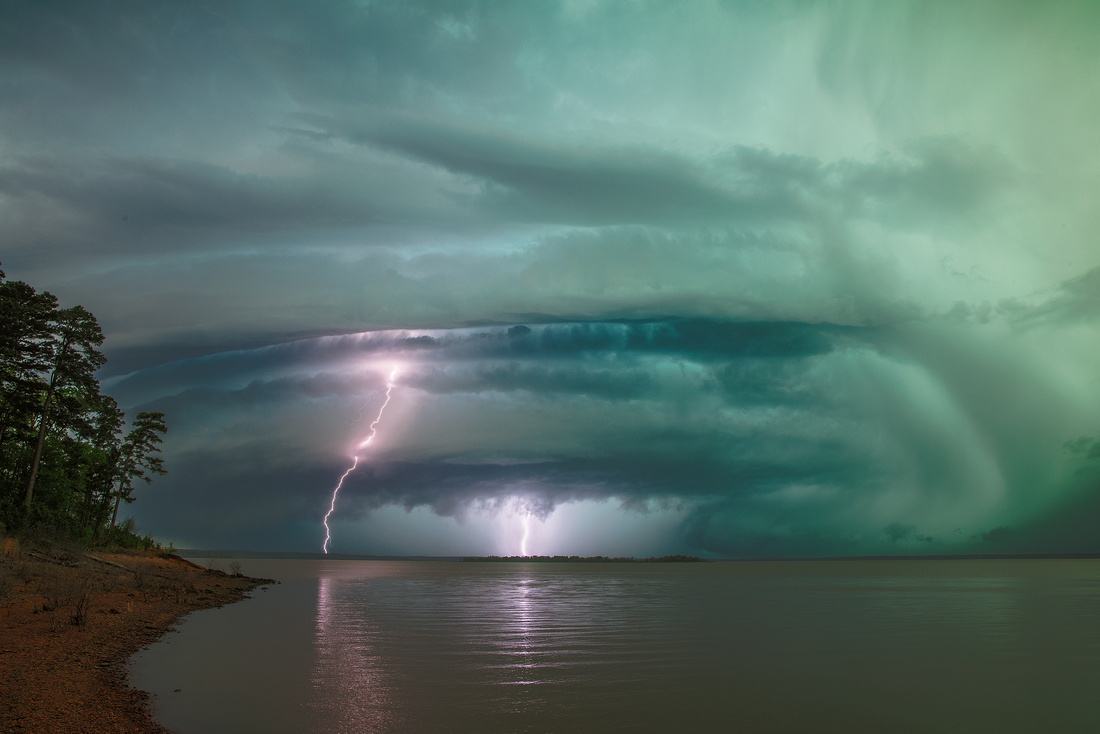
Fortunately, we found a clear and rewarding view of a supercell at Wright Patman Lake near Texarkana, Texas. We piled out of the chase van to the shore. What a sight!
We stood looking directly into the inflow notch. The structure was breathtaking. A “stacked plates” rotating mesocyclone was glowing green from backlit rain and hail. The storm’s base with an extremely low wall cloud was to the right and partially shrouded by pouring rain.
And the electricity! We were treated to several minutes of spectacular cloud-to-ground lightning strikes. Just moments after this photograph was taken, lightning struck the lake directly behind us AND in the trees to the left of us.
It was past time to leave! I’ve never seen a van fill up that quickly.
Thanks for looking,
Chuck Derus