Mexican Hat
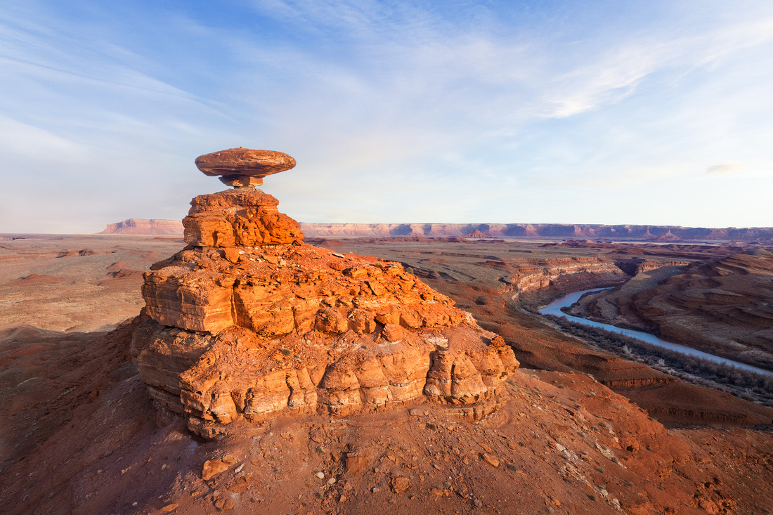

In the southwest corner of Utah, there’s a distinctive 300-foot-tall rock formation. A 60-foot in diameter, 12-foot-thick sombrero-shaped orange rock perches precariously atop a puny pedestal of shale and siltstone.
It resembles an upside-down sombrero, leading to the name Mexican Hat.
This uniquely named formation is the result of different rates of erosion and weathering. The softer layers of shale and siltstone eroded faster than the overlying more resistant sandstone cap. Such formations are usually temporary in geological terms, and continued erosion will eventually topple the Mexican Hat.
If you want to visit, the formation is in the northeast edge of the town of Mexican Hat, Utah. The town is on the San Juan River at the northern edge of the Navajo Nation's border. The population was 20 in the 2020 census.
The Shot
In the Spring of 2023, my friend and fellow photographer Jon Christofersen and I were in Mexican Hat for drone photography. We launched our drones next to this formation to a destination about a mile away.
After successfully completing our dawn drone mission, we put in a fresh battery and decided to explore this unique feature. Early morning light still warmed the rocks, and the nearby San Juan River flowed in the distance.
After taking several orbits around the Hat, I decided that this composition pleased me the most.
Thanks for looking,
Chuck Derus