The Bear's Cage


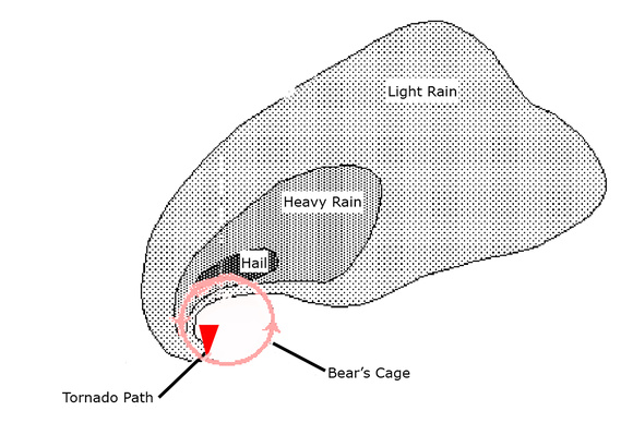
I’m not talking about visiting the zoo. The bear’s cage is a slang term used by tornado chasers. The bear is the danger of a tornado, and the cage is the area where it forms.
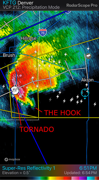
The cage is located beneath a rotating supercell wrapped in heavy precipitation (rain or hail). It often coincides with the characteristic radar hook-echo signature of potential tornadoes. Visibility in the cage is often poor, and the bear can appear without warning.


From www.flame.org


An example of a radar hook-echo signature and a tornado. I’m a safe distance away in the blue circled location.
May 21st
The National Weather Service predicted severe, dangerous storms in southwest Iowa. We drove there in the morning to be in position.
The prediction was spot on. By the early afternoon, intense storms started forming. Soon afterwards, intensifying low level winds added the last component needed to produce tornadoes. We ended up spotting four tornadoes.
Number one was near Red Oak, Iowa. It formed a nice stovepipe that lasted several minutes.


The Red Oak, Iowa tornado.
We moved to a new location to observe another supercell with tornadic potential. Since tornadoes move northeast, setting up south of the expected path is the safest place to be.
We didn’t have to wait long. A supercell approached our position at 60 mph. As it sped towards us, a big bowl-shaped tornado dropped that was wrapped in violently rotating curtains of rain.
The bear’s cage started hitting a tree line a little over a mile away when we realized we were uncomfortably close. We jumped into the van and drove away to the east at high speed.
Sitting in the rear seat, I turned around and saw the bear’s cage growing larger and closer. After what seemed an eternity (probably only 30 seconds), we pulled away to safety.
Jon Christofersen filmed a hyperlapse video of the tornado’s approach. You can view it at https://cderus.zenfolio.com/p476844829/h1bacd4b5#h1bacd4b5.
Tornado number three was a large, destructive multi-vortex tornado. We watched it roar across the road a mile or so east of us. It struck the communities of Villisca, Nodaway, Brooks, Corning, and Greenfield, killing 5 people and injuring 35 others.


An iPhone shot out the front window of the early phase of the deadly Greenfield tornado.
That tornado was rated as a high-end EF4 with ground wind speeds estimated at 185 mph. Wind speeds of 308–319 mph at 36–38 yards above the surface made it the third strongest winds ever recorded in a tornado.
The peak width was 1,600 yards. It stayed on the ground for nearly 43 miles during its 48-minute existence.
We briefly saw our last tornado, number four, as we drove north to get ahead of the storm. But a storm core with huge hail and blinding rain blocked us from continuing the chase. We called it a day.
It was an exhilarating, yet intensely sad day. A four-tornado day is remarkable. But lives were lost, people were injured, and homes and businesses were destroyed.
The Shot
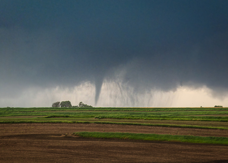
This image of tornado number two was taken a few seconds before we bugged out. From now on, the only bear’s cage I want to see up close is at Brookfield Zoo.
Thanks for looking,
Chuck Derus